MADERA COUNTY – Sept. 18, 2020 – Weather conditions for today will feature increasing humidity along with the chance for light showers in the region. This humidity will help reduce the volatility of spot fires, and slow progression of the fire in the north and northeastern sections of the fire. The favorable weather conditions continue to allow the Madera County Sheriff to relax evacuation orders. Follow this link for an interactive evacuation map. Creek Fire Evacuation Map
The Creek Fire has now burned 248,256 acres since the incident started on Friday Sept. 4, 2020 at 6:30 pm with 20% containment with full containment not expected until Oct. 15, 2020. The cause of the fire is still under investigation.
With a total personnel of 2,978 there have been no injuries/deaths fighting the fire. There are currently 331 engines, 84 water tenders, 18 helicopters, 32 hand crews, 76 dozers and 757 support members.
There are still 8,611 structures threatened with 804 destroyed and 67 structures damaged. The damage inspection teams are about 78% complete. The Madera County Sheriff’s office is personally contacting the owners of the lost property. For an interactive map of the damage inspection areas follow this link: Damage Inspection Map
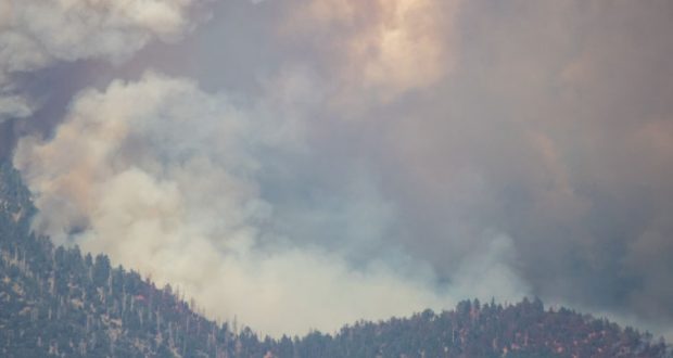
This weekend, down-sloping winds and an inversion layer will return once again trapping smoke in lower elevations and valleys.
Yosemite, Sequoia, and Kings Canyon National Parks have all been closed to the public. The Parks were closed due to the unhealthy smoke conditions, and not related to the threat of fire spread. Any remaining visitors in these National Parks will be evacuated today. All
visitors and recreationists reported to be in the Forests have been accounted for and have exited the park with no injuries reported.
Work continues on the west flank to fortify contingency lines and to protect assets such as Central Camp and the Bass Lake area. The tactics deployed in this area will provide options for our firefighting operations depending on how the fire reacts to the changing weather conditions in this area.
Preparations continue for the community of Mammoth Lakes as winds push the Creek Fire to the northeast. Management Action Points (MAPs) have been established as virtual lines on the map in relation to fire location. If the fire crosses any of these MAPs, Emergency
Officials will enact appropriate actions to protect life and property. All concerned in this specific region can visit the Sierra National Forest Facebook page, or use the following link for information: https://creek-fire-preparedness-monomammoth.hub.arcgis.com
FRESNO COUNTY – The Creek Fire’s South Zone should experience less fire activity due to an overnight weather system bringing high level tropical moisture to the fire increasing cloud cover and humidity with very light showers .
While precipitation may occur it is forecast at less than 1/10th of an inch. It will reduce fire activity in finer fuels such as grasses and brush but will not affect heavier fuels like timber. As the weather system moves out Friday afternoon south west winds will increase. This presents the likelihood that fire in the afternoon and into the overnight periods will be more substantial than the daytime
Last night the fire behavior was centered around Huntington Lake, specifically China Peak. It is also progressing towards Florence Lake and the Dinkey Lakes Wilderness.
As weather conditions allow air operations to resume, please respect the Temporary Flight Restriction; keep drones away from the fire and firefighting operations. If you fly, we can’t! Don’t be the reason a firefighting air mission has to divert!

