Badger Pass Ski Area had just opened for the season and that meant that it was time for us to do some fun snow things. Those nordic trails were open, groomed, begging us to slap our snowshoes on and see the fabulous snow blanketed high country.
 Where: Yosemite National Park
Distance: 7.37 Miles
Difficulty: Moderate
Elevational Range: 7,237′ to 7,382′
Date: December 16, 2019
Map: El Capitan Topographic Map
Dog Hike: No
We drove up to Badger Pass Ski Area just shy of the ski lodge, then turned left and parked at their lot up near the trailhead. It was about 20 degrees when we got out of the car and we were the only vehicle in the parking lot. We put on our snowshoes and off we went, making sure we stayed out of the cross country ski tracks on the trail.
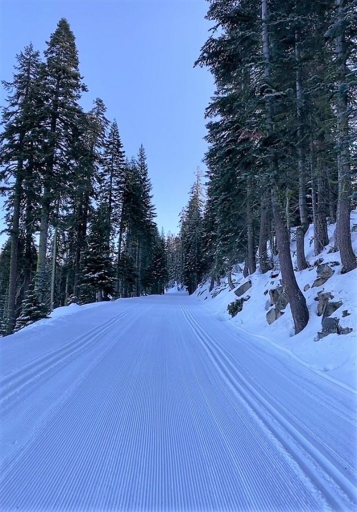
We were soon walking on Glacier Point Road with its nicely groomed trail, the snow squeaking under our snowshoes.
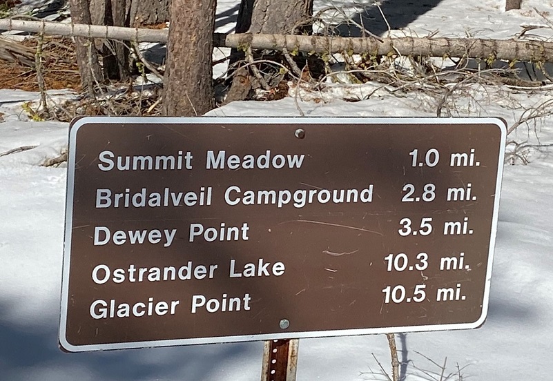
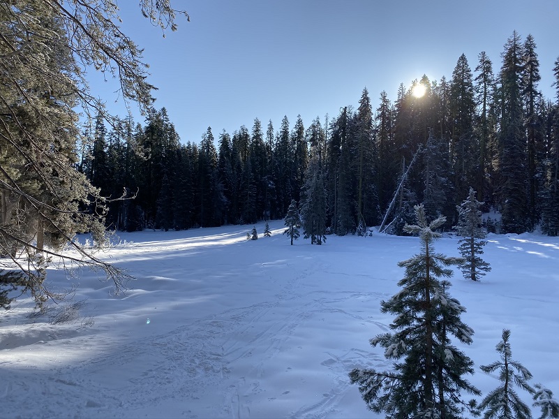
It wasn’t long before we reached Summit Meadow with the early morning sun just coming over the top of the trees.
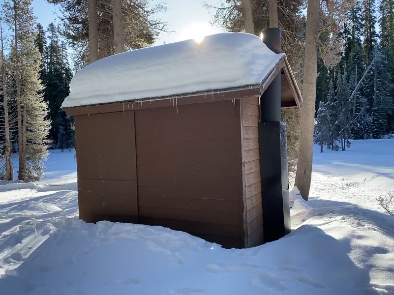
You are probably wondering why I took a picture of the restroom at Summit Meadow. Well, I had two reasons. First, we did stop here for the obvious reason plus the amount of snow on the roof is about the best way to show the base of the snow that we were snowshoeing on. Nice!
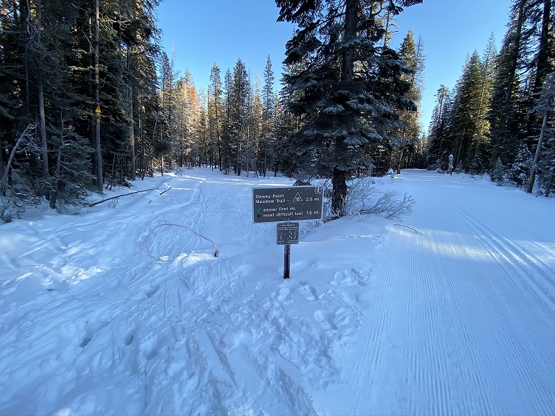
There are a couple of routes to snowshoe to Dewey Point. The Ridge Route #14 intersects Glacier Point Road just west of Summit Meadow and the Meadow Route #18 intersects Glacier Point Road just east of Summit Meadow. We chose the easier way in via the Meadow Route but sometimes we do a loop, going in one trail and out the other.
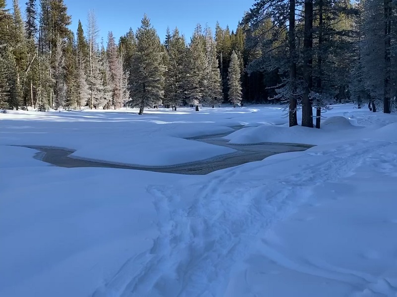
The trail had about an inch of new snow, still clinging to the trees in the early morning.
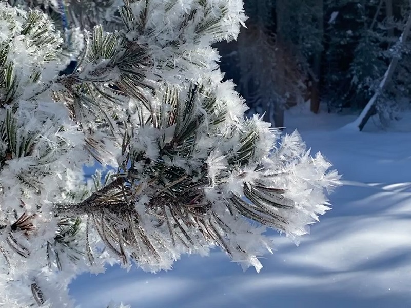
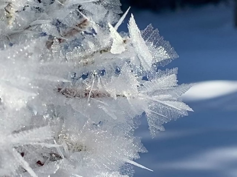
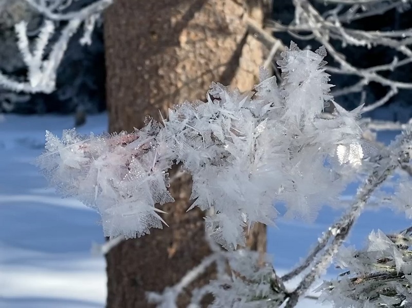
At the top of the meadow, the trees were flocked with ice crystals. Hoar frost forms overnight when it is very cold and there is some humidity. The name comes from Old English wording meaning “showing signs of age” and in this context means that bushes and trees look like they have white hair on them. There are different types of hoar frost and this type is known as air hoar when the frost is deposited above the ground on tree branches and plant stems. We also saw surface hoar, which is ice crystals deposited on the surface of previously frozen snow or ice. The patterns and crystals were beautiful and all unique.
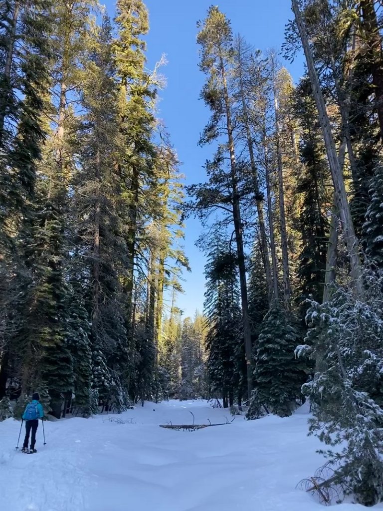
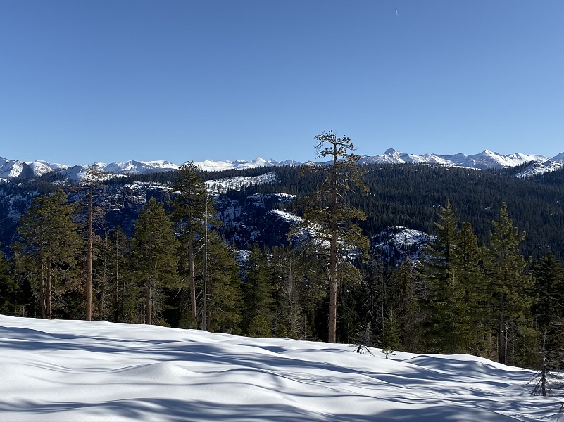
It wasn’t long before the trail began to show us sneak peeks of the snowy high country.
Then we had our first look at Dewey Point, named after Admiral George Dewey of the Spanish American War. He is best known for his victory at the Battle of Manila Bay during the Spanish-American War. He was also the only person in the history of the United States to have attained the rank of Admiral of the Navy, the most senior rank in the United States Navy. You can read more about him in my prior Blog.
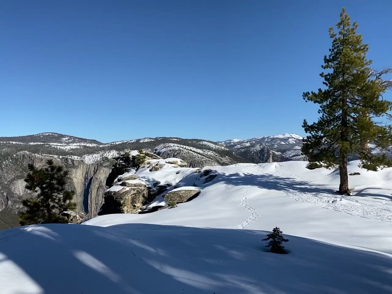

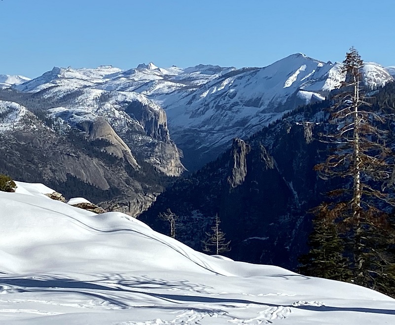

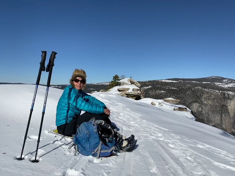
We had the place to ourselves and Dewey Point made a great lunch spot even though it was about 1030.
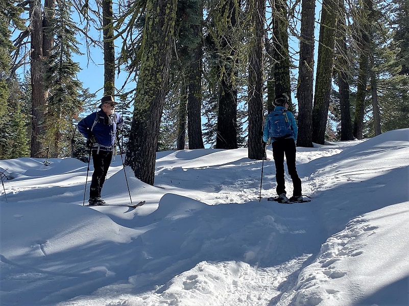
We headed back the same way we came in and met friends of ours skiing in. We stopped and chatted a bit then we all went on our way.
The snow was nice in the afternoon and the temperature was still a smidge below freezing.
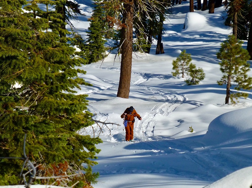
Photo by Gail Gilbert
If you are interested in snowshowing out of Yosemite Ski & Snowboard Area, they rent snowshoes and there are even guided snowshoe hikes. They are open through April 1, 2018 as conditions permit. You can also check out their webcam, along with the rental and snowshoe hikes and current conditions at the Yosemite Ski & Snowboard Area Page here.Yosemite National Park has some great information on how you can safely enjoy winter sports at the link at the end of the blog. You can also access a PDF of their Glacier Point Road Winter Trails brochure on this link, which includes a map of the trails in the area with safety information.
Dog Hike? No
Dogs are not allowed on this Trail.
Where Pets Are Not Allowed
- On trails, including the trail to Vernal Fall (however, pets are allowed on the Wawona Meadow Loop)
- On unplowed roads covered in snow
- In undeveloped and wilderness areas
- In public buildings
- On shuttle buses
- In lodging areas
- In all walk-in and group campgrounds/campsites, including Camp 4
- In any other areas, as signed
These regulations protect both pets and wildlife from disease and each other. The National Park Service has prohibited pets on trails for many years. In particular, some pets chase wildlife, pollute water sources, and can become defensive and dangerous in unfamiliar surroundings. Pet owners have the burden to assure their pet does not damage the park values for others in those areas where pets are allowed.
Doarama:
What is a Doarama? It is a video playback of the GPS track overlaid on a 3 dimensional interactive map. If you “grab” the map, you can tilt it or spin it and look at it from different viewing angles. With the rabbit and turtle buttons, you can also speed it up, slow it down or pause it.
Map and Profile:
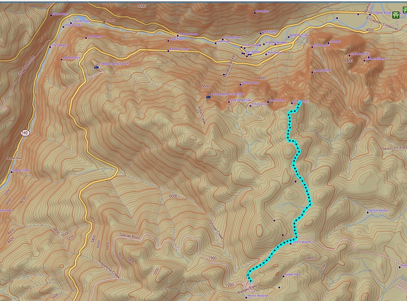
Badger Pass to Dewey Point Snowshoe Topographic Map

Badger Pass to Dewey Point Snowshoe Profile
Prior Blogs in the Area:
Snowshoeing to Dewey Point during the Government Shutdown January 8, 2019
Snowshoeing to Dewey Point December 20, 2018
Snowshoeing to Dewey Point March 12, 2018
Hiking from Tunnel View to Dewey Point January 12, 2018
Snowshoeing from Chinquapin to Monroe Meadows November 30, 2016
Snowshoe to Dewey Point . . . Again December 30, 2015
Dewey Point Snowshoe Hike February 17, 2014
Tunnel View To Dewey Point Hike January 8, 2014
Snowshoe to Dewey Point January 22, 2013
Sources: