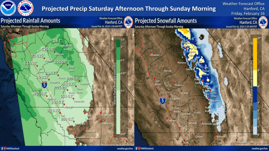
MOUNTAIN COMMUNITIES—The National Weather Service Hanford Office is predicting that our area can expect two storm systems over the holiday weekend. They will continue into next week. The first of two systems will impact Central California on Saturday, with periods of light rain below 6,000 feet. Light snow will fall above 6,000 feet. The first system will be the smaller of the two. The second system will begin impacting the area from Sunday through Wednesday morning. There will be periods of light to moderate precipitation, with the majority falling on Monday.
As always, Sierra News Online will be here monitoring and reporting on road hazards and closures, power outages, school closures and more.
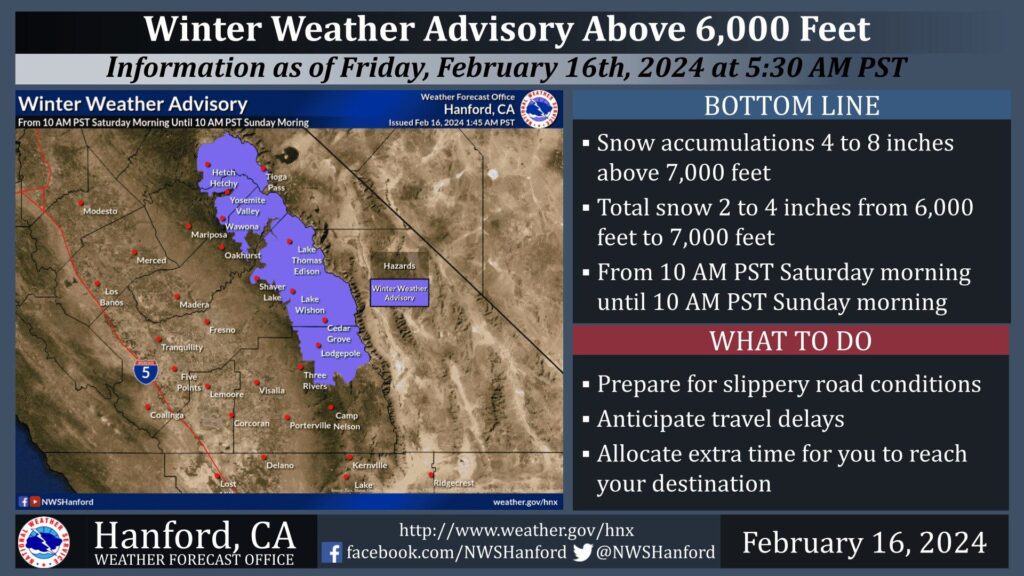
The Sierra above 6,000 feet has a 25-40% chance for 4 inches or more of snow. This has lead to a Winter Weather Advisory being issued for the Sierra Nevada above 6,000 feet and to the north of Lodgepole. The Winter Weather Advisory is in effect from 10 AM PST Saturday morning until 10 AM PST Sunday morning. A Winter Weather Advisory for snow means that periods of snow may cause travel difficulties. Motorists can expect slick road conditions and potential travel delays.
Sunday Through Wednesday
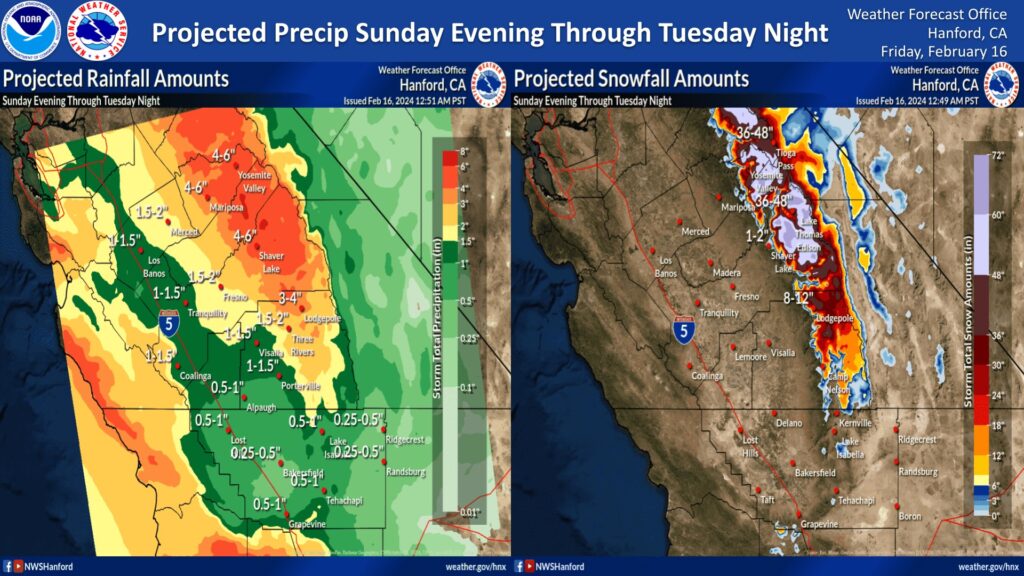
The majority of precipitation will fall Sunday evening through Monday evening. The snow level will start at around 7,000 feet Sunday evening, before dropping to about 6,000 feet Monday evening.
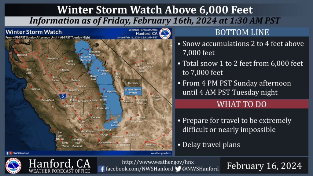
Sierra Nevada Snow
This system will also impact the Sierra Nevada above 6,000 feet, with a total snow accumulation of 2 to 4 feet of snow possible from Sunday through Tuesday night. A Winter Storm Watch remains in effect for the Sierra Nevada above 6,000 feet from 4 PM PST Sunday afternoon until 4 AM PST Tuesday night. The majority of this snow will fall Sunday evening through Monday evening. Travel may be extremely difficult or nearly impossible. As a result, travel is not advised.