Hiking to a pretty lake never gets old, especially when it reflected the surrounding mountains in its crystal clear water and I had the lake to myself.
Where: Yosemite National Park
Distance: 12.35 Miles
Difficulty: Moderate to Strenuous
Elevation Range: 7,490′ – 9,635′
Elevation Gain: 2,590′
Date: September 2, 2021
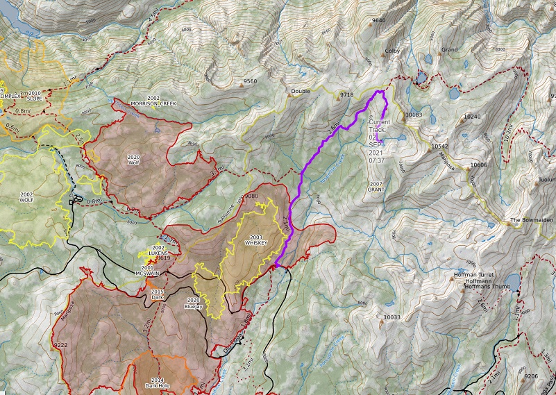
CALTOPO: Grant Lakes Hike
Dog Hike? No
Leaving the house early, I headed into Yosemite National Park via the El Portal Entrance Gate. I had already printed out my Day Pass and since the gate wasn’t staffed this early, picked up one of the temporary white slips at the Entrance Station to fill out and place on my dashboard. If you aren’t aware, Yosemite National Park has implemented a Temporary Day Use Reservation system. Day Use Entry Passes are validated at the park entrance gate on the reservation date and can be used for 3 days of entry. There are some exceptions but reservations are required to enter Yosemite for day and overnight trips and you get them through Recreation.gov. Yosemite National Park stated that the Temporary Day Use Reservation is planned to be effective through Thursday, September 30 or until local public health conditions improve. If you have questions about those exceptions or changes, you can also check out Yosemite’s How will COVID-19 affect my visit?
 Once through the gate, I headed up to and east on Tioga Road, then parked my car at the parking area at the Yosemite Creek/Ten Lakes Trailhead. There are are actually two areas to park across the road from each other. The dirt area on the north side has plenty of bear boxes, along with trash cans for backpackers. The paved parking area on the south side has restrooms, bear boxes and trash cans.
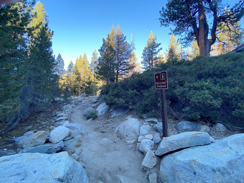
The trailhead for Ten Lakes starts on the north side of the road where the dirt parking area is located. It was 47 degrees when I started out and I picked a “cooler” summer day with a breeze for this hike for a reason. There is a lot of uphill and some areas of the trail without tree cover. Shade and a breeze on those uphill portions makes it much more pleasant.
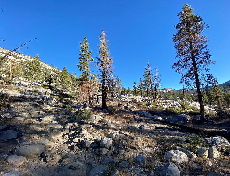
The bottom portion of the trail goes through the 2020 lightening caused Bluejay Fire which burned 6,922 acres.
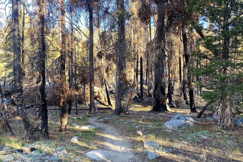
But other fires have burned through this area. I find it interesting to look at the fire history in an area and you can check out other areas on CALTOPO, going to the link provided at the top of the blog with the stats, then move the map to where you wish to view and choose “fire history” on the right hand side of the map.
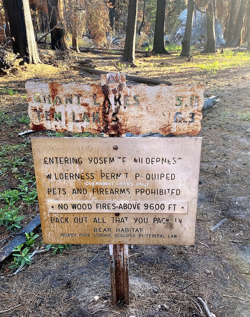
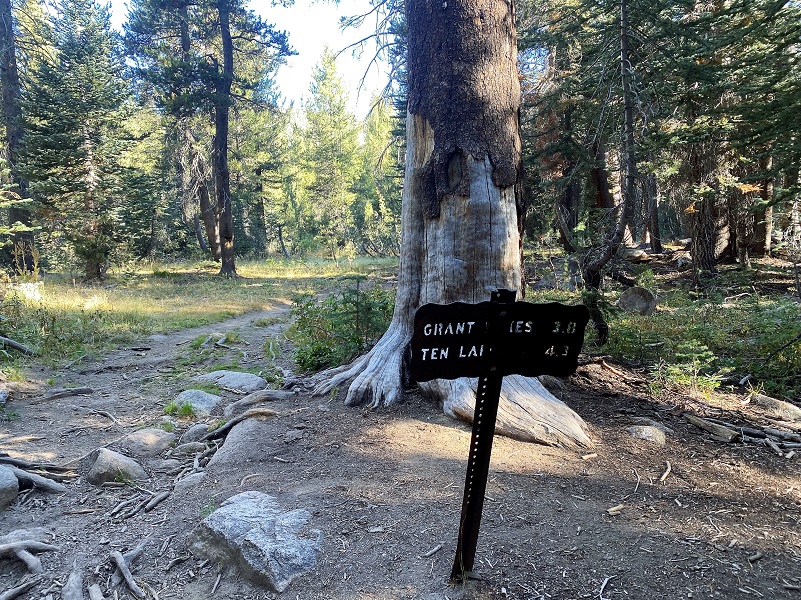
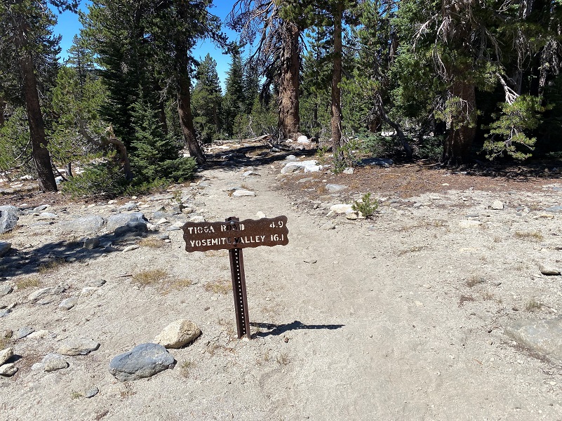
The trail was well signed throughout the hike.
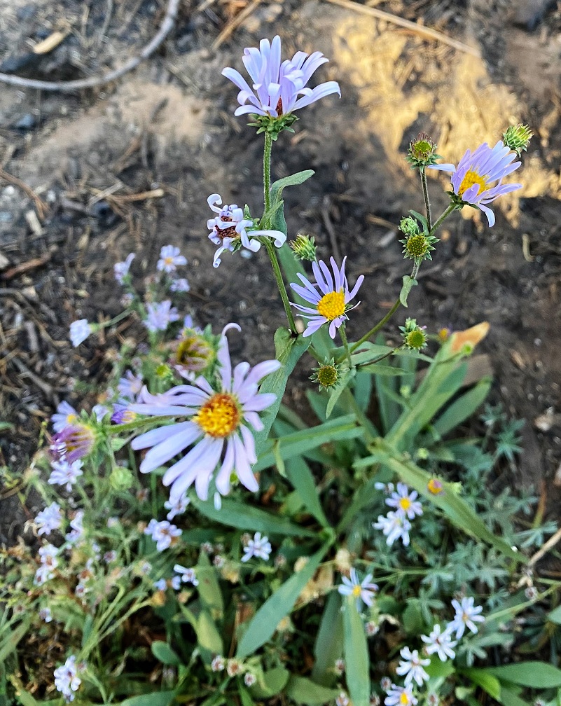
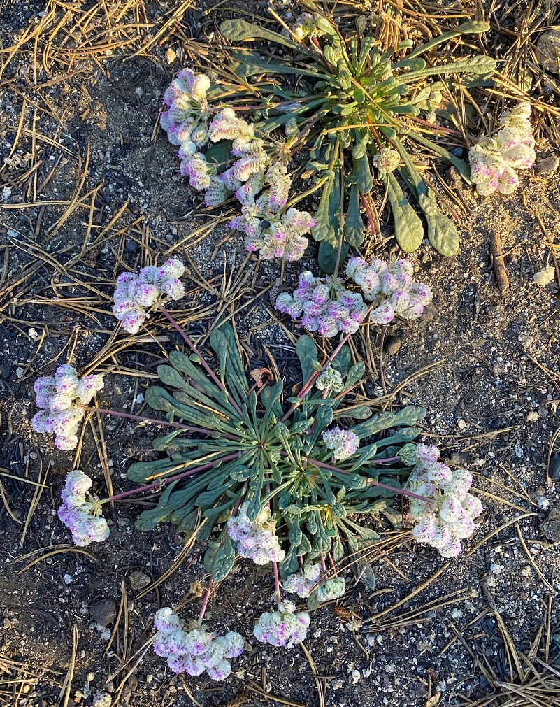
Even though the bottom portion of the trail was through a burned area, late summer wildflowers such as astors and pussy paws lined the trail in places.

The trail led on.
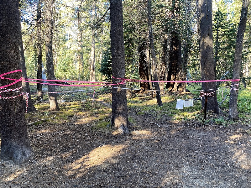
As I prepared for this hike, I had checked Yosemite National Park’s Current Conditions for trail closures because I knew that there was a 100% contained fire nearby called the Lukens Fire. It is 867 acres but still putting up some smoke at times. As of this writing, there were closures in the area between White Wolf and Lukens Lake, as well as the trails between White Wolf and Tioga Road via Lukens Lake, and the trail from near Yosemite Creek to near Harden Lake. But it didn’t list the Ten Lakes Trail and I was a little afraid that I might not be paying attention when I reached the fork in the trail that went toward Lukens Lake and closures, but there was no mistaking this closed trail when I reached that fork.
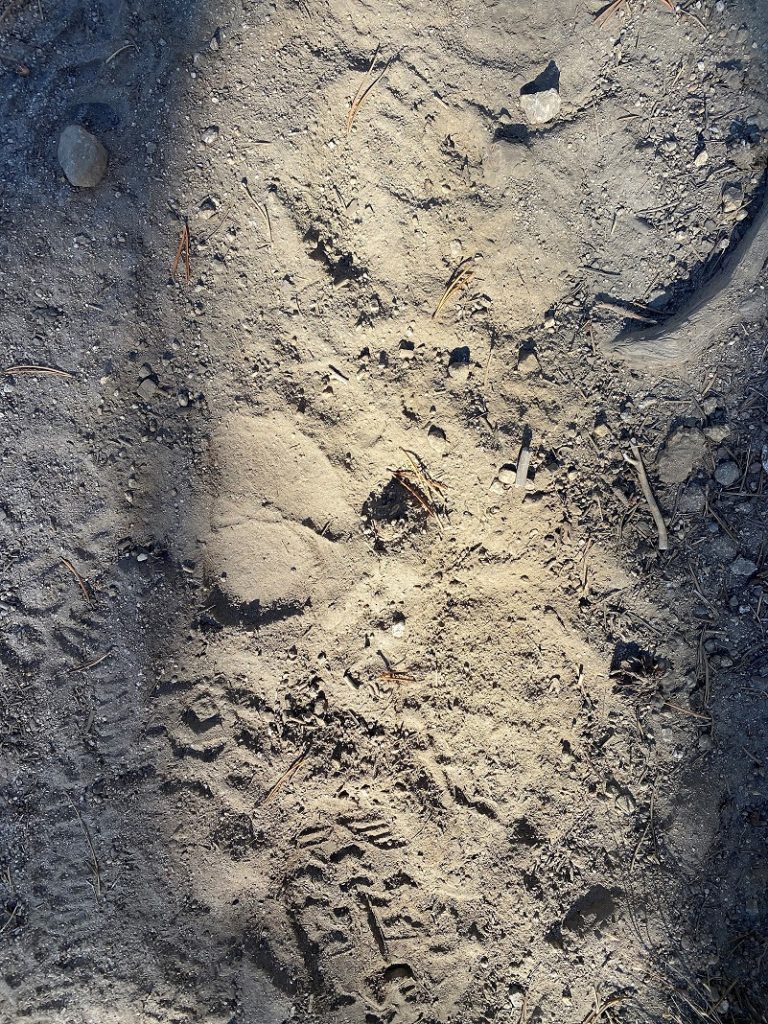
I continued following the signs to Grant Lake. The dusty trail had plenty of tracks on it, most of them from hikers but I could spot deer and an occasional bear track.
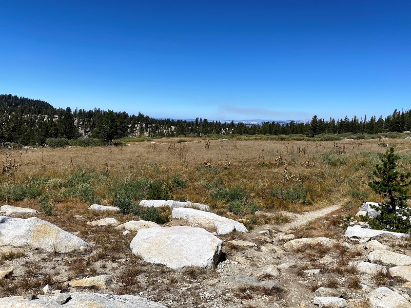
About 4 miles out, I reached Halfmoon Meadow. In the spring, it is green and lush but it was sporting it’s fall colors, getting ready for winter. Still, very pretty and flat, because soon that trail would start to climb.

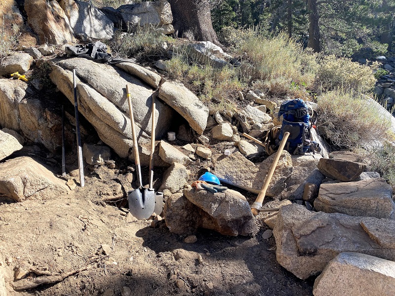
After the meadow, the trail climbed on a rocky staircased trail. I came across some trail tools and since these trails don’t build themselves, I knew the trail crew had to be near. They were on a break and I thanked them for their hard work.
After I made it above the staircased and switchback portion of the climb, the trail started leveling out. I was almost to the top but not quite.

On top in a slight saddle, the trail split, the left going down to Ten Lakes, which is a pretty hike but not where I was headed on this day. I took the right split, following the sign that said it was 1 mile to Grant Lake but the GPS tracked it as 1.2 miles.


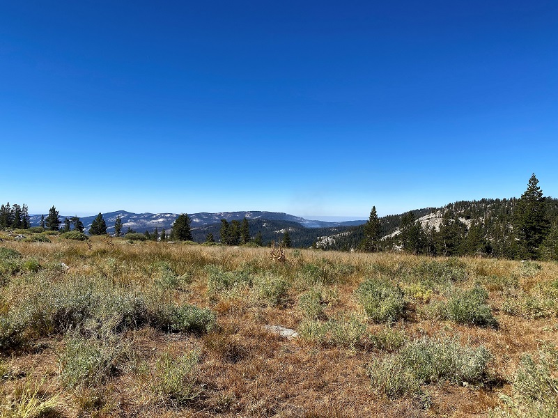
The trail was level for about a half mile as it traveled on a plateau, then headed downhill to Grant Lakes. The views were wonderful. I could see portions of the northwest side of Mount Hoffman and west side of Tuolumne Peak, with views straight out to the valley to my west.

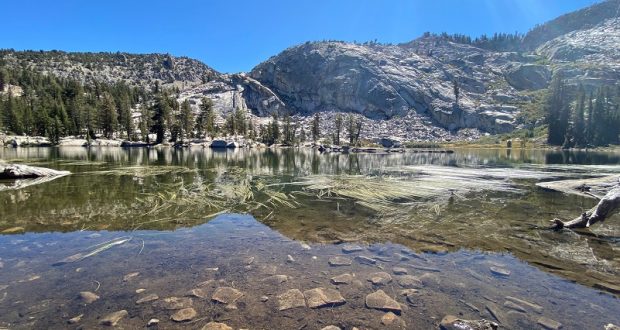
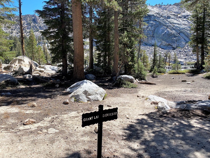
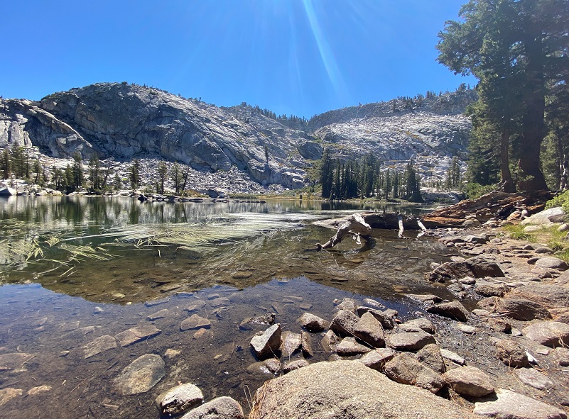
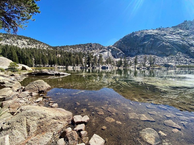
When I arrived at the first Grant Lake, I was the only person there. Yosemite Place Names by Peter Browning says the origin of the name is unknown but a likely supposition is that they were named for General, and President, U.S. Grant. The name appeared on the map in Whitney’s Yosemite Guide-Book, 1871. The sign at the first lake says the elevation is 9,500 but the GPS says it is 9,270′. The second Grant Lake is at 9,462′ elevation so maybe that is what the sign was aiming for.
I contemplated walking over to the second lake but the first one looked so pretty and I was getting hungry. It made the perfect lunch spot.

I headed back out the same way I had come in, following the signs back to Tioga Road. I met only one person heading into Grant Lakes on the plateau area.
This is a trail that gets used quite a bit by backpackers. I probably passed about 10 people during the day and I’m not sure why I lucked out with so few hikers. Maybe it was because it was a weekday when I hiked it and I imagine the weekend could have more. Maybe it was because it had been smoky on previous days but I had a perfectly clear day to hike. Folks may have avoided the area because they thought it would be too smoky that day, which could also account for the lighter traffic. There were a good share of vehicles parked, probably backpackers enjoying areas in the Ten Lakes Basin.
Dog Hike?
No, dogs not allowed in Yosemite National Park Wilderness.
Doarama:
What is a Doarama? It is a video playback of the GPS track overlaid on a 3 dimensional interactive map. If you “grab” the map, you can tilt it or spin it and look at it from different viewing angles. With the rabbit and turtle buttons, you can also speed it up, slow it down or pause it.
Grant Lakes Doarama
Map and Profile:
CALTOPO has some free options for mapping and here is a link to my hike this week, which you can view or download: CALTOPO: Grant Lakes Hike
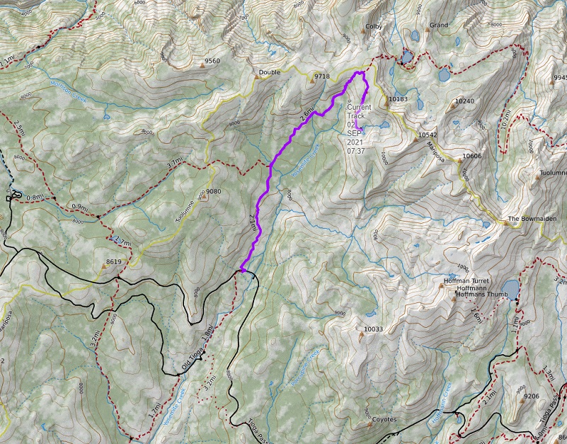
Grant Lakes Topographic Map
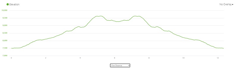
Grant Lakes Profile
Sources:
Ten Lakes Yosemite National Park
Browning, Peter, Yosemite Place Names, Great West Books, Lafayette California, 1988
Prior Blogs in This Area:

