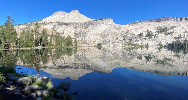
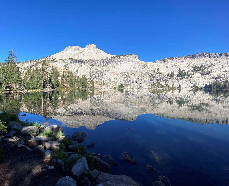
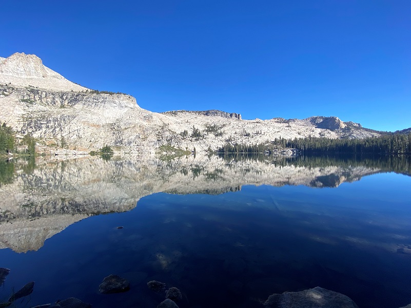
A short, early morning hike up to May Lake, with amazing reflections of Mount Hoffmann in its crystal clear waters.
 Where: Yosemite National Park
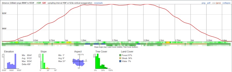
Distance: 3.65 Miles (about 6 miles round trip to the top of Mount Hoffman)
Difficulty: Moderate
Elevation Range: 8,855′ – 9,362′
Elevation Gain: 551′
Date: August 3, 2022
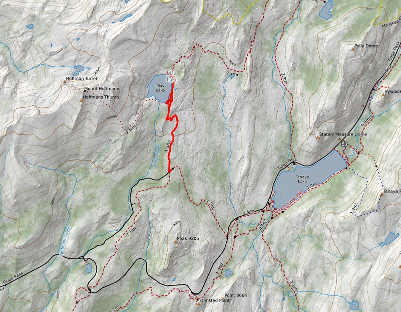
CALTOPO: Hiking to May Lake
Dog Hike? No
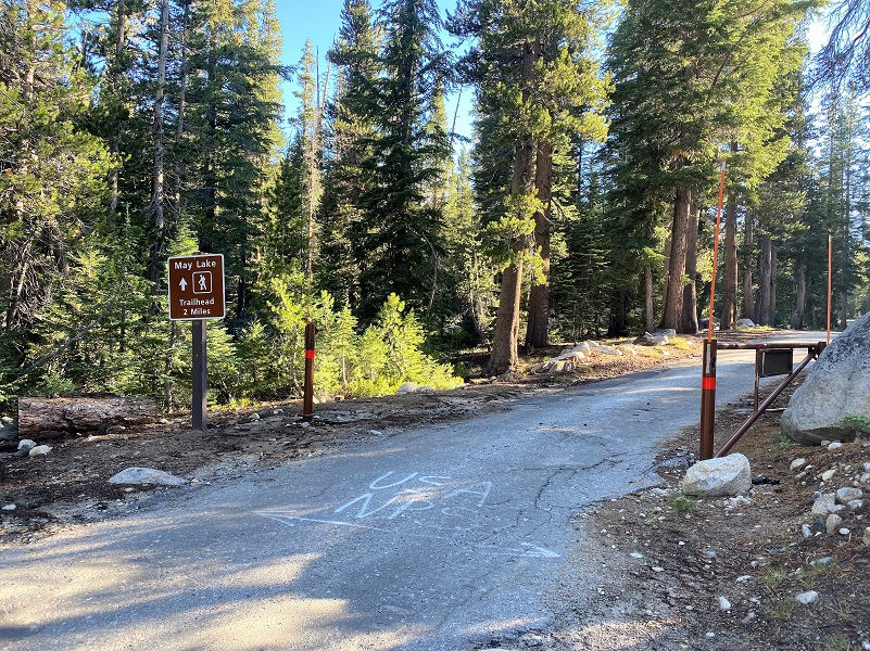
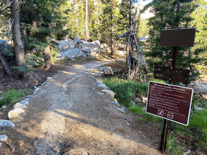 As I drove east on Tioga Road and I noticed the stars of the wildflower show had changed since I had driven through a couple of weeks ago. This week fireweed and Bigalow’s Sneezeweed were showing off, especially around the Crane Flat area, both on Big Oak Flat Road and on Tioga Road. About 28 miles from Crane Flat, I turned left (north) on the signed May Lake turnoff. The gate to the paved road to the May Lake Trailhead and High Sierra Camp was open, so I drove up it about 1.8 miles to the trailhead parking lot. I have seen it closed to vehicle traffic on prior wintry hikes. When I say paved, it is basically a wide one lane road with potholes and bumps. I think any passenger car could get up it if the road is snow/ice free if they take care. I even saw a long wheel based motorhome in the parking lot on my hike this time. I stashed my after-hike goodies in the bear box and used the restrooms before heading up the trail toward May Lake.

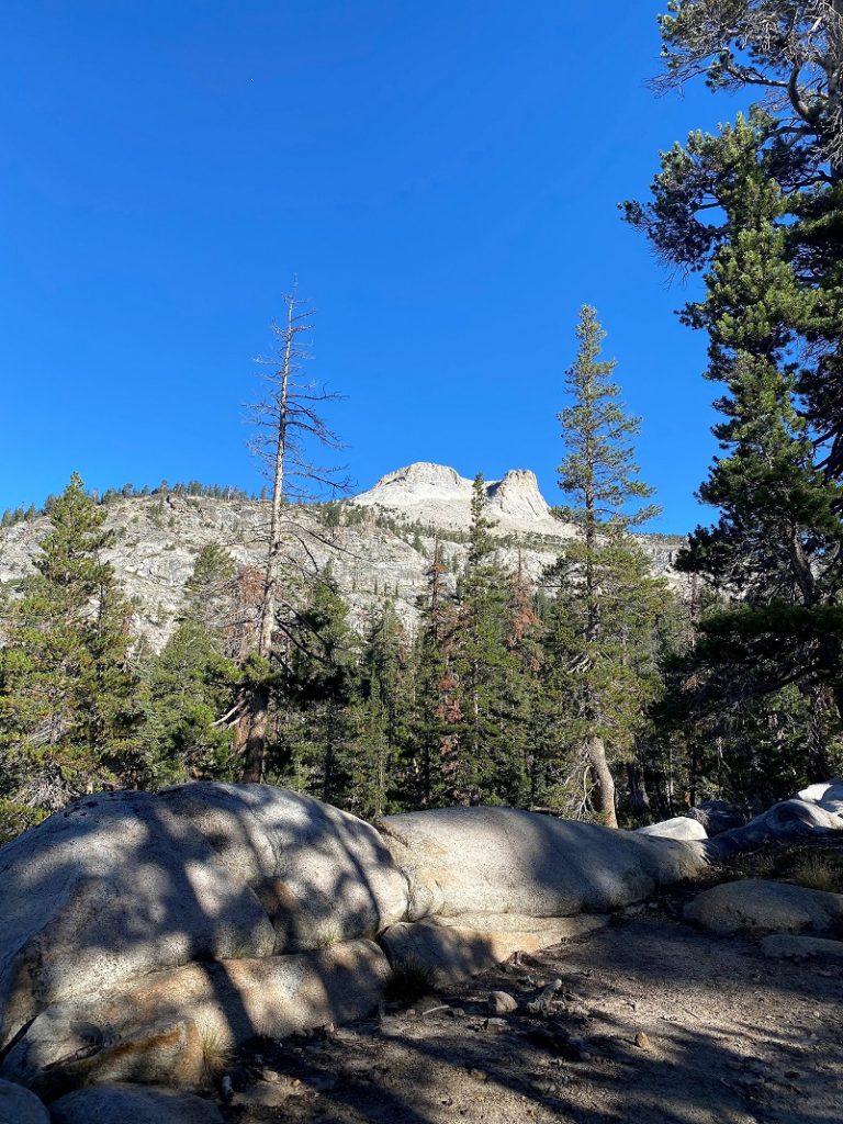
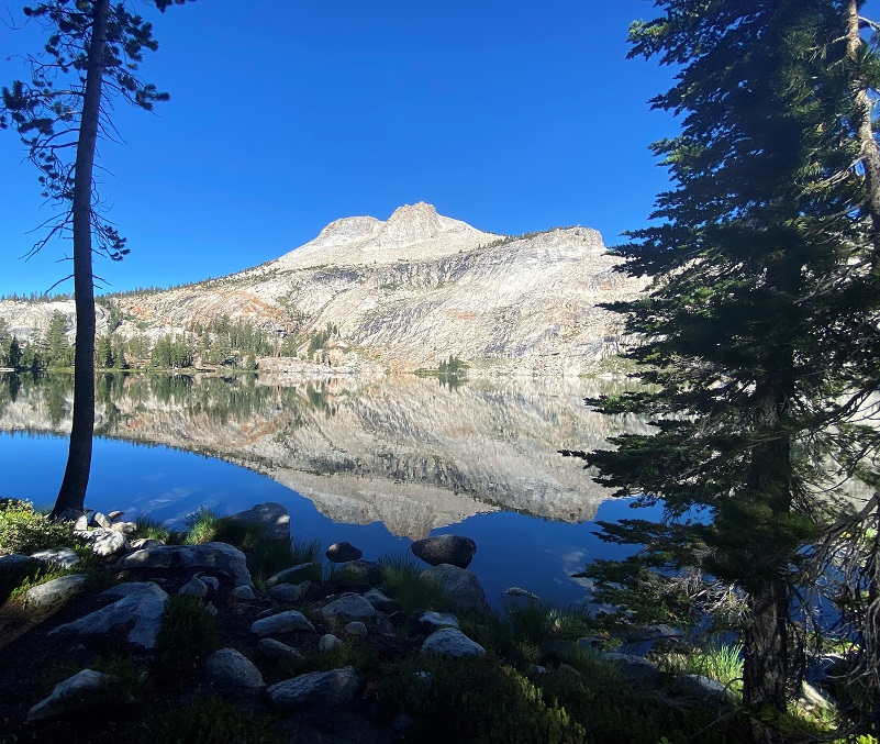
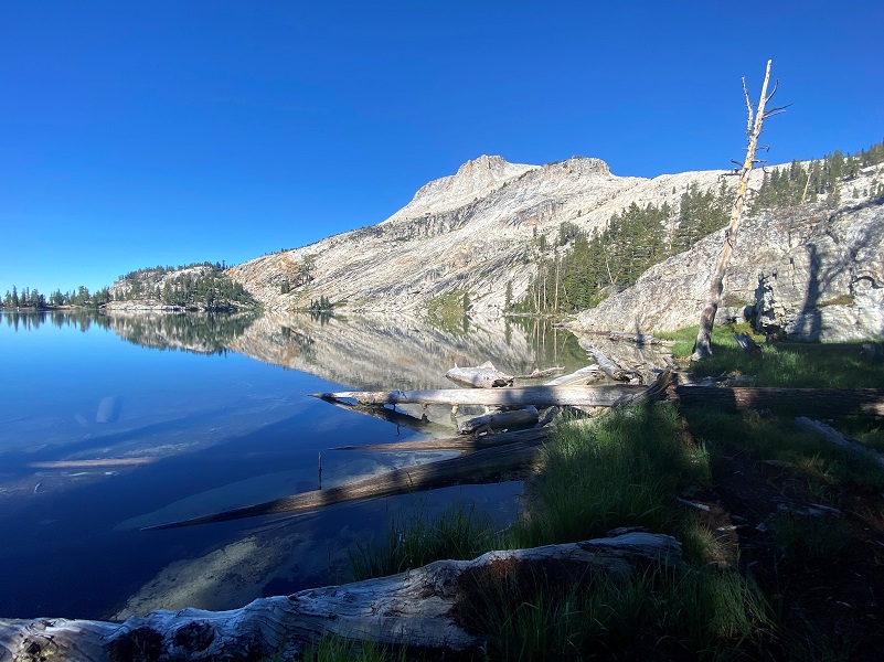
How could I not marvel at the views of Mount Hoffmann as the trail led me below it? And here is some information and history on Mount Hoffmann (10,855′ elevation), named for the cartographer Charles Frederick Hoffmann, who was part of the California Geological Survey of the Sierra Nevada.
Charles Frederick Hoffmann was born at Frankfurt-am-Main, Germany in 1838 and died in 1913 at Oakland. He was educated at an engineering school, was topographer with Frederick W. Lander on Fort Kearney, South Pass, and the Honey Lake wagon-road survey. In 1857, he came to California and 1858 he was a member of California State Geological Survey, under Josiah Dwight Whitney, throughout its existence from 1860-1874. He was a professor of topographical engineering at Harvard from 1871-1872. He was associated with his brothers-in-law, Ross E. Browne and Alfred Craven, in mining engineering at Virginia City, Nevada from 1874-1876. He also managed mines in Mexico, and at Forest Hill Divide, California from 1878-1886. He investigated mines in Siberia and in Argentina. He was associated with his brother-in-law Ross E. Browne in the practice of mining engineering, with offices in San Francisco from 1888-1906.
Josiah Whitney, the State Geologist, says in a letter to his brother, May 3, 1862: “Hoffmann does as well in his place as anyone could possibly do. He is a German, twenty-four years old, formerly topographer to Lander’s wagon-road expedition, with a capital eye for hills and orography in general, and no vices.” (Brewster: Life and Letters of Josiah Dwight Whitney, 1909, p. 214.)
Whitney, Brewer, and Hoffmann were in the vicinity of Mount Hoffmann in 1863, and one or all may have climbed it. The summit and the view are described in the report. (Whitney Survey: Geology, 1865, p. 424.) Clarence King climbed it in October, 1864. (King: Mountaineering in the Sierra Nevada, 1872, pp. 144-145.) In 1867 a photograph was taken of the summit by W. Harris, showing Hoffmann himself with his transit below. This photograph is among the plates accompanying The Yosemite Book, issued by the Whitney Survey in 1868. (See, also, S.C.B., 1923, XI:4, plate CXIII.)
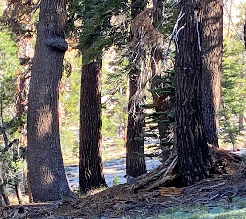
I spotted some movement along the trail ahead of me so I stopped to see what it was. I was thinking it could be a racoon or marmot. It was slowly moseying away from me and it was a marmot!
I continued on up the trail.
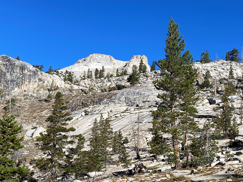
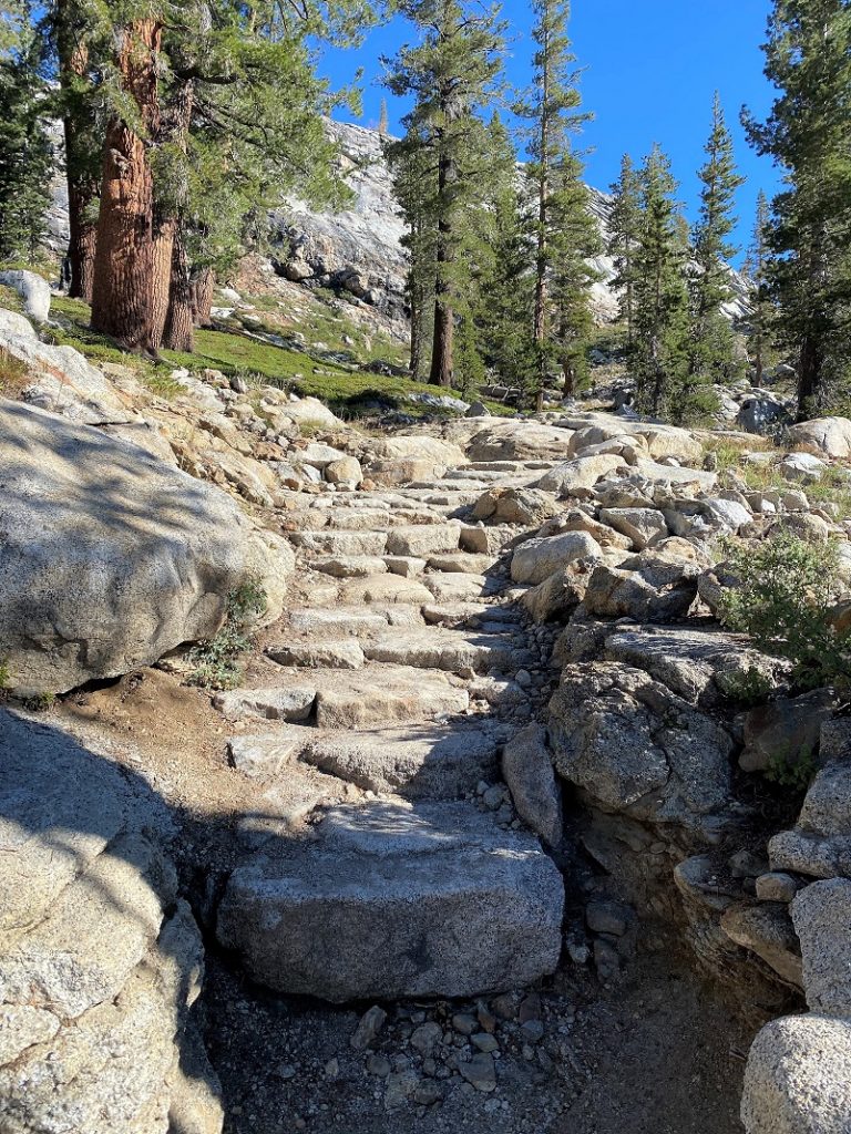
And the trail started climbing up through the granite through a few switchbacks.
Taking a look back in the direction I had come up every once in a while, I watched the views of Clouds Rest and Half Dome change as I climbed.

I kept on up the trail.

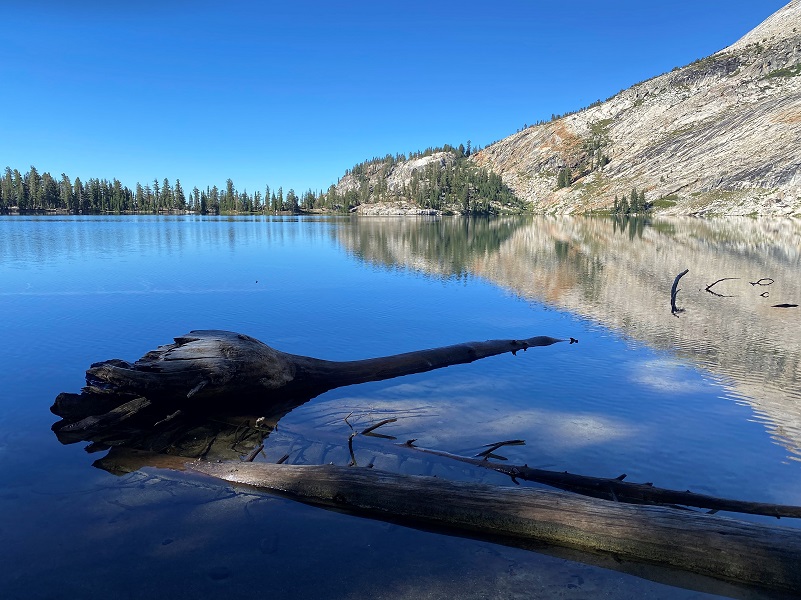
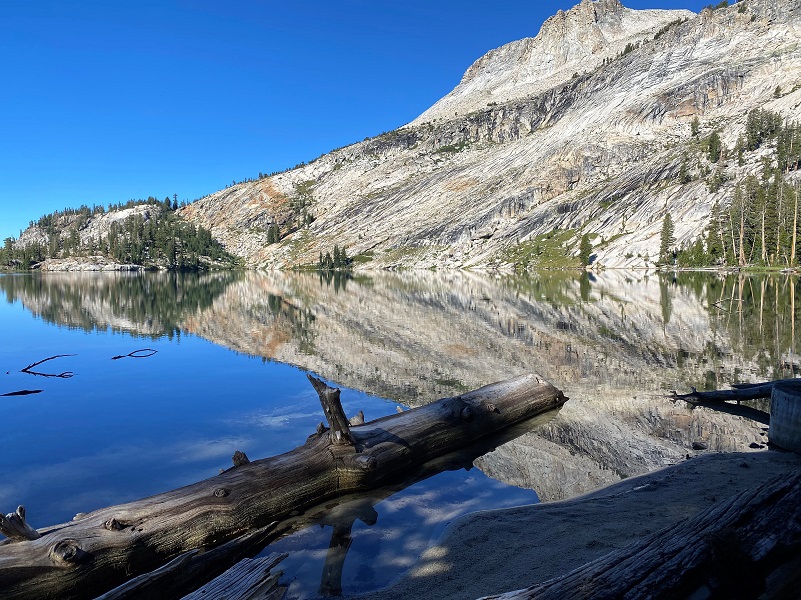
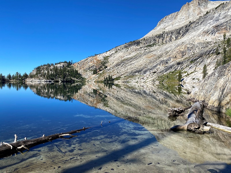
Then I arrived at beautiful May Lake (9,931′ elevation). Wow, those reflections were absolutely amazing!
Charles Frederick Hoffmann, who was part of the Whitney Survey, named May Lake for his future wife, Lucy Mayotta Browne. She was born between 1846-1848 in Washington DC and died 1926 in Oakland. They were married January 13, 1870 in Alameda County and had 4 sons. Her father, John Ross Browne, was born in Ireland, arriving 1833 in New York, and her mother, Lucy Anna Mitchell, was born in Maryland.
Lucy Mayotta Browne (From Rutherford Family Free, Ancestry.com)
Lucy Mayotta must have had quite an interesting upbringing, considering the information in the below biography for her father located on Find a Grave.
Author, Journalist, U.S. Revenue Service Agent, official reporter of the Constitutional Convention of California at Monterey, Surveyor of custom houses and mints and investigator of Indian and Land Office affairs, prolific writer of many subjects, appointed Minister to China in 1868, but recalled in 1870. His writings incidental to service with the United States Government in various capacities, Special Agent of the U.S. Treasury of California, mining and real estate investor, passionate champion for the rights of Chinese Americans and American Indians in California. He traveled widely both in government service and his own pleasure. His father edited a nationalist paper in Ireland, inspiring British authorities to put him in prison. They exiled the family to America in 1833, where they settled in Louisville, Kentucky, and his father became a schoolteacher, editor and proprietor of the Louisville Daily Reporter. In 1842, John Browne signed on to a whaling ship, traveling much of the Atlantic and Indian Oceans. The New York firm, Harpers and Brothers, published his writings and etchings of a whaling cruise in 1846. It was said his book may have influenced Herman Melville to write Moby Dick, and earned Browne international fame as an author and artist. 1849 found him in California during the Gold Rush and working at a number of government positions. Further travels to Europe and the Middle East yielded more Harpers publications in 1853, and in 1860, while in Virginia City, Nevada, after a few days visit, he complained of stomach pain caused by bad water. Harpers published his unflattering article, A Peep At Washoe. By 1855, he was friends with Mark Twain, who visited him at his Oakland, California, home. In his early days of writing, John heard from Edgar Allen Poe, who published John’s articles in his publication, Graham’s Lady’s and Gentlemen’s Magazine. His style of writing influenced a number of author’s, not only Mark Twain, but Bret Harte and Dan De Quille. John Ross Browne married Lucy Anna Mitchell in 1843 and they had ten children. By 1907, only five of their children were alive. He died suddenly at his home in Oakland, California.
I took a walk along the lake.


I swung into the May Lake High Sierra Camp which has been closed for a few years. “Due to ongoing challenges from the pandemic” is the reason given for the closure this 2022 season per Travel Yosemite. I don’t know when they will reopen but Travel Yosemite says that they anticipate having the lottery for the High Sierra Camps 2023 season open on October 1, 2022.
Wondering how the High Sierra Camps came into being? From Wikipedia:
In 1916, Stephen Mather of the National Park Service made an agreement with a private concessionaire, D. J. Desmond, to build mountain “chalets” at Tenaya Lake, Tuolumne Meadows and Merced Lake. Desmond’s company went bankrupt during World War I, and these first camps closed in 1918. In 1923, the Park Service decided that the camps should be re-opened and expanded. Ranger and naturalist Carl Parcher Russell hiked through the region and selected locations for five more camps. Three of these were built the following year by a new concessionaire, the Yosemite National Park Company. That firm merged with the Curry Camping Company in 1925, forming the Yosemite Park and Curry Company, which ran the camps for many years under the management of Donald Tresidder, until his death in 1948.
Ansel Adams defended the High Sierra Camps against critics who saw them as an encroachment into the wilderness: “The present High Sierra Camps do not, in my opinion, violate wilderness qualities as they now exist. I personally feel that a High Sierra Camp near the north rim of the Yosemite Valley would be a logical link in the chain.” A camp on the north rim was never built.
In the early years, rates were $1.00 per night and $1.00 per meal. In 1938, all-inclusive six-day horseback trips cost $46.00 per person. The rates for 2011 are $151.00 per person per day for lodging, breakfast and dinner, and $15.25 for lunch. Camps without showers charge $6.00 less per day. Six day saddle trips are $1603.00. The Yosemite Park and Curry Company operated the High Sierra Camps. YP&CC remained a Curry Family controlled corporation until the death of Mary Curry Tressider in 1970. After several ownership changes, MCA, Inc. took control of YP&CC in 1973, operating the concession until the NPS awarded a new contract to Delaware North Company in 1993. which has operated the concession ever since, and manages all of the camps except the Sequoia High Sierra Camp. Demand for reservations at the Yosemite backcountry camps is very high, and a lottery is conducted for reservations, with applications being accepted from September 1 to November 1 of the previous year for reservations the following summer.
There are five High Sierra Camps in Yosemite National Park. These camps, in conjunction with Tuolumne Meadows Lodge, make it possible to “backpack for six days without carrying a backpack. You can carry a day pack and spend each night at one of the High Sierra camps, complete with bedding and meals”. These camps provide “a fantastic way for visitors who enjoy a warm bed, a hot shower and a hearty meal to enjoy the beauty of the backcountry.”The complete loop, which offers a “maximum in scenic beauty”, has a hiking length, without side trips, estimated at 51.0 miles.
The May Lake High Sierra Camp replaced an earlier camp at Tenaya Lake, and was established in July, 1938 at a site selected by Donald Tresidder and Mary Curry Tresidder of the Yosemite Park and Curry Company. It is located at an elevation of 9,270 feet. The camp can accommodate 36 overnight guests.
It is the backcountry camp closest to a road, and is accessible by an uphill hike of 1.2 miles from the parking area. Glen Aulin High Sierra Camp is located a hiking distance of 8.6 miles northeast, and Sunrise High Sierra Camp is located a hiking distance of 8.3 miles southeast.

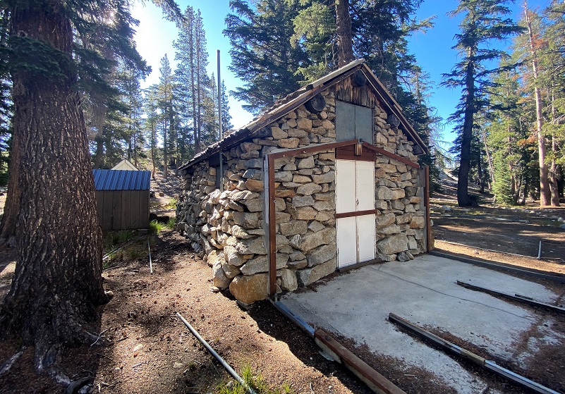
A couple of tents were pitched near the High Sierra Camp and I wandered back down toward the lake.

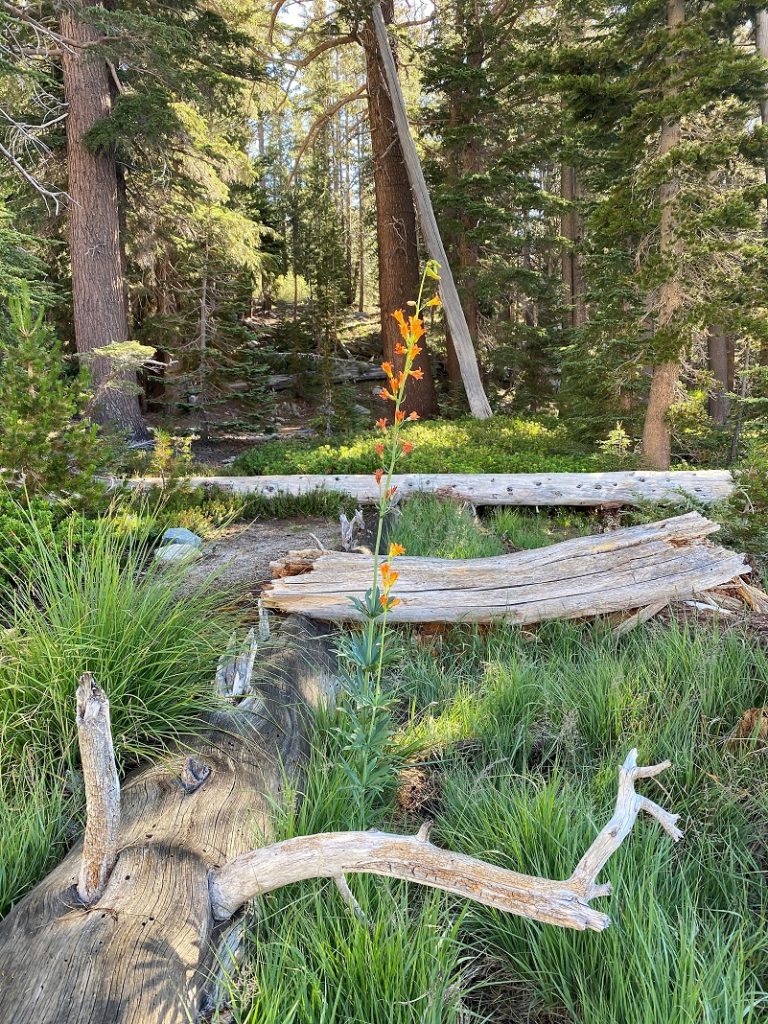
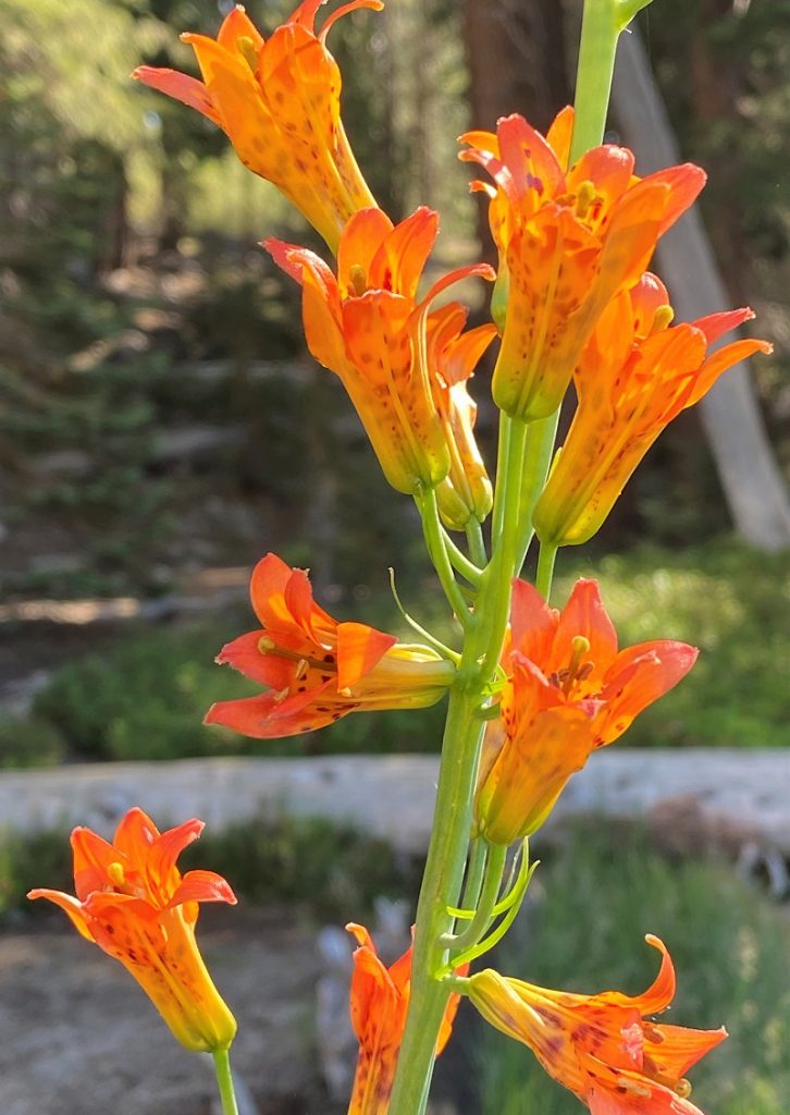
And then I spotted it! One lone Sierra Tiger Lily, almost as tall as I was and it was beautiful.
I headed back basically the same way that I had come in. Other than the people who had the tents at the lake, I didn’t see any others when I was at the lake but it was early in the morning. On the way out, about 10 or so people were heading in in small groups. This isn’t one of those hikes where you are likely to be by yourself but getting an early start helps minimize the people factor. Plus, those wonderful reflection on May Lake are most likely to happen in the early morning before any winds come up.
Also, when we have hiked up to the top of Mount Hoffmann, we always make a stop on the way in the check out the reflections and this lake is beautiful with a bit of snow and ice on it also!
Dog Hike? No, dogs are not allowed on this trail in Yosemite National Park.
Doarama:
What is a Doarama? It is a video playback of the GPS track overlaid on a 3 dimensional interactive map. If you “grab” the map, you can tilt it or spin it and look at it from different viewing angles. With the rabbit and turtle buttons, you can also speed it up, slow it down or pause it.
Map and Profile:
CALTOPO has some free options for mapping and here is a link to my hike this week, which you can view or download: CALTOPO: Hiking to May Lake
Sources:
John Muir Writings My First Summer in the Sierra by John Muir (1911)
May Lake & Mt. Hoffman Yosemite Hikes
Place Names of the High Sierra (1926) by Francis P. Farquhar
Exploration of the Sierra Nevada (1925) by Francis P. Farquhar The Whitney Survey and Clarence King
THE YOSEMITE BOOK by Josiah D. Whitney. Photographs by Carlton Watkins. (1869)
Prior Blogs in the Area:
Hiking from May Lake toward Mount Hoffmann November 14, 2018
