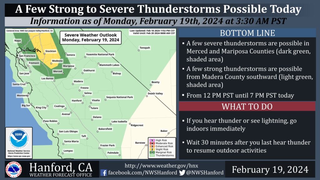
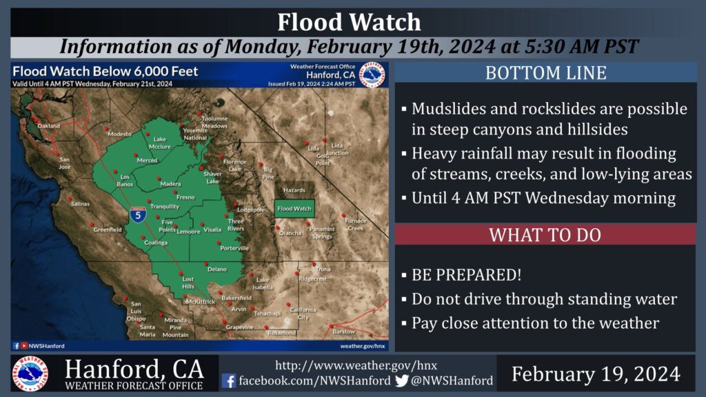
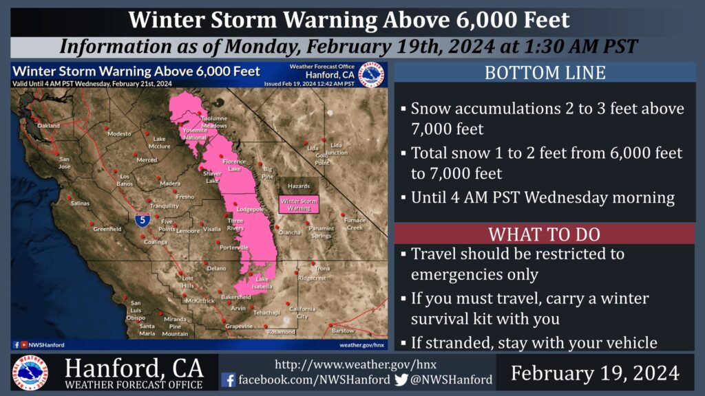
MOUNTAIN COMMUNITIES–The National Weather Service Hanford Office is predicting our area will continue to see winter weather through midweek. This includes a flood watch, excessive rainfall, thunderstorms and snow. An atmospheric river will pass through Central California today into tonight. Extreme winter storm impacts are anticipated in the Sierra Nevada above 6,000 feet due to snow load and snow amounts up to three feet. A few severe thunderstorms are conceivable in Merced and Madera Counties this afternoon into this evening. A localized risk for a brief tornado and/or wind damage are possible.
As always, Sierra News Online will be here monitoring and reporting on road hazards and closures, power outages, school closures and more.
Today and Tuesday
A strong storm system will impact Central California today through Tuesday night, resulting in periods of heavy precipitation. The majority of this precipitation will fall today into tonight. The snow level will start at around 7,000 feet today, before dropping to about 6,000 feet tonight.
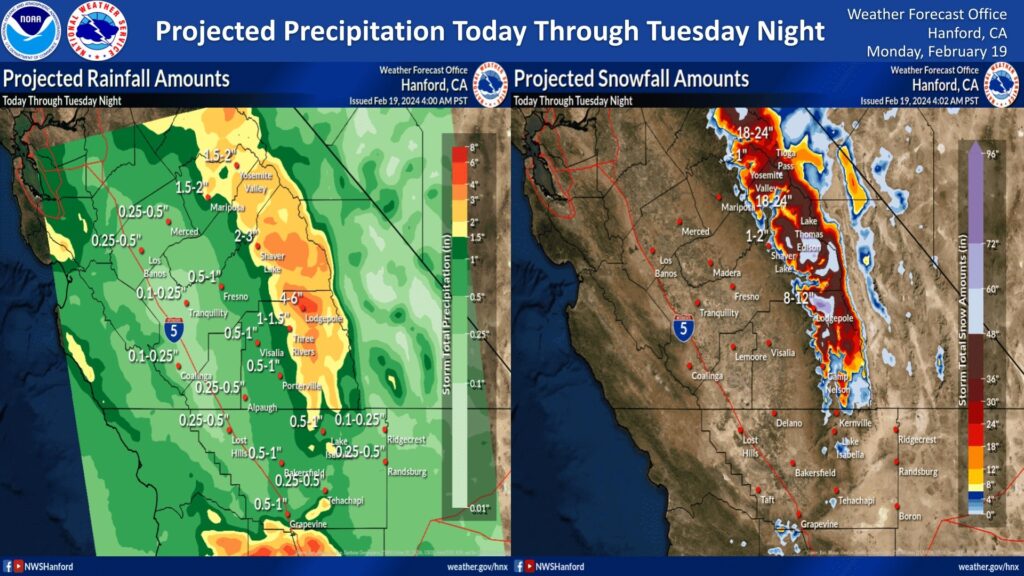
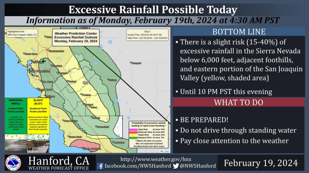
There is a slight risk of excessive rainfall in the Sierra Nevada below 6,000 feet, adjacent foothills, and eastern portion of the San Joaquin Valley until 10 PM PST this evening. Heavy rainfall may result in flooding of streams, creeks, and low-lying areas. Mudslides and rockslides are possible in steep canyons and hillsides.
Through Wednesday
A trough of low pressure will remain just off the coast of California Tuesday. A few strong thunderstorms are possible in the San Joaquin Valley, Coastal Range, and Sierra Nevada foothills Tuesday afternoon into Tuesday evening. The trough of low pressure will finally move eastward across Central California Wednesday. Scattered showers are possible Wednesday morning, ahead of this trough of low pressure. Precipitation chances should end Wednesday afternoon.
Thursday and Friday
Dry weather is expected Thursday and Friday. The next storm system may impact Central California during the upcoming weekend.

