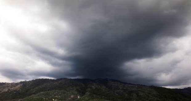
MOUNTAIN AREA — It’s cold, wet, and snowy outside in some places and that’s not going to change much over the next two days — except the snow levels will drop again — as the National Weather Service (NWS) in Hanford has issued a Winter Storm Warning for the Sierra Nevada and a Winter Weather Advisory for the foothills.
Winter Storm Watch
The NWS has issued a Winter Storm Warning for heavy snow in the Sierra Nevada from Yosemite to Kings Canyon and the Tulare County Mountains. The warning is in from early on Friday, Feb. 15 through 4 p.m. on Sunday, Feb. 17.
A Winter Storm Warning for snow means severe winter weather conditions will make travel very hazardous or impossible. If you must travel, keep an extra flashlight, food and water in your vehicle in case of an emergency.
Heavy snow is expected, with new snow accumulations of 1 to 3 feet, and up to 5 feet in the high country, along with winds gusting as high as 50 miles per hour in the high country above 7,000 feet.
Snow will move in this morning and continue through tonight — heavy at times. Snow will taper off by Saturday afternoon, Feb. 16, and be light through Saturday night. Snow will increase again on Sunday morning before ending Sunday afternoon.
Travel could be very difficult to nearly impossible. Road closures and chain controls are expected. Gusty winds could bring down tree branches.
Winter Weather Advisory
The NWS has issued a Winter Weather Advisory for snow in the Mariposa, Madera, and Fresno County Foothills, and the Tulare County Foothills above 1,500 feet, including the cities of Oakhurst, Mariposa, Springville and Three Rivers. The advisory takes effect at 4 p.m. on Friday, Feb. 15 and will last through 4 p.m. on Sunday, Feb. 17.
A Winter Weather Advisory for snow means periods of snow will cause primarily travel difficulties. Expect snow covered roads and limited visibilities, and use caution while driving.
The snow may be heavy at times, with total snow accumulations of 4 to 8 inches, with up to a foot possible above 3,500 feet.
From late tonight and into Saturday morning, snow levels drop to around 3,000 feet and drop again on Sunday to around 1,500 feet. The snow is expected to increase again on Sunday morning before ending Sunday afternoon.
Travel could be very difficult, with possible road closures and dangerous travel conditions.
National Weather Service Winter Storm Warnings


Thank you Sierra News Online for bringing the information we rely on, especially during these weather events!
oops… rely not relay