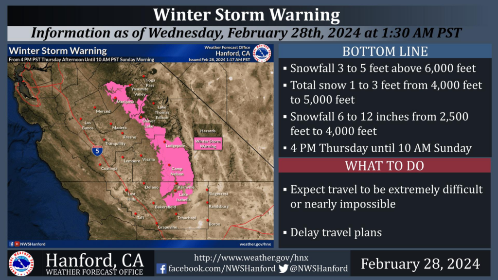
MOUNTAIN COMMUNITIES—The National Weather Service Hanford Office is warning residents of a strong storm system headed out way. It will impact Central California Thursday evening into Sunday morning. The result being periods of heavy precipitation. The majority of this precipitation will fall Friday evening through Saturday evening. The snow level will start at around 5,000 feet Thursday evening, before dropping to about 2,500 feet Saturday evening.
As always, Sierra News Online will be here monitoring and reporting on road hazards and closures, power outages, school closures and more.
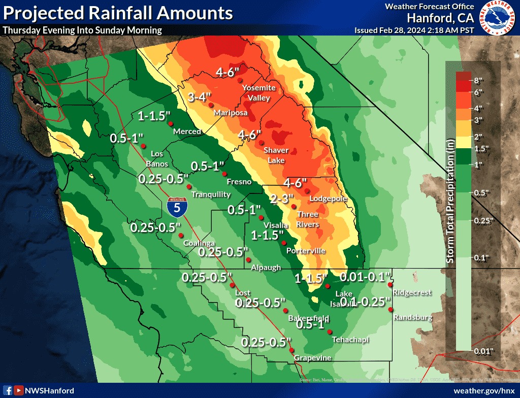
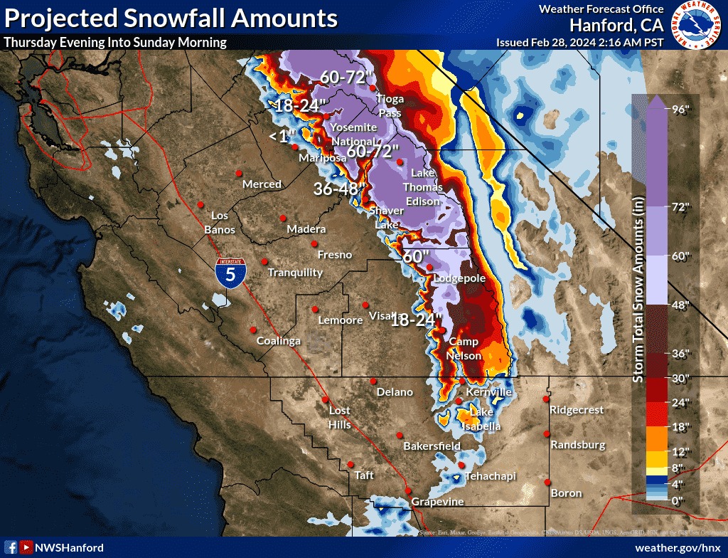
In addition to the heavy snowfall over the Sierra Nevada, strong winds with gusts up to 70 mph area expected along the ridge tops and will produce blizzard conditions across the Sierra Nevada from Kings Canyon northward. A Blizzard Warning remains in effect for these areas from 400 PM PST Thursday to 1000 AM PST Sunday. The heaviest snow will fall Friday evening through Saturday evening. Damaging winds and heavy snow could down trees and power lines. Travel is not advised.
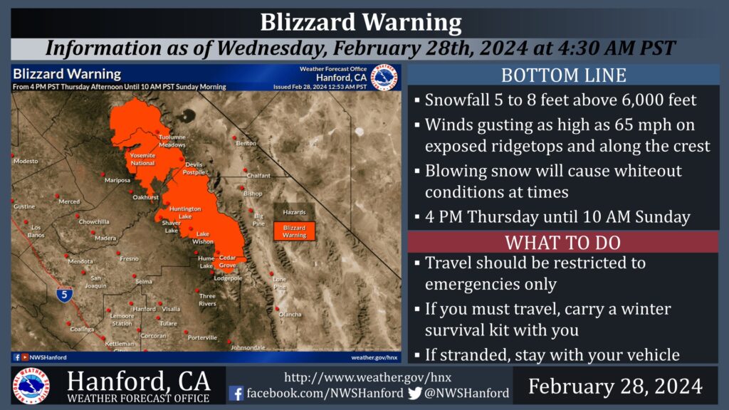
A Winter Storm Warning is in effect for the Tulare County portion of the Sierra Nevada and Sierra Nevada foothills above 2,500 feet from 4 PM PST Thursday afternoon until 10 AM PST Sunday morning. The majority of this snow will fall Friday evening through Saturday evening. If you plan to travel, consider alternate strategies.