Hiking up Yosemite’s Mono Pass Trail, up a trail full of history, up along beautiful mountains still streaked with snow, up to old mining cabins and claims. Almost 150 years have passed since these cabins and mines were built but they are still standing . . . sort of.
Where: Yosemite National Park
Distance: 9.07 Miles (About 7.4 Miles without wandering)
Difficulty: Moderate
Elevation Range: 9,596′ – 10,657′
Elevation Gain: 1,215′
Date: June 14, 2022
CALTOPO: Tioga Road to Mono Pass Mines Hike
Dog Hike? No
 I left the house early and headed into Yosemite National Park via the Arch Rock Gate. It was a smidge before 6 am and there was no one in the booth yet, but I had my Peak Hour Reservation Pass. When I went through the Tenaya Lake area, there was no road construction going on and I had a 20 minute wait at the Tuolumne Meadows construction. For the latest on Yosemite National Park’s road construction, including estimated wait time, you can read the latest here.
 I parked my car at the Mono Pass Trailhead, about 5.6 miles east of the Tuolumne Meadows Campground and 1.4 miles south of Tioga Pass. I was not going to take any chances on mosquitos so I sprayed down with mosquito repellent but lucked out with a nice breeze that blew them away on my hike. Those skeeters are out now, just be prepared.
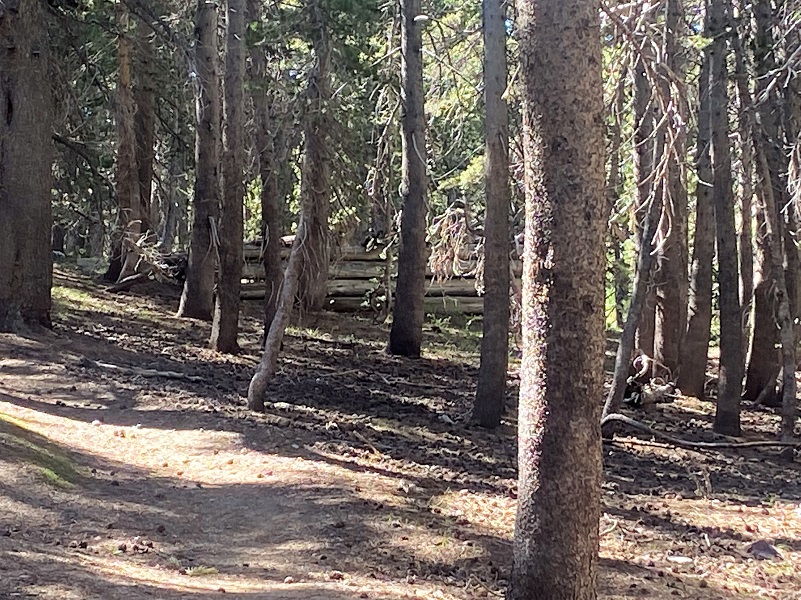
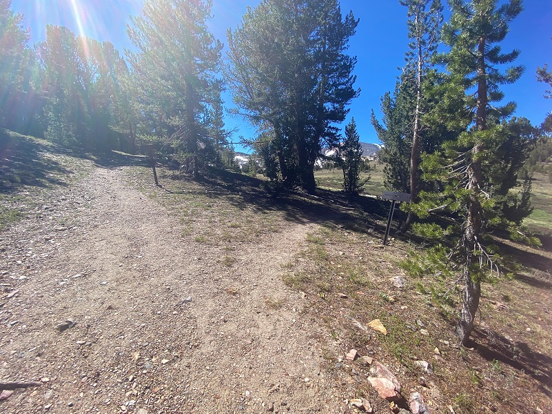
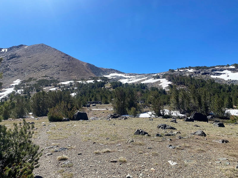
 It was 40 degrees when I headed up the trail, frost dusting the grass and the frozen mud crunching as I walked in most areas. This trail has so much history related to it. The first part of the trail follows an old dirt road that was used to truck out gravel for the realignment of the Tioga Road. This trail was a major trading route for Native Americans who used it to cross the Sierra, traveling over Mono Pass and through Bloody Canyon to Mono Lake. It is still used by them today.
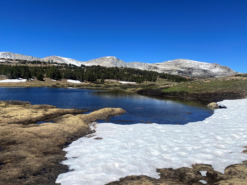
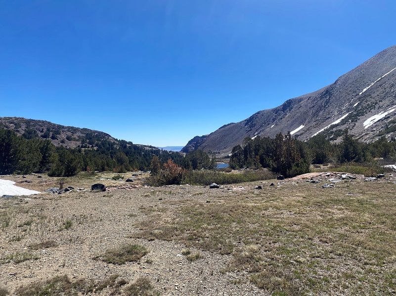
I passed by a small tarn that reflected views of Mammoth Peak (12,090′ elevation). If you read the blog a couple of weeks ago, it is the same tarn, with the grass growing up a little higher and the water slowly drying up for the summer.
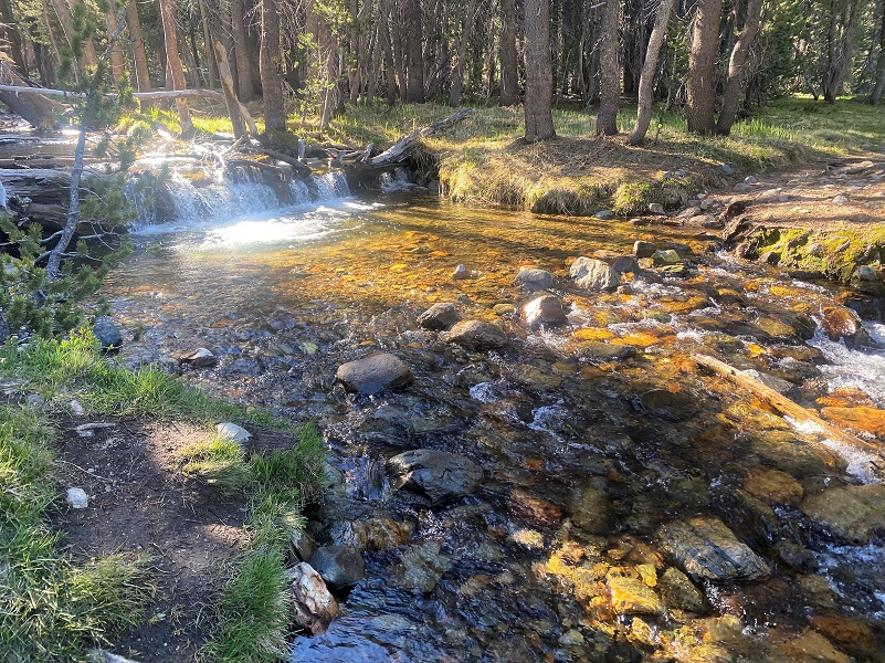
The Dana Fork was low enough that I was able to rock hop across it but that isn’t the story early in the season or when it is running higher. I continued on up the trail past the old miner’s cabin up to the trail split. The right fork goes up to Spillway Lake and I took the left fork toward Mono and Parker Passes.


As the trail climbed, I could pick out slight variations where the trail or road had deviated from the current trail. A rockfall that I call Pika City modified the course of the trail at some point. I usually hear pika calling in this area. No pika calling today, but a couple of ground squirrels were running around in the rocks.

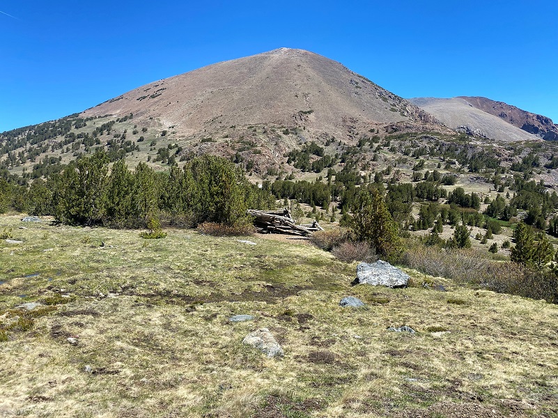
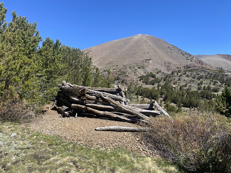
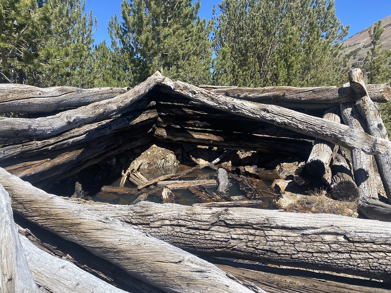
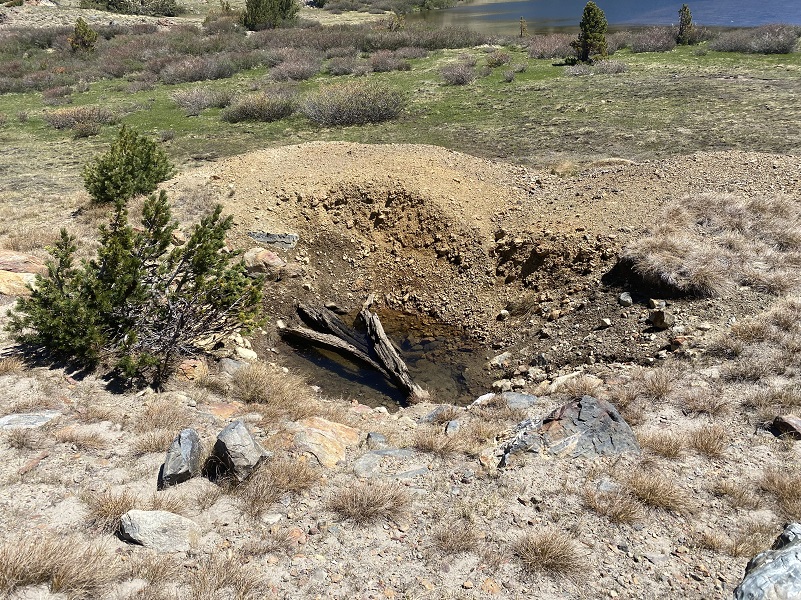
After Pika City and just before the trail climbs its way out of the trees, the remains of another old miner’s cabin are on the right. It is rapidly disappearing so you need to pay attention or you may walk by it.
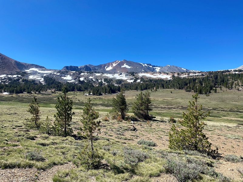
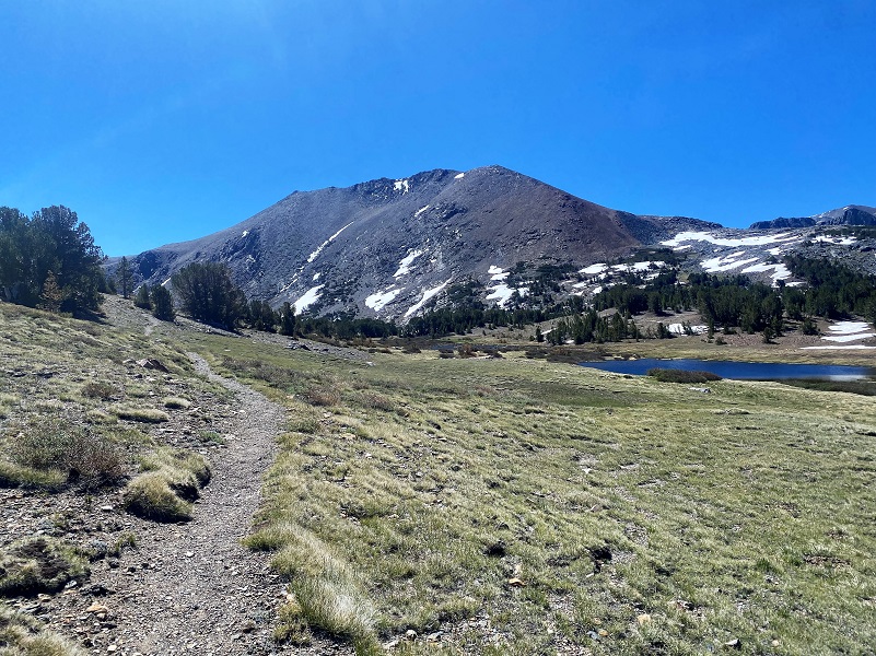
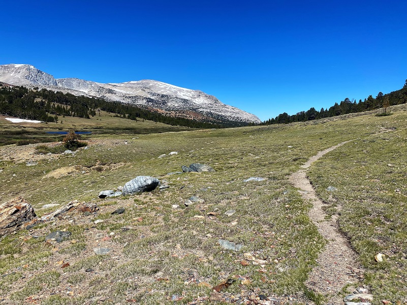
The trail soon breaks out of the trees with wonderful views toward Parker Pass and Koip Peak (12,968′ elevation). Peter Browning in Yosemite Place Names says that Koip Peak was named by Williard D. Johnson, USGS, about 1883. It was “probably named from a Mono Indian word. Koipa is ‘mountain sheep’ in the closely related Northern Paiute dialect.”
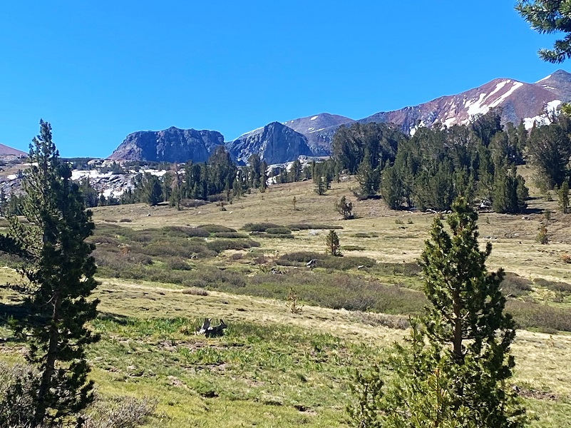
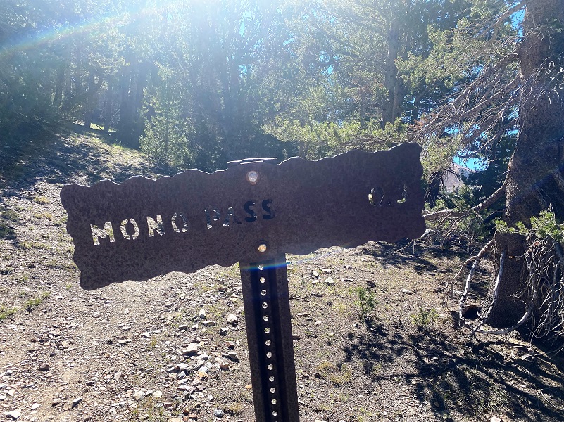
The well signed trail soon split, the right fork going to Parker Pass and I took the left fork toward Mono Pass.

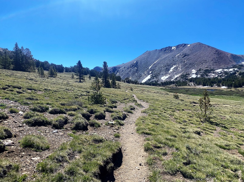
What a beautiful view! I always try to scan the countryside up here for Mountain Sheep, see plenty of sign, but never can spot them. I did see a couple of bucks feeding down along the creek. They kept their eyes on me as I walked up the trail but never left their spots.
I continued on up the trail toward Mono Pass.
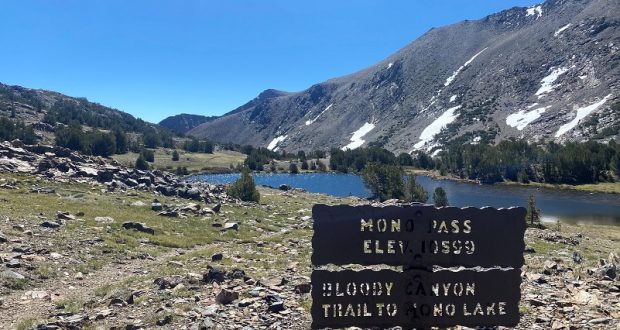
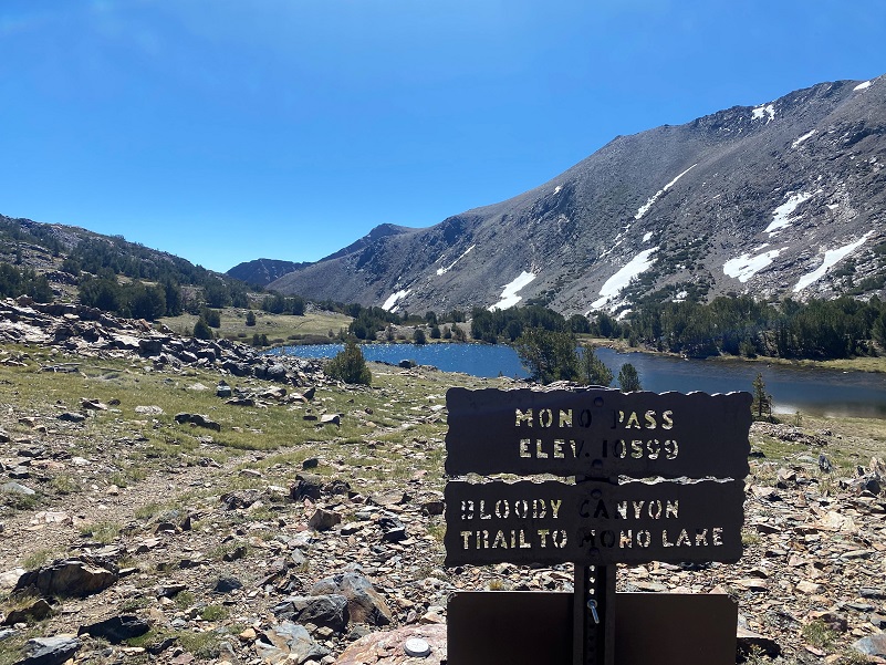
The trail to the Ella Bloss Mine and cabins is not signed but forks to the right just before Summit Lake. I wanted to continue up a smidge to Mono Pass though to get a picture. This trail continues from Mono Pass down Bloody Canyon by Sardine Lakes to Walker Lake toward Hwy 395. Early accounts say that Bloody Canyon was named because the route down the canyon was precipitous and rocky, and the legs of the horses frequently were lacerated. Others feel that the metamorphic rocks which fill the canyon have a reddish tone which gives the canyon a blood-like color.
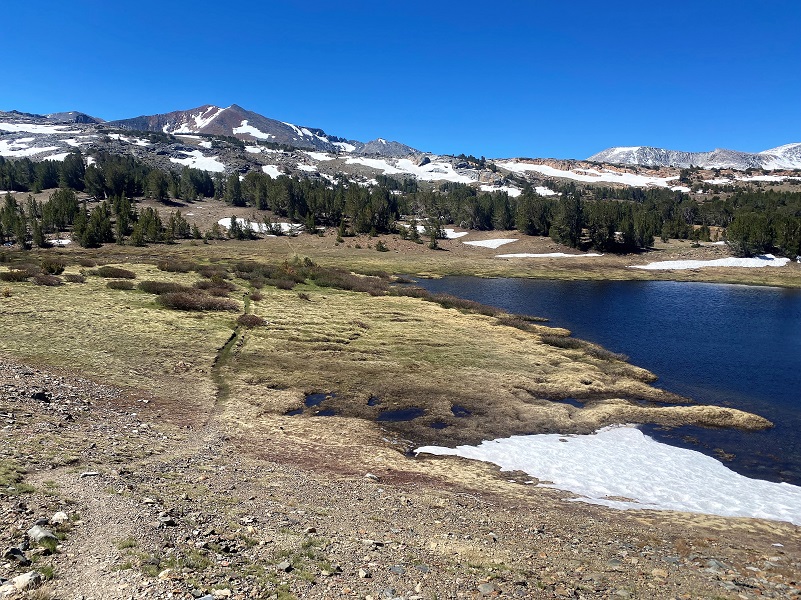
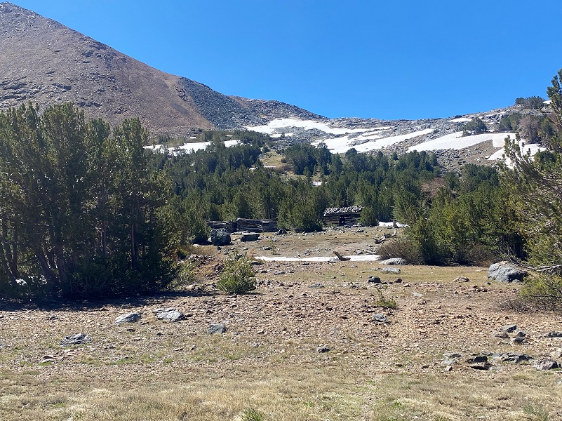
The unmarked trail over to the cabins runs between a tarn on the west and Summit Lake on the east. It can get a bit marshy early in the season but it was dried enough that I could hop a few rocks without getting too muddy. When I have hiked this area when this was an issue, I stuck to higher ground and bypassed the tarn area.
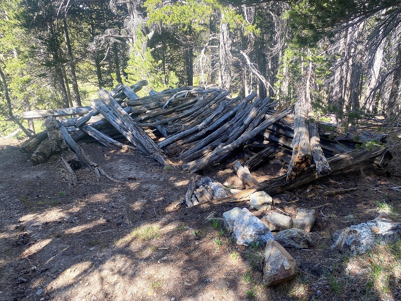
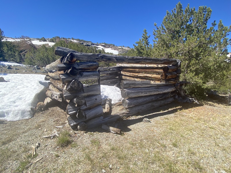
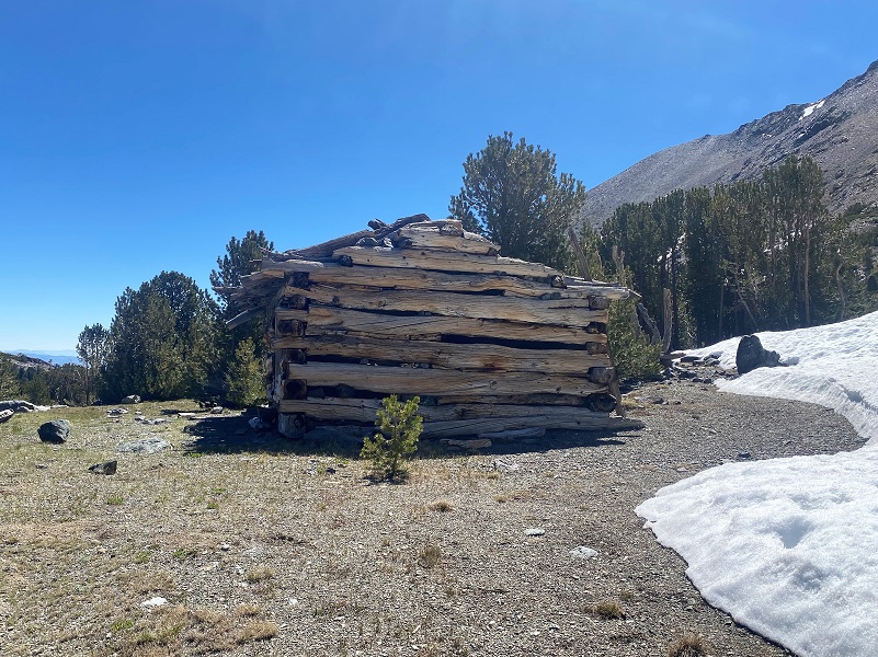
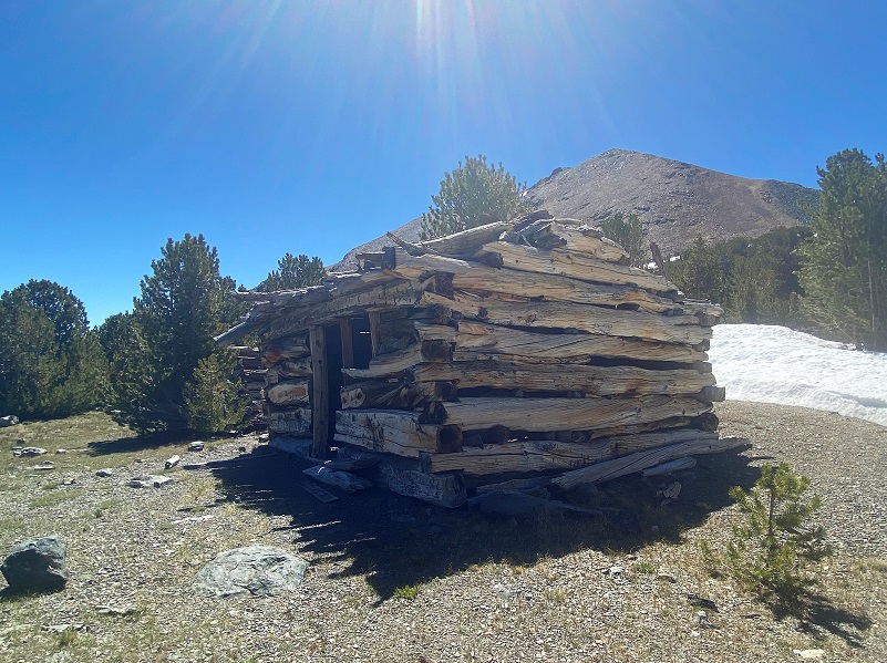
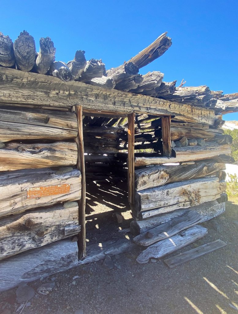
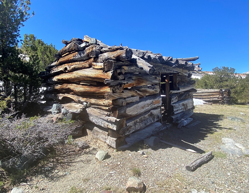
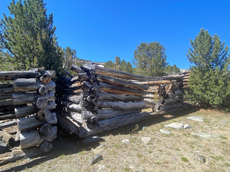
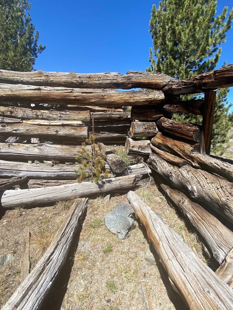
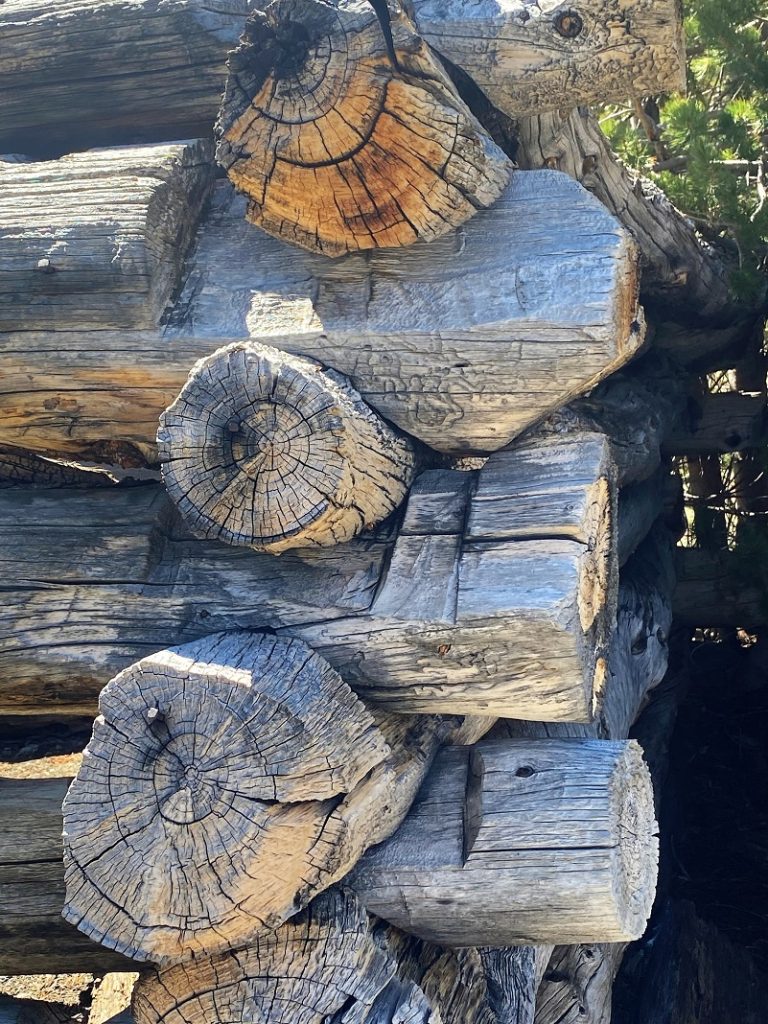
The cabins are on the ridge above this area but it is becoming more difficult to spot them because of the trees growing up adjacent to them. Some people refer to these cabins as the Ella Bloss or Golden Crown Mine cabins. Who knows what this small community was called back in its heyday but I would bet these cabins provided shelter for the men, supplies and stock that supported these mines, along with those on nearby Mt. Gibbs. These cabins are over 100 years old and of great historic importance. Please don’t disturb anything, so that others may enjoy their beauty and wonder about their history.
The trail soon led right to them.
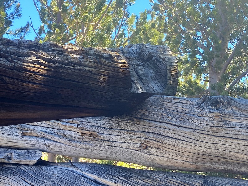
Whitebark Pine stumps still hold the old axe marks that were used to cut the timbers for these cabins.

Five log cabins are still here, over 100 years old, but they are deteriorating.
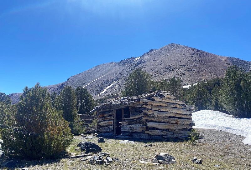
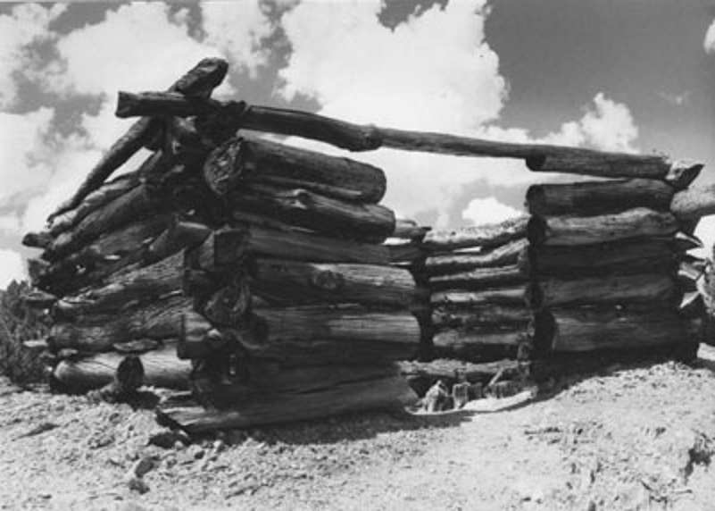
Yosemite National Park has the below cabin picture on their Golden Crown Fact Sheet and I think it may be the same cabin with Mount Lewis (12,350′ elevation) behind it in the picture above that I took. It is the only existing cabin with the door on that side but I could be wrong. What do you think? BTW, Mount Lewis was named in memory of Washington Bartlett “Dusty” Lewis (1884–1930), Superintendent of Yosemite National Park for 11 years from 1917 through 1928. He played a leading part in the development of the park and in standardizing uniforms for National Park Service employees.
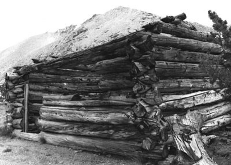
Golden Crown Cabin (Courtesy Yosemite National Park)

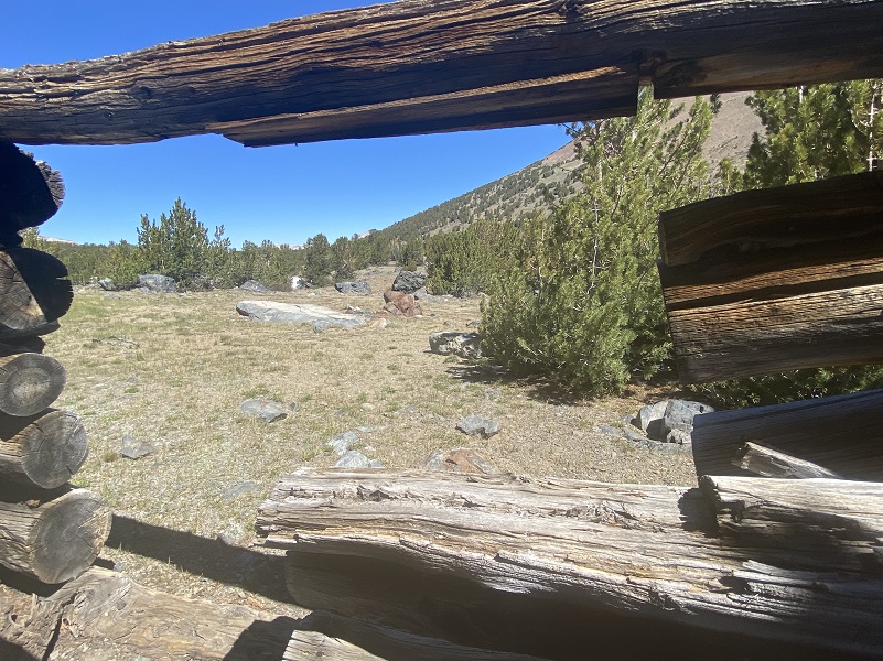
I wandered around the other cabins.


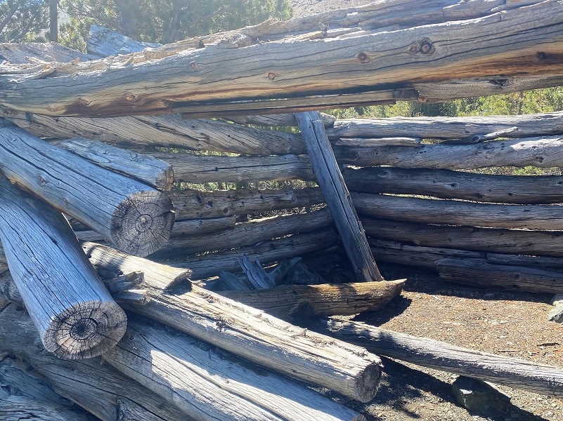
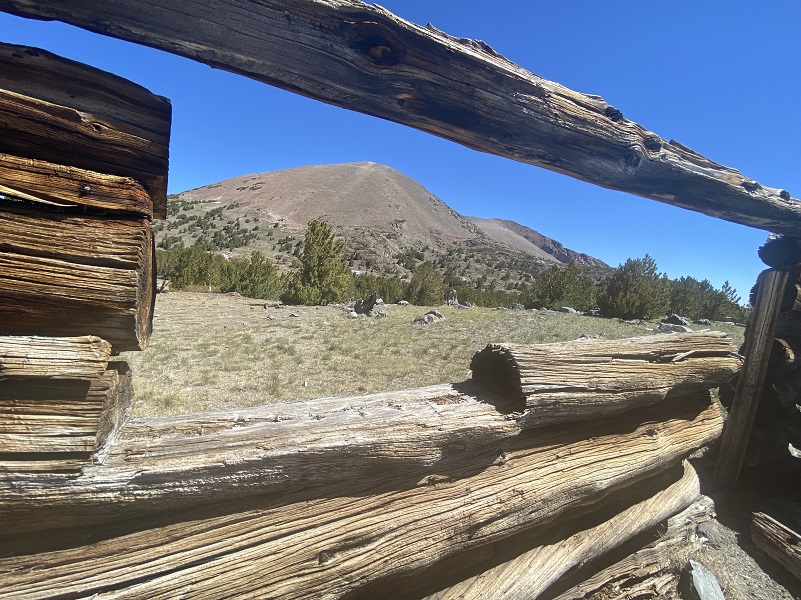
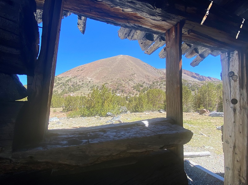
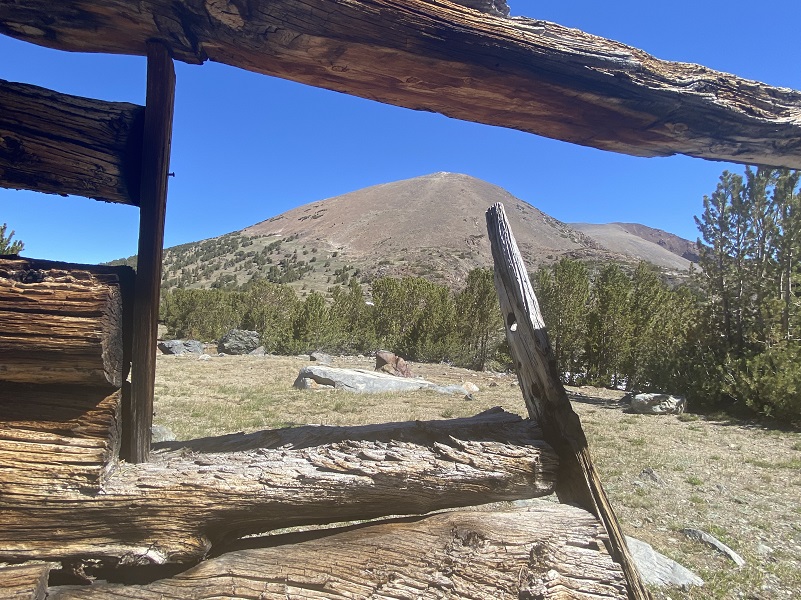
Those miners had some pretty amazing views, this one looking down Bloody Canyon.
And I don’t think it is an accident that the old cabins all have windows with stellar views, including Mt. Gibbs (12,772′ elevation)!
So why were these cabins here? It is all about the mines and the search for gold. Orlando Fuller was a miner who established the Golden Crown Mine in 1879. I had walked some of the upper mines and diggings that Orlando Fuller had in the area last season and you can read the blog about that hike which is full of history related to him here. The fact that he built his cabin hanging over Parker Pass Lake so that a horse could walk over the ice with safety intrigued me to follow his footprints to that location. Here is a timeline that I created for him:
March 7, 1825: Born Itaska, NY to Joseph Kibbe Fuller (Born 1803 Fuller’s Settlement, Itaska, NY, worked as an Assessor, enlisted in Mexican War with Michagan Infantry, and died 1848 New Orleans, LA) and Jane Quinley (Born 1804 NY, died 1840 Oshtemo, Michigan ). Joseph and Jane had 6 children. One of the daughters, Mary Ann, married Benjamin Parke Avery in Marysville, CA. He was appointed the Minister of China by President Grant in 1874. Their son, Mortimer, headed to California and was shown on the 1850 El Dorado Co., CA census as a Miner, 1860 Yuba Co., CA census as a Miner and 1880 Lincoln Co., NV census as a Miner. Mortimer never married.
April 5, 1873: An article in the San Francisco Chronicle give information on the bankruptcy of Huhn & Hunt Mine, with a filing by Orlando Fuller to declare bankruptcy.
1863-1865: Civil War Draft Registration lists Orlando Fuller as Speculator, Single in Marysville, Yuba Co., CA.
September 1, 1877: Orlando Fuller is mentioned in the Arizona Weekly Citizen as a Director filing for Incorporation for the Hackberry Mining Company in Arizona with stock worth $6,000,000. In 1909, The Weekly Journal Miner (Prescott, AZ) reported that the Hackberry Mine sold for $2,000,000. 1956 is the latest year of reported production.
1879: Orlando Fuller established the Golden Crown Mine during the Tioga silver boom that also produced Bennettville and the Great Sierra Mine near Tioga Pass.
1883: From Bennettville by Alan H. Patera:
The Great Sierra Company suspended mining operations in 1883 after they ran out of money. Charles E. Barney was the superintendent as it was about to shut down in July 1883. He was hoping to resume operations the next spring. In October, he traveled to San Francisco to make a written report to W.C.N. Swift. He describes the assessment work that had been on the mines and he mentions Orlando Fuller and the Ella Bloss and Golden Crown Mines.
Fuller told me that the deed he gave to Traynor of 1/3d Golden Crown had never been recorded. I had some doubts about it and wrote to Miller (the Clerk at Bridgeport) for information. I found a letter from him on my arrival here, saying that Fuller’s deed to Traynor had been recorded and that no transfer from Traynor was on his books, so the property still stands in Traynor’s name.
Fuller talks very loudly and confidently about the mine, wants a price on your 2/3d and a contract to sink a shaft 200 ft. deep. He is a difficult subject to deal with. I think I wrote you in my lst letter that in doing the work on the Ella Bloss a ledge was uncovered and some ore taken out. This ledge is not in line with any of the other openings and I hardly know what to make of it. There seems to be ore all through the hill. I made assays of some of this ore, which ran from $160 to $520 per ton. It is fine looking rock and comparatively free from base metals.
Nothing was found on the Ella Bloss No. 2 or Bulwark. On the Golden Crown the assays of ore taken out ran from $60 to $120 per ton. The crosscut from Golden Crown tunnel was run out of the ore into slate. It was 12 ft. long. There is ore just beyond the breast of this crosscut, which shows ore on the surface, and I have no doubt goes down.
End of 1883: From Bennettville by Alan H. Patera:
After the Great Sierra Company suspended operations there wasn’t any work to be had in the Bennettville area but a few mining claims were being prosecuted by the end of 1883. Much of the activity was on Mt. Gibbs, where Orlando Fuller had laid in a winter’s supplies to work a small force on the Original Mt. Dana and Lucky Friday claims. He had already run a tunnel in 150 feet. August Cordes had single-handedly sunk a shaft 52 feet on his New Brunswick claim on Mt. Gibbs. On the south side of Mt. Gibbs Charley Jardine-the same Charley Jardine who was to shoot a Deputy Sheriff in Lundy in 1885 –was mining, and Andy Sayre was said to have erected “a palatial residence on the southern slope of Mt. Gibbs.” however, when winter came on Andy abandoned his “palatial residence” for work in the Sweetwater district north of Bridgeport, and even Orlando Fuller’s cabin was vacant by spring.
1884: Orlando Fuller no longer in the Golden Crown Mine/Parker Pass Lake area.
1892-1894: Orlando Fuller registered to vote San Diego, CA.
1910: Orlando Fuller listed on San Diego, CA census, single, no occupation and living as a Roomer.
November 10, 1910: Orlando Fuller died San Diego, CA.
Mines go by different names over time, changing as ownership changed hands. There are also associated diggings near these mines and some of them may have yielded information to assist with alignments of the main mine’s shaft. We just don’t know a lot about why they dug in some places and not others today and no substantive information has been found on how much gold, if any, was taken out of these mines. From Yosemite Nature Notes 47(3) (1978):
The Homer Mining Index, one of the few papers in the area at the time, states that Fuller and Hayt (or Hoyt) discovered antimonial silver in Mono Pass and called their claim the Golden Crown. The Mammoth City Herald, another newspaper of the day predicted that within a year, thousands of miners would be working in Mono Pass at the Golden Crown (the row of cabins that was built there is still standing and is easily accessible to today’s hikers). Later, in 1881, when these men sold their claims to a New York company, it was shown that Fuller owned the Golden Crown, and Hoyt owned other claims, which he called the New Brunswick, the New York, and the Kalamazoo. N.P. Brady owned the Ella Bloss mines, also situated in Mono Pass. Either these cabins and mining claims changed hands, or names in the early records were incorrect, for in 1958, the Ella Bloss claim (that row of old whitebark pine cabins commonly called the Golden Crown) was sold to the National Park Service. So, these cabins began their life as part of the Golden Crown, and ended up as part of the Ella Bloss. Though the claim is principally in the Tioga Mining District, it is partially over the pass, therefore in Mono County and part of the Prescott Mining District. Another source states that the Golden Crown cabins were built by four men, Gus Cordes, Andy Thompson, Louis Amiot, and lames Camble, before the Fuller and Hoyt discovery. Of particular importance was Gus Cordes, an early packer working the Bloody Canyon route, who did the last work on the trail in the 1890’s.
Once I got home, I couldn’t think about Gus Cordes for some reason so did some digging. I discovered through Voter Registration and Census Records that August Cordes was born in Germany about 1846, arrived in the New York November 20, 1866 from Hanover, Germany. He was naturalized October 24, 1877 in New York. He is listed in Inyo County 1878, then in Mono County, CA California Voter Registrations 1879 through 1898. Can’t be positive that this is the same person but August F. Cordes is also listed on U.S. Returns From Military Posts at Camp Yosemite April through August 1909, the San Francisco October 1909.
The only census that I may have located him on was the 1910 census living in Round Mountain, Nye County, Nevada working in the gold mines. If this is him, it says he is a widower. Nye County abuts Mono County to the east. August/Gus Cordes shows up in several articles, including the below.
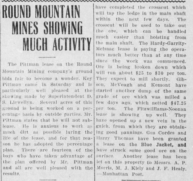
Round Mountain Mines Showing Much Activity (Tonopah Daily Bonanza, Tonopah, Nevada 17 Apr 1911, Mon • Page 3)
How about a little more about the mining history at Round Mountain, which ties in with the dates that Gus Cordes is there. Western Mining History Round Mountain Nevada shares the following:
“Gold was first discovered at this point in February, 1906, on ground owned by Louis D. Gordon. So sensational was the find that Goldfield men treked hurriedly across the unknown wastes and mountains and a new camp was born. This was the beginning, and for a few months, Round Mountain showed greater promise of golden wealth than even Goldfield at its best.
Slabs of virgin metal were almost daily found. Organizations by the dozen sprang into existence over night: for a time money poured in for development. The mine is now developed to a depth of 800 ft., equipped with a 100-ton mill, and has produced to date, in a period of two years, $709,184 in gold bullion, and has paid $192.184 in dividends.”
Pulling the mining information on the Blue Jacket Mine, it shows that the mine went by several names, including Silas Cordes. I don’t know what became of Gus Cordes. I can’t be sure that Silas and Gus are the same person. An August F. Cordes died and is buried in Greenwood Memorial Park, San Diego. This person had a brother names John. Did the packer named Gus Cordes get gold fever and head over to Nevada? If so, what became of him and is the person buried in San Diego the same person? If he continued with packing, where did he go? I just did a quick search for him but perhaps I can stumble across some more clues to help me learn more about him.
I wandered through some of the diggings and to the old mine shaft nearby.
Here is an undated photo of that mine shaft from Yosemite National Park.
Golden Crown Mine Shaft (Courtesy Yosemite National Park)
I wandered on through the diggings.

I headed back toward the same way that I had come in. I had the cabins and mining area to myself and as I hiked down, I passed about 10 people heading up the trail into them. I stopped and talking with some of them. One was a family group and I thought how fun that must be for those kids to explore this area’s history first hand.
I got to wondering on my walk about about Ella Bloss. Was there a real woman that the mine was named after so when I got home I did some searching in California, Nevada and Arizona. I didn’t find Ella Bloss but did find a Bloss family living in Bridgeport, so you just never know. Maybe it just sounded like a lucky name for a mine though!
This hike is about 3.7 miles (one-way) from the Tioga Road into the cabins and my additional mileage is due to the wandering I did in the area. Keep in mind that the hike starts above 10,000′ elevation and if you aren’t used to that altitude, those 3.7 miles will seem mighty far. There is plenty of beautiful country to see along the way and I have heard that you can stop and take breaks along the way. I saw a woman on my way down, sitting down in a shady spot with a view of a meadowy area, enjoying a book. So many ways to enjoy this beautiful area!
Dog Hike?
No, dogs not allowed in Yosemite National Park Wilderness. If you wanted to do this hike from the bottom, the trail would be in the Inyo National Forest where they are allowed. But I would not recommend this trail for dogs because the rocks are extra sharp and I believe would tear their paws up, just like the mules from which Bloody Canyon derived its name.
Doarama:
What is a Doarama? It is a video playback of the GPS track overlaid on a 3 dimensional interactive map. If you “grab” the map, you can tilt it or spin it and look at it from different viewing angles. With the rabbit and turtle buttons, you can also speed it up, slow it down or pause it.
Yosemite Mono Pass Mines Doarama
Map and Profile:
CALTOPO has some free options for mapping and here is a link to my hike this week, which you can view or download: CALTOPO: Tioga Road to Mono Pass Mines Hike
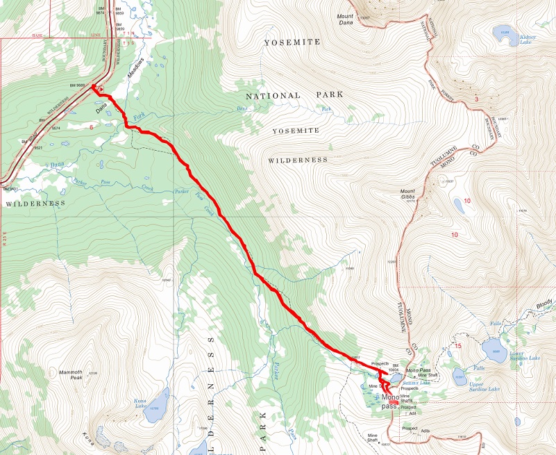
Tioga Road to Mono Pass Mines Topgoraphic Map
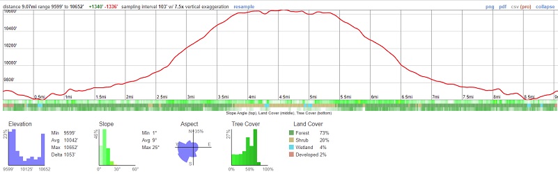
Tioga Road to Mono Pass Mines Profile
Sources:
Yosemite National Park Upper Sardine Lake and Mono Lake
Yosemite Nature Notes 47(3) (1978)
Browning, Peter, Yosemite Place Names, Great West Books, Lafayette California, 1988
Patera, Alan H., Bennettville and the Tioga Mining District, Western Places, Lake Grove, OR 2003
Ghost Mines of Yosemite (1958) by Douglass Hubbard
Mono Trail Cabin Yosemite Archives
Mono Trail Cabin Yosemite Archives 2
Golden Crown Mine Yosemite National Park
Golden Crown Mine historic Site Yosemite National Park
Fuller Family Tree, Ancestry.com
John Muir: A Passion for Nature NPS
Yosemite: the Park and its Resources (1987) by Linda W. Greene
Ghost Mines of Yosemite (1958) by Douglass Hubbard
Tonopah Daily Bonanza, Tonopah, Nevada 17 Apr 1911, Mon, Page 3
Round Mountain Nevada Wetern Mining History
Prior Blogs in the Area:
Hiking From Tioga Road to Parker Pass Lake August 24, 2021
Hiking Yosemite’s Mono Pass Trail to Sardine Lakes August 18, 2021
Hiking Up Yosemite’s Mono Pass Trail Past Spillway Lake June 17, 2021
Adventures with Candace: Hiking to Helen and Spillway Lakes June 23, 2020
Hiking up Yosemite’s Mono Pass Trail to Helen Lake July 10, 2019
Hiking to Spillway and Helen Lakes July 6, 2018
Hiking up to Spillway and Helen Lakes August 1, 2017
Hiking up to Spillway and Helen Lakes June 29, 2016
Hiking on the Mono Trail to Spillway and Helen Lakes June 8 2014
Hiking and Fishing High Lakes along the Mono Pass Trail August 14, 2013
Hiking with the Yosemite Toad to Helen & Spillway Lakes June 7, 2013

