Home » Tag Archives: Yosemite (page 49)

Articles about Yosemite

Winter Storm Warning Remains In Effect

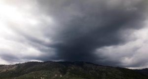
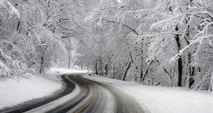
CENTRAL SIERRA — A winter storm warning remains in effect for the Sierra Nevada from Yosemite to Kings Canyon – Tulare County Mountains, until 10 a.m. on Tuesday, Feb. 21. The warning has been issued by the National Weather Service for areas above 7,000 feet. Heavy snow and blowing snow are expected, with accumulations of 20 to 40 inches from Kings Canyon ...

Read More »

Bigger Waterfall Means Better Firefall

YOSEMITE – We were mere amateurs among professionals, but no one seemed to mind, as a hush fell on the crowd looking out at Horsetail Fall in Yosemite National Park. Colors began to change on the cliffs, as light played with water, and in the setting sun, the mountain blazed with a fiery red and orange mirage: Firefall. Click on images ...

Read More »

Winter Storm Activity Causes Road Damage In Yosemite

YOSEMITE — The Big Oak Flat Road in Yosemite National Park (Hwy 120) will be closed daily from 6 p.m. to 6 a.m. between Crane Flat and Foresta due to storm-related road damage. These closures will remain in effect from Friday, Feb. 17, until at least Tuesday, Feb. 21. Visitors entering Yosemite from the Big Oak Flat entrance will not have access ...

Read More »

Winter Storm Warning For Yosemite Above 7,000 Feet

CENTRAL SIERRA — A winter storm warning is in effect for the Sierra Nevada from Yosemite to the Kern County line, from 4 a.m. on Friday, Feb. 17, until 4 a.m. on Saturday, Feb. 18. The warning has been issued by the National Weather Service for areas above 7,000 feet. Heavy snow and blowing snow are expected, with accumulations of 12 to 20 ...

Read More »

Yosemite Visitors Encouraged To Delay Arrival On Friday

YOSEMITE — Visitors planning to visit Yosemite National Park on Friday, Feb. 10, are encouraged to delay arrival until after noon due to overnight storm activity. Storm systems coming through Yosemite National Park are expected to result in heavy rain. Water and debris may be washed into roadways, say park officials. The El Portal Road (Highway 140), Wawona Road (Highway ...

Read More »

One-Way Traffic Control On Highway 41 Near Yosemite

FISH CAMP — Following recent storms and ahead of more wet weather on the way tonight, CHP reports that Highway 41 is compromised in the Fish Camp area just south of Yosemite National Park’s south gate. One way traffic control is currently in place due to a washout in the southbound lane. The lane is closed due to the severe erosion ...

Read More »

Big Oak Flat Road (Hwy 120) in Yosemite National Park is Open

YOSEMITE — The Big Oak Flat Road in Yosemite National Park (Hwy 120) has reopened to all vehicular traffic following a rockfall that occurred on Sunday morning, Feb. 5, say park officials. Visitors are urged to drive with caution along the road, as there is the possibility of more mud and debris entering the roadway. Water and debris remain on ...

Read More »

Yosemite Rockfall Year in Review: 2016

YOSEMITE — Rockfall activity in 2016 was slightly lower than in previous years, with 58 documented events (rockfalls and rockslides) and a cumulative volume of about 5,000 cubic meters (roughly 15,000 tons). Nevertheless, many of these rockfalls were consequential, impacting park infrastructure and affecting park visitors, employees, and residents. The year got off to a quick start with a rockfall ...

Read More »

Short Runs, Long Walks, And Hiking With Weights

I’ve been doing a lot of outdoor workouts of late, squeezing them in between bouts of rain, sleet and hail (thank you weather radar!). It’s been a while since I’ve be running and my body doesn’t feel quite ready for a lot of distance yet, so I’ve gone back to a trick from my hiking days in Salt Lake City. ...

Read More »

Chain Control In Place On Mountain Roads

CENTRAL SIERRA – Anyone taking to the mountain highways over the weekend should avoid any unwanted delays by making sure there are traction devices in their vehicle. Chain control is now in place on Highway 41 from three miles north of Coarsegold (the bottom of Deadwood) to Yosemite National Park (R2 – see below). The location could change as conditions warrant. ...

Read More »
Sierra News Online

Sierra News Online