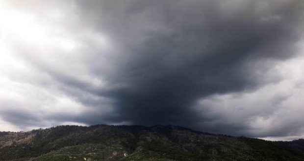
MOUNTAIN AREA — Remember all that rain we wished for all those years? We’re getting it, says the National Weather Service (NWS), as a disturbance will impact our area starting tonight, Wednesday, May 15, through Friday morning, May 17, bringing rain to the foothills and valley and snow to the mountains. Then, a series of storm systems arriving on Saturday night and continuing through Tuesday will bring unsettled wet weather to the region.
Today we are experiencing a sharp fall in high temperatures due to significant cloud cover associated with the atmospheric river event coming tonight. By mid-afternoon today, a few showers will be possible in the Sierra Nevada north of Tulare County, with increasing coverage towards the evening. In terms of mountain snow, the NWS says snow levels will begin around 8,500 feet in the southern Sierra tonight, and will fall to around 5,000 – 5,500 feet by late Thursday morning. The watch has been upgraded to a Winter Storm Warning.
Thunderstorms that may occur and could be capable of small hail, along with gusty winds, locally heavy rain, and perhaps even a funnel cloud or two — much like the thunderstorms we saw earlier this year in January through March. Late Friday night and into Saturday morning, the NWS anticipates a brief break from the active weather before another storm approaches from the northwest. Additional rain and mountain snow are predicted to occur with this system through Sunday, but details on accumulations are not clear yet.
By Monday, May 20, there could be another break from the precipitation in Central California before another storm on Tuesday. We’ll keep you posted, with lots of help from the NWS, as conditions develop.
Winter Storm Warning
The National Weather Service has issued a Winter Storm Warning for heavy snow for the Central Sierra above 5,000 feet, including the towns and areas of Fish Camp and Tuolumne Meadows. The storm warning is in effect from midnight on Wednesday, May 15 through 6 a.m. on Friday, May 17.
A Winter Storm Warning for snow means severe winter weather conditions will make travel very hazardous or impossible. If you must travel, keep an extra flashlight, food and water in your vehicle in case of an emergency.
Heavy snow is expected above 5,000 feet. Total snow accumulation of up to 2 feet is expected with winds gusting as high as 40 miles per hour. Thunderstorms are possible with heavy snowfall and gusty winds. Travel could be very difficult. The hazardous conditions could impact the morning or evening commute.
National Weather Service Winter Storm Watches and Warnings

