I thought you might like to know what I do to determine the weather for the day, whether I am hiking or just hanging out. I have a bit of a routine and there is no need to keep it a secret in case it might help you. I have several weather pages set to open on my start tabs of my web browser when I start my computer each morning. They include:
Weather Underground for Ahwahnee
National Weather Service Ahwahnee
National Weather Service Saddlebag Lake
CoCoRaHS (Community Collaborative Rain, Hail and Snow Network)
Yosemite National Park Area Webcams
I usually start with the Weather Underground Site, looking at the quick graphic of any precipitation, temperature, winds and the timing. I bet many of you do that but did you know that if you scroll down to the bottom of the page, you will see a listing of local automated weather stations?
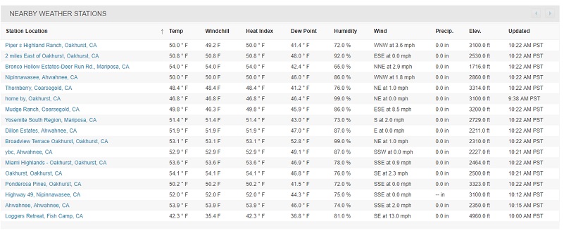
If you click on any of the stations, it will take you to more detailed information from that station such as current temperature, dew point, humidity, precipitation, wind speed, wind gusts, wind direction, etc. Historical data is also available and you can take a closer look at today’s weather reading, even look at previous date’s weather at that station. Some of the stations may even have a webcam! I took a screen shot of the weather station named Dillon Estates in Ahwahnee.

Dillon Estates Weather Station Information
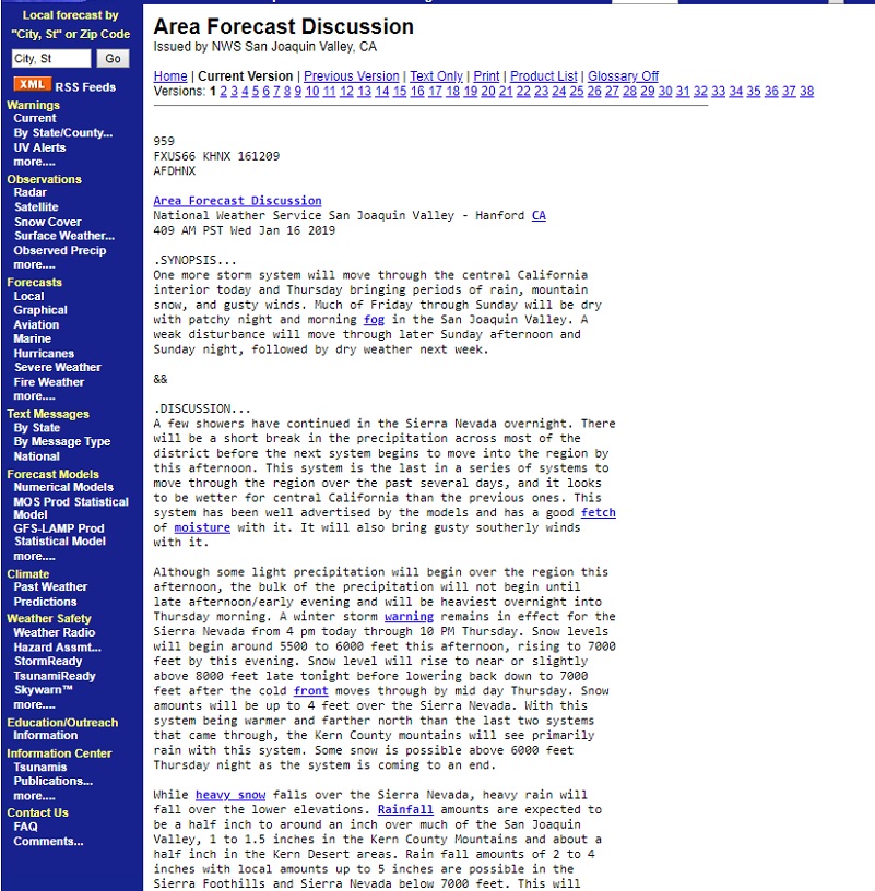
Next I will look at the National Weather Service (NWS) for Ahwahnee. I scroll down toward the bottom of the page and click on “Forecast Discussion.”
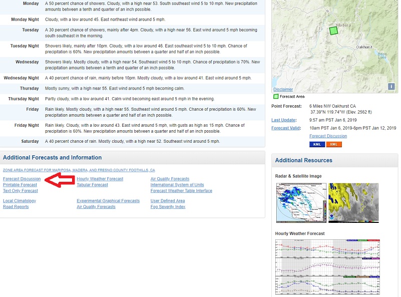
This will take me to a discussion of today’s weather and I am always interested in learning what the forecaster is sharing on the long term weather. I continue to learn about difference influences affecting our weather and how the different models are “seeing” the upcoming weather.
If we are expecting precipitation, wind or low temperatures, I will click on the Hourly Weather Forecast.

You have probably figured out how you can go to the local community weather by entering your town or zipcode.
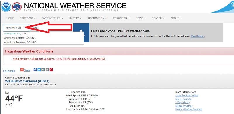
But sometimes that location you are looking for doesn’t have a community name or zipcode that is in the NWS database. Not to fear, you can still get an rough forecast.
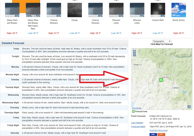
If you zoom in and click on the map to get to the location you are looking for, you can click on it and it will give you a green forecast area over the location that you are looking for

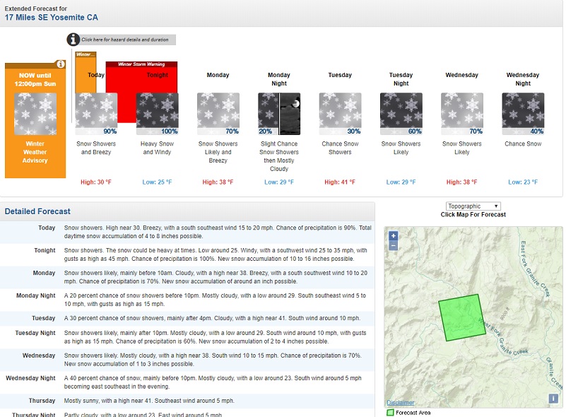
Then look at the Detailed Forecast for that location that you have pulled and you will see information more specific to the location you wanted. This is how I figure out what to wear for our hikes or if the weather will be appropriate to doing that hike that day. It helps me avoid bad weather such as high winds or lightening and time the hike to hopefully miss the larger rain or snow. It isn’t perfect though and after reading the Discussion (above), I know what some of the other possibilities could be. I may check out multiple areas in the high country before a hike because some of those areas are forecasted by Reno or Las Vegas. If I pick a location such as Saddlebag Lake or Mammoth Lakes, I can may a little different take in the discussion.
I have a weather station at my house and contribute the precipitation data to a nation wide website of weather watchers. I have always enjoyed tracking and understanding what is occurring in our local weather but the normal sources we use often fall far short for where I live and play. You can also become a weather station and track your weather or you can just peek in on the results to see what they have measured.
The organization that I track my precipitation with is called CoCoRaHS which stands for the Community Collaborative Rain, Hail and Snow Network. CoCoRaHS is a unique, non-profit, community-based network of volunteers of all ages and backgrounds working together to measure and map precipitation (rain, hail and snow). By using low-cost measurement tools, stressing training and education, and utilizing an interactive Web-site, their aim is to provide the highest quality data for natural resource, education and research applications. The network originated with the Colorado Climate Center at Colorado State University in 1998 thanks in part to the Fort Collins flood a year prior. In the years since, CoCoRaHS now includes thousands of volunteers nationwide.
You can go to the CoCoRahs Site to locate the below.
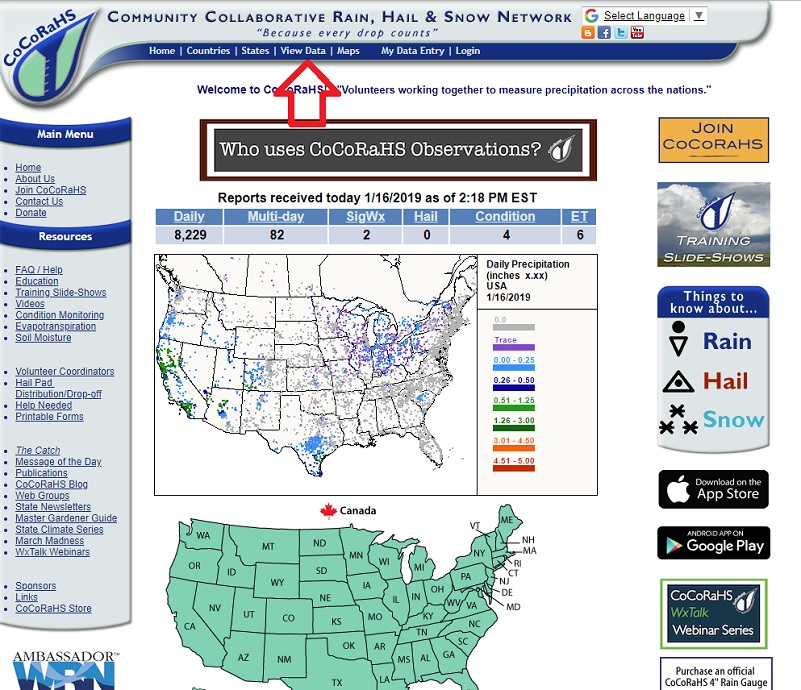
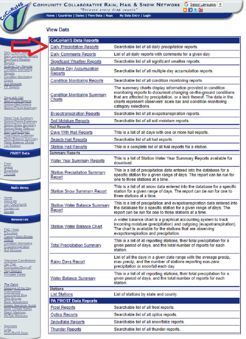
If you click on “View Data” at the top of the page, then click on the Daily Precipitation Reports at the top of that page, will see the below.
Once you are on that page, you can click on the “All Counties” Menu to the right of “California” and choose Madera County. This is what showed up on the day that I pulled the information for this blog.
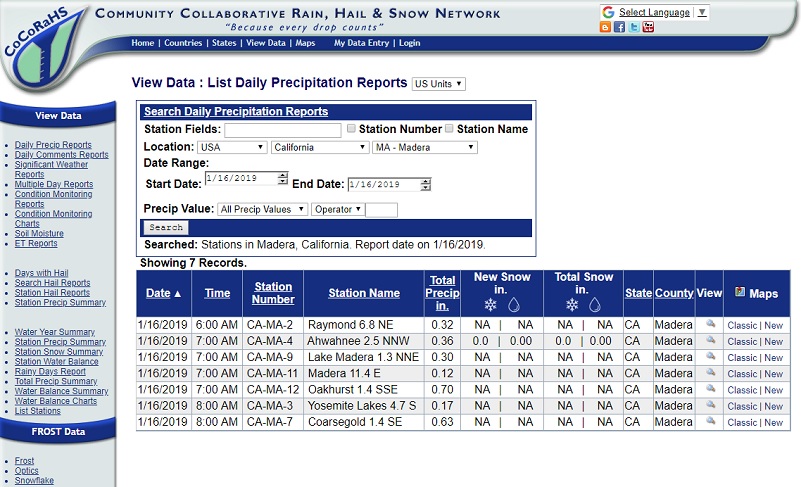
You can play around with this to see what kind of precipitation was received in your area of interest. CoCoRaHS only provides the precipitation on this website, although you may see some additional information in the notes section of any given station.
If you are interested in becoming a CoCoRaHS Weather Station, the information and application are located on their website. They would love to have more weather stations out there and everyone can help, young, old, and in-between. Their only requirements are an enthusiasm for watching and reporting weather conditions and a desire to learn more about how weather can effect and impact our lives.
CoCoRaHS is used by a wide variety of organizations and individuals. The National Weather Service, other meteorologists, hydrologists, emergency managers, city utilities (water supply, water conservation, storm water), insurance adjusters, USDA, engineers, mosquito control, ranchers and farmers, outdoor & recreation interests, teachers, students, and neighbors in the community are just some examples of those who visit the Web site and use the data.
The National Oceanic and Atmospheric Administration (NOAA) and the National Science Foundation (NSF) are major sponsors of CoCoRaHS. Other organizations have contributed either financially, and/or with supplies and equipment. Many other organizations and individuals have pitched in time and resources to help keep the network up and running.
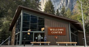
I usually keep the Yosemite National Park Area Webcams up on my computer during the day and periodically take a look at them, sometimes just because those views are so darn pretty.
There are many other lists of weather stations around. I also follow the National Weather Service Hanford Facebook Page and when we are expecting some interesting weather, they will often give a video cast, answering questions from the Facebook viewers. Another way I follow them is on Twitter @NWSHanford. There are many apps out there that you can utilize in your travels to help you stay up to date. Perhaps you have some favorites to share with me. I would love to hear what you use to keep up to date on our local weather.

Sources:
CoCoRaHS
Weather Underground
National Weather Service
NWS Hanford Facebook Page
@NWSHanford
Yosemite National Park Area Webcams
Previous Blogs: