White puffy clouds danced across the blue sky, casting their reflections in turquoise glacial-fed lakes. And those wildflowers were putting on a show along the trail that miners of yesterday utilized as they searched for their lucky strike!
Where: Harvey Monroe Hall Research Natural Area, Hoover Wilderness, Inyo National Forest
Distance: 10.05 Miles (shorter by about 2.6 miles if the water taxi is running)
Difficulty: Moderate to Strenuous
Elevation Range: 10,092′ – 10,794′
Elevation Gain: 1,253′
Date: July 20, 2022
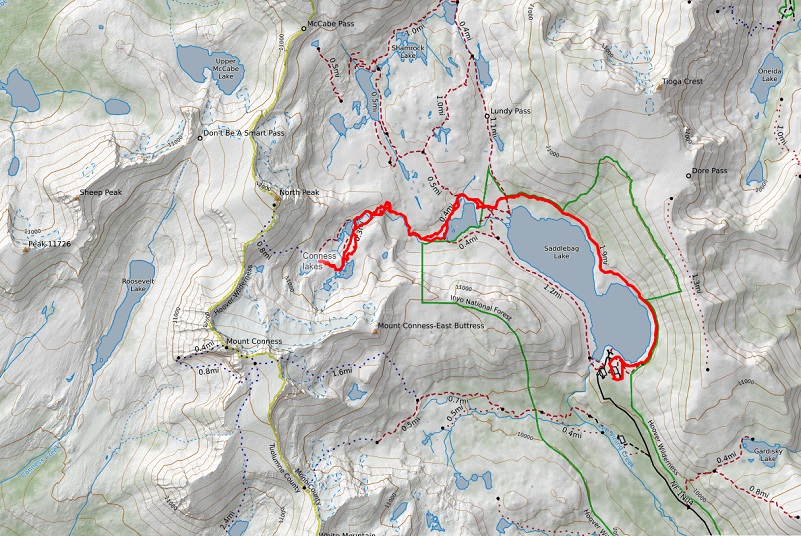
CALTOPO: Hiking to Conness Lakes
Dog Hike? Maybe
I just returned from a few days of camping with Fannie the Corgi at the Saddlebag Lake area with thunder, lightening, hiking and a little fishing.
To get to Saddlebag Lake, I exited the east entrance to Yosemite National Park at Tioga Pass then drove east on Hwy 120 about 2 miles to Saddlebag Road. Heading up the mostly dirt road to Saddlebag Lake, I stayed at the Saddlebag Lake Campground in the Inyo National Forest above the resort. If you are daytripping it, there is parking at the resort or at the adjacent backpacker parking lot.
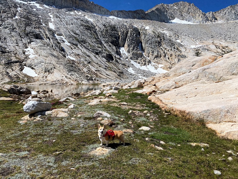
One of our hikes was up to the glacial-fed Conness Lakes. We took the Saddlebag Lake Trail that goes around Saddlebag Lake (10,066′ elevation) and I took my usual dog-friendlier way along the east side, an old road that was utilized by the Hess Mine. But you can also start on the west side which is rockier but a little shorter. Those rocky parts on the west side are tough on a dog’s feet so I usually take the east side when I hike with the dogs and I always pack dog boots when we are on these trails.
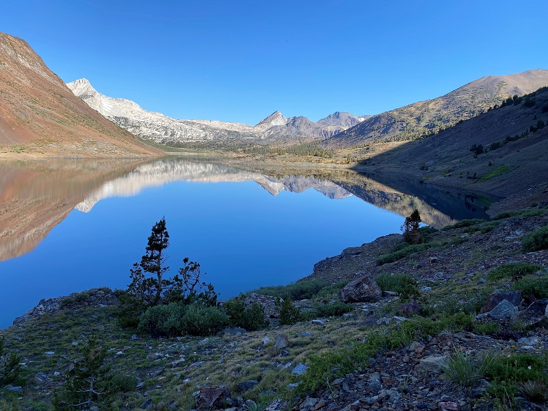
The day after a little rain from thunderstorms, Saddlebag Lake was clear as glass and full of reflections.
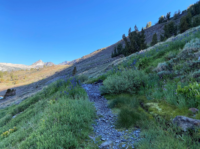
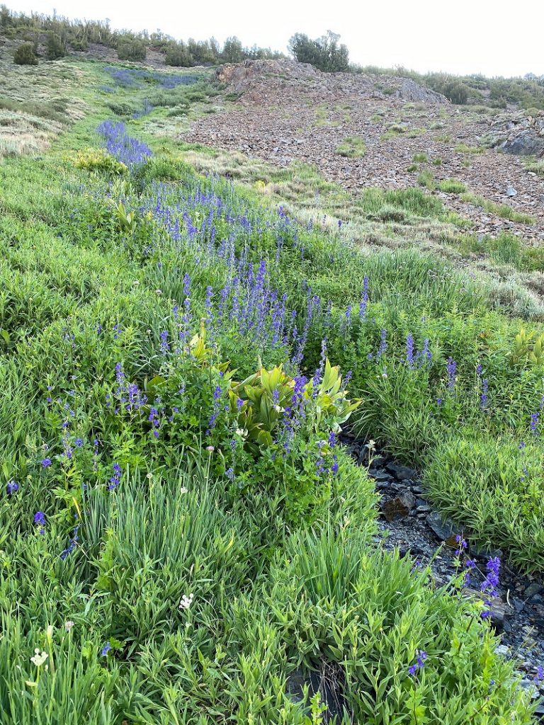
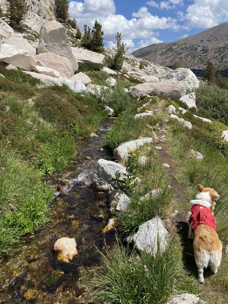
The trail was lined with wildflowers, lush where springs and small creeks crossed the trail. I love this spot of the trail where a small spring creates a creek running down the hill and wildflowers just love this area!
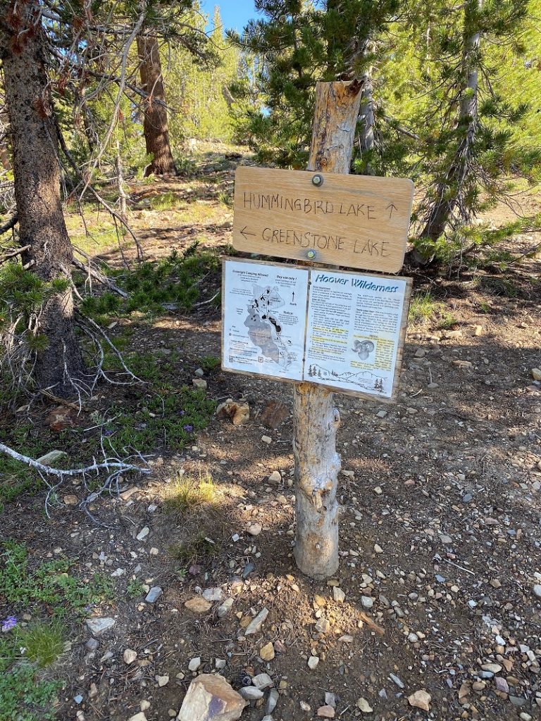
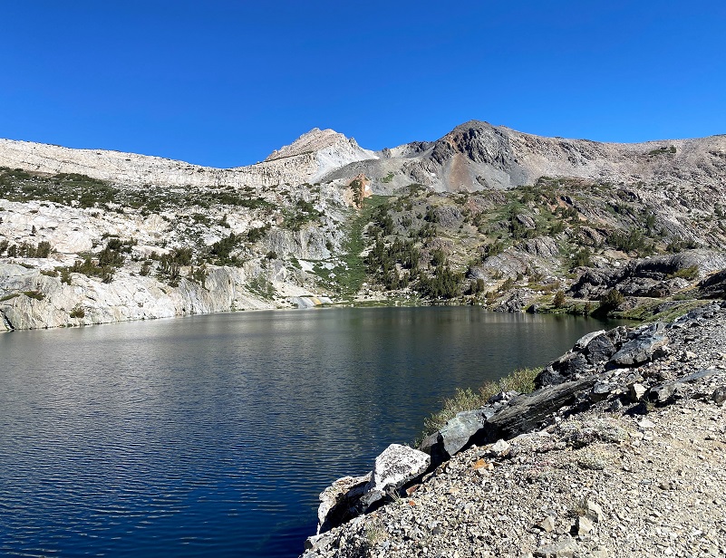
Past the Ranger’s Cabin, the trail forked and we took the left fork toward Greenstone Lake, entering the Hoover Wilderness. My oh my, was Greenstone Lake pretty this morning! No matter which angle I took the picture, the reflections was amazing.

There are a couple of ways to get around Greenstone Lake. You can follow the left side and rock hop across the inlet to the lake, then follow the trail along the east side of the creek. We headed along a trail on the north side of Greenstone Lake that ties in with that trail along the creek. We soon entered Harvey Monroe Hall Research Natural Area. This research area consists of 3,383 acres, set aside in 1933 to conduct research related to the soil and vegetation. Harvey Monroe Hall was a professor of Botany at U. C. Berkley, helping to establish methods for conducting reciprocal transplant experiments, whereas plants were moved and studied in the habitats of similar taxonomic species. One of the specific things that they studied is how plants adapted to various soils and elevations. Climate change is just one of the things that they are capturing data on.
As the trail climbed along the creek, there was a patch of what I think this is Western Labrador Tea, a member of the Rhododendron family.
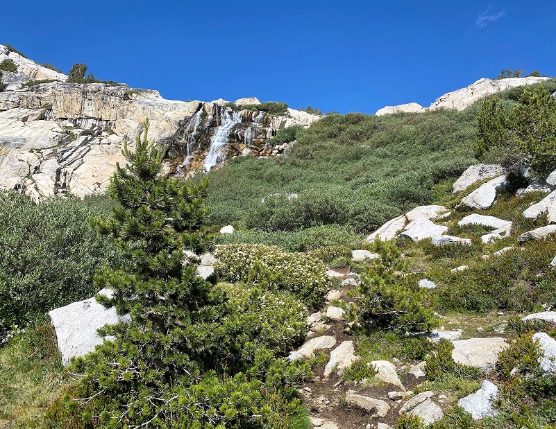
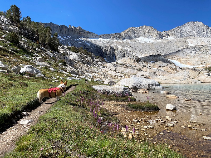
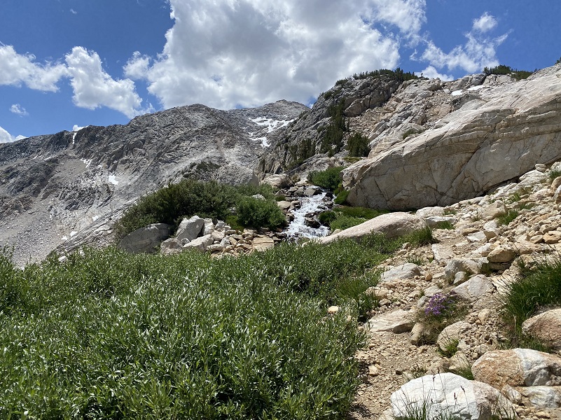
 And I had the waterfall in sight that came out of the Lower Conness Lake along where it used to flow into an old flume that was constructed for mining efforts in the area. More about some of those mining efforts a bit later.
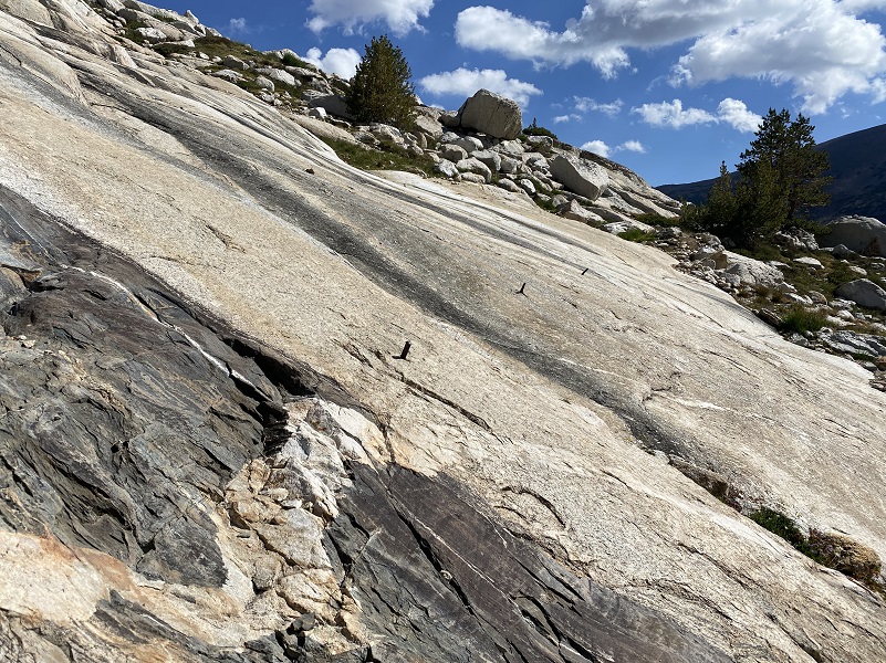
As I headed up that rocky slab, I let the Fannie off leash because it was just too much of a challenge for me to keep my footing on the narrow switchback trail with her on leash. There are actually several “trails” up this rocky slab and I took the easier and wider switchbacks to moderate the uphill angles for Fannie’s short little legs.

I took a look back where I had climbed.
We followed one of the several trails that headed up the rocky slab and I aimed for the location of the old flume that used to run across here. Metal anchors that used to hold a wooden flume ran across this stretch. I have also found old boards from it on previous hikes. This flumes probably supported several mines in this area, including the Hess Mine in the 1930-1940 era or so.
I researched the Hess Mine a few years ago, visiting the Mono County Courthouse, and learned that Gus Hess filed a Notice of Location of Quartz on his mine along the northeast side of Steelhead Lake on September 3, 1930. It ended up being primarily a tungsten mine, owned by Gus Hess. Scheelite deposits were explored at the Hess Mine in the 1940s and the only reports that I could find on production were that is was small. You can read more about this mine in my prior blog.
Mining reports indicate that the mine was closed in 1962 but some of the buildings or parts of these buildings are still in use today. The United States Forest Service Wilderness Headquarters/Ranger Station at the north end of Saddlebag Lake was one of the living quarters for the mine. Parts of some of the old buildings are now incorporated into the Saddlebag Lake Resort storage building.
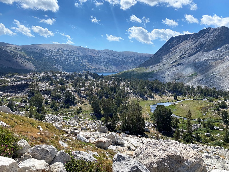
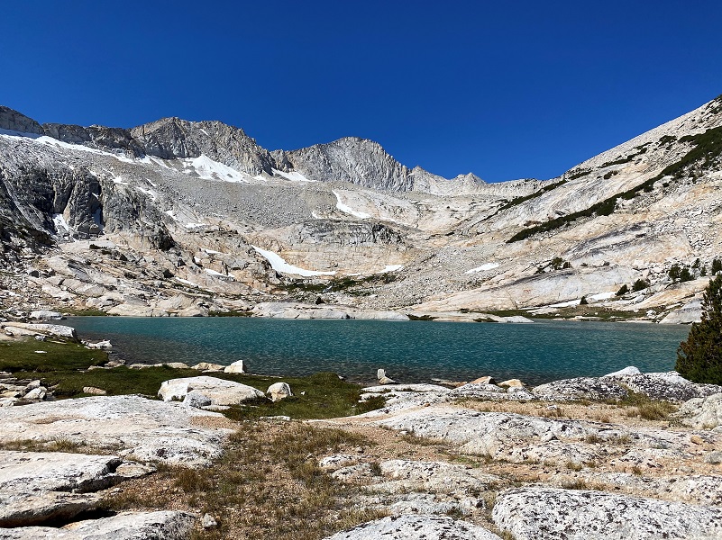
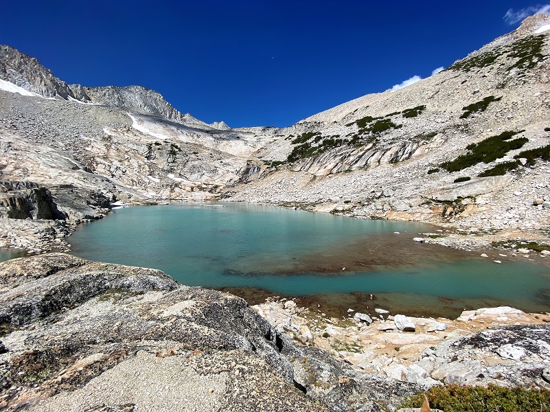
We soon reached the outlet from Lower Conness Lake and followed the trail up to it. These lakes are bordered by Mount Conness and the Conness Glacier, named for John Conness (1821–1909), a native of Galway, Ireland who immigrated to the United States in 1833. He arrived in California via Panama on the ship Sylph in 1849, engaging in mining and mercantile pursuits in El Dorado County, but by 1853, he was a member of the California Legislature. He served from 1853 to 1854 and from 1860 to 1861, and then was the United States Senator from California from 1863 to 1869. He was married twice and had at least 12 children by my count. On the 1860 census, he was living in Georgetown, El Dorado County and listed his occupation as a Miner.
On March 28, 1864, Conness introduced Senate Bill 203, known as The Yosemite Valley Grant Act. The legislation would by federal action, grant to the State of California the Yosemite Valley and the Mariposa Grove of Big Trees. The purpose of the bill was that the property “shall be inalienable forever, and preserved and improved as a place of public resort.”
No money was appropriated in support of the bill and no supporting legislation provided for federal administration of the areas. It did not establish the National Park, which came later in 1890. The Yosemite Valley Grant Act passed on June 30, 1864 and was signed by President Abraham Lincoln.
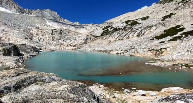
Lower Conness Lake (10,561′ elevation) has three lake sections. Earlier in the season, the lake parts are one lake but we were able to walk across the rocks to get to the other side. The water in this area was shallow enough that Fannie was able to walk about 4 feet through the water to get to the other side.
We followed the trail along the lake, beautiful with that amazing backdrop of Mount Conness to the west.
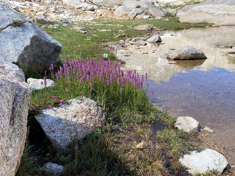
But also impressive were the amount of Little Elephant Heads blooming along the week.
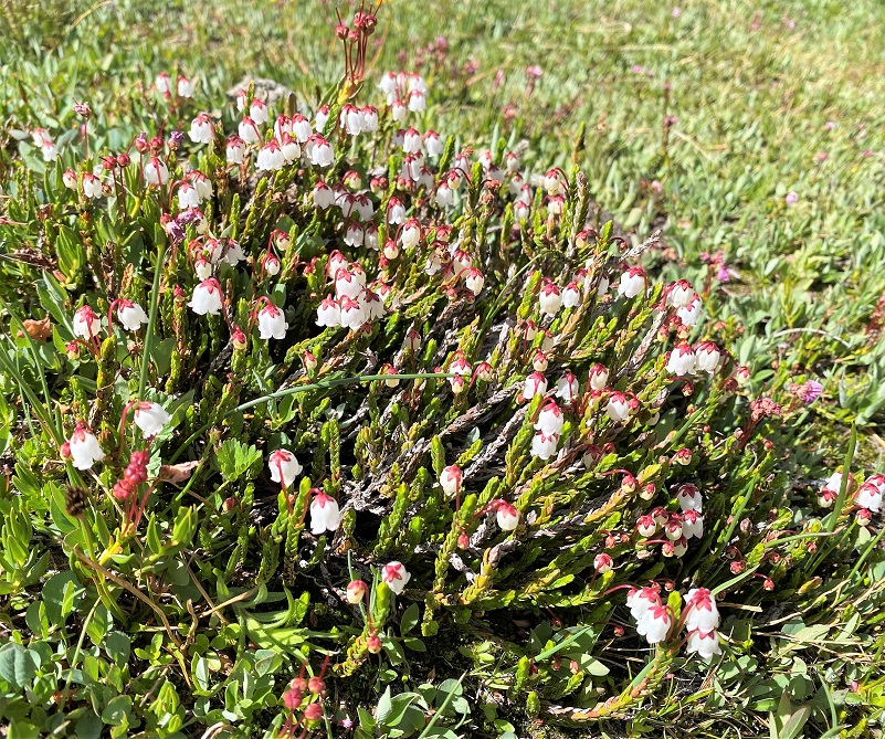
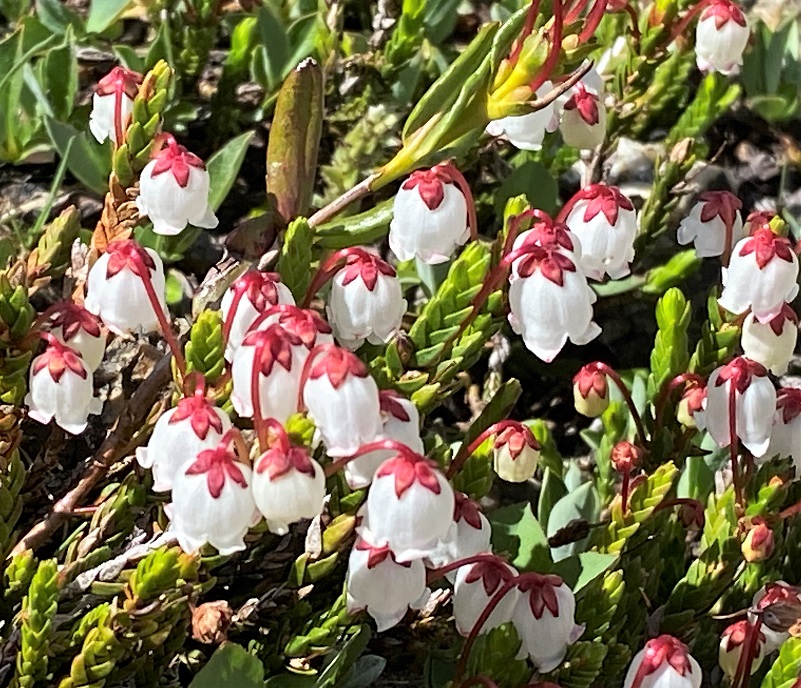
Western Moss-heather was also very pretty.
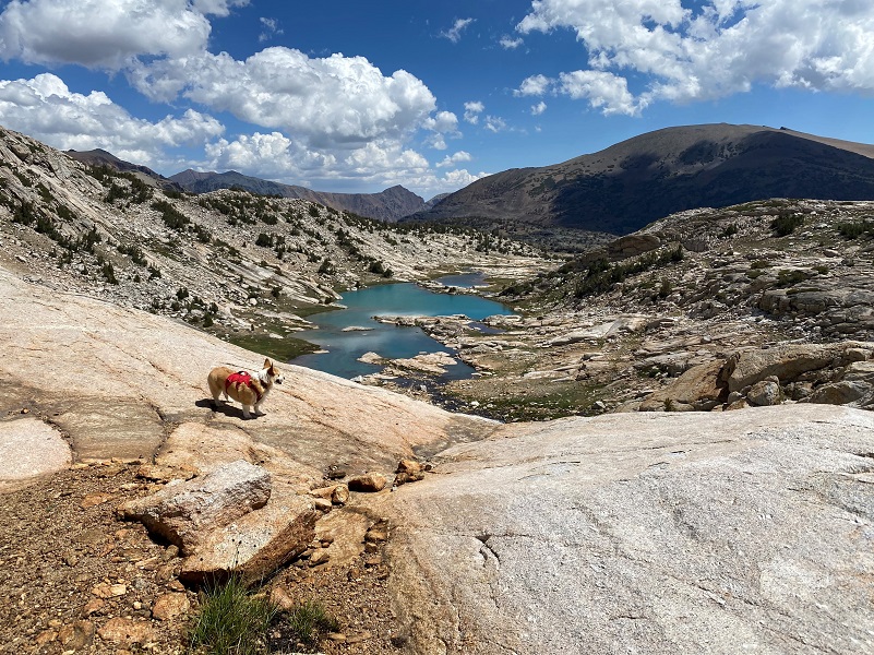
It was only about 3/4 of a mile up to the Middle Conness Lake (10,679′ elevation). There was a slight breeze and the lake was not sharing the beautiful reflections that we can sometimes get.
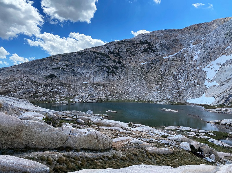
I walked along the edge and then took one of the rocky slabs up to the Upper Conness Lake (10,761′ elevation).
I wandered down to the east side of the lake. Mount Conness towers over this upper lake at 12,649′ elevation and its knife edge ridge borders the lake on the west and southwest sides. North Peak, 12,231′ elevation, borders the lake on the north side. I could also spot where the Conness Glacier lies, which they say is the largest glacier in the Sierra Nevada north of Tioga Pass. It was a perfect spot to stop and eat our lunch, then we wandered back down. Yes, Fannie had her lunch to eat also!
I decided to walk down the outlet of the Lower Conness Lake, wanting to try and check out the part where the outlet was diverted into a ditch.

From the ditch, this flume ran the water into a ditch section then a wooden flume section where the metal stakes I had stopped by on the way up still survive. The first picture is looking back where the water was diverted from the outlet from Lower Conness Lake and the second picture is part of the ditch part of the system.
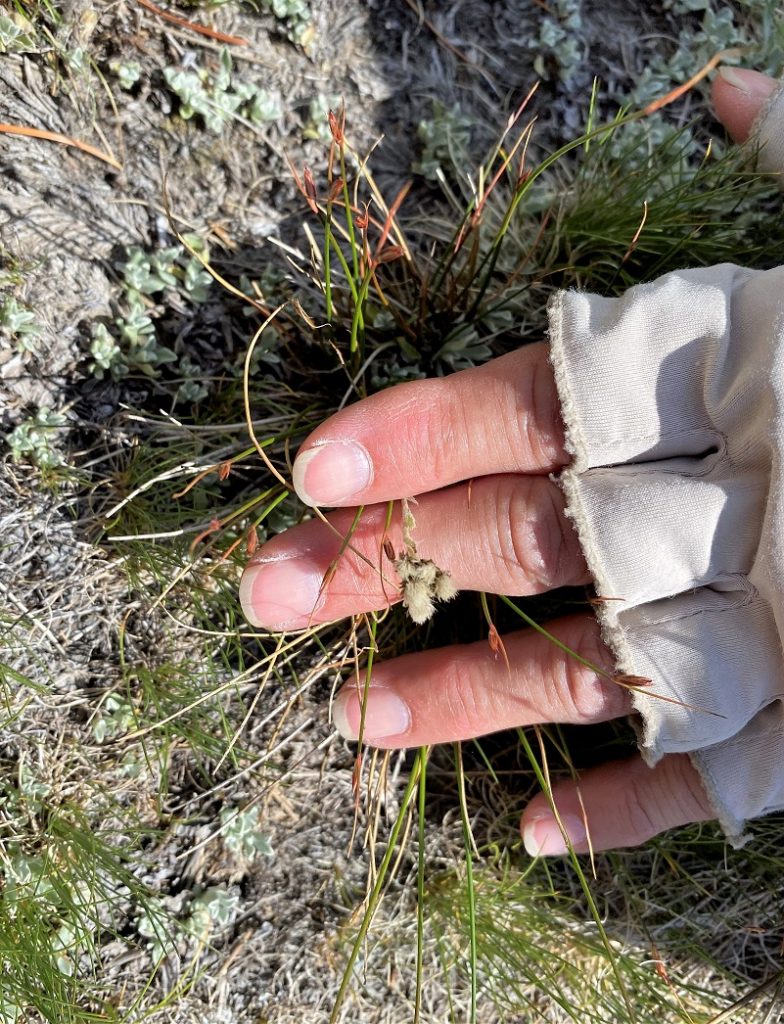
We were almost back at the campground when we came across two USFS Botanists working on a rare plant botanical survey. I asked them if they could share one of the rare plants that is located in this area and they pointed down at my feet to a Pygmy Pussypaws. She is showcasing the flower of the plant in the picture below. Very cool to learn something new about the area!
This was the second hike for Fannie during our week of camping. I rested her a day after the first hike. Her paw pads didn’t show wear from her first hike but I packed her boots just in case they might be needed but they were. Also I sprayed down with mosquito repellent but they weren’t an issue on our hike.
Dog Hike?
This hike can be a good dog hike if your dog is up to it. The rocky terrain is very rough on a dog’s feet and I packed Sally’s boots just in case she got a sore spot on her paw or sliced her foot on one of those sharp rocks. Even if you think your dog’s feet are toughened up enough for this hike, you can have surprises so please be prepared. This is a good hike for Sally. It is above tree line so I can keep a good eye on her and let her run a little. There aren’t any rattlesnakes or poison oak and there is plenty of good, fresh drinking water for her all along the way. That means I don’t have to pack her water and that is a good thing! Sally has never had any problems drinking the water out of these higher elevations but some dogs may not be as easy as Sally on this issue. I think you need to know your dog and you may need to carry some water for them. This area also has bubonic plague and if you dog gets a hold of a critter such as a squirrel or mouse, this could be something to watch for after a trip in this area.
Here is some information from Inyo National Forest regarding their dog rules:
Traditionally, National Forests have welcomed dogs. However there are a few rules that apply to assure that you and other National Forest visitors have an enjoyable outdoor recreation experience. If you are camping with your pet, please practice the following:
- Leave vicious or unusually noisy dogs at home.
- During the day keep your dog on a leash no more than 6 feet long, or otherwise restrict its freedom to roam at will.
- At night keep your dogs and other pets inside an enclosed vehicle or in a tent.
- Developed campgrounds are for people, not animals. Please do not bring more than two dogs or other pet to any one campsite.
General rules for dogs within the Inyo National Forest:
- Dogs are allowed for trips staying in the National Forest. Pet food must be stored the same as required for your food.
- Dogs are prohibited, as are any other pets, on trips visiting the wilderness of Yosemite, Sequoia and Kings Canyon National Parks.
- Pets need to be on leash or under verbal command. Do not allow pets to chase or harass wildlife.
Doarama:
What is a Doarama? It is a video playback of the GPS track overlaid on a 3 dimensional interactive map. If you “grab” the map, you can tilt it or spin it and look at it from different viewing angles. With the rabbit and turtle buttons, you can also speed it up, slow it down or pause it.
Saddlebag Lake to Conness Lakes Doarama
Maps and Profiles:
CALTOPO has some free options for mapping and here is a link to my hike this week, which you can view or download: CALTOPO: Hiking to Conness Lakes

Prior Blogs in this Area:
Hiking to Conness Lakes with Sally & Fannie July 20, 2021
Hiking to Conness Lakes Before Tioga Road Closed November 2, 2020
Hiking with Sally to Conness Lakes June 27, 2018
Hiking to Conness Lakes September 8, 2017
Hiking with Sally and Raven from Saddlebag Lake to Conness Lakes July 6, 2016
Hiking with Sally up to the Hess Mine in the Tioga Pass Area October 26, 2015
Backpack to Mount Conness August 26, 2014
Hiking with Sally and Raven to Conness Lakes July 3, 2014
Sources:
Saddlebag Lake Resort Home Page
Harvey Monroe Hall Research Natural Area Management Plan
