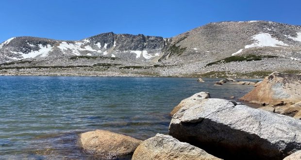
I love hiking Yosemite’s Mono Pass Trail, a historic Native American trail and there are also many lakes along and off this trail. Some lakes have names such as Sardine, Spillway, Helen, Kuna, Bingaman and Parker Pass Lakes and many aren’t named. I brought my fishing pole with me. . . just in case.
 Where: Yosemite National Park
Distance: About 9 Miles (but you can go as far as you wish)
Difficulty: Moderate to Strenuous
Elevation Range: 9,596′ – 11,151′
Date: July 7, 2020
Maps: Tioga Pass, Mount Dana, Koip Peak Topographic Quads
Dog Hike? No
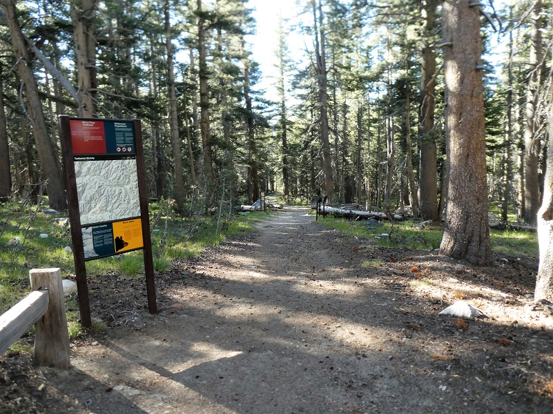
I headed out to explore the country that Yosemite’s Mono Pass Trail leads to, hiking off trail for much of this adventure. I parked my car at the Mono Pass Trailhead, about 5.6 miles east of the Tuolumne Meadows Campground and 1.4 miles south of Tioga Pass, used the restrooms there and stashed my stuff in the bear box.

The Mono Pass Trail has a ton of history, the earliest historic use being an important Native American trail. The trail was also used by miners searching for gold and silver from the 1860’s to 1890’s or so. A few cabins were located along the trail to the Golden Crown Mine and Bloody Canyon, but only one of them remains is left until you get to the cabins of the Golden Crown Mine.
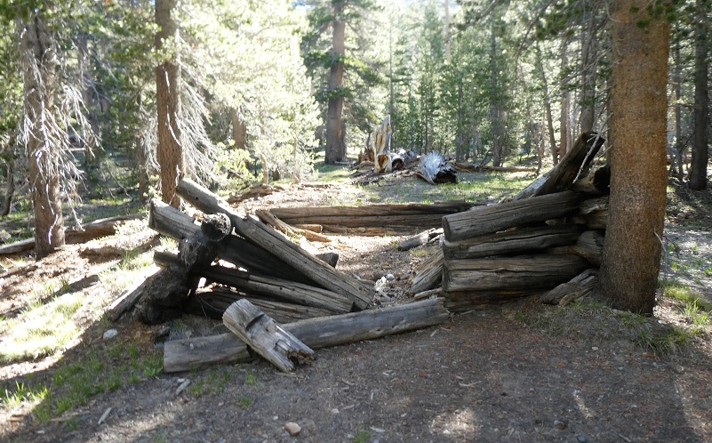
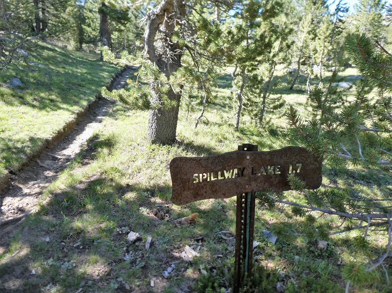 I reached the junction with the trail that goes to Bloody Canyon via Mono Pass. If you head to the left, the trail will lead you to the Golden Crown Mine, established in 1879 by Orlando Fuller during the Tioga silver boom that also produced Bennettville and the Great Sierra Mine near Tioga Pass. Around 1890, the mines were abandoned. If you stay to the trail on the right, it will take you to Spillway Lake. I chose to leave the trail and wander cross country to the west. Sometimes I come across evidence of mining in this area but I haven’t located any of these diggings on any old maps.
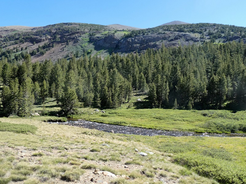
I took a look back at where I crossed Parker Pass Creek, then headed up the hill through the trees.
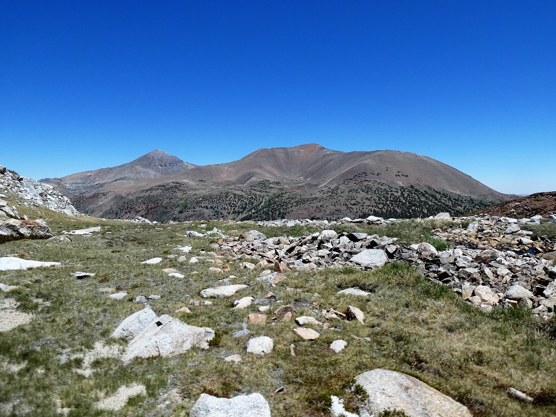
After I made my way above the trees, colorful views started appearing. Mount Gibbs (elevation 12,772′) was to the east.
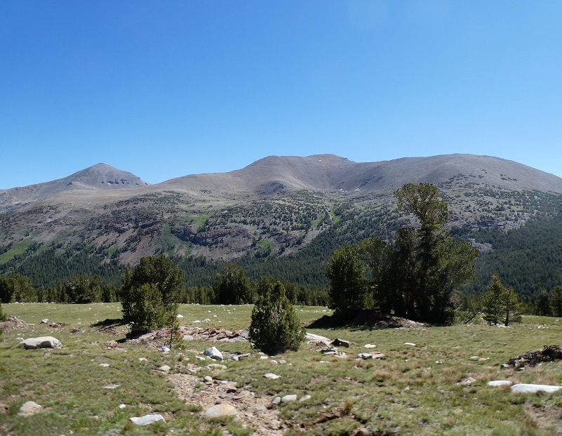
And I could make out where the Mono Pass Trail headed down.


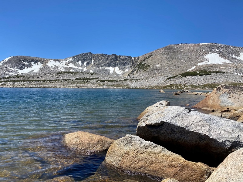
I headed up along side the hill to Bingaman Lake (elevation 11,160′).
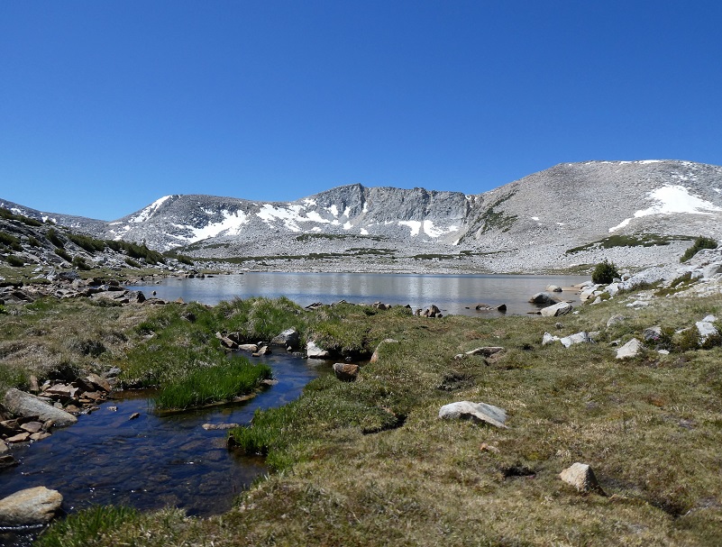
 Bingaman Lake was named for John Walter Bingaman, a park ranger who stocked the lake with fish in exchange for the naming rights. In retirement he wrote two books (links under sources), Pathways, Guardians of the Yosemite: A Story of the First Rangers (1961), and The Ahwahneechees: A Story of the Yosemite Indians (1966), where the following biography was located:
Born on a farm June 18, 1896, in Bellevue, Ohio. His parents were John Daniel Bingaman and Susan Jane Boyer Bingaman both born near Lewisberg, Pennsylvania. They moved to Bellevue, Ohio in 1895. Grand-father Bingaman moved to Union County Pennsylvania in the early 1800s from Reading, Pennsylvania.
John attended the public school in, Bellevue, Ohio, and helped his father on the farm. In 1914-1915 he worked as yard checker for the New York Central Railroad in Elkhart, Indiana and in 1916 moved to Stockton, California, where he worked for the Southern Pacific Railroad for a short time and for the Holt Tractor Company of Stockton making big tanks and combinders during the World War I.
John married Martha Buyek in Oakland, California, on June 17, 1916. Martha was born in Railroad Flat, Calaveras County, California. Her father, Frank Buyck, was a miner in his early life and later worked on the water projects in Calaveras County. Her mother died when Martha was six years old.
On April 20, 1918 John and Martha went to the Yosemite, where he worked for the Yosemite Park Company as guide and packer under Jim Helm who was manager of the horse concession at that time. The winter of 1919 he was caretaker and hotel manager at Glacier Point Mountain House. During the winter of 1920 to the opening of the summer season he managed the Company Stables at Kenneyville.
June 15, 1921 John was appointed permanent park ranger under Chief Ranger Townsley and W. B. Lewis Superintendent. His first assignment was fighting a 30 acre forest fire at Big Meadow with one other ranger and assisted by the Meyers Boys. During 1932-1933 he was in charge of the Camp Grounds. 1934-1936 headquarters duty. On June 22, 1937 he was promoted to district ranger in charge of the Wawona district. In October of 1940 he changed to the Mather ranger district and then in 1944 he changed back to the Wawona District. During 1950 he was in charge of the Tuolumne Meadow District and then back to the Wawona District from 1951 to 19.54 in charge of Wawona District. 1955-1956 he was again assigned to the Tuolumne Meadows District. He retired from the Service October 31, 1956.
As a ranger he received special training at the NPS Fire Training School, the F.B.I. Training and Instruction and all routine training and instruction courses given to seasonal employees to keep up standard procedures and to fully cooperate with Forest Service.
He was district ranger of the Mather District on September 9, 1948 when the Rancheria and Pate Valley Fire started. This was the largest fire in Park records and over 11,000 acres were burned.
During his long service as a Yosemite Park ranger he did many things such as fighting forest fires, handling crews and organizing search for lost people. He was assigned to many important visitors and took them through the Park. These special assignments included ranger service and guide for Stephen T. Mather, Horace M. Albright, President Franklin D. Roosevelt and Mrs. Roosevelt on their trips to Yosemite and also a number of Senators and Congressmen when they visited the Park.
On retirement he and Martha have turned to trailer life spending their winters in the desert and summers in the mountains and National Parks.
Both died in Stockton, Martha on May 23, 1970 and John on April 5, 1987.
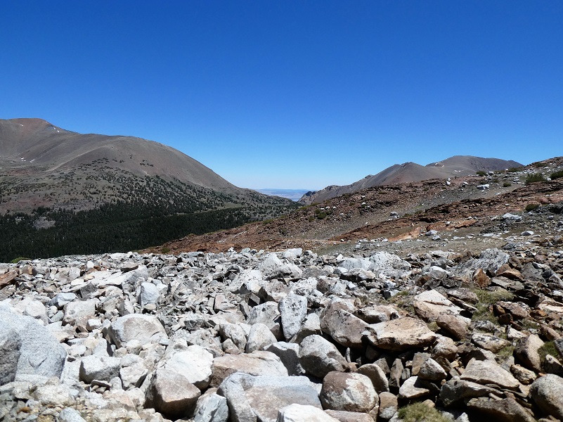
It was time to head down the hill. As the sun moves across the sky, the surrounding mountain’s colors change a bit. The reds pop a little more in some areas and the white in other spots.
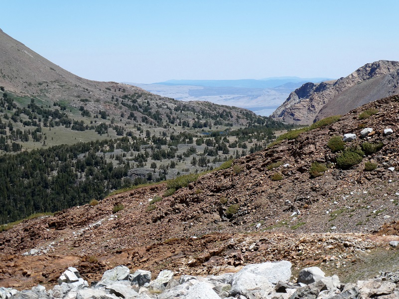
Looking down Mono Pass, I could see a glimpse of the country along Hwy 395.

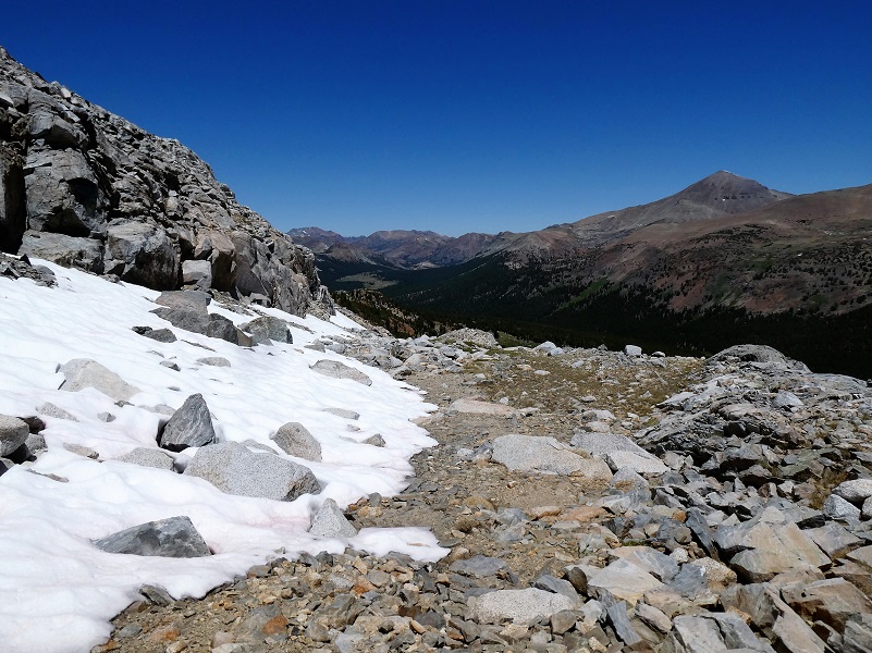
I didn’t head down exactly the same way but deviated a little when I saw something interesting to check out like this snow.
I wandered down the hill, swinging wide in the hopes of stumbling across some old mining diggings but didn’t find any. Crossing Park Pass Creek again, a short walk up to the trail and then I headed back out to the car.

I did a little bit of fishing along my way and those brook trout were biting. I didn’t spray down for mosquitoes this time because the weather forecast was for a bit of wind. I hoped that the wind would blow those skeeters away from me and I guessed right but carried some spray with me just in case. There is a creek crossing toward the beginning of the trail where the trail crosses Dana Fork. Early in the year, it can be a bit high and you might need water shoes or luck out and locate some logs to cross over. The water was low when I hiked it this time and I was able to rock hop across the creek. But I did bring those water shoes to cross Parker Pass Creek and did use them.
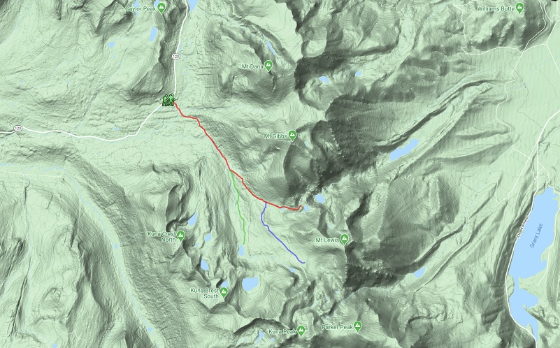
I didn’t share a detailed track on the topographic map on this hike because I really wandered around where I was drawn to, most of it off trail. If you decide to head off trail, bring your map and GPS. I don’t want you to get turned around and find yourself wandering out there for days. I also carry an InReach Mini with me just in case. There is plenty to see in this area and you don’t need to hike too far to see something beautiful.
Dog Hike? No, dogs are not allowed on this trail in Yosemite National Park.
Doarama:
What is a Doarama? It is a video playback of the GPS track overlaid on a 3 dimensional interactive map. If you “grab” the map, you can tilt it or spin it and look at it from different viewing angles. With the rabbit and turtle buttons, you can also speed it up, slow it down or pause it.
Map:
Mono Pass Trail Map (Courtesy Yosemite National Park) https://www.yosemitehikes.com/tioga-road/mono-pass/mono-pass-map.htm
Prior Blogs in the Area:
Wandering up Yosemite’s Mono Pass Trail August 14, 2019
Hiking up to Bingaman Lake on a Chilly Day November 8, 2018
Hiking along Yosemite’s Mono Pass Trail August 15, 2018
Hiking up to Mono Pass Trail’s High Lakes August 25, 2017
Exploring High Lakes Above the Mono Pass Trail July 28, 2016
Hiking and Fishing High Lakes along the Mono Pass Trail August 14, 2013
Sources:
Mono Pass Trail Yosemite Hikes
Pathways: A Story of Trails and Men (1968), by John W. Bingaman
The Ahwahneechees: A Story of the Yosemite Indians (1966) by John W. Bingaman
The above two books by John W. Bingaman were digitized by Dan Anderson, September 2004, from a copy in the UCSD Library. These files may be used for any non-commercial purpose, provided this notice is left intact.
—Dan Anderson, www.yosemite.ca.us
