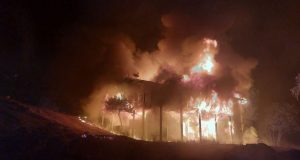
TWAIN HARTE – A YouTube video is causing quite a stir over the cause of the now 219,277 acre Rim Fire that has been ripping through Tuolumne and Mariposa Counties, and Yosemite National Park for the past two weeks.
Todd McNeal, Twain Harte Fire Chief and Division Group Supervisor on the Rim Fire, addressed a community meeting last week, where he talked about what may have caused the fire.
“We know it’s human caused,” said McNeal. “There was no lightning in the area. But we don’t know the exact cause. Highly suspect that there might have been some sort of illicit grove, a marijuana grow type thing.”
 We contacted the Forest Service fire information center for a response to the remarks, and were told that the cause of the fire is still under investigation.
“There’s been progress made in the case but there are no additional details at this time. We don’t have a date as to when any more information will become available.”
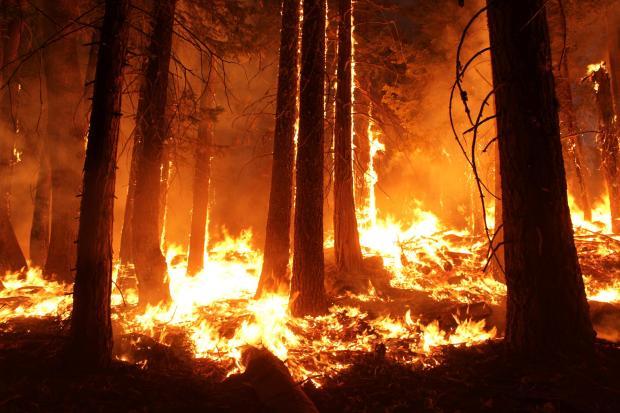
The Rim fire, which started on Aug. 17, is the largest fire in the United States in 2013, and is now 35% contained. Nearly 5,000 personnel are assigned to the incident.
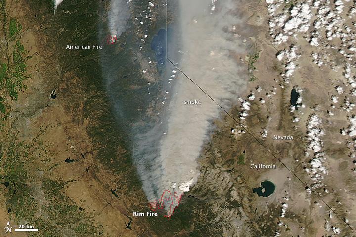
 After two weeks of clear skies in Eastern Madera County, the smoke arrived yesterday as winds shifted and the valley and foothills experienced what others to the north and east of the fire have been dealing with. Health officials have advised sensitive individuals to stay indoors.
Last night a spot fire crossed Old Yosemite Road, prompting an expansion of the Mandatory Evacuation in Mariposa County to include areas north and south of Bull Creek Road to Little Grizzly Mountain.
Visitors coming to Yosemite for the holiday weekend will have to plan their route to avoid the closures. Highway 120 remains closed from Buck Meadows to 1 ½ miles east of White Wolf.
A portion of the Tioga Road, from Crane Flat to White Wolf, was temporarily closed to all vehicular traffic beginning Wednesday, Aug. 28, at noon. The closure was necessary to allow firefighters to perform fire suppression activities along the road.
This portion of the road is anticipated to be closed at least through Labor Day weekend, meaning that access to the valley from Tioga Pass will not be possible.
Highway 120 east/Tioga Road remains open from 1 ½ miles east of White Wolf to the Tioga Pass entrance.
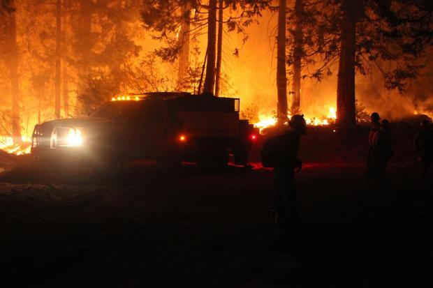
On the fireline, crews have been working on direct line construction, supported by heavy aircraft, to contain a large spot fire southeast of Pilot Lookout. They are also continuing direct and indirect line construction, accompanied by burnout operations where accessibility and safety allow, along the northern and eastern edges of the fire. Burnout operations are also planned in the Hull Creek Drainage.
There will be continued contingency line construction in advance of the communities of Tuolumne City, Twain Harte, and Long Barn. Mopup and contingency line construction will take place on the western and southern edges of the fire today, along with continued construction and improvement of contingency lines along Dodge Ridge.
A burnout operation is planned for the eastern edge of the fire in Yosemite National Park between the Hetch Hetchy Reservoir and Harden Lake and along the Big Oak Road near Crane Flat as favorable conditions allow. Burnout operations on the northern edge of the fire between Hells Mountain and Clavey Meadows will continue.
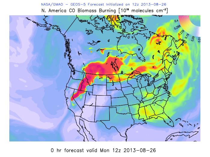
Continued warmer and drier weather is forecasted for the next several days, which will elevate control concerns and slow burnout progress. Remotely piloted aircraft is providing real-time visual and infrared intelligence on the fire.
The cost to date to fight the Rim Fire is nearly $55 million, and the date for total containment is estimated at October 20.
Fire Update
Last night a spot fire crossed Old Yosemite Road, prompting an expansion of the Mandatory Evacuation in Mariposa County. Crews burned south from Hetch Hetchy toward Harden Lake on the eastern flank.
Crews continued structure defense in the Highway 108 and 120 corridors, and around Cherry Lake.
Today’s operations will included actions to control the spot fire south of Old Yosemite Road. Crews will also begin a burning operation from Duckwall Mountain north to Fahey Meadow along Forest Road 3N07and will continue a burning operation in Yosemite National Park near Harden Lake and south to White Wolf and to Tioga Road. Aircraft will continue to support burning operations.
Park and Forest Closures
Yosemite National Park has closed Tamarack Flat and Yosemite Creek Campgrounds, both located along Tioga Road. White Wolf Campground and White Wolf Lodge remain closed.
The Stanislaus National Forest has issued an area closure for the entire Groveland Ranger District and for the Mi-Wok Ranger District east of Highway 108. Additional details are available from the Stanislaus Forest Supervisor’s Office, 209-532-3671; Mi-Wok Ranger Station, (209) 586-3234; Summit Ranger Station, 209-965-3434; and Groveland Ranger Station, 209-962-7825.
Road Closures
Highway 120 remains closed from Buck Meadows to 1 ½ miles east of White Wolf. Highway 120 east/Tioga Road remains open from 1 ½ miles east of White Wolf to the Tioga Pass entrance. Cherry Lake Road is closed at Highway 120.
Evergreen Road and Old Yosemite Road are also closed. Highway 120 from Ferretti Road to Buck Meadows remains open for local residents and businesses only.
Evacuations and Advisories
The Mariposa County Sheriff has expanded the Mandatory Evacuation along Old Yosemite Road to include areas North and South of Bull Creek Road to Little Grizzly Mountain.
The Tuolumne County Sheriff’s Department on Thursday lifted the evacuation advisory for Tuolumne City, Soulsbyville and Willow Springs. The evacuation advisory remains in effect for Ponderosa Hills and areas east, along the south side of Highway 108 up to Pinecrest.
An Evacuation Warning has been issued for all residences of Bondurant Mine Road, Texas Hill Road, and Wampum Hill. Highway 120 at the Yosemite National Park boundary west to Buck Meadows has been evacuated.
Evacuation centers are at the Mother Lode Fairgrounds in Sonora and at the Greeley Hill Community Center.