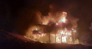
TUOLUMNE COUNTY – With full containment of the Rim Fire in sight, and fire activity waning, crews and resources are being demobilized every day.
As the firefighters head home, another team moves in to start the next phase of the process.
First, work begins on Fire Suppression Repair. This is a series of immediate post-fire actions taken to repair damages and minimize potential soil erosion and impacts resulting from fire suppression activities, and usually begins before the fire is contained and before the demobilization of an Incident Management Team.
This work repairs the hand and dozer fire lines, roads, trails, staging areas, safety zones and drop points used during fire suppression efforts.
Next comes the work of the Burned Area Emergency Response (BAER) team.
Their job is to identify imminent post-wildfire threats to human life and property, and critical natural or cultural resources on National Forest System lands, and take immediate actions to implement emergency stabilization measures before the first major storms.
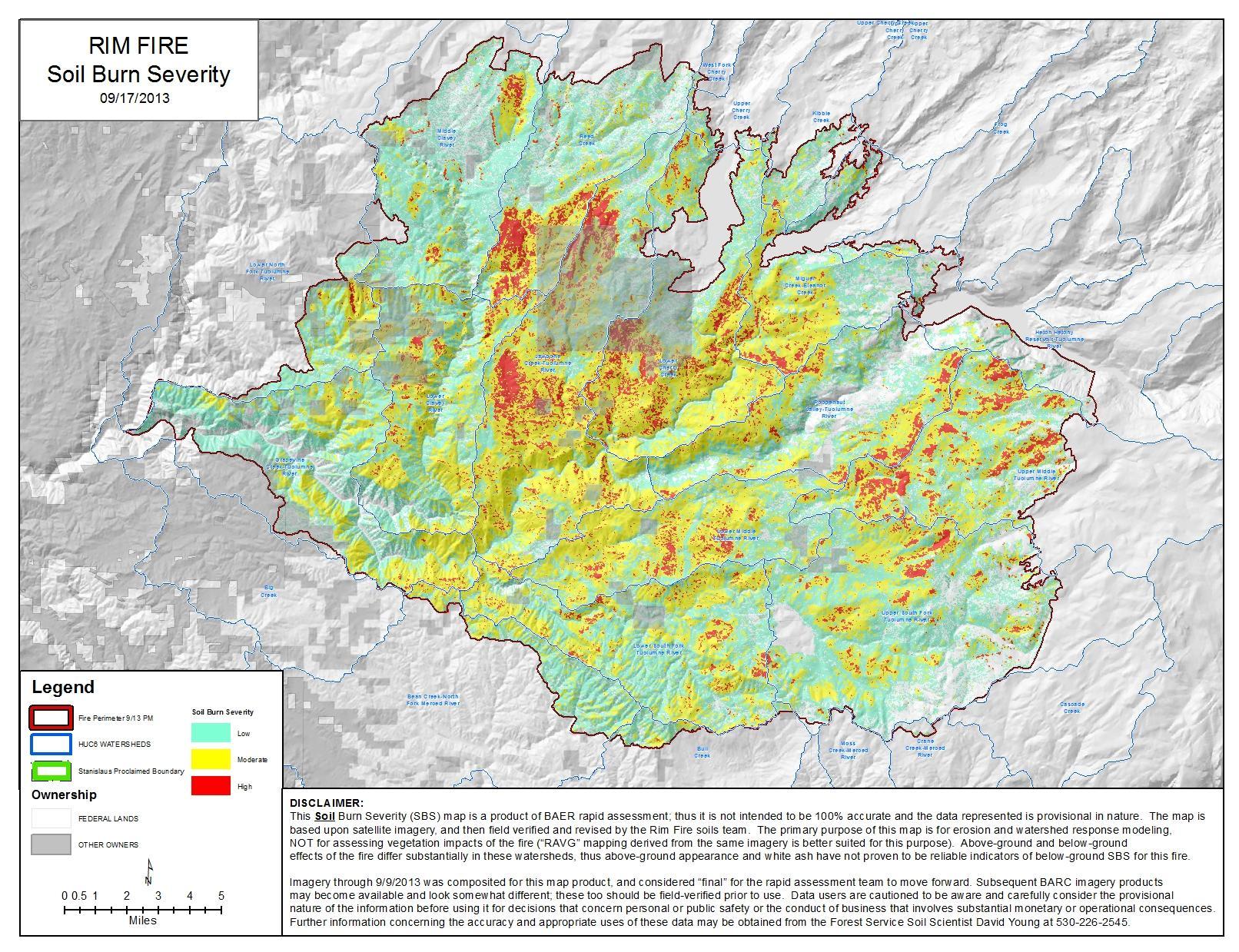 The BAER team has completed the soil burn severity map for the Rim Fire, using burned acres as of Sept. 13, and their assessment shows that approximately 56% of the 254,926 acres within the Rim fire perimeter are either unburned or received a low-severity burn. Some 37% sustained a burn of a moderate severity, and approximately 7% burned at a high severity.
BAER specialists concluded that the amount of high severity burn is fairly low given the time of year and comparison to other fires.
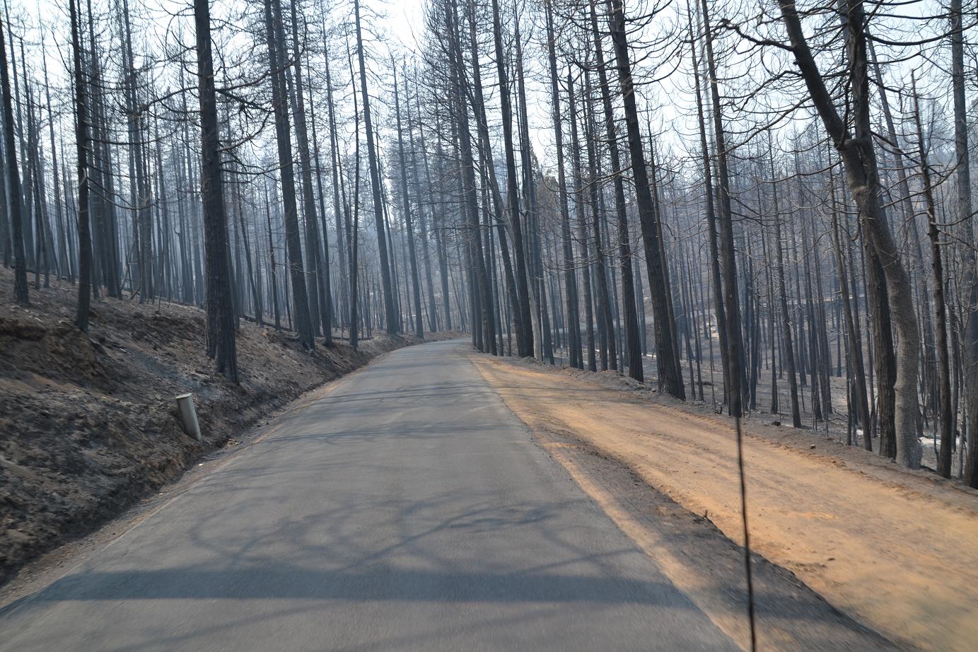
Fires result in loss of vegetation exposure of soil to erosion and increased water runoff that may lead to flooding increased sediment debris flows and damage to critical natural and cultural resources.
BAER may recommend actions such as seeding, mulching, installation of erosion and water run-off control structures, temporary barriers to protect recovering areas and installation of warning signs. BAER work may also replace safety related facilities, remove safety hazards, prevent permanent loss of habitat for threatened and endangered species, and prevent the spread of noxious weeds and protect critical cultural resources.
Long-Term Recovery and Restoration utilizes non-emergency actions to improve fire-damaged lands that are unlikely to recover naturally and to repair or replace facilities damaged by the fire that are not critical to life and safety.
This phase may include restoring burned habitat, reforestation, other planting or seeding, monitoring fire effects, replacing burned fences, interpreting cultural sites, treating noxious weed infestations and installing interpretive signs.
Fire Update
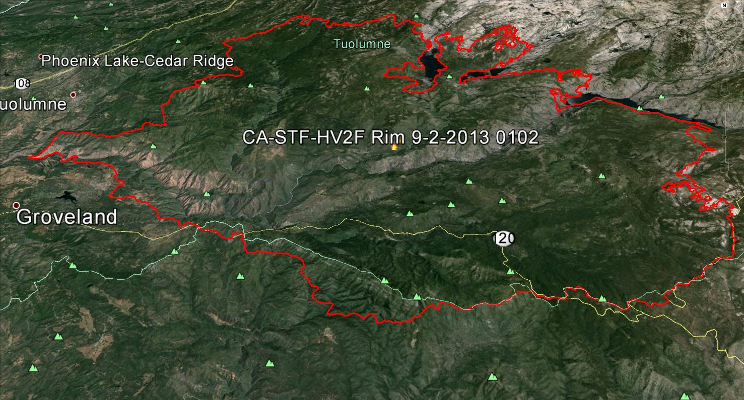 The Rim Fire has burned 256,895 acres and is 84% contained. About 1,380 personnel remain assigned to the incident.
The estimated date for containment has been revised to Oct. 1.
The fire continues to creep and smolder in the Emigrant and Yosemite Wilderness. A Red Flag Warning will be in effect through to midday Saturday.
Fire crews will continue mop-up and patrol of fire lines with the objective of keeping fire within existing containment lines and natural barriers. Structures are no longer threatened.
Cooler high temperatures in the 70s F. with 15 mph SW winds are predicted today; ridge tops may have gusts to 20 mph by the afternoon. The fire will continue to spread slowly in rocky areas within the Yosemite and Emigrant Wilderness, areas east of Cherry Lake and north of Hetch Hetchy reservoir.
Suppression repair continues and repairs to date include 88 miles of dozer line and 52 miles of chipping along roads. A total of 155 miles of suppression line repair remain.
Aspen Valley continues to be closed to public access due to a lack of power and ongoing mitigations of hazards caused by the fire. Progress is being made to mitigate these hazards and restore power.
Employees of Hetch Hetchy Water and Power have returned to the residential areas at O’Shaughnessey.
The pockets of unburned fuel within the perimeter of the fire area continue to consume fuels.
The Hodgdon Meadow Campground, Hodgdon Meadow residential area, Carlon Falls Trailhead, Merced Grove, Tuolumne Grove, the Crane Flat Lookout, and wilderness areas remain closed. The Big Oak Road is open from Crane Flat to Yosemite Valley. Facilities and areas along the Tioga Road west of Lukens Lake Trailhead are closed, including Tamarack Flat, White Wolf and Yosemite Creek Campgrounds, and White Wolf Lodge.
Evergreen Road has been opened to Evergreen Lodge, but remains closed from there on. Old Yosemite Road, Harden, and the Cherry Creek Road remain closed.
A forest closure order is in effect for locations within and proximate to the fire area.
Resources continue to monitor the fire as it slowly spreads northeast further into the Yosemite Wilderness in areas east and northeast of Lake Eleanor where fuels are limited and large natural rock barriers are abundant.