YOSEMITE — The South Fork Fire continues to grow just east of the community of Wawona near the southern boundary of Yosemite National Park.
The fire is burning in wilderness but is being managed for protection objectives due to its close proximity to Wawona.
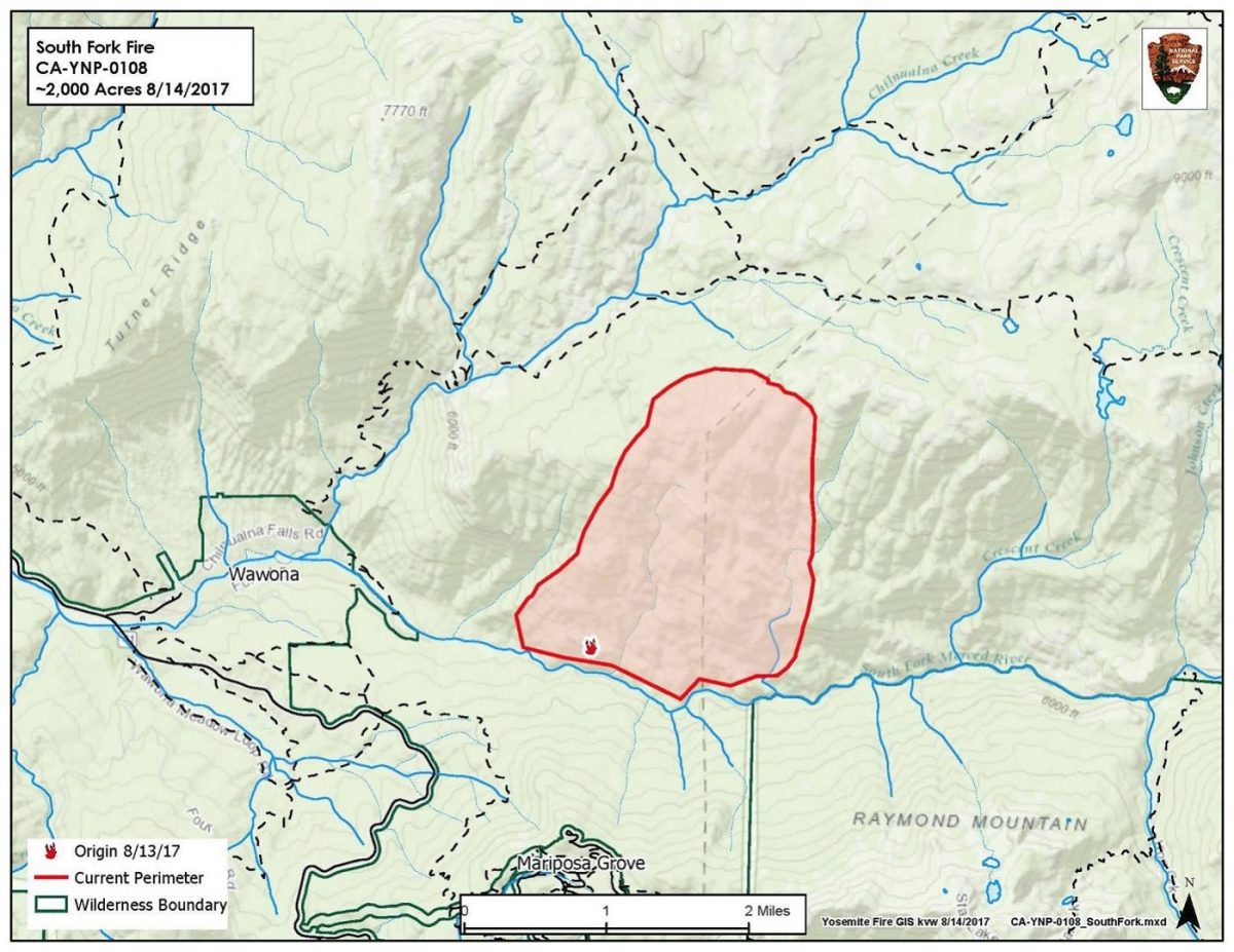
The South Fork Fire is now estimated at 1,613 acres with 0 percent containment.
There are currently 148 personnel assigned to the incident including Hot Shots and ground crews, with many more resources on order. There are an estimated 8-10 aircraft including helicopters and fixed-wing tankers.
An Incident Command Team will take over management of the fire some time tomorrow.
The Wawona Campground is being closed tomorrow to accommodate firefighters.
The fire was reported just after 2 p.m. on Sunday, Aug. 13, and is burning on the South Fork of the Merced River drainage, south of Wawona Dome approximately one mile east of the Swinging Bridge.
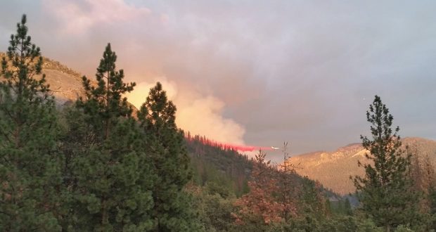
The South Fork Fire in Yosemite – photo NPS
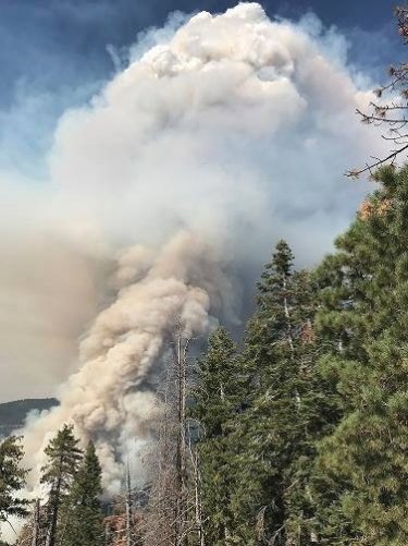
Firefighters are dealing with difficult terrain, extreme fire behavior, group torching, short crown and uphill runs.
Crews continue to aggressively suppress the fire spread toward the community of Wawona on the west flank of the fire.
Residents and visitors in the Wawona area are warned to make appropriate pre-evacuation preparations. If there is an actual need for evacuation, there will be door-to-door notifications by park staff.
As of today, the fire is still a little over a mile from the inhabited areas.
Heavy smoke is impacting Wawona and the areas surrounding Yosemite, especially overnight and through the morning hours, adding more smoke to what is being produced by the Empire Fire near Bridalveil Campground, which is now estimated at 1,320 acres.
Air quality in Wawona is expected to be extremely smoky and to reach unhealthy/ hazardous conditions. Smoke is expected to fill the canyons west of Wawona to Mariposa, and affect visibility along Highway 140 from El Portal to Mariposa, Wawona Road south to Fish Camp, and roads along Tioga Pass to the Mono Lake area.
Recommendations:
– Close windows and doors to keep smoke out.
– Consider leaving the area if you have the option.
The fire is burning in a rugged wilderness area, and the cause is under investigation.
We will update as new information becomes available.
Click here for a perimeter map.
Click here for interactive map.
Map below shows South Fork Fire on the south and Empire Fire on the north.

I am a Fly Fishing guide for Sierra Fly Fishers, out of Oakhurst and had a guide on the South Fork of the Merced River, I finish with them at noon and fished up stream to the falls, about a mile or so from where Wawona get their water supply. I was fish just below the falls about 3:30 pm heard helicopters, and looked up to see the smoke the appeared very close, at that point it didn’t look that bad, to I stared down the hill, fishing on the way and saw the helicopter dipping water out of the river, but couldn’t see from where so I kept working down stream and as I was fishing just about the Wier ( Wawona’s water supply), the helicopter came right down in front of me and filled its bucket with water and returned about everyn5 minutes to refill it.
I’ve got pictures and video if you would like them
Bob Ramos 209-483-1103