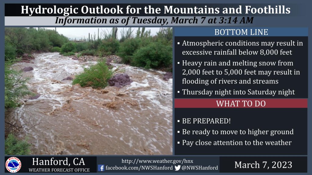
MOUNTAIN COMMUNITIES—The National Weather Service Hanford Office predicts heavy rainfall and melting snow, leading to a threat of flooding Thursday night through Saturday in the Sierra Nevada Foothills and Mountains below 5000 feet.
Wednesday
A trough of low pressure will pass eastward across Northern California Wednesday. The tail end of this trough of low pressure may be responsible for light snow in Mariposa and Madera Counties portions of the Sierra Nevada and adjacent foothills Wednesday. Snow amounts should be one to three inches in the Sierra Nevada and an inch or less in the Sierra Nevada foothills above 1,500 feet. Any precipitation Wednesday will remain north of Fresno County.
A warming trend will begin Thursday ahead of the main event.
Thursday and Friday
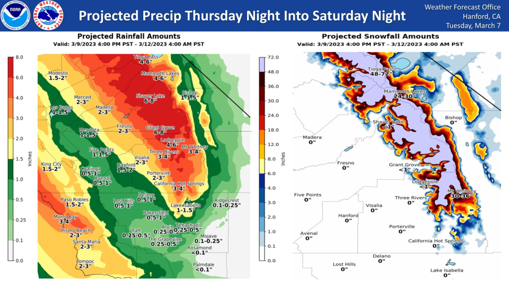
A strong storm system over the Eastern Pacific Ocean will approach the coast of the Pacific Northwest Thursday night and Friday. An abundance of subtropical moisture will move inland over Central California along the southern periphery of this storm system Thursday night through Friday night. Mild air associated with this air mass will cause snow levels to rise to around 8000 feet Friday. In addition, heavy rainfall and the mild air mass will result in melting snow in areas below 5000 feet.

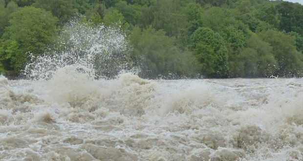
In the Sierra Nevada foothills, four to six inches of rain is possible Thursday night into Saturday night. The majority of this rain should fall Thursday night and Friday. It looks as if there will be a brief break in precipitation Sunday into Monday morning before the next storm system impacts Central California. Persons living near rivers and streams should closely monitor water levels and be ready to move to higher ground if the threat of flooding becomes imminent. If you live in a flood-prone area or near rivers and streams, now would be a good time to prepare and have an evacuation plan in place if high water threatens your safety. Stay tuned to NOAA Weather Radio or your favorite media source for further hydrologic updates. You can also follow us on Facebook, Twitter, and our website at www.weather.gov/hnx.
Sand and sandbag location are available here.
For how to be safe during floods check here.