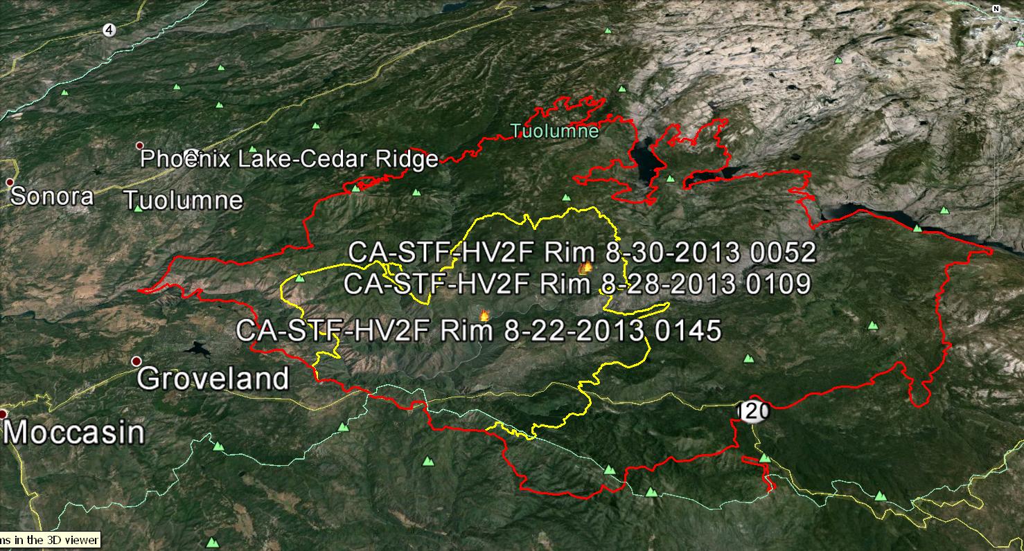
TUOLUMNE COUNTY – Some residents are being allowed to return home near the 201,894 acre Rim Fire. The fire now covers some 315 square miles and is 32% contained.
The Tuolumne County Sheriff’s Department on Thursday lifted the evacuation advisory for Tuolumne City, Soulsbyville and Willow Springs.
There are 4,931 personnel currently assigned to the incident, with a cost to date for suppression efforts at $47 million. Four injuries have been reported.
Fire Update
Burnout operations continued overnight in the southeastern area of the fire. Fire crews continued construction of fire line along 3N01 Road to stop fire spread to the north. Structure defense continues in Pinecrest, Mi-Wuk Village, Confidence, Cold Springs, and Hodgdon Meadow and Big Oak Flat in Yosemite National Park.
Today’s plans are to continue the burnout in the Yosemite National Park south of Hetch Hetchy. If conditions allow, the Duckwall Mountain north to Fahey Meadow burnout will start. Air operations will be used to support all firefighting efforts, as needed.
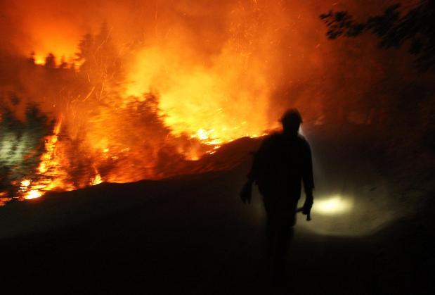
 Rapid fire growth and extreme fire behavior continue to hamper suppression efforts. A significant utilization and reliance upon aerial resources with heavy air tankers including the VLAT DC-10 and MAFFS is occurring with reinforcement of control lines in advance of the fire’s spread, control of spot fires, and slowing the fire’s advancement through terrain inaccessible to ground resources to allow time for indirect line construction to be completed. (click may to enlarge)
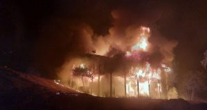
Type 1 helicopters are providing point protection and cooling areas where direct line construction can be achieved safely. Approximately 4,500 structures remain threatened in advance of the fire on both the east and west sides.
Fire is expected to continue its eastward spread farther into the west side of Yosemite National Park, east of Aspen Valley. Several residents remain under mandatory evacuation in the Scotts Ridge area south of Highway 120.
Due to inaccessible steep terrain and extreme fire behavior suppression efforts on active portions of the fire are being significantly challenged. Heavy reliance on aviation resources has been critical in an effort to slow the fire’s progress to allow suppression resources to establish indirect control lines in areas where accessibility and safety can be achieved. The availability of heavy aircraft is pertinent to the success of suppression efforts.
Continued warmer and drier weather is forecasted for the next several days, which will elevate control concerns and slow burnout progress. Remotely piloted aircraft is providing real-time visual and infrared intelligence on the fire. Continued unified command with CAL FIRE.
Park and Forest Closures
Yosemite National Park has closed Tamarack Flat and Yosemite Creek Campgrounds, both located along the Tioga Road. White Wolf Campground and White Wolf Lodge remain closed. If you have questions about Yosemite National Park call 209-372-0327 or 209-372-0329.
The Stanislaus National Forest has issued an area closure for the entire Groveland Ranger District and for the Mi-Wok Ranger District east of Highway 108. Additional details are available from the Stanislaus Forest Supervisor’s Office, 209-532-3671; Mi-Wok Ranger Station, (209) 586-3234; Summit Ranger Station, 209-965-3434; and Groveland Ranger Station, 209-962-7825.
Road Closures
Highway 120 remains closed from Buck Meadows to 1 ½ miles east of White Wolf. Highway 120 east/Tioga Road remains open from 1 ½ miles east of White Wolf to the Tioga Pass entrance. Cherry Lake Road is closed at Highway 120. Evergreen Road and Old Yosemite Road are also closed. Highway 120 from Ferretti Road to Buck Meadows remains open for local residents and businesses only.
Evacuations and Advisories
The Tuolumne County Sheriff’s Department on Thursday lifted the evacuation advisory for Tuolumne City, Soulsbyville and Willow Springs. The evacuation advisory remains in effect for Ponderosa Hills and areas east, along the south side of Highway 108 up to Pinecrest.
An Evacuation Warning has been issued for all residences north of Bull Creek Road (Forest Road 2S02), Bondurant Mine Road, Texas Hill Road, and Wampum Hill.
Residents living north of Old Yosemite Road (Forest Road 2S01) are under a Mandatory Evacuation. Highway 120 at the Yosemite National Park boundary west to Buck Meadows has been evacuated.
Evacuation centers are at the Mother Lode Fairgrounds in Sonora and at the Greeley Hill Community Center.