YOSEMITE – Firefighters continue their efforts to contain the northern perimeter of the Ferguson fire, now estimated at 95,946 acres with 83 percent containment.
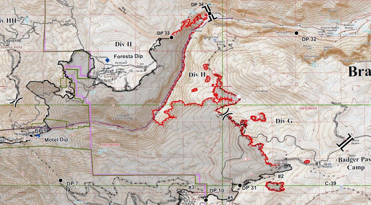
Firing operations were completed along Highway 41 yesterday to Elephant Rock, and a sprinkler system is assisting firefighters in ensuring the fire doesn’t move outside the containment lines.
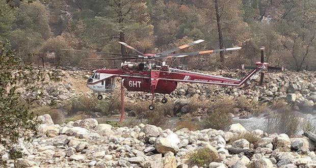
Spot fires continue to be an issue as firefighters work in the steep terrain south of the entrance to Yosemite Valley, but crews have been able to contain them with assistance from helicopters.
The section of fireline north of the Merced Grove has been moved into the “contained” column as the heat from burning snags has diminished enough for crews to be able to get in and finish mopping up that corner of the perimeter.
Also, the line running east from Yosemite West toward Badger Pass has been contained and the hose lays removed.
There is still much work to be done along Highway 41 north of Yosemite West, and officials do not expect it will be safe to reopen the road for at least a week.
The Hetch Hetchy Road and dam reopened on Saturday, Aug. 11. Hours will be 10 a.m. to 6 p.m. The Wapama Falls trail will remain closed.
Yosemite Valley is scheduled to reopen to the public on Tuesday, Aug. 14, at 9 a.m. The Mariposa Grove of Giant Sequoias will open on Monday, Aug. 13, at 9 a.m. (see details below).
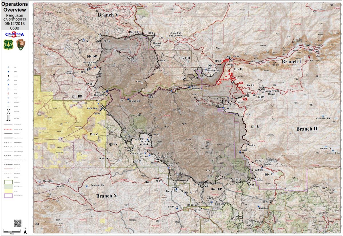
The remainder of the fire is in mop-up and patrol status, and suppression repair efforts are ongoing on most sections.
As containment on the fire grows, the number of personnel assigned to the incident has dropped to 1,142. Some firefighters are being demobilized from the Ferguson Fire but will be sent to other fires across the region. Others have “timed out” and are being released for some mandatory and well-deserved R&R after a tough assignment.
The Ferguson Fire started on Friday, July 13, at 8:30 p.m., near Savage Trading Post on the south side of the Merced River canyon along Highway 140. The cause remains under investigation.
The Ferguson Fire is now the largest fire in the history of the Sierra National Forest.
The estimated date for full containment is Wednesday, Aug. 15.
Yosemite National Park
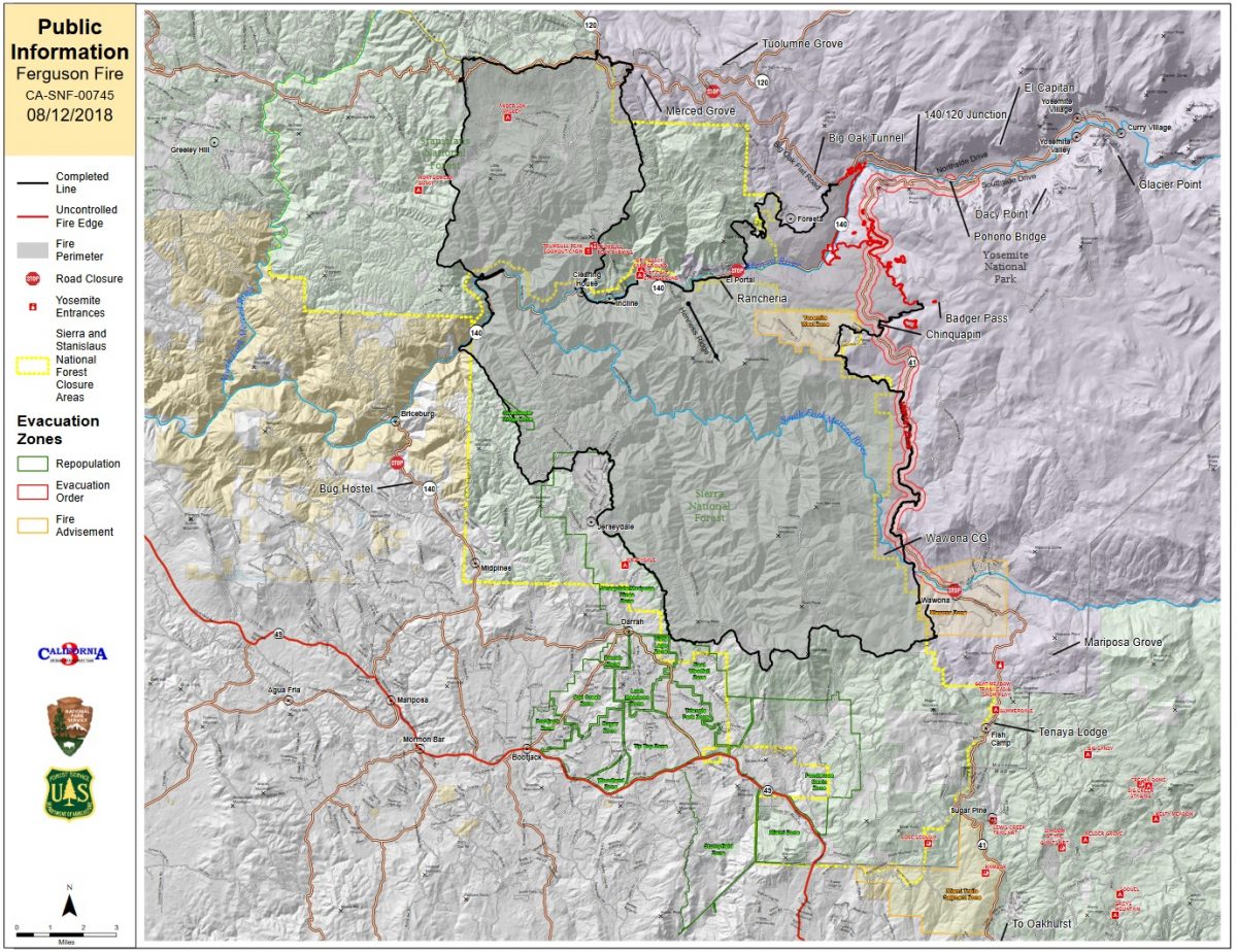
Yosemite Valley will reopen to visitors on Tuesday, Aug. 14, at 9 a.m. after being closed since July 25. Visitors can access Yosemite Valley from the El Portal Road (Highway 140), the Big Oak Flat Road (Highway 120), or the Tioga Road (Highway 120).
The Wawona Road (Highway 41) will remain closed from Wawona to Yosemite Valley for at least another week due to ongoing fire activity and firefighter operations. Park visitors should be aware that there is still active fire and smoke on the roads and people should drive with extreme caution.
Delays on the roads are possible due to fire activity and ongoing firefighter operations. There will be limited hours and limited visitor services at park facilities as the park returns to normal operations.
The Mariposa Grove of Giant Sequoias will reopen to the public on Monday, Aug. 13, at 9 a.m. Visitors can access the Mariposa Grove via the South Entrance (Highway 41) and park in the newly-constructed parking area.
The free shuttle buses to the Mariposa Grove will begin at 9 a.m. and take visitors to the newly-restored Mariposa Grove of Giant Sequoias. The Mariposa Grove reopened to visitors on June 14, after a 3-year restoration project conducted in partnership with Yosemite Conservancy.
Visitors will be able to travel to the Wawona area via the South Entrance (Highway 41). However, there is no access to Yosemite Valley via Highway 41.
The Glacier Point Road remains closed and is expected to open when the Wawona Road (Highway 41) reopens.
The Hetch Hetchy Road and dam reopened on Saturday, Aug. 11. Hours will be 10 a.m. to 6 p.m. The Wapama Falls trail will remain closed. These limits are in effect due to air quality concerns.
For updated 24-hour road and weather conditions for Yosemite National Park, please call 209-372-0200, press 1 and press 1 again. Updated information is also available on the park’s website at www.nps.gov/yose and on the Yosemite National Park Facebook page.
Structures and injuries
Ten structures have been destroyed by the Ferguson Fire. Amazingly, no inhabited homes have been lost. Damage assessment teams have been able to get into some of the burn areas of the fire, and report that most of the 10 structures reported lost were in the Ned Gulch area on the north end of the fire. According to locals, these were historic mining operation structures that were being restored and used weekly for various types of outings and expeditions.
There have been 19 firefighter injuries reported, and numerous instances of heat exhaustion-type symptoms. There have been two fatalities on the fire; HFEO Braden Varney was killed in a dozer rollover accident on July 14, and Brian Hughes, Arrowhead Hotshot Captain, lost his life on July 29 when he was struck by a tree during a firing operation.
Air quality issues
For information on air quality specific to Mariposa County visit http://www.mariposacounty.org/index.aspx?NID=1434. For additional information on air quality you can visit the AirNow website or the air fire smoke page.
The San Joaquin Valley Air Pollution Control District has also warned that a health caution is in place and smoke impacts will continue until the fire is extinguished.
Wildfire smoke is a mixture of gases and fine, microscopic particles that can cause health problems including triggering asthma attacks, aggravating chronic heart and lung diseases, and increasing the risk of heart attack and stroke. Where conditions warrant, people with heart or lung disease should follow their doctors’ advice for dealing with episodes of particulate exposure. People with existing respiratory conditions, young children and elderly people are especially susceptible to the health effects from these pollutants. Anyone being exposed to poor air quality or wildfire smoke should move inside to an air-conditioned environment.
Residents can check the San Joaquin Valley Air Pollution Control District’s wildfire page at www.valleyair.org/wildfires for information about any current wildfires and whether they are impacting the Valley. The District’s Real-time Air Advisory Network (RAAN) provides localized air quality data from an extensive air-monitoring network which allows Valley residents to track PM at any Valley address by visiting myraan.com.
General Information
If community members see new fire activity, they are asked to call 911, not the fire information line.
As of July 21, there are fire restrictions in place on the Sierra National Forest. Please read and be informed before you use any type of fire in the forest.
The Incident Command Post for the Ferguson Fire is located at the Ahwahnee Hills Regional Park. Please be aware of heavy fire equipment moving through the area. There is also a base camp set up on the Stanislaus National Forest. Personnel at the fire camp at Badger Pass have been relocated to the ICP in Ahwahnee due to active fire in the area.
Cal Fire exited Unified Command as of 6 a.m., Thursday, July 26, because of reduced threats to state and private lands. Cal Fire remains committed to the Ferguson Incident as an assisting agency. California Interagency Incident Management Team 3, led by Incident Commander Mark von Tillow, assumed management of the Ferguson Fire as of 6 a.m. on Friday, Aug. 3, transitioning in for California Team 4, which had be managing the fire since July 19.
For information about the fire please call 530-377-6221.
Stanislaus National Forest Supervisor Jason Kuiken has signed a forest order closing several Groveland Ranger District roads and trails impacted by the Ferguson Fire. This closure is based on the current and expected fire behavior and will be in effect until Sept. 30, or until replaced or rescinded. Click here for details and a map of the closure.
Be sure you are signed up to receive alerts when wildfire or other emergencies threaten.
- To sign up for the Mariposa Sheriff’s Office Emergency Alert System visit https://local.nixle.com/register.
- To register for the Madera County Sheriff’s Office Emergency Alert System visit mcalert.org.
Evacuations
- Yosemite Valley – open to residents only. The valley will reopen to the public on Tuesday, Aug. 14 at 9 a.m.
Road Closures
- Highway 140 is closed from the park gate east. It is scheduled to reopen to the public on Tuesday, Aug. 14, at 9 a.m.
- Highway 41 is closed at the south gate except to residents of Wawona and Yosemite West.
General information on returning to previously evacuated areas:
Mariposa County Sheriff’s Office will have a heavy presence in the area to ensure the security and safety of residents and businesses.
There will still be smoke in the respective areas as firefighters continue firefighting operations. If at any time you feel unsafe, please call 911.
For questions or concerns regarding power, please contact PG&E at 800-743-5000 or visit their website at www.pge.com.
The Mariposa County Health Department has health and safety information for residents returning to their homes on their website at http://www.mariposacounty.org/health or call 209-966-3689.
Mariposa County Health and Human Services will be available to assist residents with gaining additional services. Additional information regarding these and other services is available at www.mariposacountyrecovers.org.
SAFETY MESSAGE – The public is reminded to stay vigilant on current fire conditions. Please continue to adhere to road closures and any evacuation warnings. If you see electrical wires on the ground, stay clear and contact PG&E immediately. Trees and poles with deep charring, particularly if still smoking, should be considered hazardous. Please drive slowly and yield to emergency personnel in the area. As you re-enter your property and evaluate damage, be aware that hazardous conditions may exist, particularly if a residence or out-building has burned. Hazards may include asbestos, heavy metals, by-products of plastic combustion and various other chemicals. We encourage the public to remain prepared year-round for wildfires by visiting the www.readyforwildfire.org website. The best show of support is having your home and property “fire-ready.”
Cooperating Agencies on the Ferguson Fire include:
- Bureau of Land Management
- California Conservation Corps
- California Department of Corrections
- California Highway Patrol
- California Office of Emergency Services
- Cal Fire
- Caltrans
- Central Califonia Animal Disaster Team
- Hetch Hetchy Water & Power
- Madera County Sheriff
- Mariposa County Public Works
- Mariposa Public Works
- North Fork Rancheria of Mono Indian of California
- Pacific Gas and Electric
- Red Cross
- San Francisco Department of Emergency Management
- Sierra Tel
- Tuolumne County Sheriff
- Yosemite Mountain Ranch

Today the reopening of CA-41 is listed as being “…at least a week…” away.
Yesterday the reopening of CA-41 was listed as being “…at least a week…” away.
The day before that, the reopening of CA-41 was listed as being “…at least a week…” away.
Don’t get me wrong: I am extremely grateful for all the firefighters’ efforts! It simply seems that the progress being declared on this stubborn section of the fire is not matched by the reality.