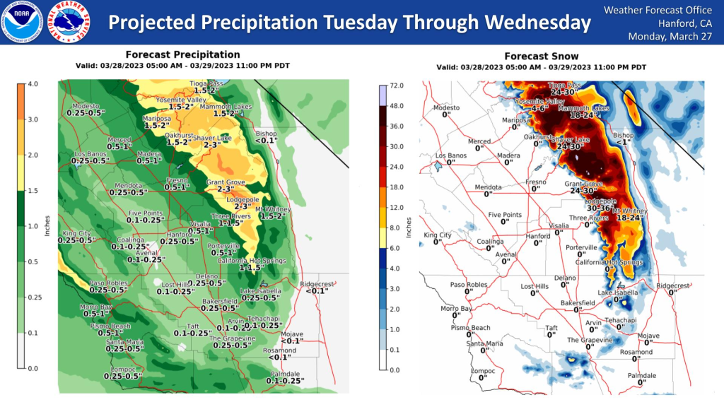
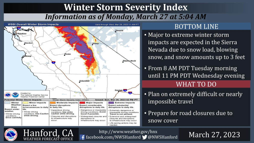
MOUNTAIN COMMUNITIES—The National Weather Service Hanford Office is warning residents that a storm system will impact Central California Tuesday through Wednesday, resulting in periods of rain in the San Joaquin Valley and the Sierra Nevada foothills. Major to extreme winter storm impacts are expected in the Sierra Nevada. The majority of this precipitation will fall Tuesday evening and Tuesday night.
As always, Sierra News Online will monitor and report these storms’ impacts, including road conditions, traffic hazards, power outages, and school closures.
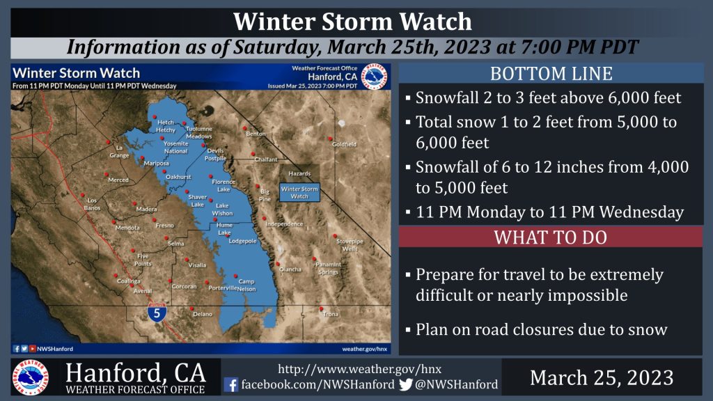
A Winter Storm Watch is in effect for the Sierra Nevada and adjacent foothills above 3,000 feet from 11 PM PDT Monday until 11 PM PDT Wednesday. A Winter Storm Watch means there is potential for significant snow accumulations that may impact travel. The majority of this snow will fall Tuesday afternoon and Tuesday evening. Wind could gust as high as 60 mph on exposed ridgetops and along the crest. Travel may be extremely difficult or impossible. If you plan to travel, consider alternate strategies. If you must travel, remember to carry tire chains, plenty of food, a good deal of water, warm clothing, and a flashlight in your vehicle.
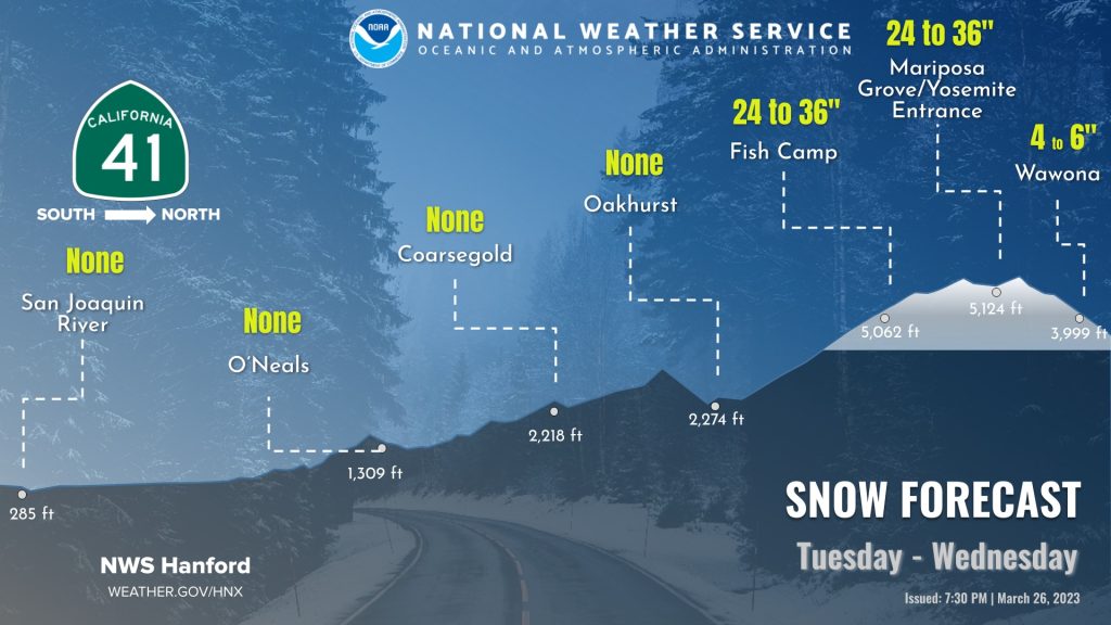
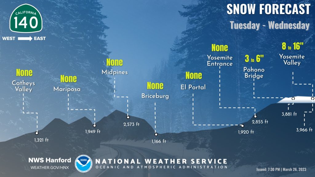
Major to Extreme Winter Storm impacts are expected across the Sierra Nevada with this week’s storm. The bulk of the rain and snow is expected to fall Tuesday afternoon and evening.
Although snow levels will start as low as 3500 to 4000 feet at the onset of the precipitation Tuesday morning, they will rise steadily to around 5500 to 6000 feet by Tuesday afternoon. Snowfall accumulations up to 3 to 4 feet are likely at the higher elevations, with 1 to 2 feet down as low as the 4000 to 5000-foot level.
Later in the Week
Some mainly light mountain showers will linger late Wednesday night through Thursday morning on the backside of the system. In addition to precipitation, the passing storm system brings cooler-than-normal conditions, with afternoon highs around 10 degrees below normal Wednesday and Thursday, even approaching record-low maximum temperatures for the date at some locations. Temperatures then trend back upward to just a few degrees below normal through the end of the week and into the start of next week ahead of another developing Northeast Pacific low-pressure system.


