Glacier Point Road was back open! So we really needed to get up to Ostrander Lake to check out how much snow was up there and we were very curious whether the lake was still iced over. Plus we had a very special critter sighting!
Where: Yosemite National Park
Distance: 12.58 Miles
Difficulty: Moderate to Strenuous
Elevation Range: 6,998′ – 8,613′
Date: May 11, 2016
Maps: El Capitan, Merced Peak Topographic Quad Maps
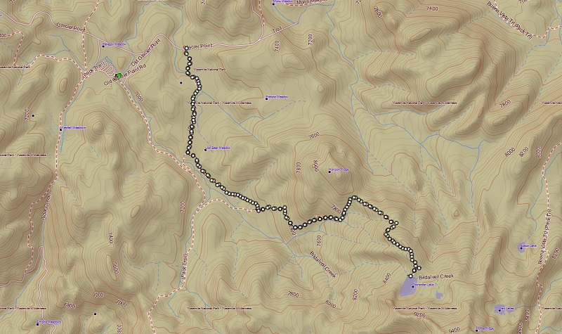
We headed up Highway 41 through the South Entrance to Yosemite near Mariposa Grove, then up Glacier Point Rd. We continued about 9 miles to the wide parking area that is just off the road on the right hand side, just past where Glacier Point Rd. crosses Bridalveil Creek. The sign that says “Ostrander Lake” was along the right side of the road where you turn into this parking lot. We put our goodies in the bear box and used the restroom before heading up the trail, following the signs along the way.
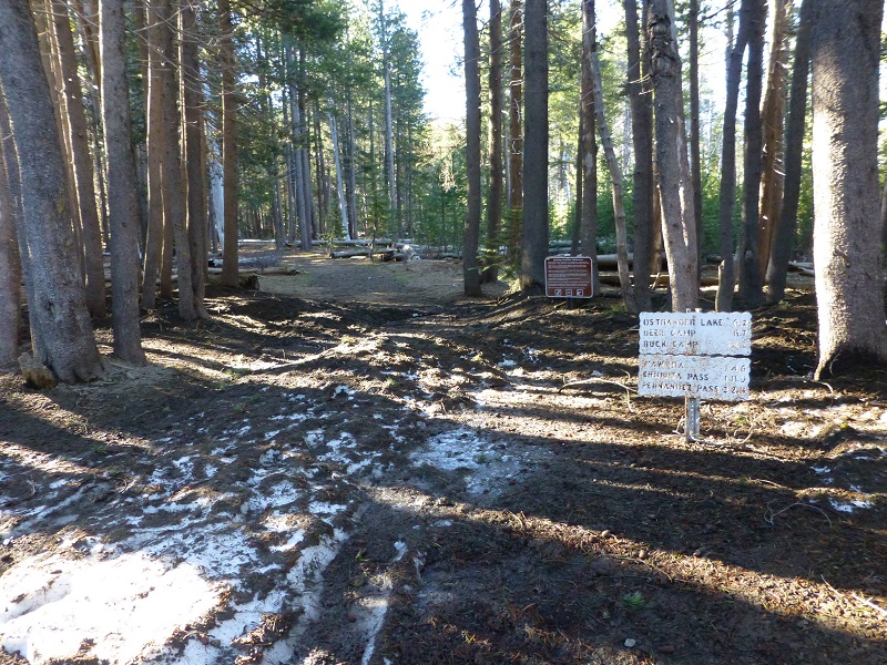
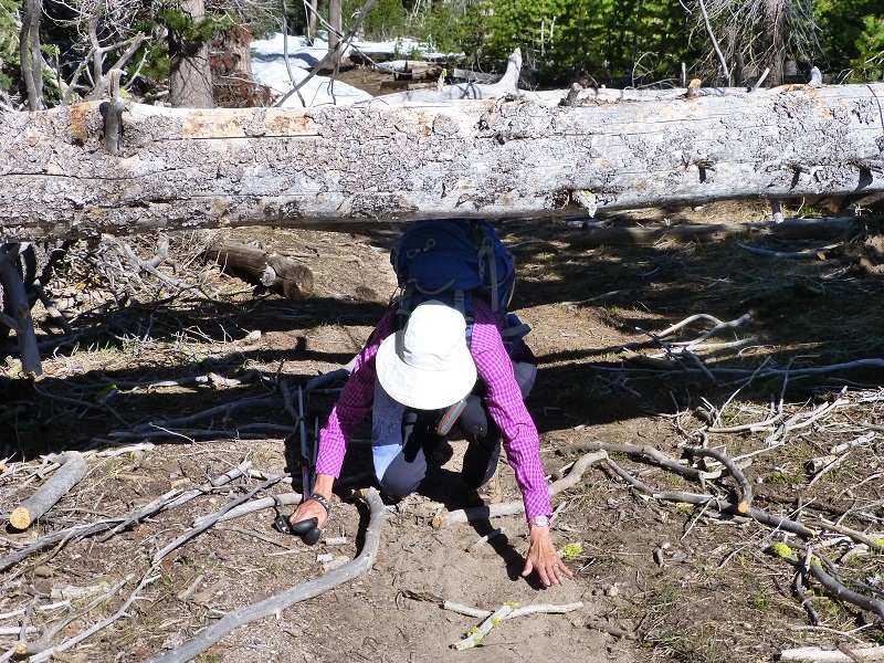
It wasn’t too long before we hit some snow on the trail but nothing we couldn’t walk on. It wasn’t a problem to work our way by the large puddles and small streams of water running down the trail. The trail also had many down logs across it in places, but we were able to climb over or crawl under those. It would be a different story for stock using this trail. Until those trees get cleared, those down trees would be a problem for the horses and mules. There is no getting around some of them.
Just above “Heart Attack Hill”, at about the 7,800′ elevation, we pretty much hit total snow coverage on the trail. It was a little on the soft side but wasn’t too bad of post holing. We noticed freshly fallen trees, some of them with the trail markers, that required us to go around them and off the trail for a while. Not too many people had traveled this trail since the last snow and it would be easy to lose the trail if you don’t know where you are going.
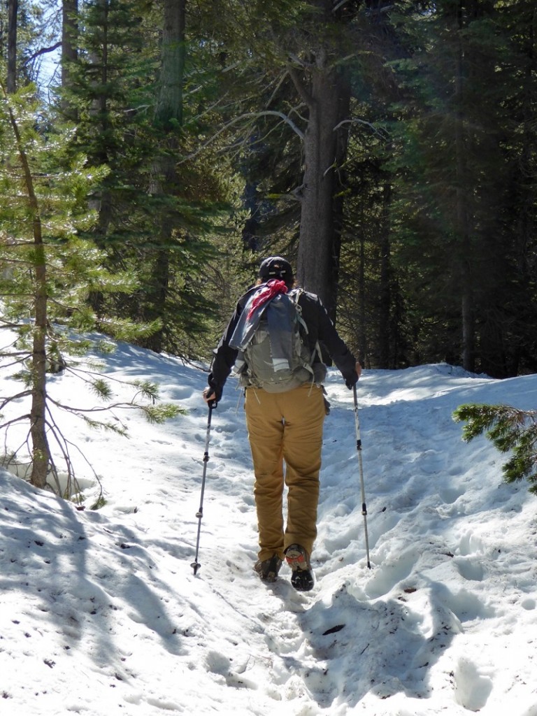
Working our Way Up the Trail (Photo by Gail Gilbert)
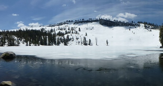
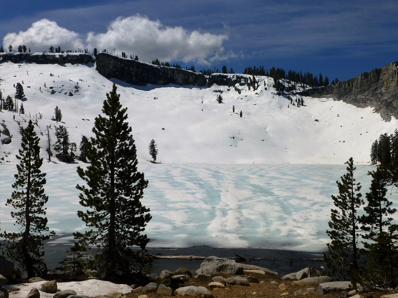
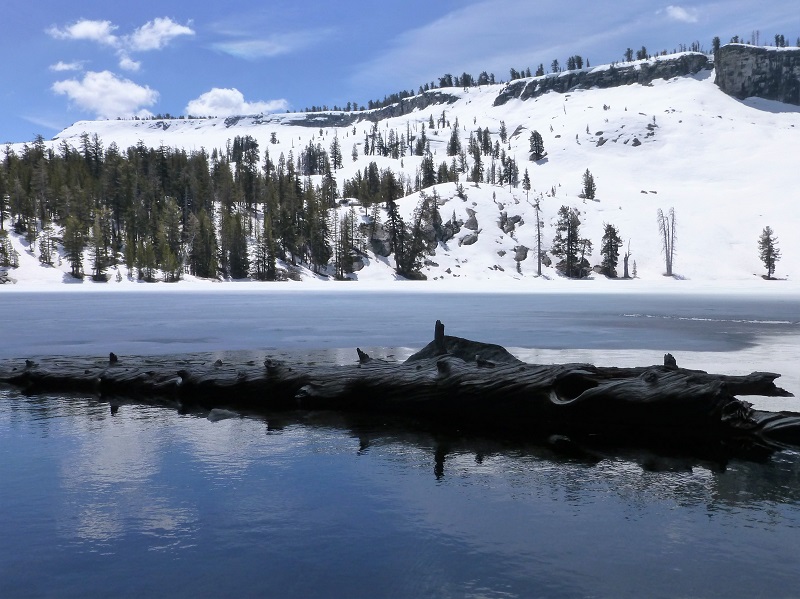
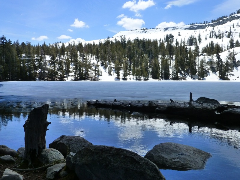
We really didn’t know whether there would still be ice on Ostrander Lake and were thrilled as we caught our first glimpse of the lake. Beautiful!
Ostrander Lake is the primary source of Bridalveil Creek, which feeds Bridalveil Falls. I have found 3 different stories about how Ostrander Lake got its name. Wikipedia says that the lake is named for a descendant of Alexander Ostrander (1783) of Smithfield NY and that this branch of Ostrander family settled in Colorado (Georgetown, Granby, Hot Sulphur Springs, Golden) prior to 1872, some moving from Colorado to California. Yosemite National Park’s website says that is named for a Sheepman.
One site even says that the lake is named after Alexander Ostrander who settled near the lake. Well, that last one is not true because this Alexander Ostrander never left New York.
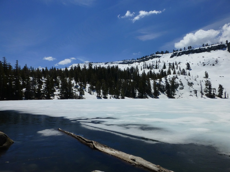
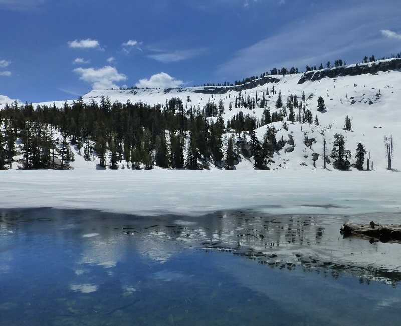
We worked our way around the north side of the lake, admiring the beautiful reflections.
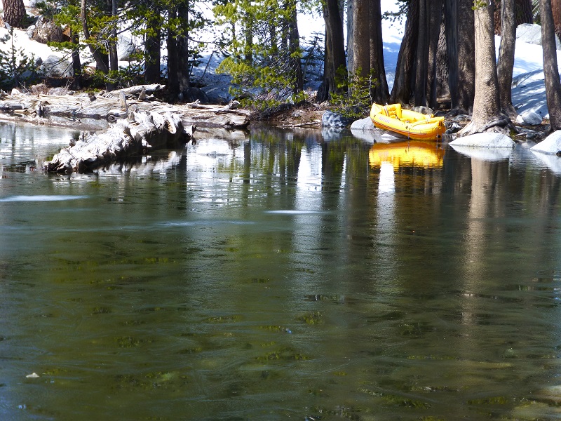
We were sure surprised to see this boat along the lake. Someone put in a lot of effort to pack it up here.
We found a great lunch spot (aka flat rock) and watched the show that the clouds put on for us. Their shadows changed the way the landscape looked and their reflections in the lake were just gorgeous.
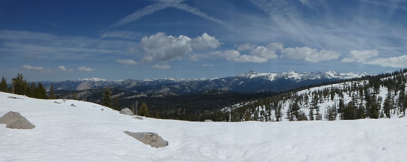
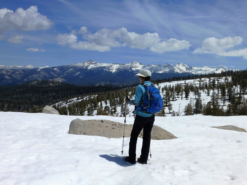
It was time for us to head back and we decided to head a little off the trail to check out the view of the high country to our east. We can’t wait until Tioga Rd. reopens and we can access that country.
We were about half way back when I was coming around a corner on the trail at the same time a mama bear and her tiny cub were coming up the trail and around that same corner. I stopped as soon as I saw them, about 4 feet away. The bear took a quick glance at me, then her cub did the same, then mama looked into the brush on my left side, then the cub looked the same way and off they went. I could hear a big “wuf” then and smaller “wuf” as they made their get away. The whole thing happened so fast, maybe less than 10 seconds before they were gone. We stood where we were, making lots of noise, to make sure they knew where we were and that they got away. In the back of my mind, I couldn’t be so sure that bear’s glance into the bushes wasn’t at another cub. But we will never know. The cub I saw was very tiny, probably the tiniest cub I have seen this close in Yosemite.
There is more snow in accessible hiking areas than we have seen in the past few years. Sometimes the actual trail is not easily seen because it is covered in snow or the trees with the trail markers have fallen down. It requires paying attention to where you are going and if you are not good or comfortable with this type of hiking, I recommend holding off just a smidge until the trails are clearer.
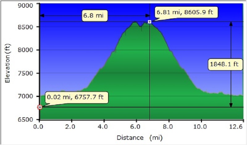 Ostrander Lake Topographic Map and Profile
Prior Blogs in the Area:
Ostrander and Heart Lakes Hike April 4, 2015
Glacier Point Road to Ostrander Lake Hike April 23, 2014
Ostrander Lake Hike May 29, 2013
Sources:
Yosemite Valley Place Names (1955) by Richard J. Hartesveldt

Thanks for the report! I’ve been wanting to stay a night at Ostrander for some time now, and was hoping to at the end of this month. About how deep was the snow at the peak areas, and can you give any estimation of what a couple weeks of good weather would do in regards to that?
There is about a foot or so at the high points of the trail before dipping into Ostrander Lake. There is a cold storm coming in a few days and I would keep an eye on that for possible new snow up there. If we keep having weather like we have today, I don’t think snow will last. Hope that helps. At the high peaks, I think the snow will be hanging around longer though.