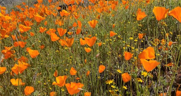
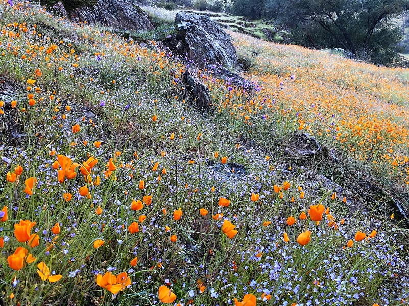
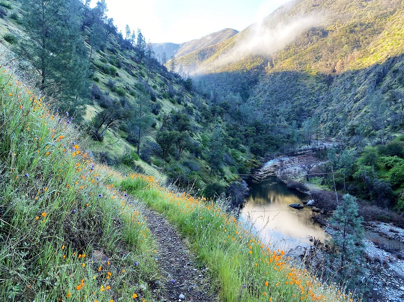
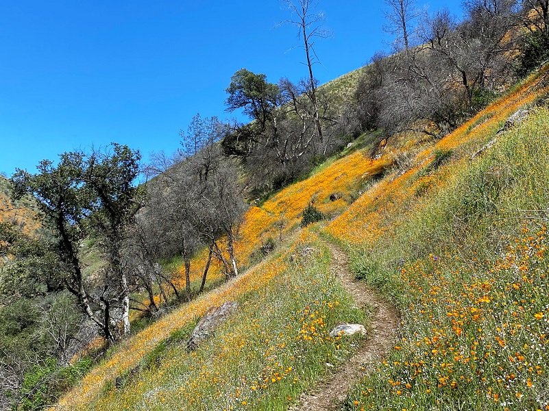
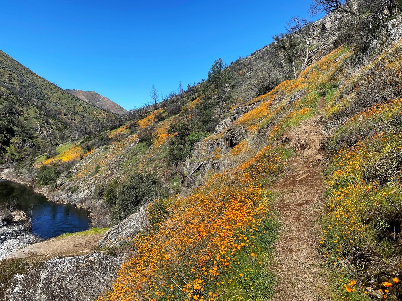
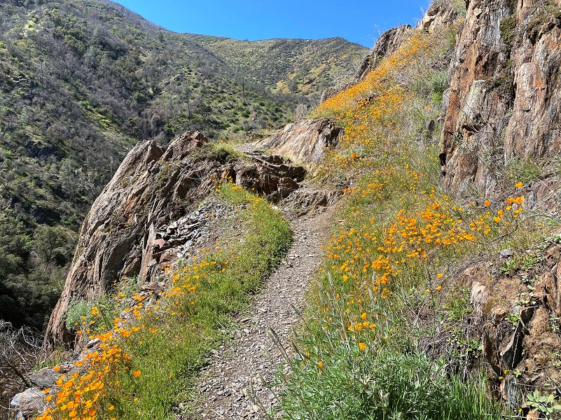
The Merced River Canyon’s Hite’s Cove Trail has reopened just in time for a glorious poppy extravaganza. It has been 3 long years since it was closed from the Ferguson Fire. If you don’t feel like going the distance that I did, the most concentrated area of poppies is within the first 1/2 mile or so. But that is also the most concentrated area for people also.
Where: Private Property, Sierra National Forest
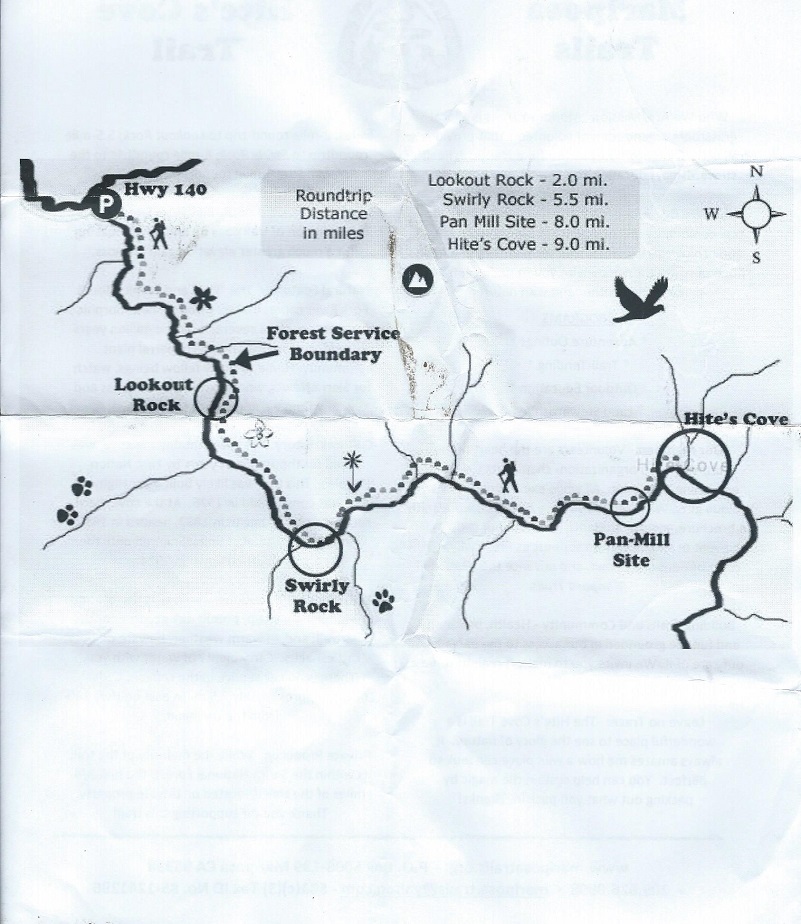
Distance: 7.93 Miles
Difficulty: Easy to Moderate
Elevation Range: 1,407′ – 2,045′
Date: March 23, 2021
CALTOPO: Hite’s Cove Trail
Dog Hike? Maybe
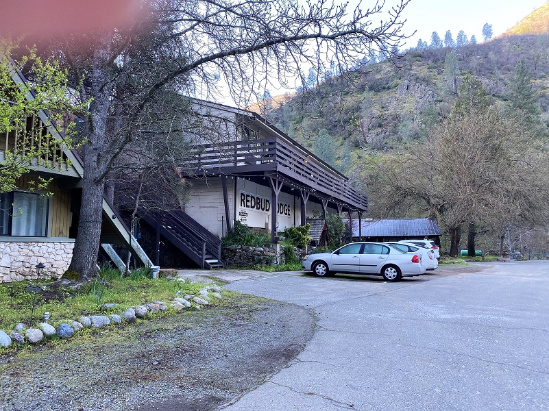
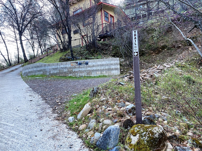
I headed up Hwy 140 toward Yosemite. Savage’s Trading Post, next to the Redbud Lodge, is on the right after you cross the South Fork Bridge and I parked across the road (on the river side). I walked across the road from where I parked and the trail began with a short climb through private property for 3/4 of a mile. There were good trailhead signs on this hike, but that is not always the case. I made sure to carry plenty of drinking water and kept an eye out for rattlesnakes.
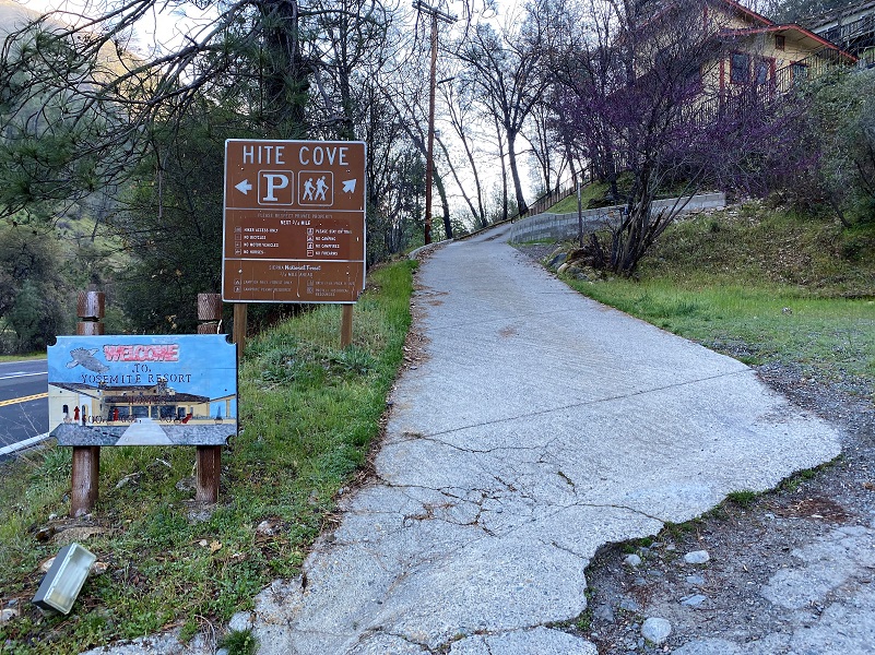

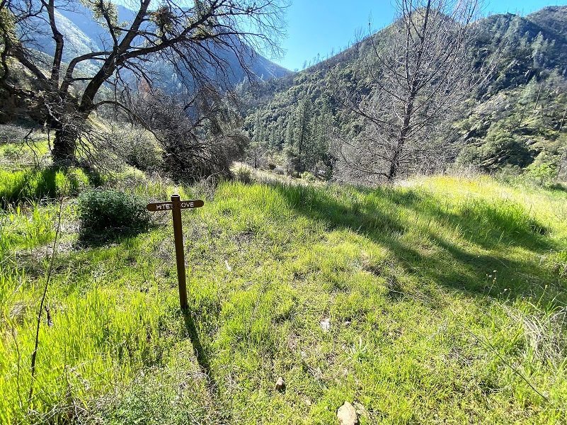
At the beginning of the trail, a box held flyers prepared by Mariposa Trails on the Hite’s Cove Trail. Mariposa Trails is a local organization of volunteers that provides trail access and promotes its use for adventure, health, stewardship, education and community prosperity. If you click on the copies of the handout below, they will become larger.
Whether you call it Hite’s, Hites, or Hite Cove, it is all acceptable and the same place. My destination was to the old mining town of Hite, which was named after John Hite who discovered gold there. Placer mining began in the area shortly after the beginning of the gold rush, and the Hite Mine was discovered in 1862 by John R. Hite. He operated the property for 17 years and became quite rich. The mine was active again during the early 1900s and there has been some prospecting in the area in recent years. The Hites Cove post office operated from 1868 to 1869, and from 1878 to 1889. The Hite post office operated from 1901 to 1902. The town burned down in 1924.
The Hite’s Cove Trail has been closed since the Ferguson Fire started on the evening of Friday, July 13,2018 along Highway 140 (South Fork of the Merced River) in the Sierra National Forest in Mariposa County. Two firefighters were killed while fighting the fire which burned 96,901 acres of the Sierra National Forest, Stanislaus National Forest, Yosemite National Park, and state lands. It was declared fully contained on August 22, 2018. The cause of the Ferguson Fire was determined to be vehicle-related. Specifically, investigators believe super-heated pieces of a catalytic converter came into contact with dry, roadside vegetation, igniting the fire.
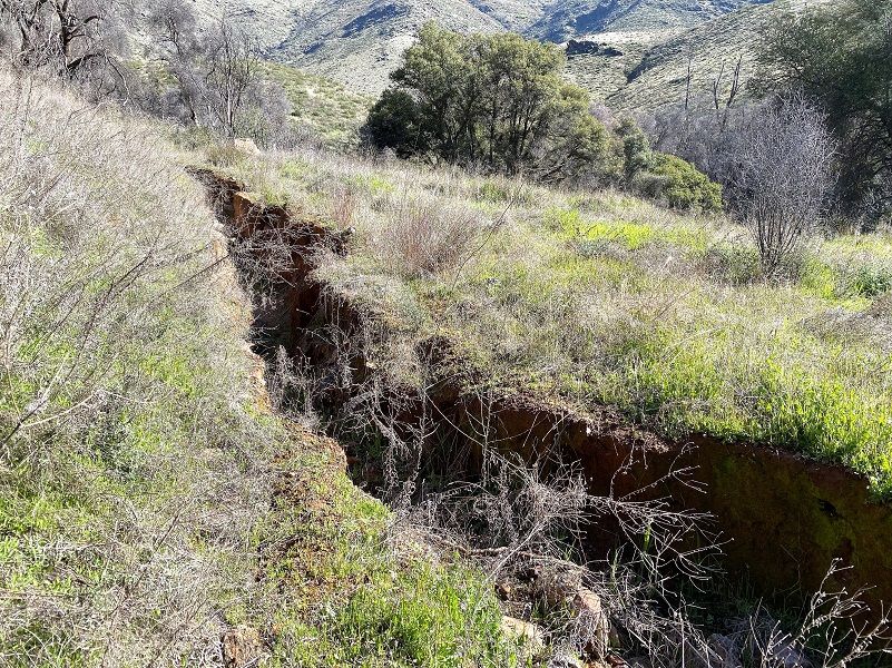
Even after the Ferguson Fire was controlled, this trail remained closed for public safety due to the risk of landslide and rock fall associated with the moderate to high intensity fire effects from the fire on the soil and vegetation surrounding these trails. It is officially open now but note that the 4WD road from Jerseydale down to Hite’s Cove is still closed.
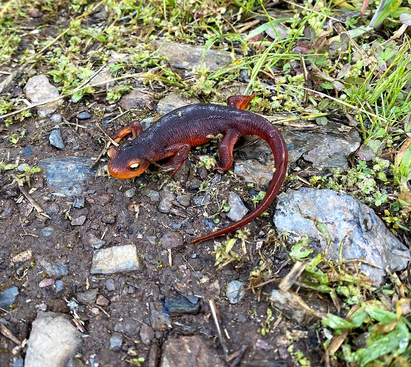
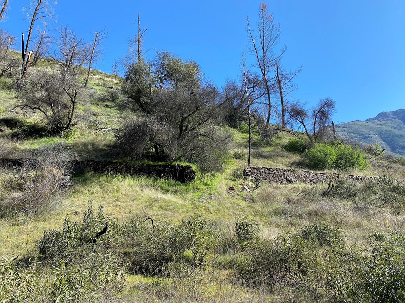
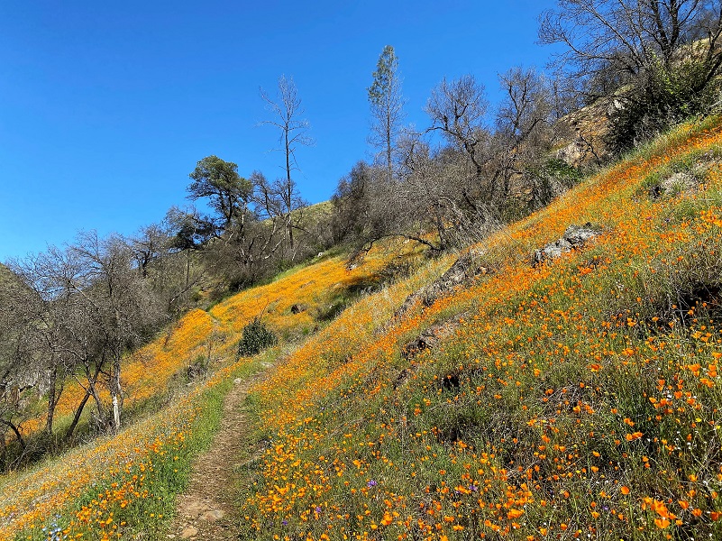
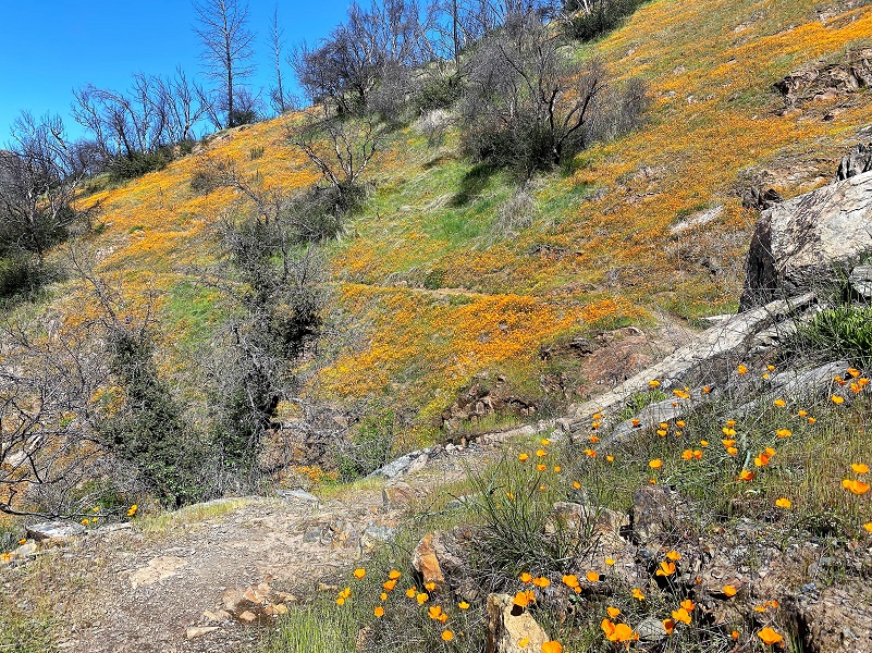
My plan was to head up the trail early, hoping to see some Newts, be back in the poppy areas in the afternoon and beat the crowd. I hit the trail around 8 and the poppies were still closed up, but I could see that this year is a very good season for poppies here!

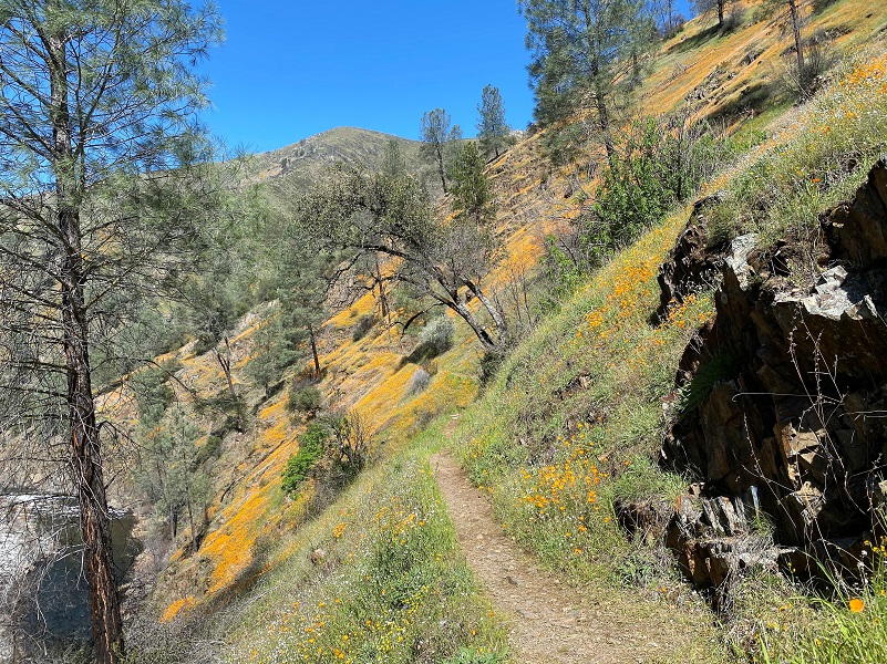
As I continued up the trail, wispy clouds hung in the canyon.

Oh, and the poison oak was beginning to leaf out. On some areas of the trail, it encroached on the trail a little bit. If you are very allergic to poison oak, this may not be the right hike for you.
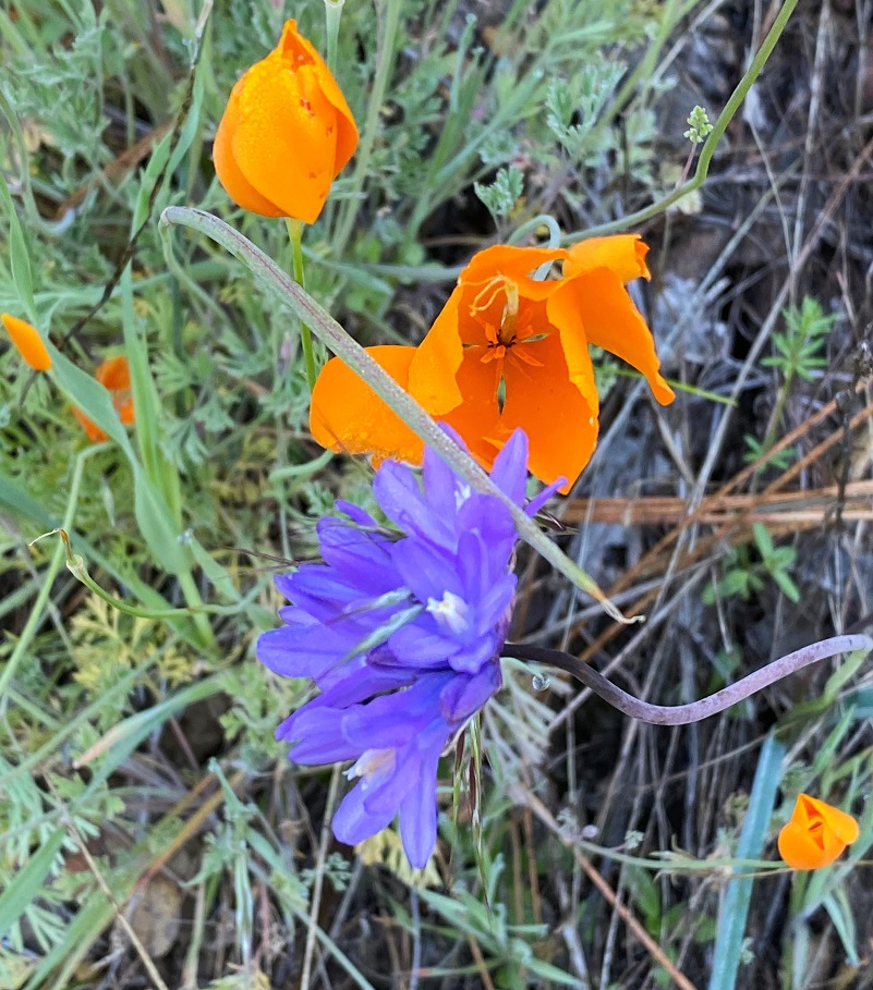
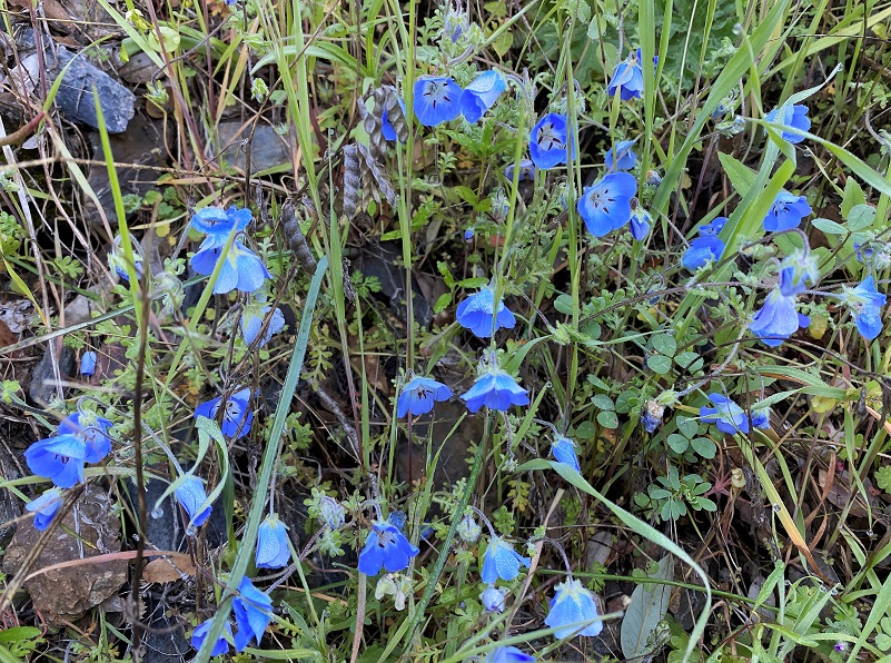
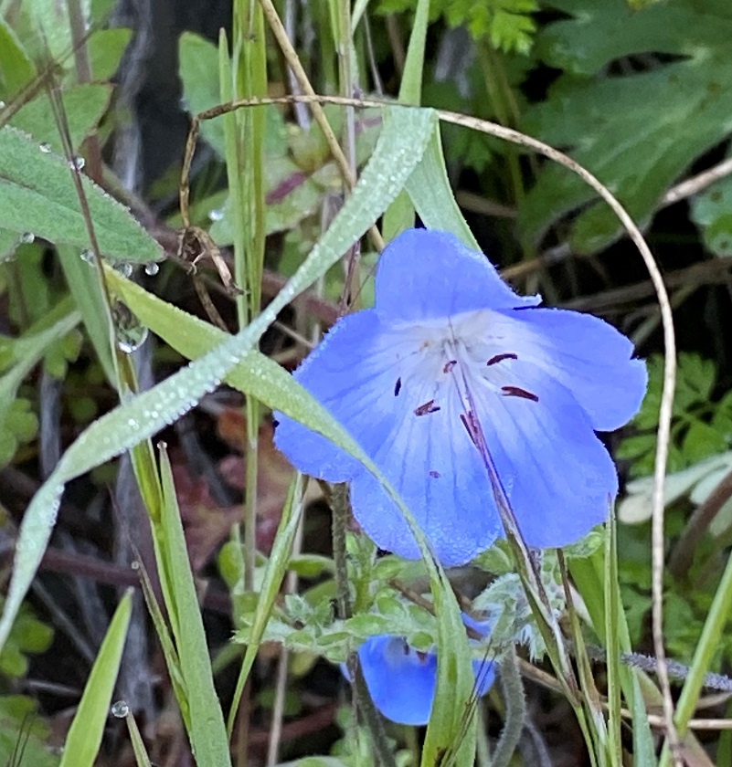
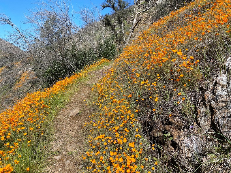
Poppies weren’t the only flowers along the trail. Redbud, sky pilots, popcorn, bluedick and the below baby blue eyes were showing off.
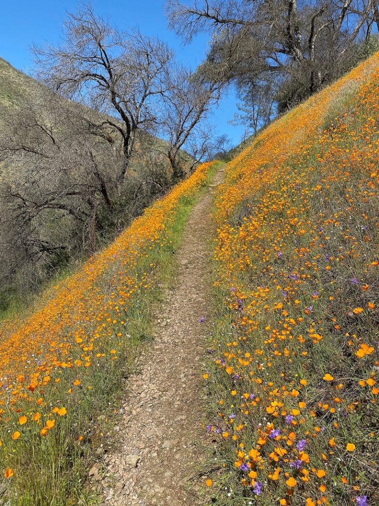
The color combinations changed as I moved down the trail.

Then I came across a Sierra Newt walking across the trail.
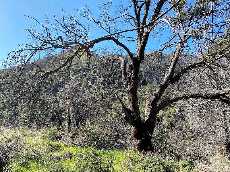
There were a few smaller trees and a couple of trees about the size of the below picture that I had to climb under or over.
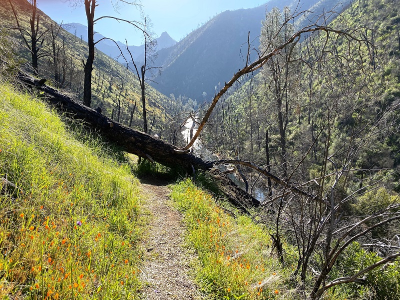
Then there was a short stretch with a detour downhill to get around a down tree.

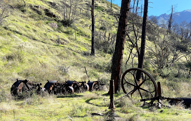
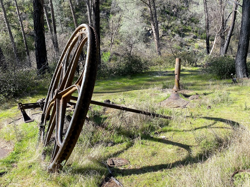
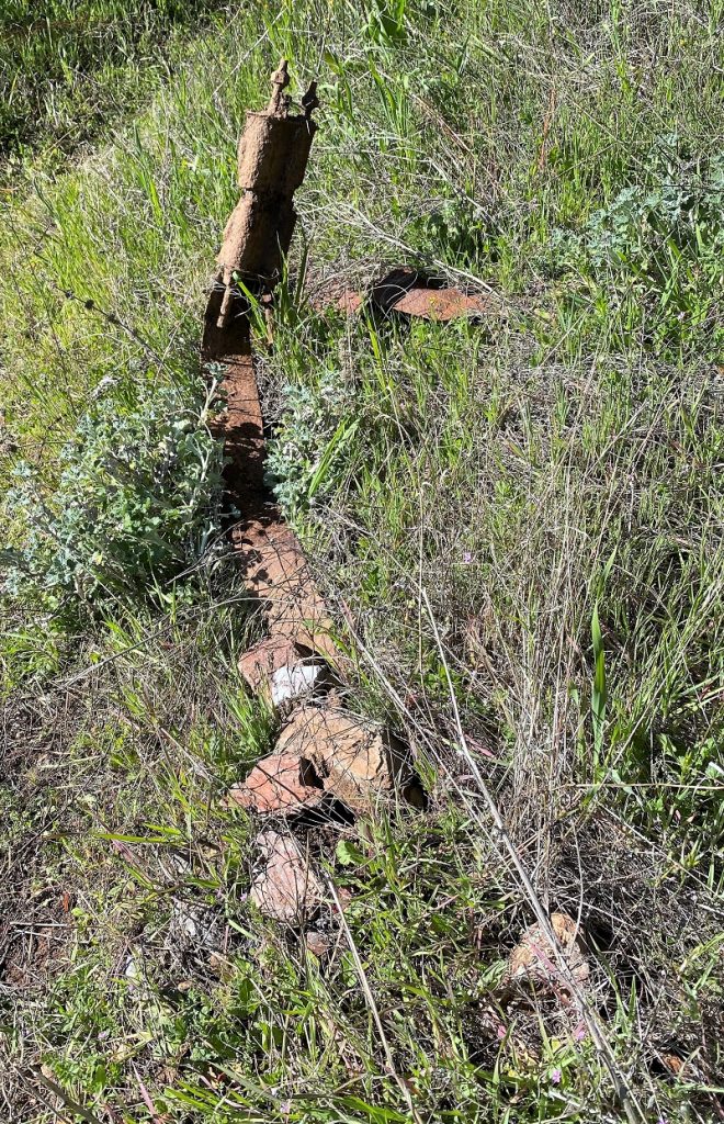
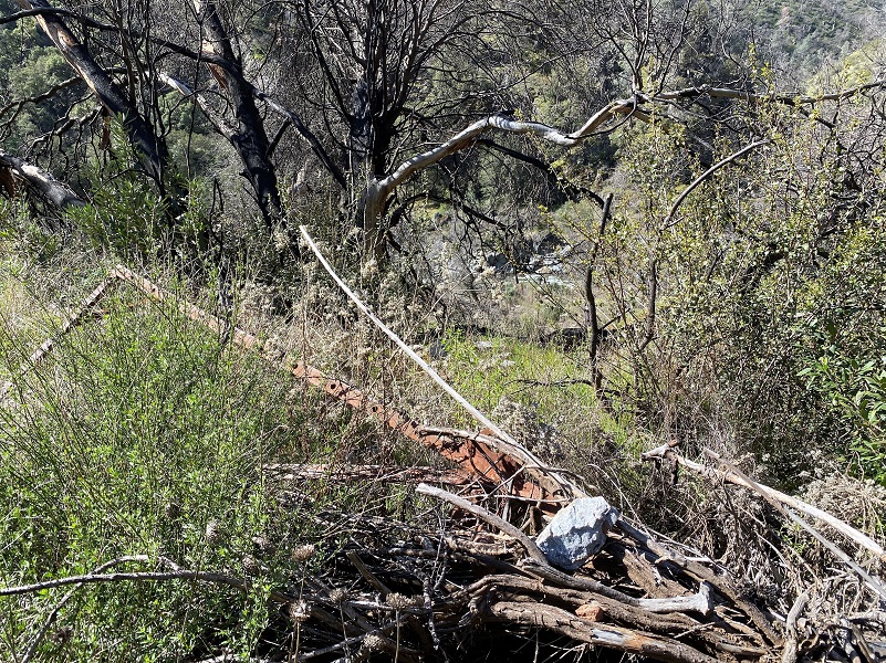
As I approached the old community of Hite, I walked by the remains of big iron arrastras and cone grinders that had been brought in to rework the old tailings of the Hite Mines around 1900. But back in the day, this mining operation was a big and complex one. It is hard to believe that in 1864, the town of Hite Cove had a population of about 100 and a ten stamp milling operation. That ten stamp mill had cost $11,000 and was in full operation back in 1867 when it was destroyed by flooding in March of 1867. A twenty stamp mill replaced that one back in 1868. A diversion dam and its ditches brought water down to the “new” forty stamp mill that John Hite built in 1875, with tram cars moving the material from the mines, then traveling down a steep tramway to the stamp mill.
Did you know that Hite’s Cove is considered one of the Chinese Heritage Sites of the American West? A crew of forty-five Chinese workers were living in Hite Cove in 1866. The Chinese lived primarily in a Chinatown at the south end of Hite’s Cove, although some individuals lived within the main part of the community. They were the men who built the Hite Cove Road from Snyder down to Hite’s Cove. They were the hard workers who hauled all of the construction materials and equipment down. According to census records, they were employed as miners, mill workers, laborers, storekeepers, blacksmiths, cooks, and in the laundry service. Their community was located on the north end of town after you pass the old mining equipment and on the left. The stone walls of their houses and shops line the old road.

The fire had removed vegetation that had covered up old road beds. I could envision the “bones” of the town a little better with the travel routes better defined.
The trail crews that did such a wonderful job getting the trail ready for us to view the wildflower show haven’t gotten to the section just before you reach the main part of the old town of Hite. The trail fizzled out at about this point, is overgrown or eroded. I followed the old road that came down from the Hite Mine, rutted out since the fire.
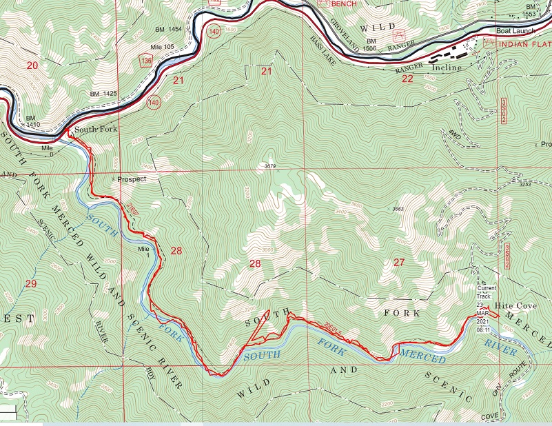
This is the old road that not only came down from the Hite Mine but was also the main trail that led out of the town to the Merced River at Incline and what we call Indian Flat, long before the “Hite’s Cove Trail” that I had come in on existed. The older map below shows my red track on this hike and the road to the south is what we today call the the Hite’s Cove Four Wheel Road that heads up the canyon to Jerseydale Road.
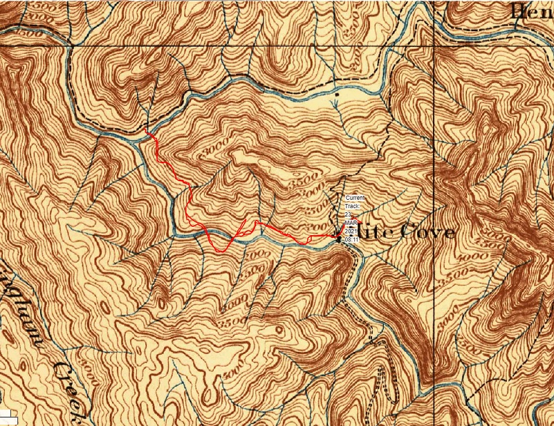
1885-1915 Topographic Map
I wandered through the area where John Hite had his gardens that supplied his hotel and walked by where the dance hall built in 1878-1879 used to stand. I explored stone foundations where buildings once stood, remains of a spring-fed water system and newer old buildings where the hotel once stood. The town of Hite actually had 2 hotels. Because of its isolated location, drinking and gambling were popular diversions.
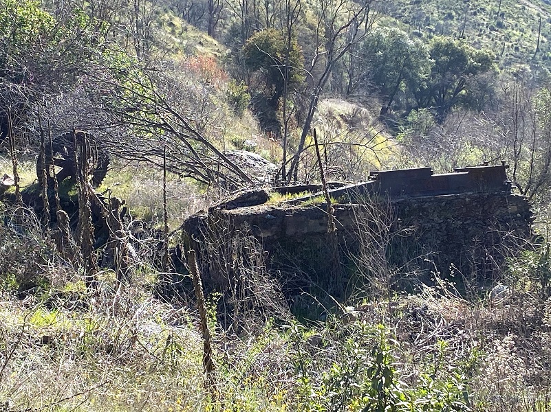
An old barn used to sit by this tree but it burned in the fire. Here is what it looked like when I visited it in 2018.

Hite’s Cove Barn in 2018, Burned Down in the Ferguson Fire
And here is what it looked like on this visit. That old barn is no more.
I continued up the old road, being as cautious as I could in the tall grass to alert the rattlesnakes that I was coming through. I didn’t see any but I bet they saw me. That is one reason I visited this area in the cool of the morning but that isn’t a guarantee because a snake could be warming itself up against a rock very easily.

I checked out old stuff I came across until I reached the point where the old suspension bridge spanned the South Fork of the Merced River. I could see the remains of the foundations and cables that are all that are left of that old bridge. Compare the picture that I took with a copyrighted 1911 picture from Dick Etsel’s wonderful website where you can see what Hite’s Cove looked like here. That important old road is currently closed, called the Hite’s Cove Four Wheel Road, heads up the canyon to Jerseydale Road.
And from this perspective, here is a photo of of the town that shows that suspension bridge and in the upper left, the road that I had walked up to the hotel that I had walked through. I love this photo because there is so much detail.
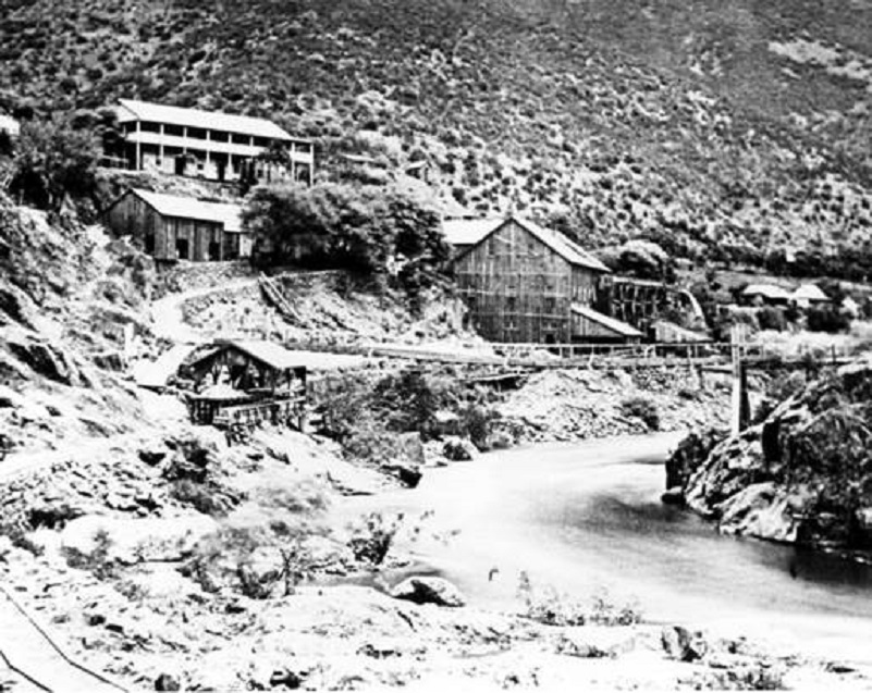
Hite’s Cove 1911 (Courtesy Explore APA Heritage, Chinese Heritage Sites of the American West)
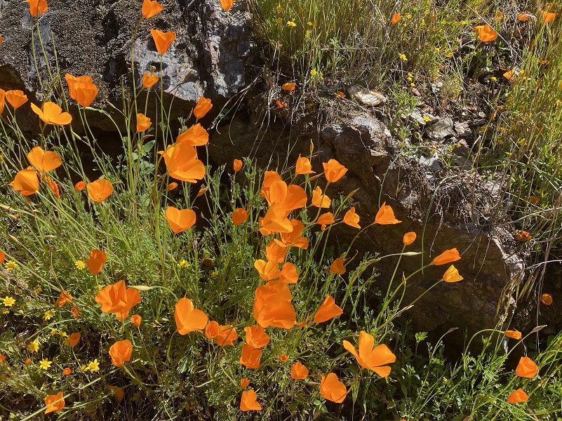
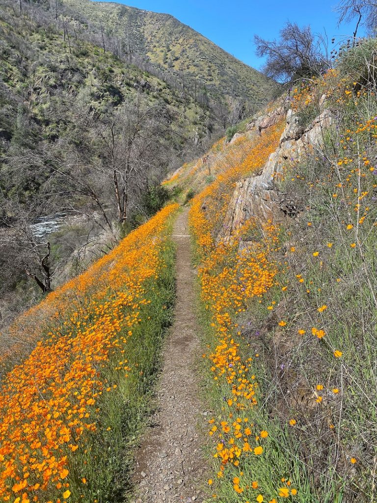
I headed back down the trail the same way i came in but those poppies were open now.


Time for a closer look.


You can join me as I walk down the trail by clicking on the first picture, then on the arrow on the right side of each picture.


I didn’t see anyone on my way out in the morning but on the way back, I passed by about 20 people and 3 unleashed dogs. One of the dogs was out a ways from it’s pack of humans when it met me but it was in a wider area of the trail. If you meet up with people or dogs in the very narrow areas of the trail, there may not be room for two people to pass each other. In other areas, there may be 2-3 feet available on the trail to pass. Out of the 20 people I passed by only 2 groups of 2 donned a mask as they passed me. I wore my mask when I was getting close to people. I share this with you so you can be prepared. I would guess that the weekend will have even more people bunched in the first 1/2-3/4 mile of the trail but the great news is that there are poppies spread out for a huge area and you can find some space to enjoy them if you walk a little farther.
It gets mighty warm in this canyon and I always bring plenty of water, continuing to hydrate throughout the hike. I didn’t see any rattlesnakes on this hike but they are out there and I am sure they saw me. There is lots and lots of poison oak, sometimes intruding onto the trail and if you are highly allergic to it, this may not be the hike for you.Ticks and gnats can also be a problem.
I located a wonderful website called “Dick Estel’s World” (link at end), which has some wonderful old pictures of the area. One of the pages, called “Old Mariposa” has photos that were provided by native Mariposa resident Ralph Walker. The pictures from his collection were either taken by or collected by Ralph’s father, C.J. (Charlie) Walker, who lived from about 1875 to 1928, and had a garage in downtown Mariposa from 1914 to 1928. Most of his photos date from the 1920s. Some older photos were most likely taken by Carlton E. Watkins, a noted photographer who worked in California in the mid-1800s. Within this collection is a picture of the town of Hite Cove taken in 1911, but since it is copyrighted, wanted to share the link with you: Dick Estel’s World
Another fantastic resource related to Hite Cove and the South Fork of the Merced River is the book Treasures of the South Fork by Ralph R. Medershausen. The book is long out of print but you may be able to pick up a used copy on EBay or Amazon. There are amazing pictures and information related to the people who lived in and around the South Fork.
Dog Hike?
I did not bring Sally on this hike because this is not a good one for her but I have seen some people with dogs on this hike. There are some really steep areas at the Savage’s Trading Post side of the hike that I feel an active dog could hurt themselves. These steep areas are also narrow in many places. If you had an uncontrollable dog, they could potentially knock into a fellow hiker, causing them to fall in those steep areas.
Doarama:
What is a Doarama? It is a video playback of the GPS track overlaid on a 3 dimensional interactive map. If you “grab” the map, you can tilt it or spin it and look at it from different viewing angles. With the rabbit and turtle buttons, you can also speed it up, slow it down or pause it.
Hiking The Hite Cove Trail Doarama
Maps and Profile:
CALTOPO has some free options for mapping and here is a link to my hike this week: CALTOPO: Hite’s Cove Trail
Hite’s Cove Trail Topographic Map

Hite’s Cove Trail Profile
Sources:
Mendershausen, Ralph R., Treasures of the South Fork, 1983
Hite’s Cove Chinese Heritage Sites of the American West
Favorite Hikes of the Sierra Seniors Book, Jim Putman, July 2010
Sierra National Forest Hite Cove Trail Closure
Gold Districts of California Bulletin 193 California Division of Mines and Geology 1976 Hite Cove District
USGS Map Locator and Downloader
Guide to the Ghost Towns, Mining Camps, and Other Formerly Inhabited Places in Mariposa County, California
Chamberlain, Newell D., The Call of Gold: True Tales on the Gold Road to Yosemite, Valley Publishers, Fresno, California 1972
Dick Etstel’s Old Mariposa 1911 Hite Cove Picture
Prior Blogs in This Area:
Hiking from Savage’s Trading Post up the Hite Cove Trail April 15, 2018
Hiking from Indian Flat through Hite Cove April 21, 2017
Hiking From Indian Flat to the Old Hite Mine January 15, 2016
Hite Cove Wildflower Hike March 22, 2015
Hiking on the Savage Lundy Trail March 7, 2015
Hiking With The Sierra Newt To View Wildflowers At Hite Cove March 22, 2014
Hite Cove Wildflower Hike- Part 1 March 18, 2013
Hite Cove Wildflower Hike- Part 2 March 18, 2013


