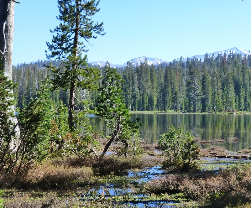
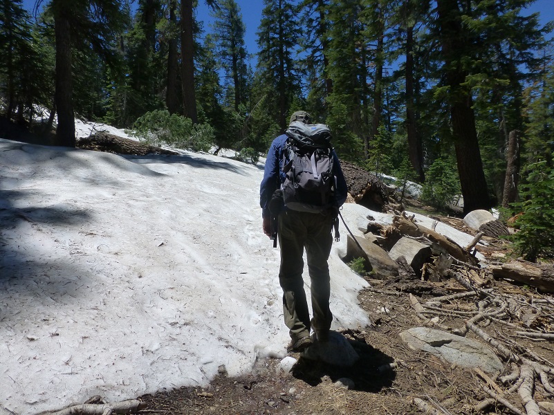
The trail was tricky. Much of it was covered with snow up to 5 foot drifts and we sloshed through stretches that were covered in water. The creeks were high but our persistence rewarded us with a lake that was still partially iced over and bordered by snowy mountains.
Where: Sierra National Forest, Ansel Adams Wilderness, Yosemite National Park
Distance: 13.35 Miles
Difficulty: Moderate
Elevation Range: 7,241′ – 8,963′
Date: June 26, 2017
Maps: Merced Peak Topographic Quad, Sierra National Forest Map
Dog Hike? No
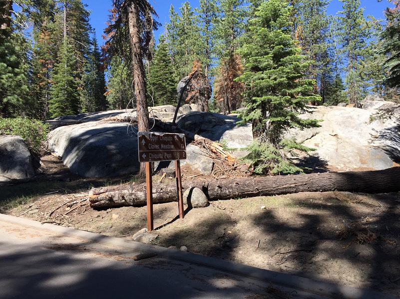
We met up at The Pines Market in Bass Lake and then drove up Beasore Road. We had wanted to start our hike from the Quartz Mountain Trailhead but Steve took a run up there the day before and it was not accessible for us so we started from the Chiquito Trailhead, which added a couple of bonus miles each way. We turned left at the Chiquito Pass sign onto a good dirt road and drove about 2 miles to the Trailhead parking on the right, put our goodies in the bearbox, sprayed down with repellent and walked across the dirt road to the Trailhead, heading up.
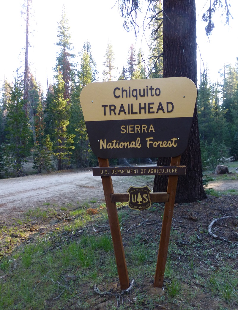
Chiquito Trailhead Parking Area
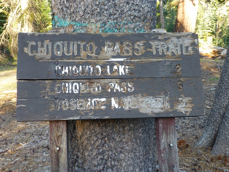
Chiquito Trailhead
Please don’t attempt this hike in these conditions if you are not really familiar with this trail. You will need to refer to your GPS and maps to make sure that you are headed in the correct direction. It is really easy to get off the trail because you can’t see it. Down trees, overgrown brush, snow and trails that are more like little lakes make it easy to get off the trail.
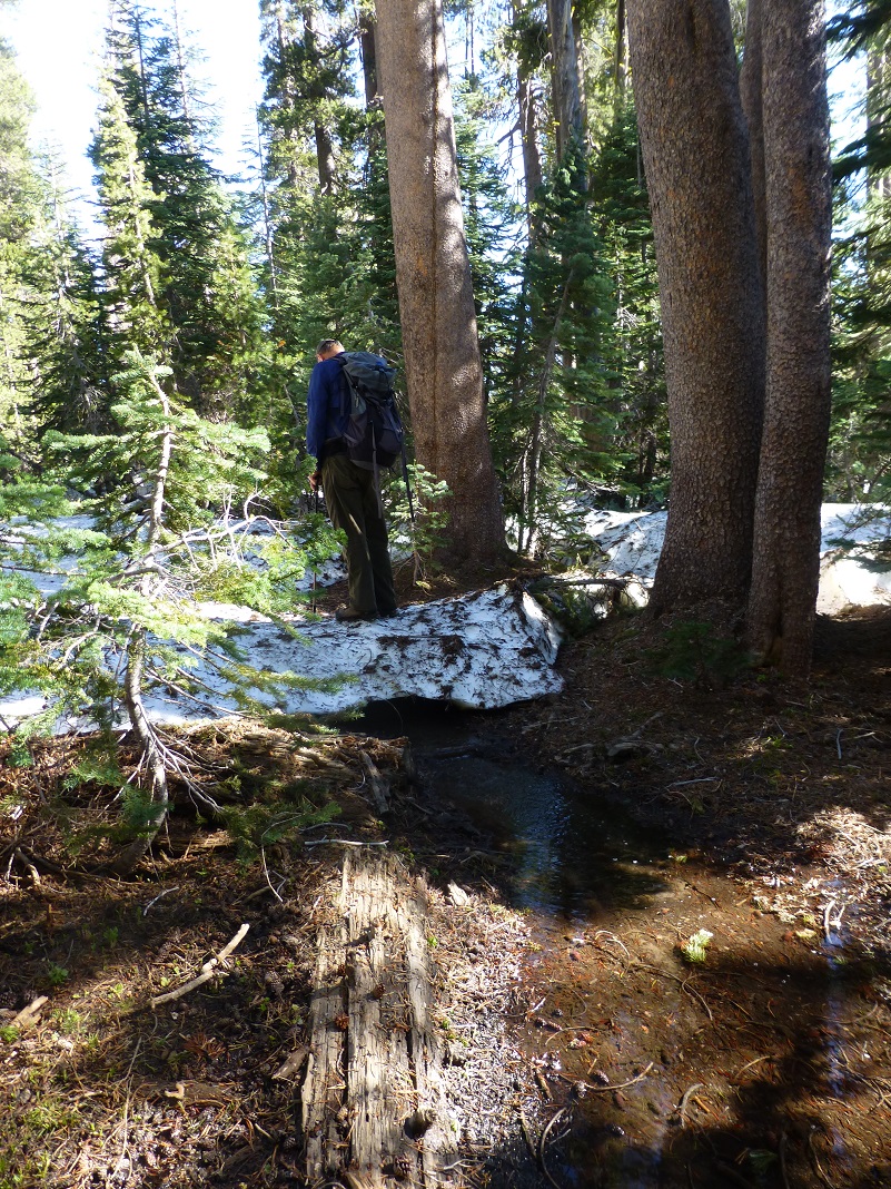
We headed up the trail and started getting small snow drifts on the trail at about the 7,600′ elevation. As we approached Chiquito Lake, the trail had become completely buried in snow and we really needed to utilize our route finding skills, while climbing up snow drifts and slogging through water.
After a little over 2 miles, we could see Chiquito Lake and it was full. In fact you might say that it was more than full.
We skirted Chiquito Lake, trying our best to stay with the water covered trail. Our Gortex boots got a real water test but performed like champs on this hike.

Photo by Gail Gilbert
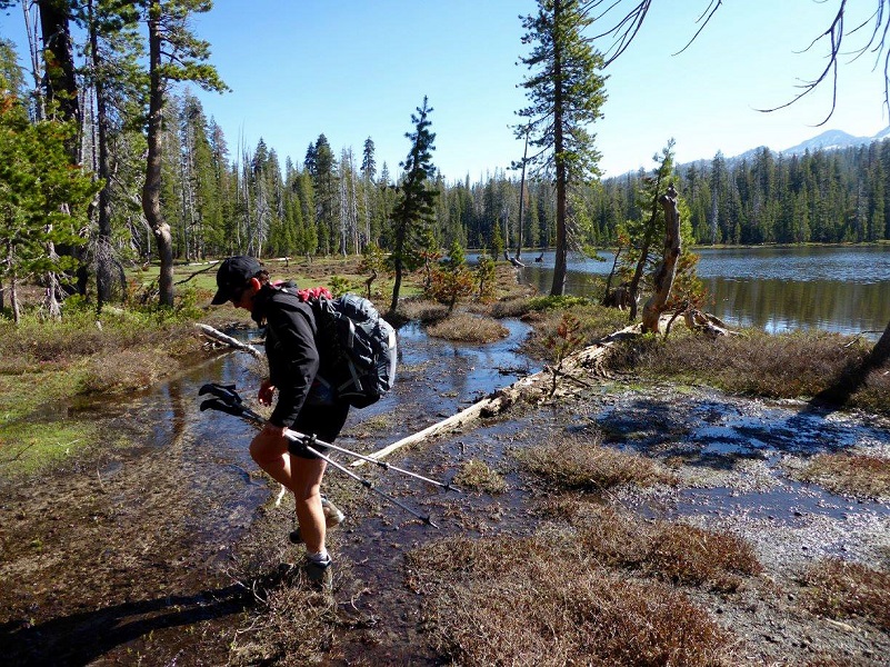
Photo of Me by Gail Gilbert
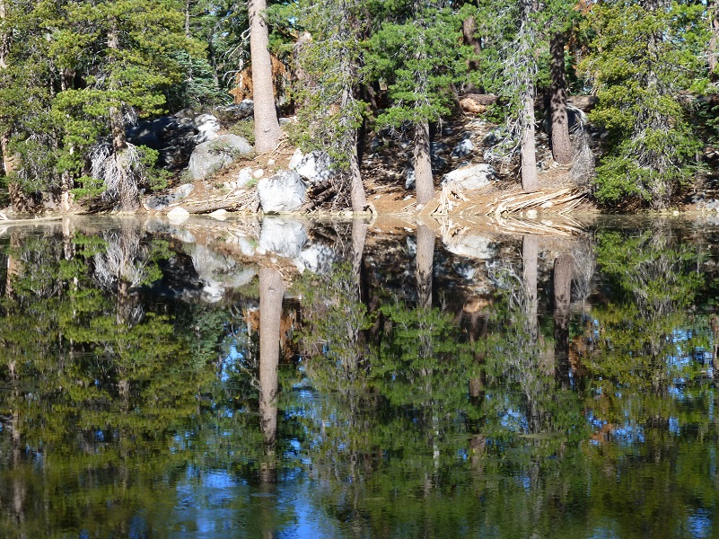
We passed by small tarns and as we reached the Yosemite National Park boundary, we took note of the trail sign under water. Can you spot it?
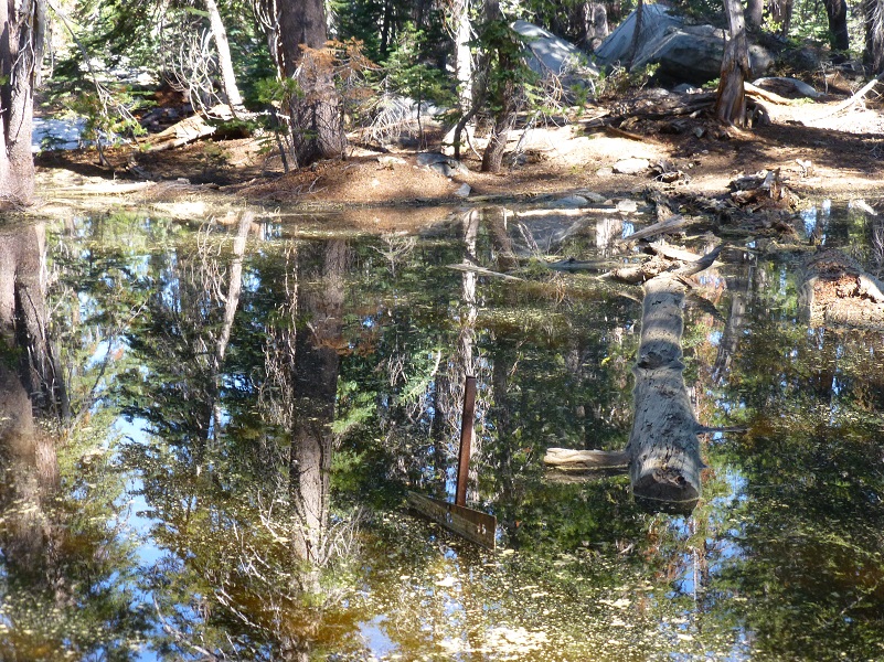
The reflections in those tarns was amazing.
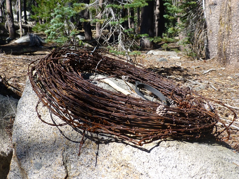
There was a fence at the Park boundary and there were a few coils of barbed wire that were left as if someone was coming back soon to do some work on that fence.
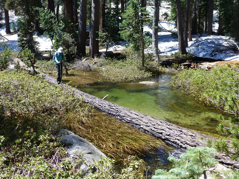
We had several small creek crossings, some that we took our shoes off and waded, and some that we got lucky when we located rocks or logs to get across. We couldn’t get across the outlet of the creek that comes out of Lower Chain Lake at the trail because it was really roaring over boulders. We worked our way uphill through the snow until we found a calm spot with a really long log across it and it that did the trick.
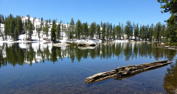
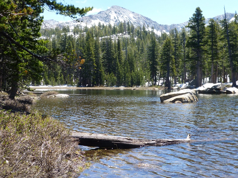
As soon as we reached Lower Chain Lake, I headed over to the outlet to capture that first view.
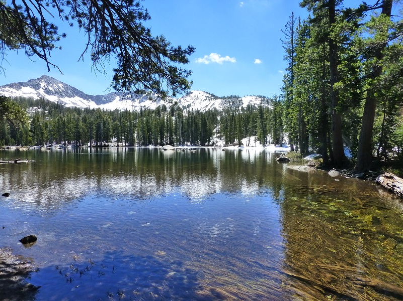
Then we wandered along the shore of the lake that still had a bit of ice and snow on it.
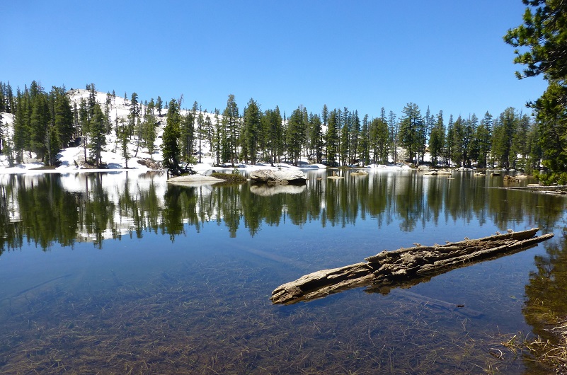
We decided that this is about as far as we should go on this day and found a good lunch spot on sunny rocks.
Sadly, it was time to head back back through the snow and water. We did have a little excitement when we reached Chiquito Lake and saw a Pine Marten. I just kept watching him and he skirted where we were, keeping a watchful eye on us, and didn’t think to take my camera out. That was a very rare sighting for us!
We had high hopes of making it to the Upper Chain Lake at the 9,291′ elevation but the snow really slowed us down, and we had to take time to find our route when we deviated from the watery or snow covered trail. I look forward to returning some day and make it farther but feel very happy that we made it as far as we did because we saw some beautiful sites still covered in snow.
We sprayed down for mosquitos pretty heavily when we left our vehicle and had some buzzing around us in the morning but by the afternoon as we reached the Chiquito Lake area, those skeeters got more lively. We was using our hats and hands to keep them away and were thankful when a breeze temporarily took them away. I wanted to point this out to you in case you head up that way because I bet those skeeters will be getting much worse with all of that standing water.
Dog Hike? No
Our hike led us into Yosemite National Park Wilderness where dogs are not allowed. If you don’t want to go that far and stay within Sierra National Forest, this could be a good hike for you and your dog. In late summer, most water sources lower up can dry up so you may need to pack dog water.
Maps and Profile:
Chiquito TH to Lower Chain Lake Doarama

Chiquito Trailhead to Lower Chain Lake Topographic Map
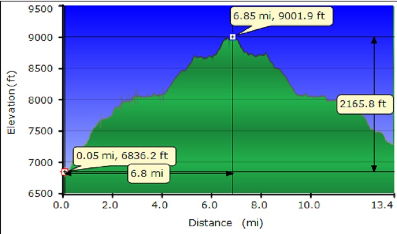
Chiquito Trailhead to Lower Chain Lake Profile

