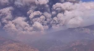
FRESNO COUNTY, CA – The Garnet Fire has grown to over 40,000 acres. Air quality in North Fork was poor this morning with low visibility, but by late afternoon the wind had shifted the smoke to the east and the air was clear for the first time in many days.
On Sunday afternoon, fire officials working the Garnet Fire elected to change Zone K29 from an evacuation warning to an evacuation order. This zone is located at the northwestern edge of the fire and encompasses the Dinkey Creek Campground area. A roadblock is in place at Dinkey Creek Road and Summit Meadow Campground.
Previously activated Zones K27, K28, K30, K31, K32A, K40 remain under an evacuation order.
Previously activated Zones K32B, K41, K61A, K74, K85, K160 and K166 remain under an evacuation warning.
Link to the Fresno County Sheriff’s evacuation map:
The following update was provided by the US Forest Service
Garnet Fire border map
Garnet Fire Quick Facts:
Location: Sierra National Forest, Fresno County
Start Date: August 24, 2025
Cause: Lightning
Size in acres: 46,451
Percent contained: 14%
Total personnel: 2,052
Current Situation:
September 7, 2025 8:00 a.m. The Garnet Fire was relatively quiet again overnight, and crews are taking every crucial opportunity they’re given to prepare containment lines for when the fire meets them.
Work continues along the Sycamore Ridge Road, which is being prepared to receive fire. The fire has held at Dinkey Creek, but containment on that line is tenuous and crews are ensuring that there are multiple options available to them. Contingency lines are being constructed concurrently to use as an alternative if necessary.
As the fire moves north, the heavy timber component and multiple bug-killed trees increase the potential for active fire growth and the possibility of long-range spotting. Continued fire activity was observed in the Turtle Creek area on the northwestern side of the fire, with a visible column building again over the fire once the smoke inversion lifted. With few opportunities for containment on the fire’s edge due to the rocky, steep terrain, firefighters are focusing on constructing lines to the north of the fire along the McKinley Grove Road. This multi-day effort includes a combination of hand and machine clearing, pre-treatment of vegetation with retardant on the ground, and strategic firing. These tactics have been very successful. The fire has reached the road where the power lines cross it, and crews are being vigilant about any spot fires that may occur.
Firefighters on the eastern side of the fire have been using favorable conditions to contain the fire on its active edge. With air support and dozers, they have been successful.
The Trimmer Springs Road remains in a mop up and patrol status; no threats to containment have been seen in multiple days but firefighters remain alert.