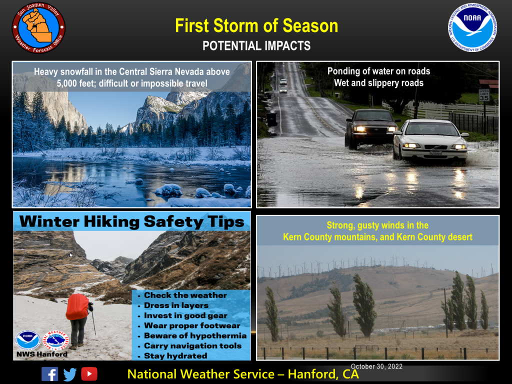
MOUNTAIN COMMUNITIES–The National Weather Service Hanford Office is predicting the first significant storm of the season will impact Central California Tuesday through Thursday. Heavy snow is possible in the Sierra Nevada mainly north of the Kings River above 5,000 feet, especially Tuesday afternoon and Wednesday night. Snow levels will begin at around 7,000 feet on Tuesday , before falling to about 5,000 feet by Wednesday morning.
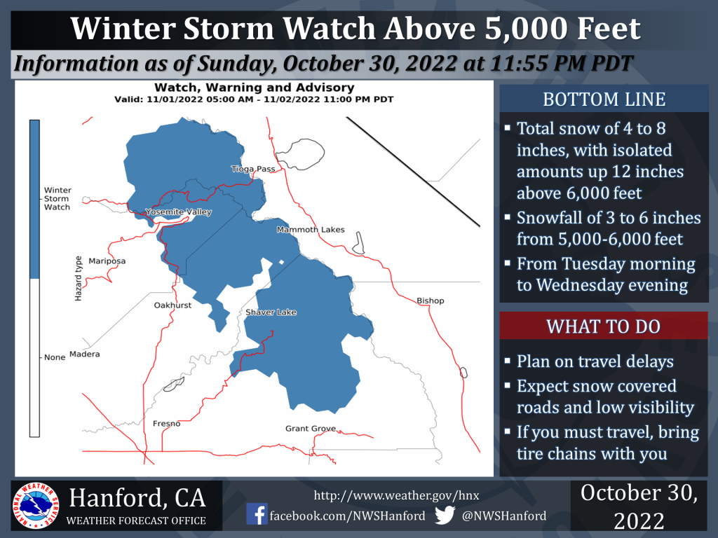 A winter storm watch has been issued for above the 5000 foot elevation for Yosemite National Park and the surrounding areas. It takes effect
starting Tuesday morning and run through late Wednesday night for the Central Sierra Nevada including most of Yosemite. This watch could possibly be upgraded to a Winter Storm Warning depending on
the range of snowfall being forecast in the Sierra Nevada.
Strong, gusty winds are expected in the, Kern County mountains, and Kern County desert Wednesday, and again Thursday. In the San Joaquin Valley, light to moderate rain will result in wet and slippery roads . Please drive extra carefully.
Due to this being the first storm our areas have had in several months, please be careful! The oily roads have the potential to be extremely slick. Give yourself extra time to get to your destination. Also, the Sierra Mountain passes may have chain requirements or need to be closed. Tioga Pass will be closed ahead of the storm today at 6:00 pm.
Check our website often as we will be adding any traffic collisions, hazards and/or power outages that impact our communities.