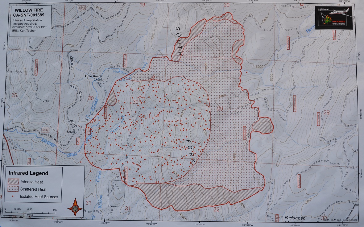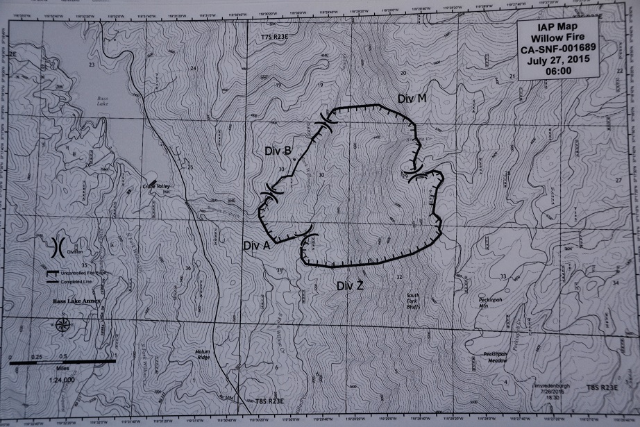
NORTH FORK – There has been no change to the estimate on acreage for the Willow Fire, with fire officials holding it at yesterday’s 1,521 acres. The updated map shows only a small push-out to the east in Division M. (see maps below)
The 5 percent containment number has also not changed as of this hour, but we await reports of progress after today’s shift change at 6 p.m. About 785 personnel are currently assigned to the incident.
Fire crews will continue to build containment lines on all sides of the fire using direct and indirect strategies. The fire is in steep and rugged terrain, which requires hand crews hiking in and being supported by helicopters and air tankers.
Overnight in Division A, a Type 3 strike team held the line and did mop-up 20 to 30 feet inside the perimeter in some places. The division was reported as “pretty quiet.”
Firefighters experienced a bit of activity in the higher end of Division B, and plans are in place to shore up those lines with air support today. There has been some spotting in the area of Brown’s Creek ditch, and a lot of potential for spotting into the Sand Creek drainage.
Division M along the road held well through the night.
In Division Z, the section the Rio Bravo and Sierra Hotshots punched in was plumbed with hose lay overnight. Handline reportedly looked good and crews were able to initiated some mopup.
Air Attack was over the fire at 8 a.m., orchestrating the work of six air tankers, one DC-10 (VLAT – Very Large Air Tanker), one Type 3 and four Type 2 helicopters, and 3 Type 1 helitankers.
The build-out of the Incident Command Post continues at the Old Mill Site, including a heliport. Communications teams will be installing repeaters on Shuteye and Goat Mountain today.
A strong high pressure system is expected to move into the area starting today. High temperatures are anticipated over the fire area for the next few days associated with the weather system.
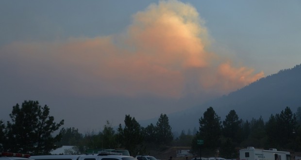
As the Willow Fire continues to burn, smoke will be impacting local communities, with effects typically greater in the morning and evening hours. For more information about smoke impacts, please visit the San Joaquin Valley Air Pollution Districts website at: http://valleyair.org/wildfires.htm
H407 helicopter is available for medical emergencies today. There has been one heat-related incident on the fire so far.
Closures still remain in place on Road 274 between Willow Canyon Drive and Marina View. Everyone to the east of that section of road has been evacuated, and Marina View residents remain on an evacuation advisory, as is Cascadel Woods.
Whiskers Camp, Gaggs Camp, Whiskey Falls and Central Camp have been evacuated.
Douglas Ranger Station Road is closed at Trails End, and residents of Wild Rose and Bear Clover have been notified that they need to be prepared to leave, but they are not under an evacuation order at this time.
Autumn Ridge Way (Whiskey Falls Road/Forest Road 8S09) is closed at Cascadel Woods, and the campgrounds above it have been evacuated.
About 450 structures are threatened, though none have been lost.
The American Red Cross of the Central Valley has opened an evacuation center at the Oakhurst Community Center, 39800 Road 425B, for residents affected by the Willow Fire.
Volunteers will be on scene to provide comfort, snacks, and water for evacuated families. The Red Cross is also coordinating with the Central California Animal Disaster Team to care for domestic pets.
The Willow Fire was reported on Saturday, July 25, at about 2 p.m. The cause remains under investigation.
Cooperating agencies include Cal Fire, Madera County Fire, CHP, Madera County Sheriff’s Office, PG&E, the American Red Cross, California Office of Emergency Services, and the Mono Rancheria of Mono Indians.