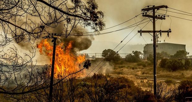
MARIPOSA COUNTY — The Detwiler Fire is now estimated at 19,500 acres with 5 percent containment.
At about 12:30 p.m., the town of Mariposa was evacuated, and the Red Cross shelter is being moved to Caesar Chavez Junior High, 161 S. Plainsburg Road in Planada.
There is also a shelter in Oakhurst at the EV Free Church at the end of School Road, 50443 Road 427.
The Coarsegold Rodeo Grounds is open for large animal evacuations. Call Belinda for more information at 559-676-3702. Click here for a map.
A new location for the scheduled community meeting tonight has not been determined. We will update if the meeting is canceled or relocated.
As of 1:15 p.m., CHP has been notified to set up to divert northbound traffic off Highway 49 South at Triangle Road, and off Highway 140 North onto Triangle road, in order to detour around the town of Mariposa.
Traffic is being allowed to leave Mariposa headed east into Yosemite, and south into Oakhurst.
The Sheriff’s Office urges everyone to please stay out of the area. Emergency vehicles need safe, clear access, and fire conditions are changing rapidly.
The most recent evacuations from the Mariposa County Sheriff’s Office. Conditions may have changed since this information was provided:
- Town of Mariposa
- Highway 140 from East Whitlock to Hwy 49 South both sides of the road.
- Hornitos Road from Mt. Gaines to Highway 140, including Bear Creek and Whispering Oaks, El Toro Road, McCay Road and Granite Lane
- CYA Camp Road
- Morrissey Road
- Mosher Road
- West Whitlock Road from Golden Creek Lane to Mosher Road
- Detwiler Road – ALL Homes
- Hunters Valley Road – All Homes
- Hunters Valley Access Road – All Homes
- Bear Valley Road – Between Hunters Valley and Hunters Valley Access Road (Both sides of Bear Valley Road)
- Cotton Creek Road – All Homes
- Bear Valley Road from Cotton Creek Road to Hwy 49N (Both Sides of the Road)
- Bear Valley Road from Cotton Creek to Exchequer Road- (North Side of the Road only
- Hwy 49N – Mt. Ophir to Fremont Fort (Monument at the top of the Bagby Grade)- (Both Sides of the road)
- Pendola Gardens to Old Toll Road
- Mount Bullion Ridge Road from Highway 49N to CYA Road
- Old Toll Road between Corbett Creek Road and Highway 49N, including Corbett Creek Road
- Mount Gains Road to No.9 Road including No.9 Road
- Highway 49N from Mount Bullion Ridge Road (Fremont Fort) to old Toll Road
- Pendola Gardens Road from Highway 49N to Old Toll Road
- Highway 49N from Old Toll Road to Agua Fria Road
- Area known as Mount Bullion
- Mount Bullion Cut off Road and Agua Fria Road from Highway 49N to Highway 140
Advisement Only (NOT an Evacuation Order, simple advisement of fire in the area only)
- Hornitos Road
- Bear Valley Road – All homes from Exchequer Rd to Hornitos Road
- Hornitos Town Area
Road Closures:
- Highway 49N at Highway 140 on the south, and at Highway 132 (Coulterville) on the north
- Highway 140 from Hornitos road to Mariposa
- Mt. Gaines at Hornitos Road
- Mt. Bullion Cutoff Road at Highway 140
- W. Whitlock from Mosher Road and Golden Creek Lane
- Agua Fria at Creek Crossing
- Old Toll at Hornitos Road
- Bear Valley Road at Exchequer Road
- Mt. Gaines at No.9 Road
These conditions change by the minute, so please be prepared to evacuate if you live in the fire area.
