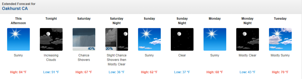
MOUNTAIN COMMUNITIES–Could it be that fall has finally arrived in our mountain communities? The NWS Forecast Office Hanford, CA is predicting much cooler temperatures for the following 10 days starting tomorrow. There is also some indications that we might get some much needed rain!
Dry weather and unseasonably warm temperatures will continue today due to high pressure over the area. Expect temperatures to fall to below normal over the weekend as a low pressure center moving through the Great Basin brings much cooler temperatures, increased winds and light precipitation to the area.
Madera Sets New Record High
Persistent high pressure is providing our area with an unseasonably warm airmass and near record high temperatures. In fact, Madera did set a new record high temperature for October 20th, 2022, reaching 90 degrees, which broke the previous record high of 89 degrees set in 1973.
Big Changes Over The Weekend
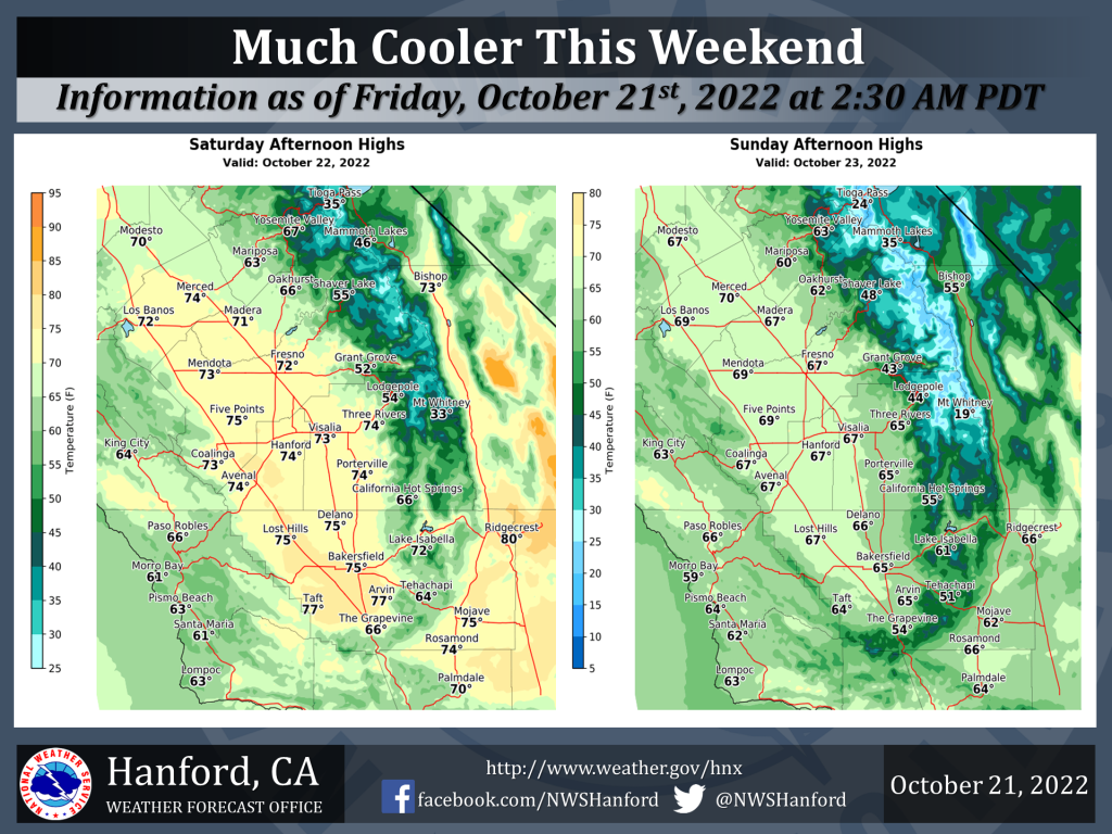
One more unseasonably warm day is expected today across our area before a cold upper low pressure center which will drop southeast out of the Gulf of Alaska today and into the Pacific Northwest by Saturday. This upper low will then carve out a trough over the Great Basin by Saturday night and push a strong cold front through central California Saturday afternoon and evening. This will bring much cooler temperatures to our area this weekend with temperatures lowering to near normal levels by Saturday and below normal levels on Sunday. High temperatures on Sunday are expected to be 20 to 25 degrees below today’s.
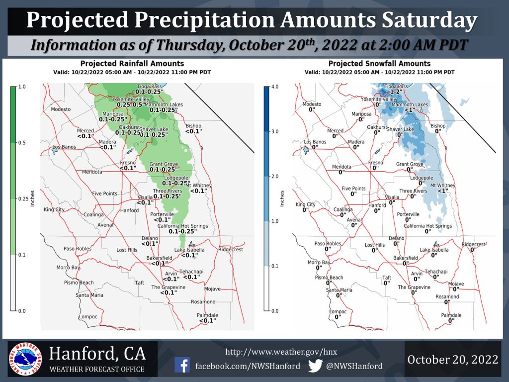 The system will also bring a chance of light precipitation to the area Saturday morning through Saturday evening with Yosemite National Park having the potential for a tenth to a third of an
inch of liquid precipitation. The snow level is projected to be between 8500 and 9000 feet at the onset of the precipitation early Saturday morning lowering to 6500 to 7000 feet Saturday night when the precipitation is expected to taper off with only isolated showers near the crest anticipated on Sunday.
Between 1 and 3 inches of snow are possible above 8500 feet in Yosemite National Park (YNP) on Saturday and Saturday night. Lesser precipitation amounts are possible elsewhere with a few hundredths of an inch to two tenths of an inch of precipitation possible in the Sierra Nevada south of YNP and the higher Sierra foothills.
Next Week
Another inside slider type system is predicted to drop into the Great Basin on Wednesday. This will bring another cooling trend to our area with temperatures lowering to slightly below normal. This system will be moisture deficient and precipitation chances will be confined to isolated showers
near Yosemite National Park.