MOUNTAIN COMMUNITIES—The National Weather Service Hanford Office is warning residents that more rain, flooding, and high winds are on the way for our area and most of Northern California. Combined with all the snow and rain, we’ve already received, we can expect more problems, including flooding, power outages, and traffic issues.
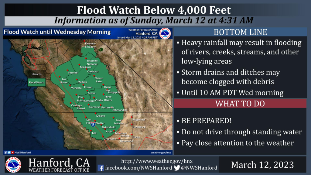
A Flood Watch remains in effect until Wednesday morning for most areas below 4,000 feet.
Precipitation will begin Monday night and increase in intensity overnight into Tuesday with this next system. Another plume of deep subtropical moisture will arrive late Monday night/early Tuesday morning and remain in our area until at least Tuesday night when the bulk of the precipitation will occur. It appears the arrival of this storm will mainly be late Monday night. Chances for rain and high-elevation snow will last until Wednesday. Additional remaining snow on the ground in the lower elevations will continue to melt.
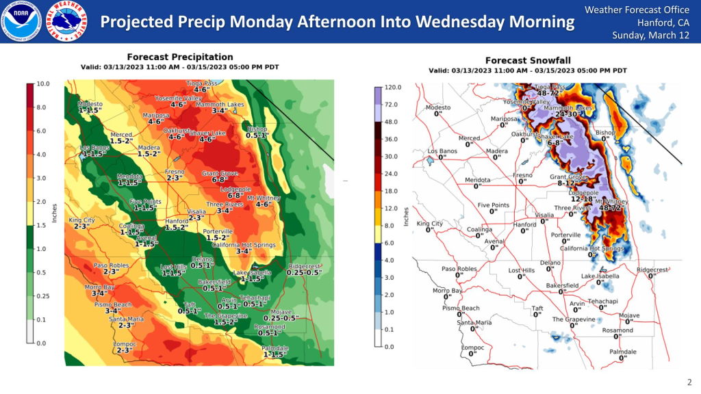
The latest precipitation and snow graphics forecast are available for the Monday PM through Wednesday storm. Expect most of the precipitation from Monday night until Tuesday evening.
The latest precipitation amounts are about one to two inches in the San Joaquin Valley. Sierra foothill amounts vary from 1.50 to 5.00 inches, with the highest amounts from Mariposa County to around Three Rivers in Tulare County. Sierra Nevada rainfall will range from around three to six inches at elevations up to around 7,000 feet. Heavy snow will again fall above 7,000 feet, so the Winter Storm Warning will continue until Wednesday. Expect a total of 2-4 feet of snow in the Sierra for the 7000 to 8000-foot level, 4-6 feet at 8000 to 9000 feet, and 6-9 feet above 9000 feet from Monday evening until Wednesday.


