YOSEMITE – Oct 30, 2020 – There are multiple fires burning in Yosemite National Park. Each fire is burning in fire adapted ecosystems in Wilderness.
Due to the fires there are trail closures in effect. Click here to see map of trail closures.
All fires may be visible from Tioga Road (Highway 120 through Yosemite National Park), Glacier Point, and high country vistas.
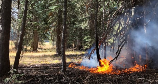
Overall, smoke production is minimal, with columns rising around 1,500 feet from the ground and dispersing to the east. Smoke may be grey to brown in color. Park managers are working with local air quality districts to monitor smoke impacts in the park and local communities. Smoke from ongoing regional fires continues to impact the area.
Please heed all signed trail closures and follow all traffic controls in areas you will be visiting.
Blue Jay Fire
Location: Yosemite Creek drainage south of the 10 Lakes trail at 9,000 feet elevation.
Discovery Date: July 24, 2020
Size: 6,9150 acres
Containment: 50%
Strategy: Confine and Contain
Cause: Lightning
Fire behavior is minimal. Primary activity is on the northern flank adjacent to the Yosemite Creek Drainage, northeast of Lukens Lake, and in green pockets inside the perimeter. Fire is creeping and smoldering through ground litter and pockets of accumulated dead and down logs, with some isolated single tree torching. Weather conditions may create potential for increased fire behavior. There may be impacts to Tioga Road (Highway 120 through Yosemite National Park). For park road information call 209-372-0200 Press 1 then 1.
inciweb.nwcg.gov/incident/6888/
Wolf Fire
Location: North of White Wolf Campground and west of Lukens Lake Trail at 9,000 feet elevation.
Discovery Date: August 11, 2020
Size: 2,040 acres
Containment: 30%
Strategy: Confine and Contain
Cause: Lightning
Fire behavior is minimal. Primary activity is on the northwest corner, with some activity on the southwest corner, along the Middle Tuolumne drainage, and the southwest flank. The fire is smoldering and creeping in dense pockets of vegetation and accumulated dead and down logs, with some isolated single tree torching. Weather conditions may create potential for increased fire behavior. There is no apparent threat to White Wolf at this time.
inciweb.nwcg.gov/incident/7134/
North Whizz Dome Fire
Location: South of Cathedral Creek and 1 mile northwest of Tioga Road at 8,400 feet elevation.
Discovery Date: August 27, 2020
Size: 200 acres
Containment: 50%
Strategy: Monitor
Cause: Lightning
The fire has shown minimal activity with a 20% active perimeter and slow rate of spread. Primary activity is on the west and east perimeters. The fire is creeping and smoldering through ground litter and in pockets of accumulated dead and down logs, with isolated single tree torching. Fire personnel will continue to monitor fire behavior and growth. Smoke may be visible from Tioga Road.
inciweb.nwcg.gov/incident/7135/
Horse Fire
Location: Horse Ridge, 1 mile southeast of Ostrander Lake at 9,500 feet elevation.
Discovery Date: August 24, 2020
Size: 30 acres
Containment: 60%
Strategy: Monitor
Cause: Lightning
The fire has shown minimal activity. The fire is creeping and smoldering in pockets of compact high elevation fuels in rocky terrain within the perimeter. There are no threats to trails or infrastructure. Fire personnel will continue to monitor fire behavior and growth.
https://inciweb.nwcg.gov/incident/7149/
These updates occur weekly unless significant activity occurs. For the most up-to-date fire information go to: Inciweb
- Air Quality: Yosemite Air Quality Page or gov or airnow.gov/fires
- Trail Closures: https://www.nps.gov/yose/planyourvisit/conditions.htm
- Fire Restrictions: https://www.nps.gov/yose/planyourvisit/firerestrictions.htm
- Sign-up for Alerts: nps.gov/alert
