CENTRAL SIERRA — Heavy precipitation is expected near northern California over the next few days with significant snowfall in the Sierra Nevada into Friday morning, says the National Weather Service, as a wet, active pattern is expected to continue through the weekend for the West.
Heavy rainfall across California
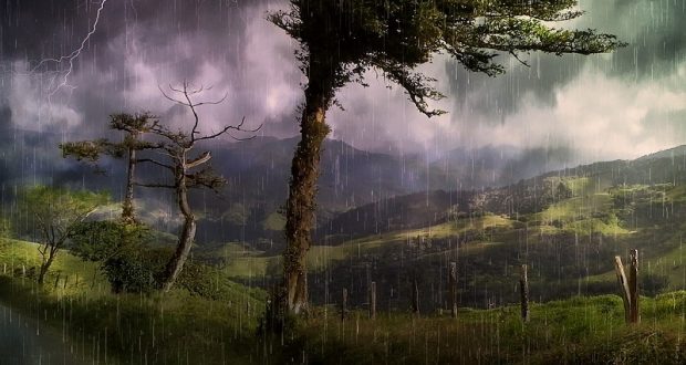
A frontal boundary approaching the West Coast is currently bringing heavy rainfall, with embedded thunderstorms, across California with heavy snow in the higher elevations. This will continue throughout the day today with lighter precipitation across the Pacific Northwest and Great Basin.
By Friday evening, California will begin to dry out with lighter showers and higher elevation snow in the Great Basin/central Rockies. However, another frontal boundary will approach the Pacific Northwest at this time — bringing more precipitation to the region in addition to northern California.
Winter storm warnings will continue for the Sierra Nevada through Friday morning, with total snow accumulations of over two feet expected above 7,000 feet. Wind gusts as high as 50-miles per hour will also be a concern.
Because of the recent burn scars and expected heavy rainfall over several days, flash flooding remains a concern for parts of California. As such, flash flood watches are in effect in portions across the state.
Flash Flood Watch remains in effect
The Flash Flood Watch continues for a portion of central California through 10 a.m. Friday morning, Nov. 30, including the Mariposa, Madera, and Fresno County Foothills and Tulare County Foothills. Flooding is possible in Ahwahnee, Coarsegold, Mariposa, North Fork, Oakhurst, and O’Neals. A Flash Flood Watch means that conditions may develop that lead to flash flooding, a very dangerous situation.
Heavy rain may occur at times especially over burn scars, which will make the foothills susceptible to flash flooding and possible debris flows. You should monitor later forecasts and be prepared to take action should Flash Flood Warnings be issued.
Storm Warning remains in effect
A Winter Storm Warning remains in effect until 4 a.m. Friday, Nov. 30 for the Sierra Nevada from Yosemite to Kings Canyon and the Tulare County Mountains, including the towns of Bass Lake, Fish Camp and Wawona.
A Winter Storm Warning for snow means severe winter weather conditions will make travel very hazardous or impossible. Heavy snow is anticipated, with total snow accumulations of over two feet expected above 7,000 feet. Winds could gust as high as
50-miles per hour over the crest.
Travel could be very difficult to impossible. The hazardous conditions could impact the morning or evening commute. Strong winds could cause tree damage. If traveling into the Sierra Nevada, consider alternate plans.
Remember to carry tire chains, extra food, water and clothing. Keep an extra flashlight, blanket, food and water in your vehicle in case of an emergency.
The latest road conditions can be obtained by calling 5 1 1.
For more information and tips regarding winter driving please go to the Caltrans website for road conditions and important safety measures to be taken when traveling in the Sierra during the winter months.
National Weather Service Flash Flood Watch


