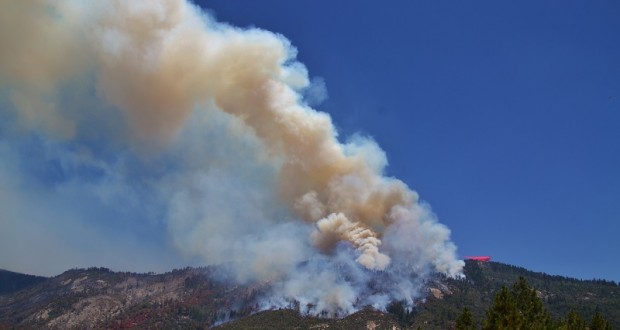
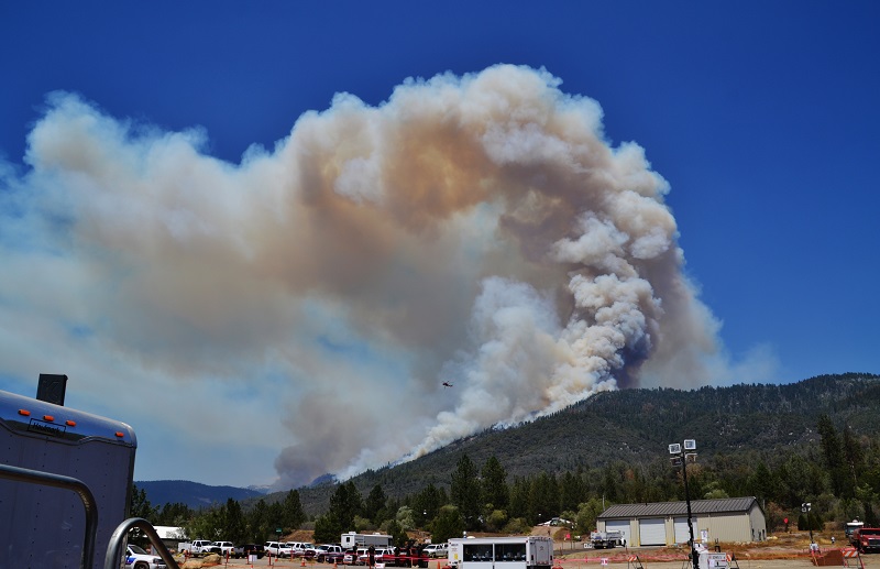
NORTH FORK – The Willow Fire was very active today, putting up huge columns of smoke and raising concerns as residents once again lined the roadways to watch trees torching and helicopters and tankers come and go in rapid succession.
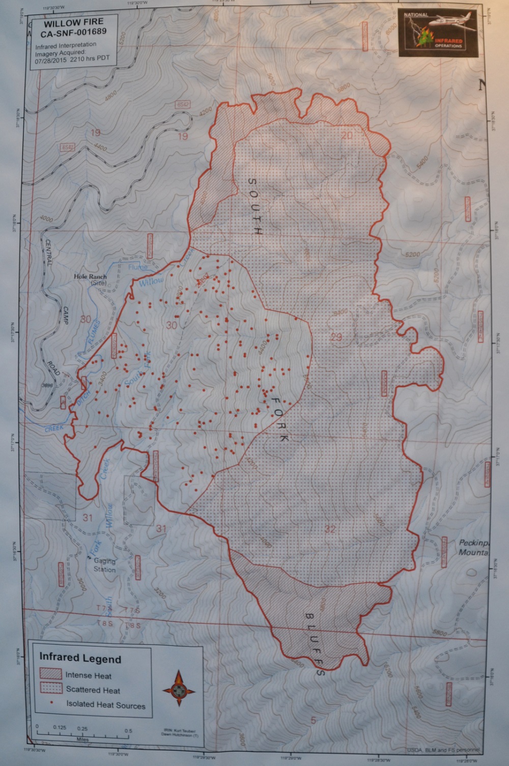
As of 9 p.m. there is no update on estimated acreage, still reported at 2,077 with 30 percent containment. New numbers will be available after tonight’s fly-over.
As the heat of the day and terrain driven winds hit the Willow Fire, it began to move south along Peckinpah Mountain, increasing the threat to homes in the Cascadel Woods area, and a second alert went out to residents. They had been notified shortly after the fire started last Saturday to be prepared.
Sheriff’s deputies went around to homes in the area, making sure everyone is aware of the possibility that a mandatory evacuation may be called for, but that has not happened at this time.
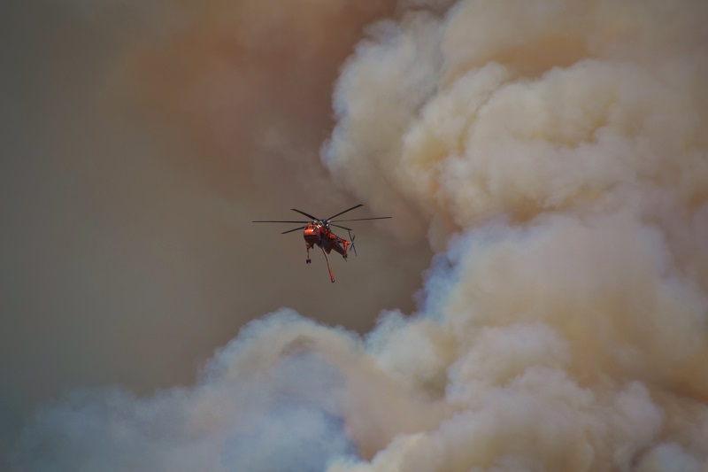 Heavy bombardment by air resources went on all afternoon, but extremely dry fuels and buffering winds have proved challenging for firefighters.
Fire officials report that direct attack on the southern flank is no longer feasible as it has become unsafe for firefighters, and they have determined that there is a low probability of success using that method of attack. Crews have initiated firing along the southeast edge to prevent it from out-flanking them and to maintain firefighter safety.
Dave Martin, retired Bass Lake District Ranger, and Deputy Planning Chief on the team managing the Willow Fire, explains what happened over the past 24 hours on the southern perimeter.
“Last night the wind pushed the top of the fire faster than the fireline below,” Martin explains. “One thing you really don’t want when you’re fighting fire is something called underslung line. You don’t want the fire above you, because burning debris can roll down, or the fire could come around you because there’s unburned fuel between you and that fire. It was burning very hot and fast with winds that were more than expected, so at some point you have to say, there’s no way we can catch up.”
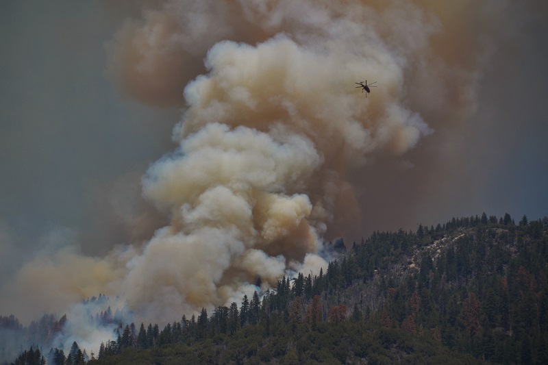 Though the huge columns of smoke are alarming to residents, sometimes rising about 15,000 feet into the air, those managing the fire are always thinking at least one step ahead of what the fire wants to do, and they already know what steps they will take next to adjust to their action plan.
“We always have contingency plans,” says Martin. “We always work at least one contingency ahead, and sometimes two and even three, depending on how active the fire is.”
Planners develop things called “management action points,” so that if the fire gets to a certain point, the team goes to contingency one; another set point, they move to contingency two.
“We’re always thinking way out ahead of the fire,” says Martin, explaining that with an action plan in place, there are no surprises, perhaps just a lack of cooperation from the weather. And again, they have a plan for that too.
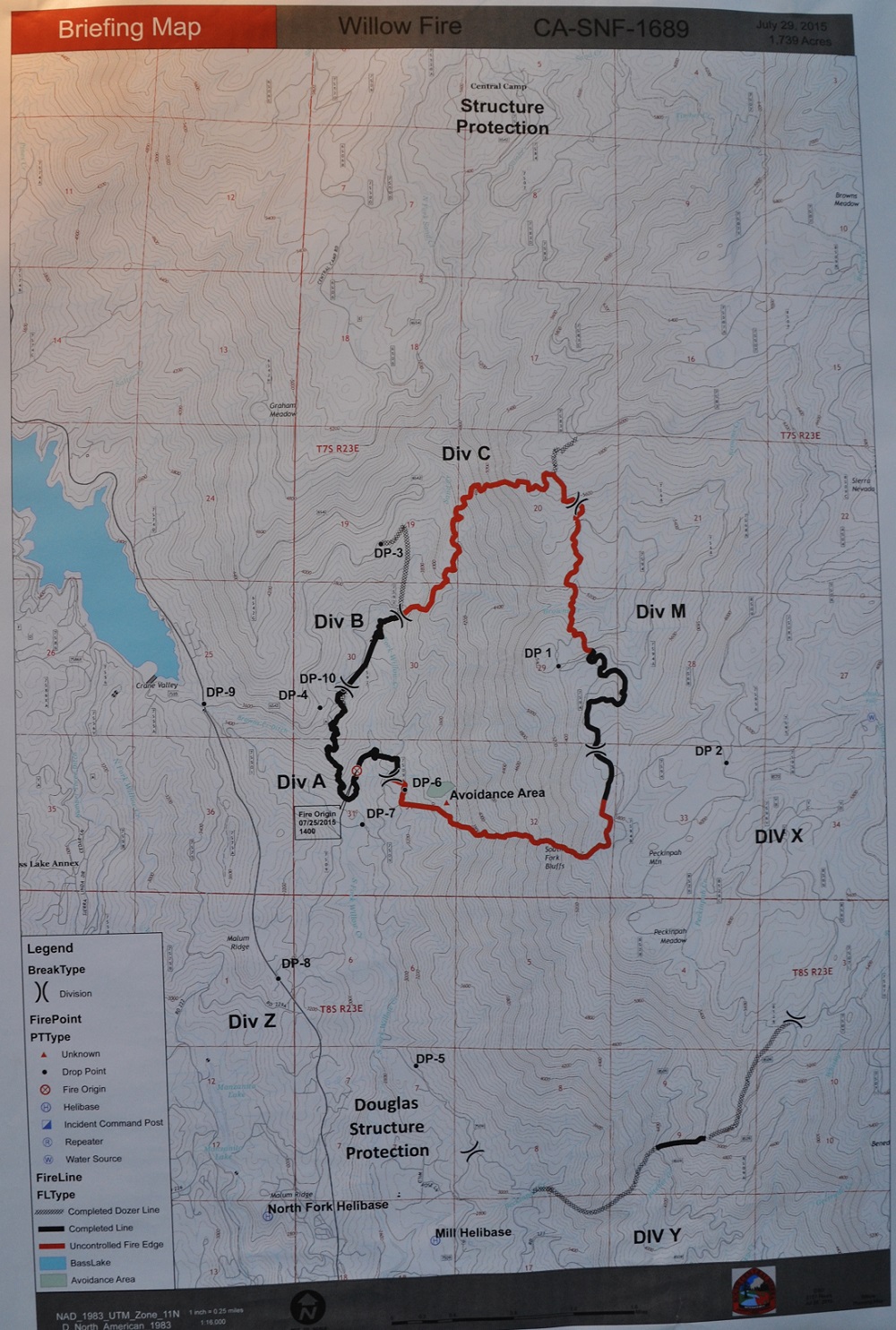
Further south from the leading edge of the fire, a contingency line from the 2001 North Fork Fire has now become the primary control line to protect the community of Cascadel Woods.
Over the past few days, dozers have been working to reopen the old line from the 2001 fire, which can now be clearly seen from vistas along Road 274. If it becomes necessary, crews may backfire from this line to remove fuel between the head of the moving fire and the homes along Cascadel Road (Road 223).
On the northern perimeter the fire pushed through an anchor point at a large granite face known locally as the 7 Rock. Crews are continuing to scout the previously constructed fuel breaks and road systems on the northern edge with a potential for use as contingency lines.
 Along the eastern and western flanks, crews have established good, solid lines and spent the day shift working on mop-up and even beginning some rehab of firelines.
The forecast is for continued heat and poor relative humidity, with some northerly gusts expected to reach 15 to 20 mph in places.
Fire officials anticipate very active fire behavior overnight, as critically dry fuels and rough terrain continue to present challenges.
If evacuations are ordered, the Red Cross Evacuation Center will be reopened at the Oakhurst Community Center on Road 425B, and the Central California Animal Disaster Team’s shelter will be available at that location for small animals.
There are 1,545 personnel currently assigned to the incident, with 116 engines, 36 hand crews, 22 water tenders, 14 dozers, 9 helicopters, and 4 air tankers available.
Douglas Ranger Station Road remains closed north of Trails End Road. Whiskers Camp, Gaggs Camp, Whiskey Falls and Central Camp are still closed.
Willow Canyon Road is closed at Road 274. Central Camp Road is closed at Road 274 and at Beasore Road. Autumn Ridge Way (Whiskey Falls Road/Forest Road 8S09) is closed at Cascadel Woods, and the campgrounds above it have been evacuated.
A juvenile boy has been identified as the person who started the Willow Fire when he was playing with a lighter, burning branches, and the fire got away from him. Charges are expected to be filed later this week, according to the Madera County District Attorney.
The Willow Fire started on Saturday, July 25, at about 2 p.m., and is burning just east of the south shore of Bass Lake, and about three miles north of North Fork, Calif.
Cooperating agencies include Cal Fire, Madera County Fire, CHP, Madera County Sheriff’s Office, PG&E, the American Red Cross, California Office of Emergency Services, the California Conservation Corp, and the Mono Rancheria of Mono Indians.