A little more mileage on my adventure took me up to the Lone Sequoia and it is called that for a reason. But it wasn’t alone. It was accompanied by snowplants, wildflowers and dogwoods getting ready to bloom. . . and gnats.
 Distance: 12.37 Miles (but you can go shorter or longer)
Difficulty: Easy to Moderate
Elevation Range: 3,418′ to 4,619′
Date: April 28, 2020
Maps: Ben Hur and Daulton Topographic Maps
Dog Hike: Maybe
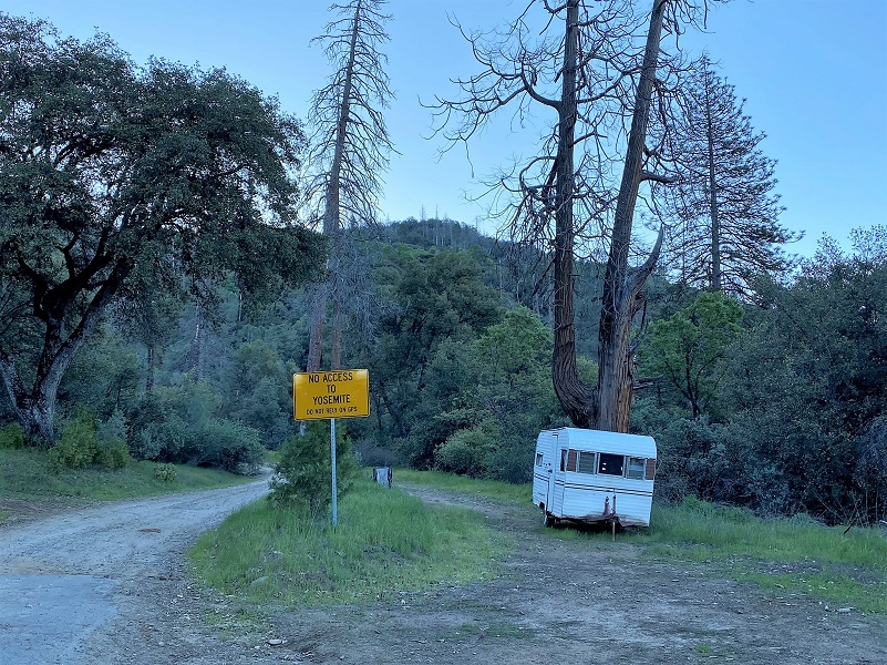
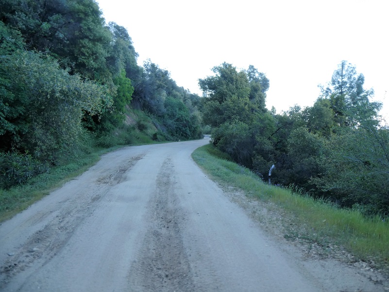
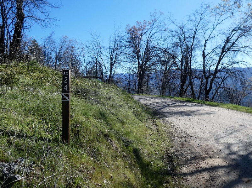
The day I chose to hike this one was a bit warmer and no breeze was forecast, so I took preemptive action. I wore shorts, sprayed my legs down with mosquito spray and brought along my bug net for my head, just in case. I also brought some bug spray with me in case I needed to cover more. I started my walk across from Worman’s Mill, parking off the road in a wide spot at the intersection of Road 601 and Worman Road and making sure I wasn’t blocking anyone. I headed up Worman Road which turns into N-6S24.
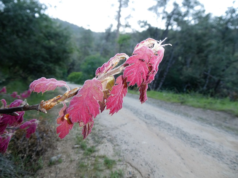
Oaks were starting to leaf out.
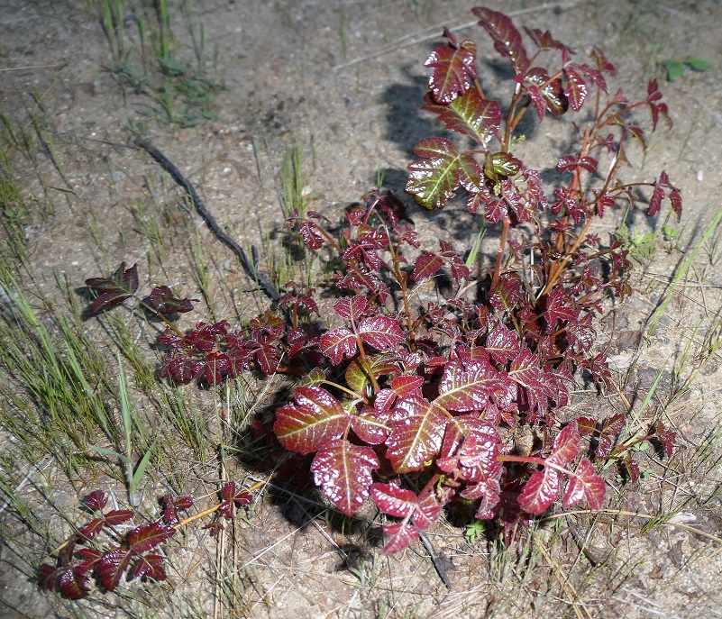
And so was the poison oak.
Immature mosquitoes were hovering around my arms but none lit as I walked up the road. I saw plenty of lizard and snake tracks on the dusty road.
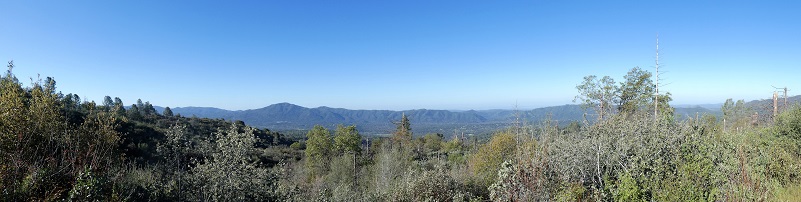
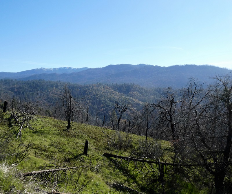
Peeks between the trees gave me views of Nipinnawasee and Ahwahnee.


And then those gnats started getting pretty bad and my hiking buddies know that it isn’t often that I put this silly thing on. I had utilized my handkerchief swishing method for a while but it wasn’t cutting it. It was time to do it and I am glad I did. There are lots of vendors that make these things and they usually come in a little stuff sack that you can keep in your pack.

The road crossed Carter Creek, one of the very few spots of water along my road on this day. I mention this in case you may want to take your dog with you because you would probably need to pack water for them.
More view spots.
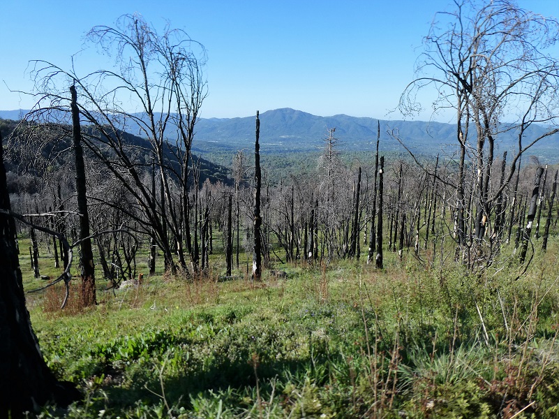
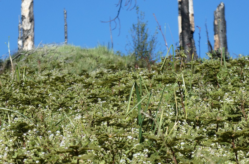
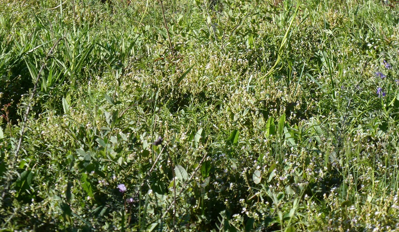
I walked through the 2018 Oak Fire from a couple of years ago and when I looked closer I could see a multitude of wildflowers getting ready to put on a show. This area will be amazing in a short while.
I reached the area that I call the notch and continued on. I named it that because it is a lightly lower “pass” between two slightly higher points. I look forward to views of snow mountains when I make the curve but the snow has really receded since I walked this area about a month ago.
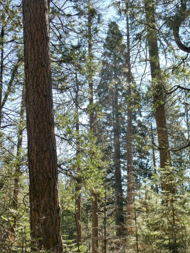
I continued up the road.

 About 1 1/2 miles later I reached the Lone Sequoia Trailhead. There is a vault bathroom and a few picnic tables here. I didn’t check to see if the bathrooms were open but I wouldn’t expect that they would be from the information that the Sierra National Forest had recently put out.
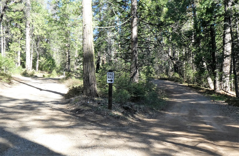
I walked through the picnic area and stayed to the right to follow the one way traffic sign. I didn’t want to disobey the sign and as soon as these two one-way roads met back up, that is where you will find the Lone Sequoia on your right, next to the small creek.
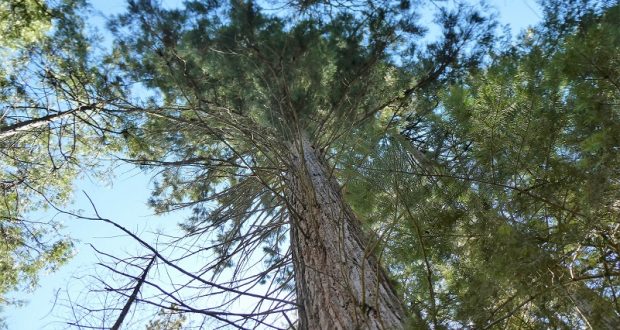
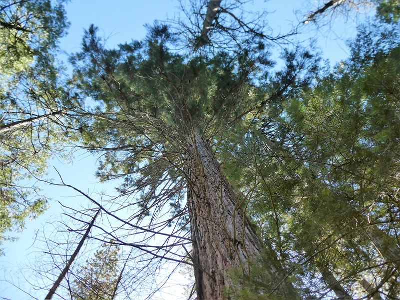
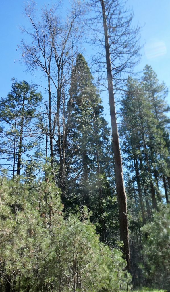
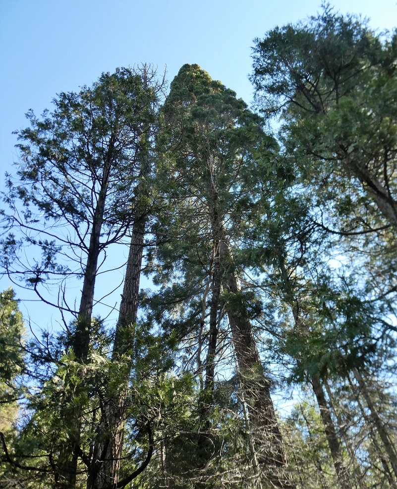
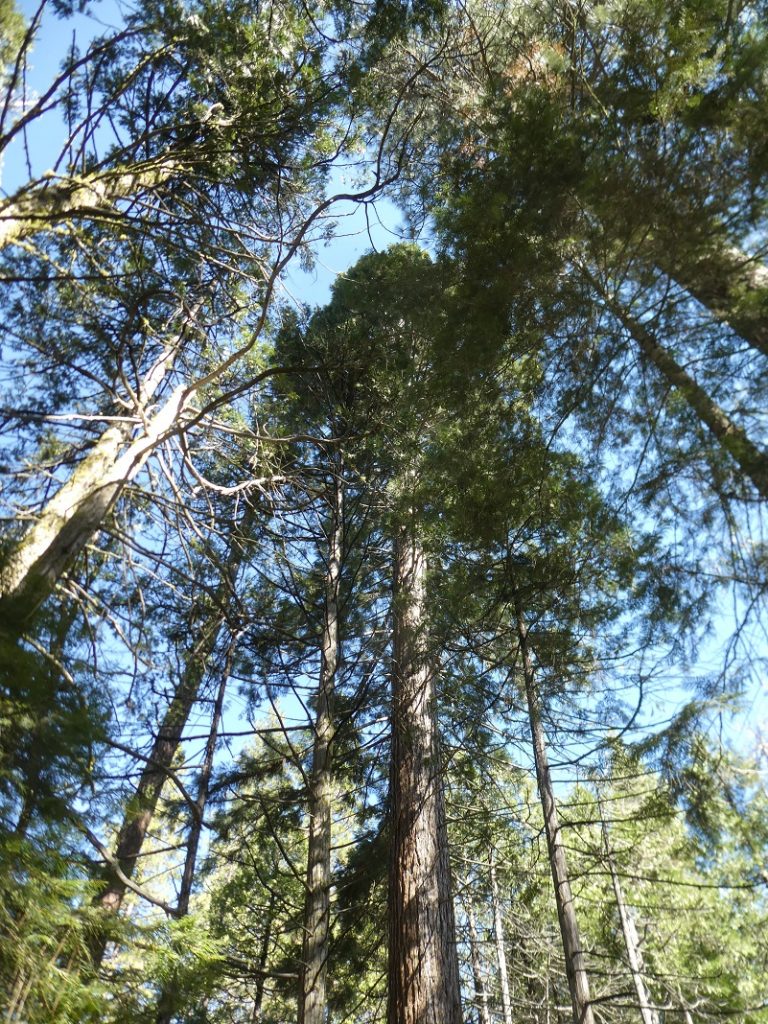
The Lone Sequoia isn’t a really big tree by Giant Sequoia comparison but it all by at itself at this lower elevation of about 4,400′. Even though it is a smaller one, it is hard to get a good picture with all of it in the picture.

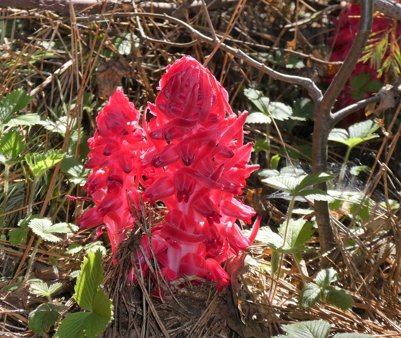
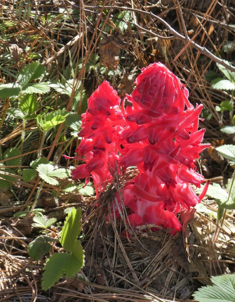
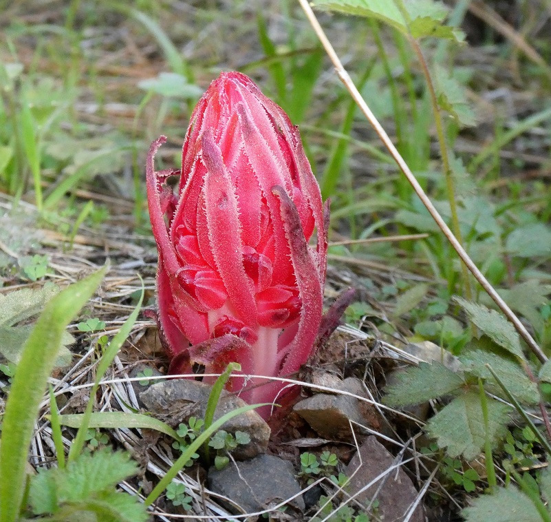
I decided to continue up the road to see if I could find a spot above the Lone Sequoia to get a better picture. As I wandered around, I located some snow plants, working their way out of the ground. These unique plants do not contain any chlorophyll and they receive their nutrients from fungi underneath the soil on conifers. They grow in pine needles and forest litter near a conifer. The brilliant red part of the plant begins to grow in spring.
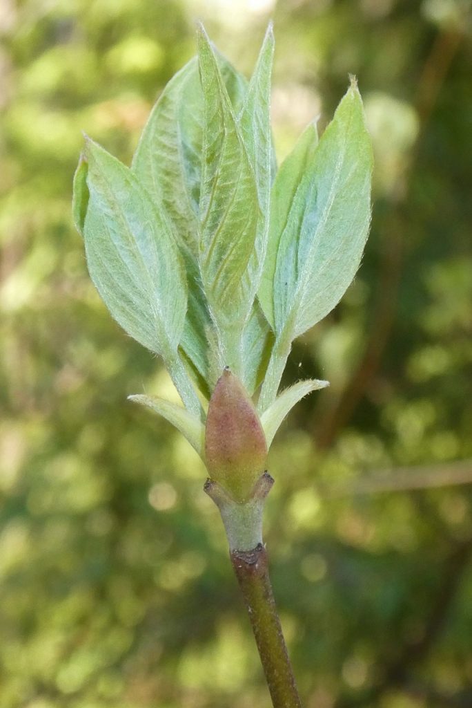
And I found some dogwoods, just starting to awaken from winter.
I never could find a wonderful place to capture the Lone Sequoia from uphill. I tried my best though.

I headed back the same way that I had come in. It was a good morning’s adventure with a little mileage. No one was at the Lone Sequoia area and I only met two pickups heading up the road in the morning. Those were the only people but you can expect to see 4-wheelers and motorcycles on this road.
Dog Hike? Maybe
This could be a good dog hike if your dog is a good fit. The road is lightly traveled by vehicles so you would need to keep an eye open for a vehicle coming around one of the curves. I would imagine in the summer that you could run into a rattlesnake out here also. This is mountain lion country, along with other wildlife that you could encounter. There were a couple of areas with running water on my hike but it probably dries up in summer, so you would probably need to pack dog water.
Doarama:
What is a Doarama? It is a video playback of the GPS track overlaid on a 3 dimensional interactive map. If you “grab” the map, you can tilt it or spin it and look at it from different viewing angles. With the rabbit and turtle buttons, you can also speed it up, slow it down or pause it.
Worman’s Mill to Lone Sequoia Doarama
Map and Profile:
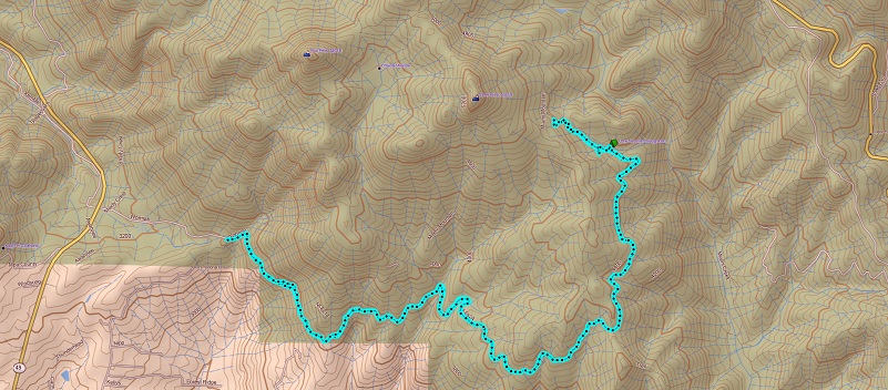
Worman’s Mill to the Lone Sequoia Topographic Map
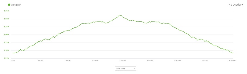
Worman’s Mill to the Lone Sequoia Profile
Sources:
Dubel, Zelda Garey, To Yosemite by Stage, Zulu.com, Third Edition, 2011.
Greene, Linda, YOSEMITE: THE PARK AND ITS RESOURCES; A History of the Discovery, Management, and Physical Development of Yosemite National Park, California, U.S. Dept. of the Interior, National Park Service, September 1987
In the Heart of the Sierras by James M. Hutchings (1888)
Snow Plants U.S. Forest Service
Prior Blogs in this Area:
Walking up a Dirt Road: Worman’s Mill to Pilot Peak April 22, 2020
Walking up a Dirt Road: Worman’s Mill to O’Neals Meadow April 15, 2020
Walking up a Dirt Road: Worman’s Mill to Sunny Meadows April 10, 2020
Walking up a Dirt Road: Worman’s Mill and Beyond March 31, 2020


