Long before YARTS existed, daily automobile shuttles ran from Madera to Wawona on the road we call Miami Mountain Road today. Before that, it was an old stage route and I had been walking up parts of it the past few months. This time I visited the locations where some of the people that I had written about died and were buried. While visiting the land that these men walked on and researching their lives, this week’s blog is kind of a closure for me related to John Ruffin O’Neal and John Eldridge LaTouche.
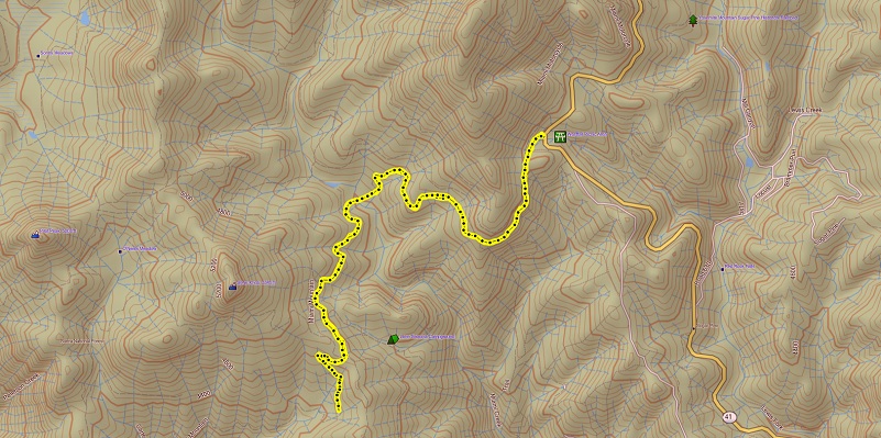
Distance: 7.20 Miles (but you can go shorter or longer)
Difficulty: Moderate
Elevation Range: 4,398′ to 4,813′
Date: June 2, 2020
Maps: Ben Hur and Daulton Topographic Maps
Dog Hike: Maybe
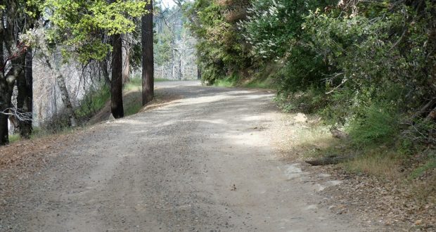
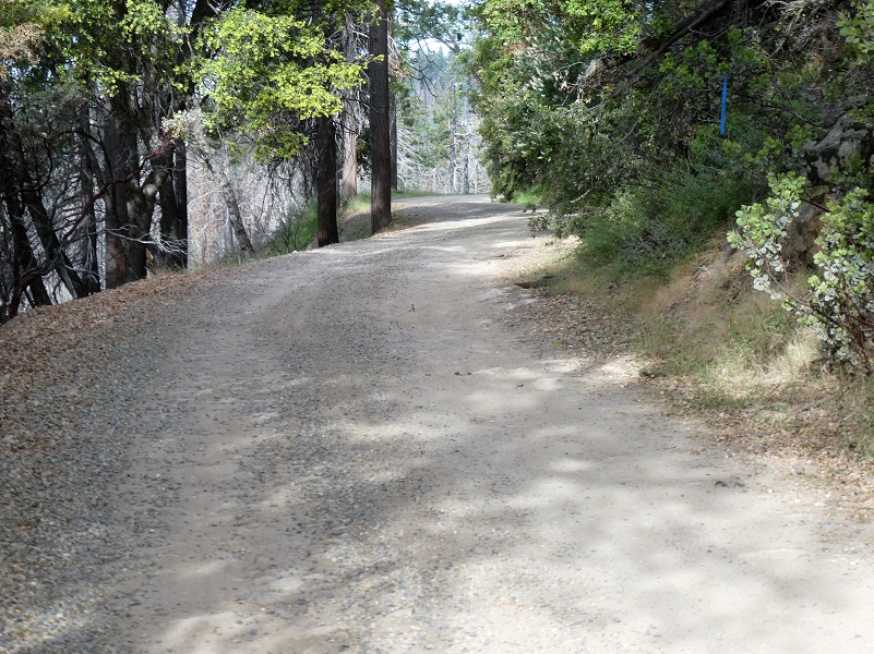
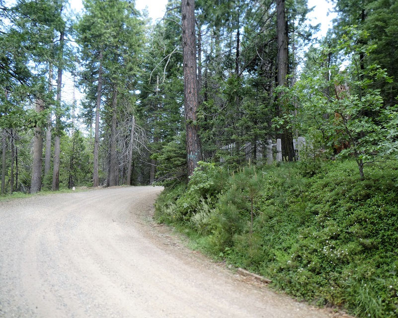
 I had been walking the old wagon roads near my house for a couple of months, checking out every spur road along the way. It was going to be a warm day and if if was much cooler, I might have tackled this one from my house but I wasn’t looking forward to walking back in the afternoon on the exposed south facing slope in 95 degrees after a 20 mile walk. So I parked on the opposite side of where the road came out and walked in and out the same way. I drove up Hwy 41 toward Fish Camp and my plan was going to park at the Westfall Picnic area. After driving through it, it was very rutted which limited where people could drive and park. I decided that I would be potentially blocking access if I parked there so drove up Miami Mountain Road (across the street) to the first good pullout and parked there.
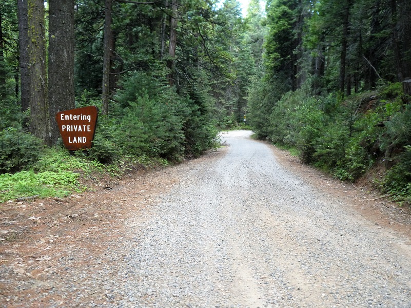
They are logging in this area but weren’t the morning I took this adventure. Logging equipment was parked along the road and logs were decked, so be careful driving in this area. I started walking up Miami Mountain Road, an important early wagon, stagecoach, logging and early automobile route into the Wawona area. An 1885 Yosemite Stage and Turnpike Company Route Map shows the way from Raymond to Wawona. I imagined all sorts of people who traveled up and down this road.
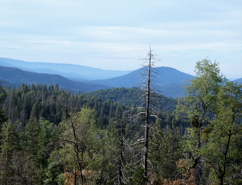
And there were some pretty nice views along the way.
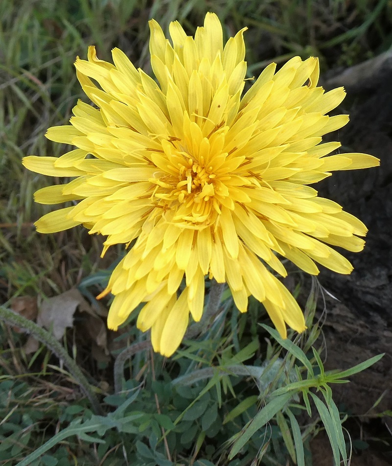
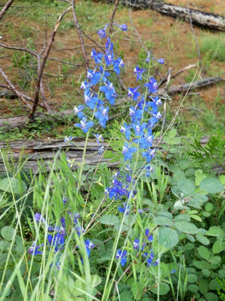
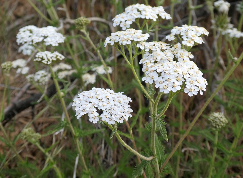
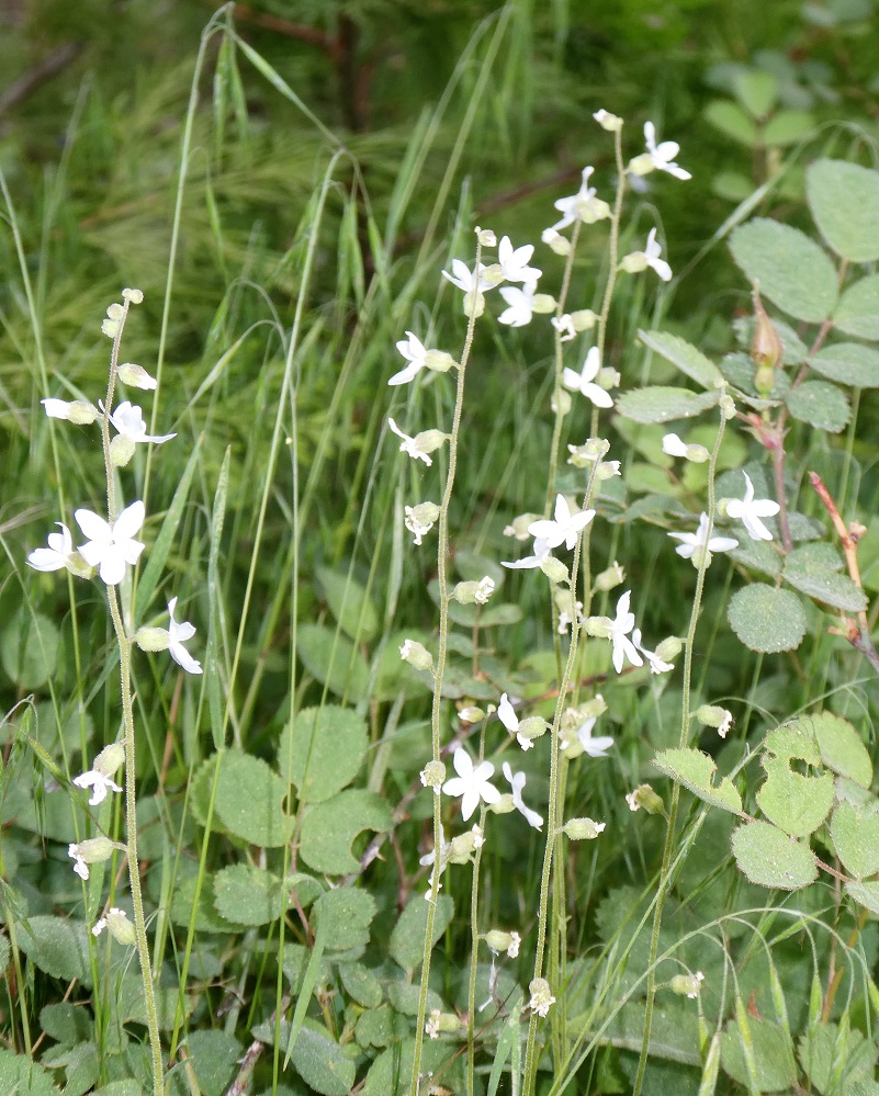
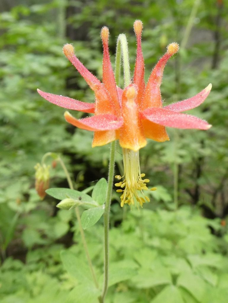
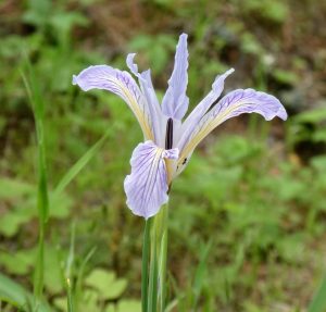
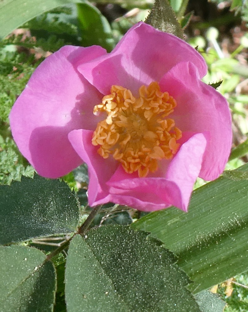
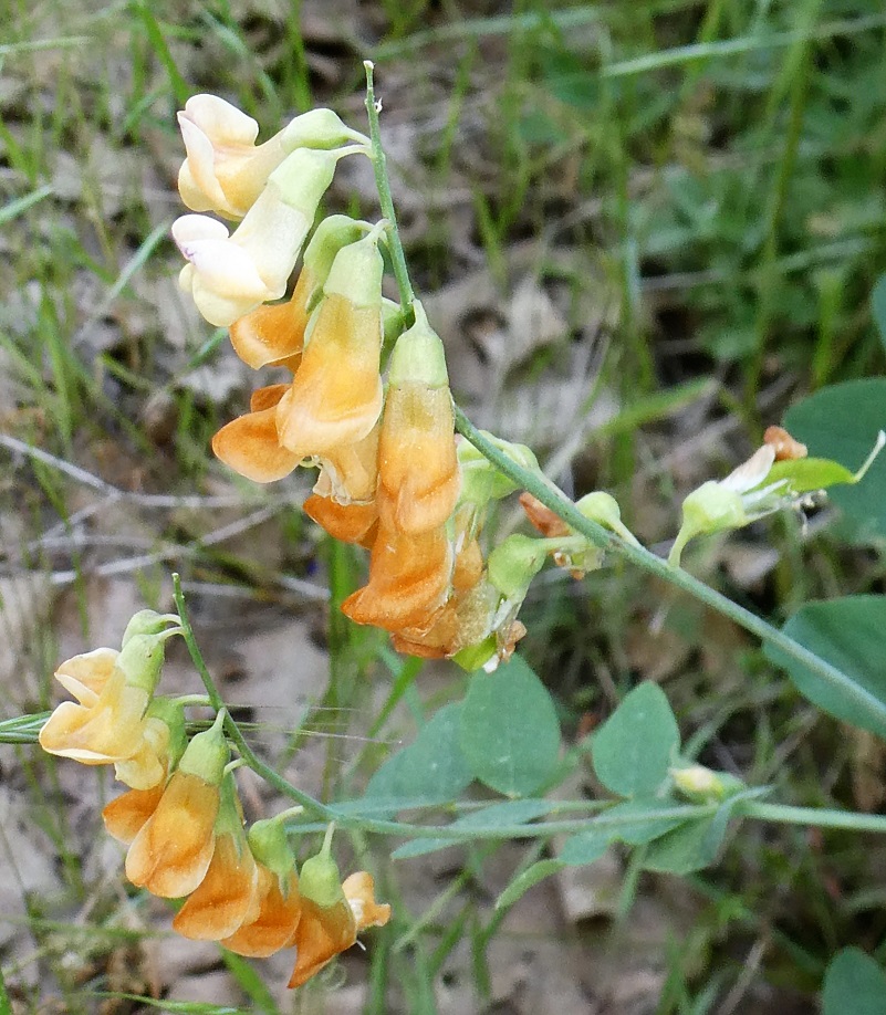
If I were driving down this road, I wouldn’t have noticed how many beautiful flowers were blooming.


A big reason why I was walking this part of the road was to stop by the Westfall Burial Ground where two people that I have written about in prior blogs are buried. There is an outstanding book by Zelda Garey Dubel on the history of our area called To Yosemite by Stage: Raymond to Wawona and Remembering Cedarbrook Inn. It is full of interesting history that I often reference and it has a section on the Westfall Burial Ground. That is where much of my information comes from for this blog.
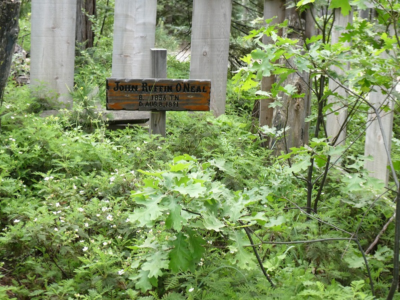
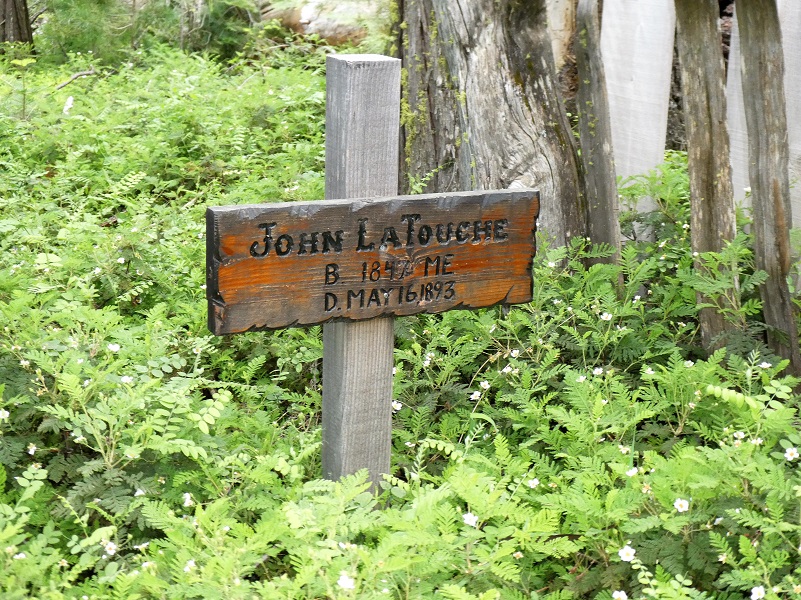
Located adjacent to the road, two people are buried in the Westfall Burial Ground, John Ruffin “Ruff” O’Neal and John Eldridge “Jack” LaTouche.

I had written an earlier blog on John Ruffin “Ruff” O’Neal whom O’Neals Meadow was named after. He was born about 1836 Tennessee or Mississippi, filed for his first homestead of 160 acres at what became known as O’Neals Meadow in 1883. The first time I located him in California was when he registered to vote in 1867 and he was a miner living in Buchanan City near Raymond. When he first settled his homestead in 1882, there were already 3 log cabins and a barn on the property at O’Neals Meadow. Ruff ONeal owned stock, had a 1 acre apple orchard where he picked two tons of apples in good years. He also raised 3-4 tons of potatoes and harvested 6-7 tons of hay each year. He died when he was falling a tree and it pinned his leg underneath it in a way that he could not free himself. They buried him where they found him.
When Ruff O’Neal went missing, his long time neighbor John LaTouche searched for him and eventually located him. LaTouche and O’Neal had known each other since at least 1880. Back when the 1880 census was taken, both O’Neal and John E. LaTouche were living in the same household of Virgel Coons and they were both shake makers. I haven’t written very much about John Eldridge LaTouche and it is now time to learn more about his life.
The 1880 Census says that LaTouche was born in Ireland, both parents also born in Ireland but that may not be correct. His California voter records say that he was born in Massachusetts.
He married Phoebe Ellen Branson November 24, 1884 at her parents house in Snow Creek (Darrah). They had 4 children, the first born at Cold Spring (Ponderosa Basin) and the last two children born at Twin Springs near the Westfall Burial Ground.
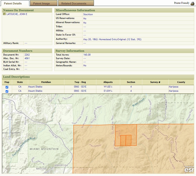
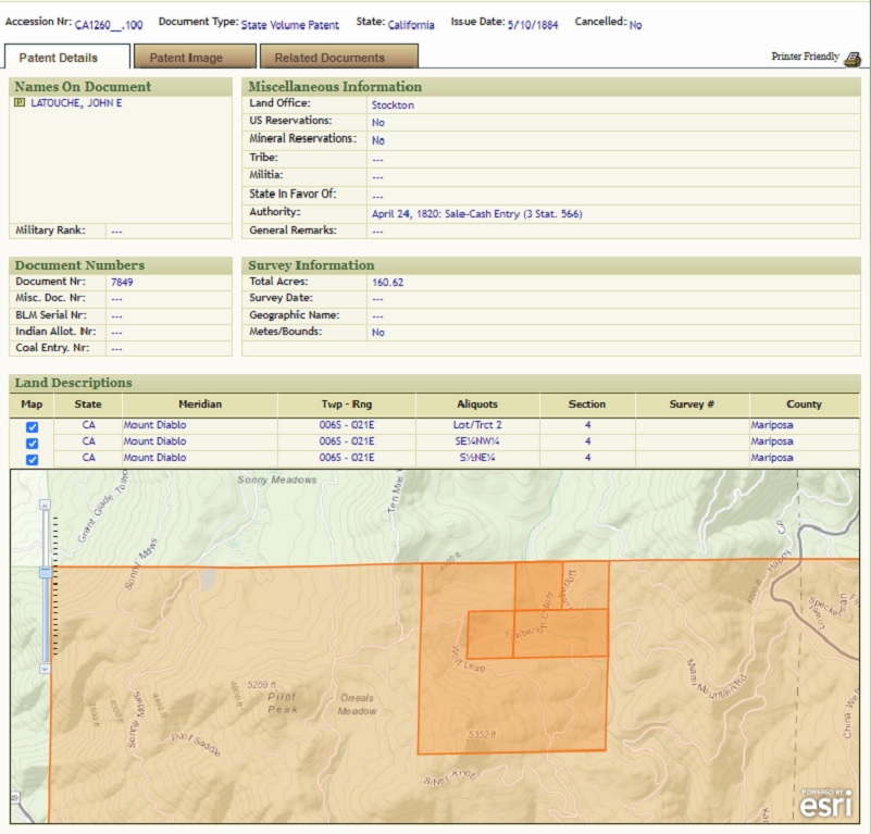
He is listed on the 1884 Great Registrar of Mariposa County and took out a Homestead May 10, 1884 on the east side of Silver Knob prior to his marriage and added an additional Homestead Patent on May 16, 1892, just north of his earlier homestead and east of O’Neals Meadow.
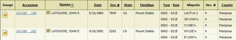
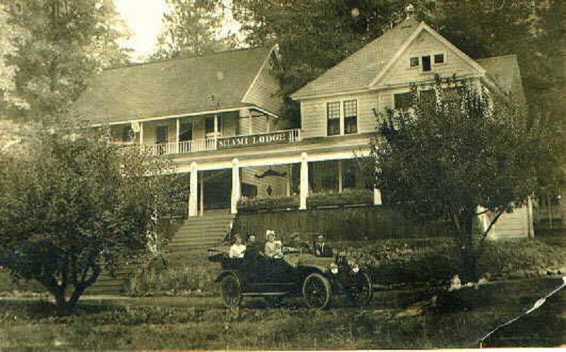
LaTouche had a cabin by Miami Lodge in the timber above Miami Mountain Road. The Madera Flume and Trading Company (which was later purchased by the Madera Sugar Pine Company) owned the property surrounding LaTouche’s place. Loggers were cutting timber around his house and told him to get out because they were going to fall the timber and if he didn’t leave, they might fall a tree though his house. He owned the land and didn’t think that they had a right to cut the timber, so he didn’t leave. The loggers cut a huge tree which did fall through the cabin and killed him.
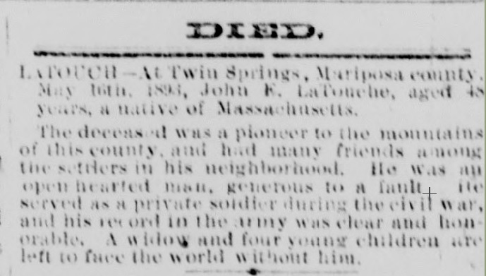
Mariposa Gazette, Volume XXXVIII, Number 49, 20 May 1893
But there is more mystery on John Eldridge Latouche’s background. He served in the Civil War, 19th Infantry and 4th Heavy Artillery, Company K, Union Army from Massachusetts.
He and his wife applied for a Civil War pension and those records said that John E. LaTouche, alias John E. Phelan, served. As an invalid, he submitted his application in 1892. We don’t know why he used the alias. Zelda Garey Dubel did research on his name and pension but was unable to pin him down but she did share some possibilities.
![National Archives and Records Administration. U.S., Civil War Pension Index: General Index to Pension Files, 1861-1934 [database on-line]. Provo, UT, USA: Ancestry.com Operations Inc, 2000.](https://sierranewsonline.com/wp-content/uploads/2020/06/LaTouche-Pension.jpg)
John e. LaTouche Pension File Index
I looked around the Mariposa area for a John E. Phelan and located J.E. Phelan, born about 1844 Canada and a house painter.

I located numerous Civil War records for the below John E. Phelan, who was in the 19th Regiment Massachusetts. He was hospitalized during the war and transferred, reenlisted and also signed up as a Reserve after the war ended. There is a discrepancy on the birth location. The military record says that he was born in Canada, enlisted at Boston, Massachusetts. The only census record that I have located for John C. LaTouche shows that he was born Massachusetts. We don’t know who filled out that information and it could be incorrect. The only California Voter Registrar record I show for John Eldridge LaTouche was in 1888 and it says he was born in Massachusetts. I could not find any voter records for John Phelan.

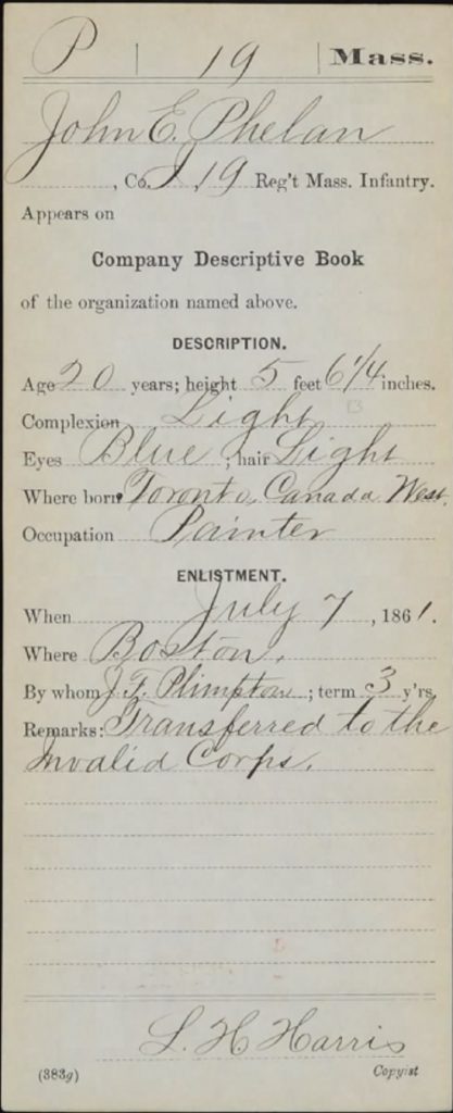
I located several Civil War hospital records for this person and paperwork showing that he did not desert but was in the hospital. I can’t be sure if this John E. Phelan is the same one as the alias that John E. LaTouche used but they are both born in the same timeframe and I think there is a good chance that the J.E. Phelan on the 1870 Mariposa census is the same person on the Civil War records because of the occupation of painter.

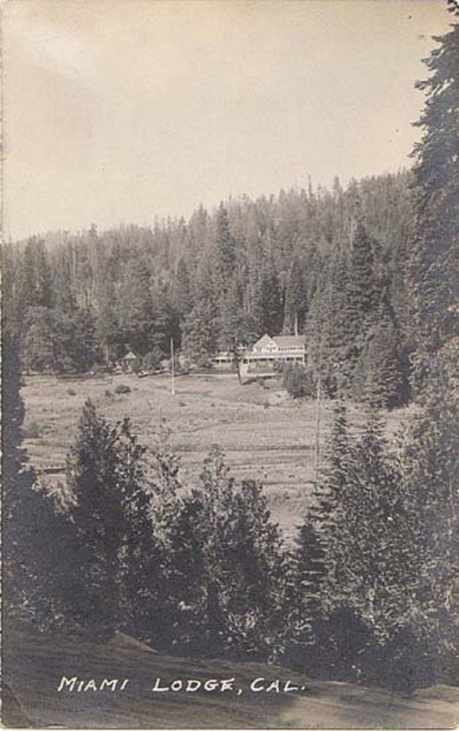
I continued on the road, passing by the intersection of the area know as Twin Springs back in the day. The road then led me through the property that was previously known as the Miami Sawmill and later Miami Lodge.
Miami Creek runs through this property and that is likely why it received its name. A sawmill was planned at this location back in 1881 by William H. Crooks who lived at Gertrude and he went into partnership with Edwin James Leonard. The sawmill was referred to at times as Crooks & Leonard’s saw mill. The sawmill operated at this location until it was moved near the Worman Brothers Sawmill and the new location was known as Miami Sawmill. A new investor, and the original sawmill location was improved and was back in operation there in 1884. It was operational in 1884 when it hauled lumber into Yosemite Valley to build Degnan’s Bakery. After the railroad came to Raymond in 1886, lumber from the Miami Sawmill was hauled by a team of 6 horses to build a one room grammar school. There is plenty of documentation on the use of the lumber that was milled from this sawmill being used in the area. Crooks sold his investment in 1891 and afrer Grant died that same year, the mill moved into the possession of Dr. Castle (Cassell) and he started operating the mill under contract to the Madera Flume & Trading Co. The lumber was hauled from the mill to the flume at Gertrude (Poison Switch) by team then transported by flume to Madera. In 1902, Cassell deeded the sawmill holdings to Arthur Hill of Saginaw, Michigan and Elddridge Merick Fowler of Pasadena.
In 1907/8, William Marin Sell leased the Ahwahnee Tavern to Edwin Town “Ed” Huffman and he operated it as a lunch station for his auto stages. He started the “Horseshoe Route” into Yosemite, autos coming from Merced and across from Mariposa. In 1911 he operated auto stages from Madera to Wawona, then in 1913 he moved to Miami Lodge. He enlarged the old Miami Lodge Hotel that had been built sometime after the sawmill started in 1882, built some new buildings and moved some cabins. Miami Lodge was now a stage and luncheon stop for the automobile stages.
 In 1914, a newspaper article: “Into the Mountains in 5 hours by Automobile. Over one of the best mountain roads in the state, from Fresno to Madera to Raymond, to MIAMI LODGE. In the heart of the Sierras, 4,500 feet elevation–Excellent fishing in Miami creek. Large clubhouse. Ideal for a Weed-End. Always Cool. Miami Lodge, Grub Gulch P.O., Cal.”
Guests from all over the world visited. A two story hotel with 12 rooms, long sun porches on each floor and a piano in the lounge. A Chinese cook was known for his fruit and elderberry pies. Services at the hotel included a garage and telephone. The hotel closed for the winter but in 1917, a news article said that it would remain open during the winter so that guests may take advantage of winter sports “not thirty minutes away.” In 1926, an article stated a new concrete swimming pool and one room bungalows, horseback riding, fishing, tennis and dancing every night.
Highway 41 was built and added to the state highway system in 1933, bypassing Miami Lodge and it began to lose business and closed in 1930. They announced a grand reopening in 1933. Harold Baker from Merced purchased Miami Lodge in 1943, tore down the buildings and sold the property to the Oakland Area Girl Scouts and renamed it Timberloft. Their development was for summertime camping and was operational until 1958. Regarding the property that the Miami Sawmill and Miami Lodge were located on, I located a prior Lands of America Real Estate Listing for the now off the market property with pictures if you would like to learn more. The meadow area that the road led me through was apparently split off and sold in the 1970’s.
What a history was at this location. Fresh horses were exchanged here for the stage couches and freight wagons from Raymond to Wawona. President Teddy Roosevelt’s four-horse state changed horses here in 1903. Some of the cabins had been moved to Fish Camp in 1913. Some of the brown cottages were moved behind the Silvertip Lodge at Fish Camp.

I continued back to my car. People activity is picking up in this area although I didn’t see anyone on my walk. I like to hit the trail early so that is probably one big reason. You can expect vehicles, including 4 wheelers, motorcycles on this road. As a reminder:
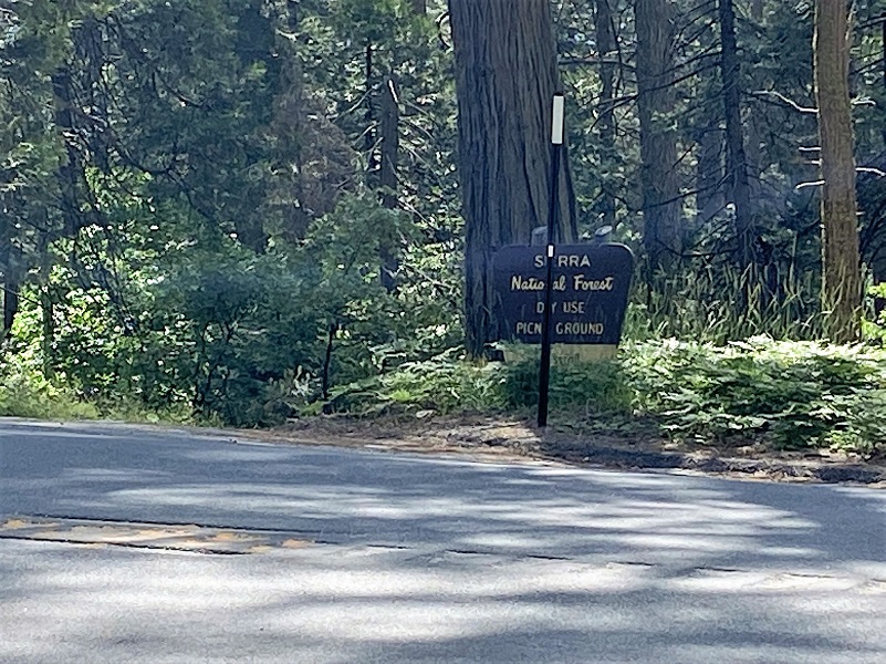
Courtesy Sierra National Forest
I originally had this blog scheduled to publish a couple of weeks ago, but Yosemite National Park reopened, and I had to get up there immediately and share those adventures with you. This winter when I couldn’t hike in the areas I usually hike that time of the year, I took a close look at the roads and history in my own backyard. Boy, was I surprised at some of the interesting people that I learned about, including Ephraim Cutter Carter, Samuel Lane Hogan, John Ruffin O’Neal, John E. LaTouche and Cora Matilda Ives. And, there are many more people who lived in the area who had interesting stories to uncover.
Dog Hike? Maybe
This could be a good dog hike if your dog is a good fit. The road is lightly traveled by vehicles so you would need to keep an eye open for a vehicle coming around one of the curves. I would imagine in the summer that you could run into a rattlesnake out here also. This is mountain lion country, along with other wildlife that you could encounter. There were a couple of areas with running water on my hike but it probably dries up in summer, so you would probably need to pack dog water.
Doarama:
What is a Doarama? It is a video playback of the GPS track overlaid on a 3 dimensional interactive map. If you “grab” the map, you can tilt it or spin it and look at it from different viewing angles. With the rabbit and turtle buttons, you can also speed it up, slow it down or pause it.
Westfall Miami Mountain Road Doarama
Map and Profile:

Sources:
Dubel, Zelda Garey, To Yosemite by Stage, Zulu.com, Third Edition, 2011.
Wawona’s Yesterdays (1961) by Shirley Sargent
Rare brochure for Yosemite Stage Co. 1900
Rules and Regulations Yosemite National Park, United States National Park Service, 1925
Ancestry.com, Census Year: 1880; Census Place: Magoon, Mariposa, California; Roll: 68; Page: 180D; Enumeration District: 041
1884 Great Register of Mariposa County – Developed by Tom Margrave
John LaTouche 1884 Land Patent Map BLM Land Records
John LaTouche 1892 Land Patent Map BLM General Land Records
Mariposa Gazette, Volume XXXVIII, Number 49, 20 May 1893
National Archives and Records Administration. U.S., Civil War Pension Index: General Index to Pension Files, 1861-1934 [database on-line]. Provo, UT, USA: Ancestry.com Operations Inc, 2000.
John E. Phelan Civil War Record Fold 3
Ancestry.com, Census Year: 1870; Census Place: Township 4, Mariposa, California; Roll: M593_74; Page: 147A; Family History Library Film: 545573
Lands of America Real Estate Listing
Miami Lodge Mariposa County History & Research
Miami Lodge Penny Postcards From California
Prior Blogs in this Area:
Walking up a Dirt Road: Worman’s Mill Loop Along Sunny and O’Neals Meadows May 20, 2020
Walking up a Dirt Road: Worman’s Mill to O’Neals Meadow Loop May 5, 2020
Walking up a Dirt Road: Worman’s Mill to the Lone Sequoia April 28, 2020
Walking up a Dirt Road: Worman’s Mill to Pilot Peak April 22, 2020
Walking up a Dirt Road: Worman’s Mill to O’Neals Meadow April 15, 2020
Walking up a Dirt Road: Worman’s Mill to Sunny Meadows April 10, 2020
Walking up a Dirt Road: Worman’s Mill and Beyond March 31, 2020


Walking up a Dirt Road, you must have safety. Westfall Picnic Area up Miami Mtn Road is like a jungle and may have some animals who are dangerous for us. so keep up safety
Hello, i found your blog online and was amazed because John Ruffin O’Neal is my ancestor and you have all this info about him ! I was so excited to see it all and a picture of his cross/ grave. His story is so sad but i am glad he lived in a beautiful area. I have a Ancestry account and you can view his family on there. I linked your story to his page and i would love to put his grave picture with your permission on there as well as his homesite picture. I do understand if you don’t prefer it but i did link to here. Thank you so much for the beautiful pictures , you live in a wonderful area. I am in Tenn. He was my 3rd grandfathers son with his second wife, so my 3rd great uncle ! His family lived in Erath county, Texas and were a tough hard working group, mostly farmers. Thank you again, Kasandra Greene
https://www.ancestry.com/family-tree/tree/20099136/family?cfpid=896617442&fpid=1159971171
I am so glad you saw the article and am happy to have you use whatever you would like from it. I wrote a couple of articles about him and hope you found the first one with information on his homestead and newspaper articles.