Whose footsteps did I walk in this week? I sure didn’t expect to discover a connection to Hite’s Cove on my looped hike along Sunny Meadows and through O’Neil’s Meadows.
Distance: 12.12 Miles (but you can go shorter or longer)
Difficulty: Moderate
Elevation Range: 3,417′ to 4,862′
Date: May 18, 2021
CALTOPO: Worman’s Mill to Sonny Meadows and O’Neil Meadows Loop
Dog Hike: Maybe
As I walk up these old roads, I wonder who else has walked this path before me. What were they doing up here, where were they going and what was their life like? I discovered a tie to the Sunny Meadows area with Hite’s Cove this week. Then I did a little more digging and discovered even more connections.
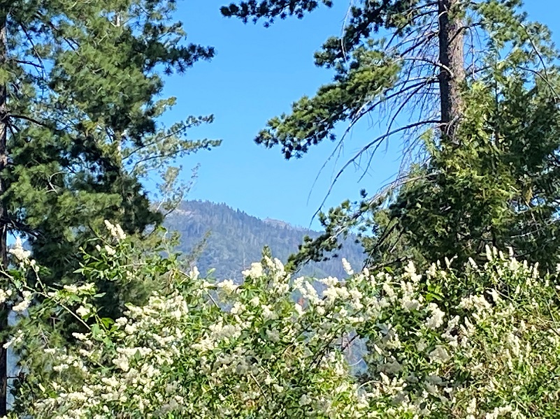
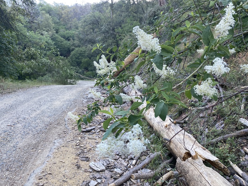 I started my walk across from Worman’s Mill, parking off the road in a wide spot at the intersection of Road 601 and Worman Road, making sure I wasn’t blocking anyone. I headed up N6S24 then left up 5S16. Deerbrush was blooming along with several other wildflowers that included Chinese Houses.
The road started wrapping around the north side of the mountain where I crossed a creek, then 5S16A was on the right. This road was part of the old wagon road that Galen Clark’s company, “Mariposa Big Trees and Yo Semite Turnpike Company,” built to tie in Mariposa and Wawona. There were actually several ways that visitors reached the Wawona area by stage. Before the Raymond Road was the preferred route, this upper road that went over the mountain into what was then called Hogan Meadow, renamed Sonny/Sunny Meadows in 1947, then followed Miami Creek into Miami Lodge. I walked up 5S16A.
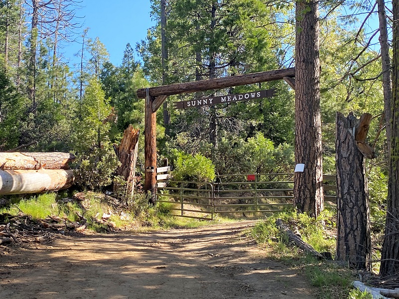
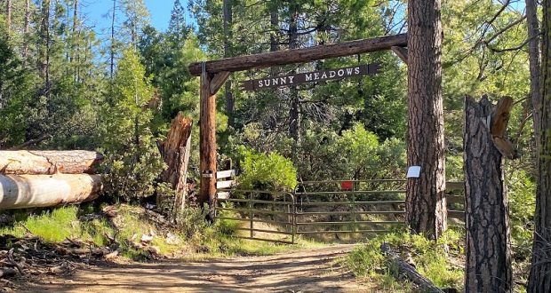
Sunny Meadows was originally homesteaded back in 1850 and is on private property, so I didn’t go any further than the gate. I did walk down the fence line a little bit and took this zoomed in shot from the fence.

A while back Sunny Meadows was listed for sale but I don’t know if it sold. It doesn’t appear to be on the market but I previously locates an older real estate listing with the following information:
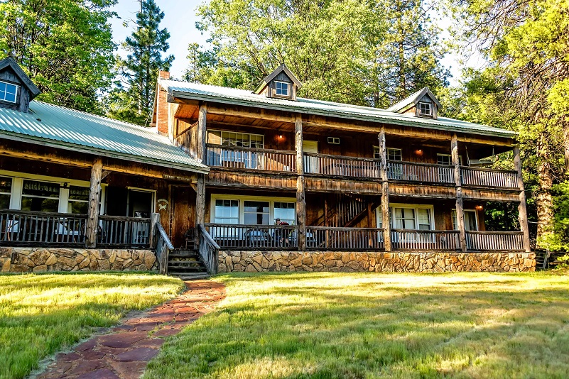
One of the largest parcels for sale in California and one of the only left of this caliber. A rare 443+ acre Trophy Private Ranch completely surrounded by National Forest with 7 bodies of water, including 6 Pure Mountain Spring Water lakes that produce 2500 gallons per day, and 150+/- gorgeous acres of meadow/wetland. This property is appropriately named Sunny Meadows for its endless pastures and never-ending adventure. Pictures definitely do no justice to this spectacular piece of heaven.
Here are a few pictures from that prior Realtor.com listing but the link doesn’t exist now.


A prior blog talked about Samuel L. Hogan’s homestead at this location. He supposedly had an older 1850 homestead but I couldn’t find the patent online. I did find an 160 acre homestead patent for this area for Samuel L. Hogan dated 1877 though.
From this information I was able to learn that his full name was Samuel Lane Hogan, born 1832 Johnson County, Missouri and died 1921 Mariposa County. He is first shown in this area on the 1860 census, living Mariposa, single and a farmer. On the 1870 census, he is a farmer, shown living with a Native American woman Nichola, born 1844 California and 4 children. On the 1880 census, he is a farmer, single and living with Mary Ann born 1840 California and 8 children. 3 of the children from the 1870 census are in the household on the 1880 census. On the 1900 census, Samuel is shown as widowed, a farmer and living with 5 of his children and their families in the household. He is shown on the 1910 and 1920 census, living with family, in Mariposa County. Samuel died in 1921 Mariposa County and is buried at Hogan Cemetery, Mariposa County. I located the obituary on Find a Grave contributed by Alma Stone.
After turning around at the gate, I headed back down to 5S16 and turned right, back on 5S16.
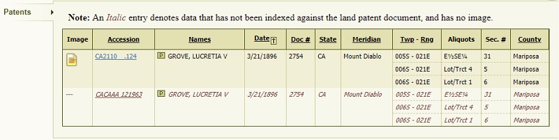
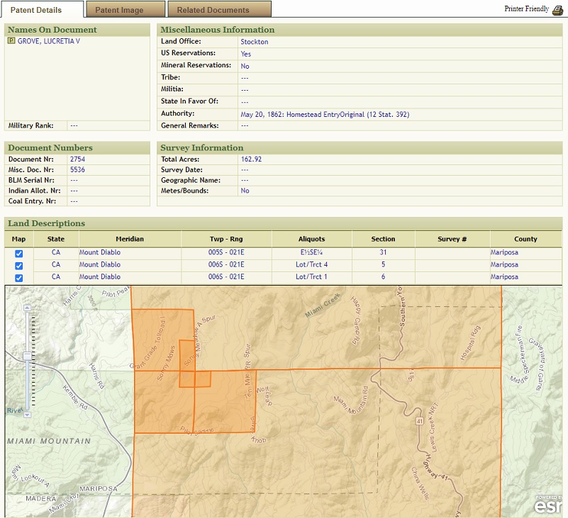
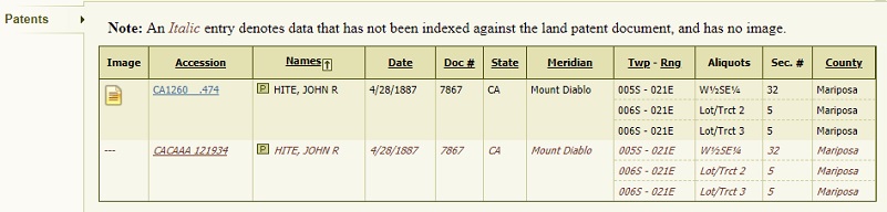
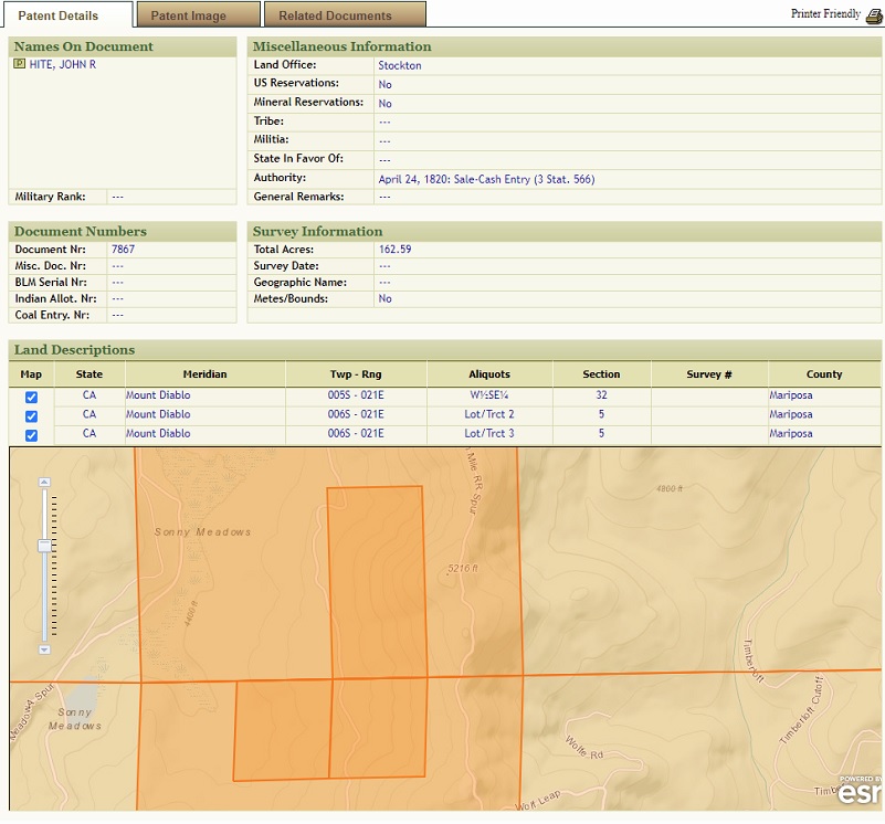
I discovered that others had filed Homestead Patents on property in the area of Sunny Meadows. Back in 1896 Mrs. Lucretia V. Grove filed on 162.92 acres here but who was she?
After doing a bit of digging I was surprised to discover that she was the sister of John Rankin Hite who we all know from Hite Cove. He is one of very few men who struck it rich in gold mining.
Lucretia Virginia Hite, daughter of Gabriel Jones Hite and Mary Mathews Rankin, was born February 20, 1823. She was one of 9 children and one of her brothers was John Rankin Hite who is known for his mining role in the town of Hite in the South Fork of the Merced River. Much is known about him, the wealth that he accumulated from his mining endeavors and his marriage to an Native American named Lucy. But what about Lucretia?
Lucretia was the oldest of the children, marrying James Rankin Grove May 19, 1846 in Augusta County, Virginia. They had 7 children and by the 1880 census, they had moved to Russian River in Sonoma County. Her husband listed his occupation as farmer on the 1880 census and died in August 8, 1886 in Mendocino County. Her brother John Rankin Hite died in 1906, leaving some money to her.
The Estate of John R. Hite Court Proceedings provides some interesting information and here is a snippet.
John R. Hite died April 18, 1906, leaving a large estate, and papers purporting to be a will with two codicils thereto. The will bore date July 29, 1902. By it, he gave to his sister, Lucretia V. Grove, ten thousand dollars(Page 438), to his half-brother Gabriel Hite ten thousand dollars, to Alex. Matthews and Etta Gross, children of an old friend, five thousand dollars each, to a Mrs. Stearn, five thousand dollars, to two named charities five thousand dollars each, to any person legally determined to be his widow five dollars, and all the rest and residue of his property in one-third shares to his sister Lucretia V. Grove, his nephew J. Claude Riley, and the children of his deceased sister, Mrs. Cupp, of whom appellant is one.
On April 16, 1906, he executed a second codicil, giving to his sister Lucretia V. Grove, a legacy of two hundred thousand dollars in place of the ten-thousand-dollar legacy originally given, and providing that such disposition should not interfere with the residuary provision already made in her behalf.
The Will was contested of course and a synopsis of that is within the Court Proceedings link above.
Lucretia died May 14, 1914 at Berkeley, Alameda County and was buried Cypress Lawn Memorial Park, Colma, San Mateo County.
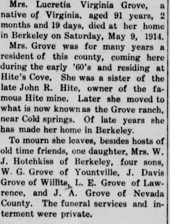
Lucretia Virginia Hite Grove Obituary (Mariposa Gazette, Volume LIX, Number 51, 16 May 1914 — Death of Old Resident)
We continued on the road, walking through old burn areas with a Penny Pines Plantation. Over the years groups have contributed more than a million dollars to the Penny Pines Reforestation Program. Through these donations, more than 27 million of seedlings have been planted, renewing 88,000 acres of national forest land in California. If you are interested in learning more information about donating to Penny Pines, you can lean more here.
And we could soon spot Signal Peak (Devil’s Peak) Lookout, located at 7079 feet in elevation. It has been staffed by volunteers for several years now due to Forest Service funding cutbacks. The only access to the tower is by hiking up to it.
Signal Peak Lookout was originally constructed in 1900 as a compass lookout. In 1911 it was rebuilt as a 12′ x 16′ cabin by Ray Smithers. It had windows on all four sides and a phone was installed. In 1916 a octagonal second story was added to the cabin. In 1926 a 4AR type house was constructed. The 14′ x 14′ wood hip roofed lookout house had a steep 12/12 pitch roof with 2 pane windows and door in the center of the wall. In 1951 the lookout was rebuilt in the current configuration as it is today. The C-3(L) type tower is a 14′ x 14′ hip roofed wood tower standing on a 10′ x 10′ concrete block base.
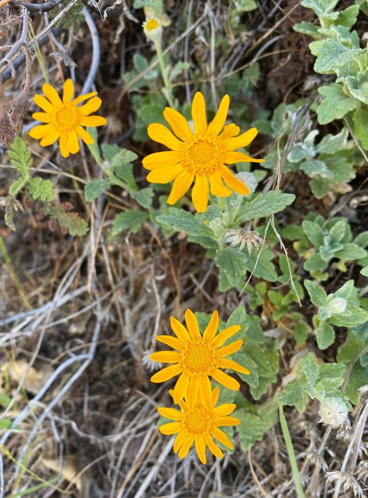
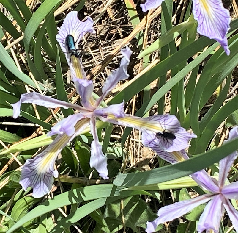
As I walked up the road, wildflowers were blooming along the road and the wild iris was full of bugs helping to pollinate them.
 We reached the junction of 5S12, although there wasn’t a sign. This is the junction where the road also goes down toward Cold Springs and there was a restoration sign, warning about vehicle use in this area that could cause damage. This was a great spot for us to take a snack break before another short uphill climb.
There was also a sign at the junction for the road I had walked up, 5S16, and I turned right at the sign. From To Yosemite by State, I believe this road was the upper road on Grant Grade built by Judge Grant in 1886.
The Grant Grade went from about a mile and a half above Grant Springs (near Old Hwy 49 and Harris Ranch Road just over the county line in Mariposa County), around, underneath the mountain to the right. Lewis, in an interview in 1983, said that the first visitors to Grand Springs Hotel in 1883 came on the state route between Mariposa and Merced, not on the road from Raymond. Sometimes they took Grant Grade over the mountain to Miami Lodge and then down by the old Murphy’s Ranch where they had a saloon and eating house and stage stop, and then on to Wawona. They also built an upper road on Grant Grade that went over the mountain into Hogan Meadow (renamed Sunny Meadow in 1947). The road went through Hogan Meadow and above O’Neal’s Meadow and followed Miami Creek into Miami Lodge.
The road that I was walking skirted the east side of Sunny Meadows, private property, and it was well signed. Last year I had hiked this same loop about this same time and the dogwood blooms were wonderful. There were very few blooms in their prime but we found some.
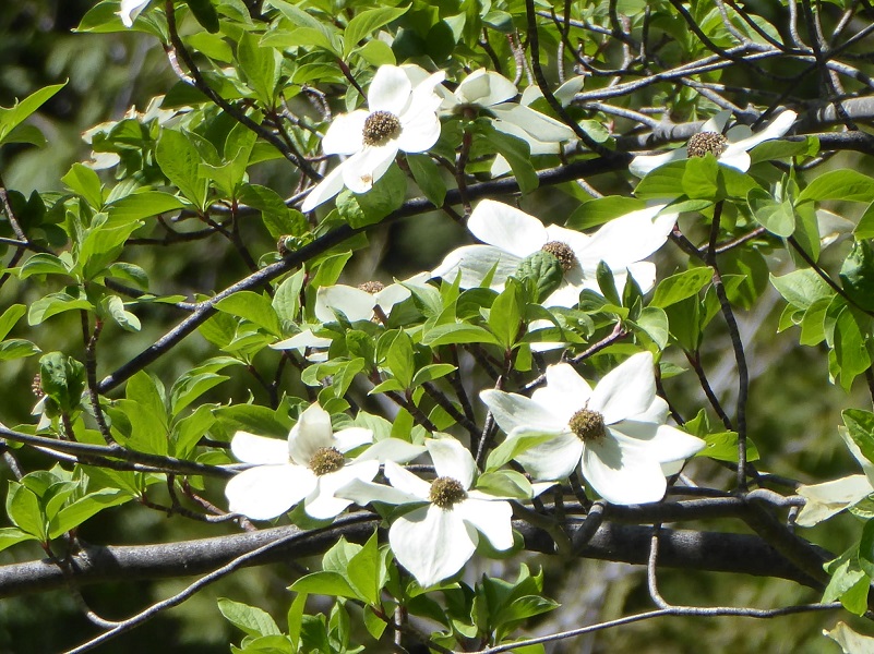
Photo by Gail Gilbert
Most blooms were over the hill.

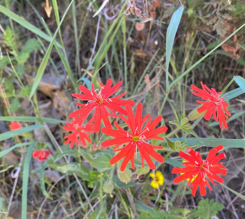
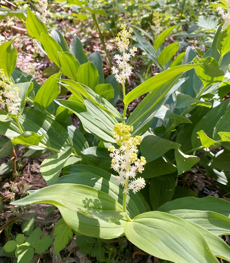
But other flowers were showing off such as False Soloman’s Seal and Wild Rose.
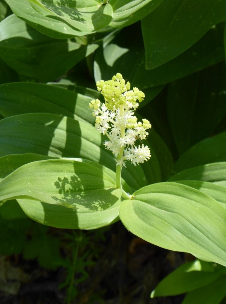
Photo by Gail Gilbert

As I walked up the road, I was walking through part of a Homestead Patent filed by James Rankin Hite. Yes, the famous mine owner whom Hite’s Cove is named after.
That got me wondering if Sunny Meadows might have had another name after Hogan Meadow. Could this also be the Grove Ranch referenced in Lucretia’s Obituary? I went back to the obituary on Samuel Hogan’s Find a Grave and located this:
He first settled on a ranch in the mountains, now known as the Grove ranch, later moving to the Pea Ridge section, where he lived for many years.
So the Grove Ranch is the same as Hogan Ranch and Sonny/Sunny Meadows!
I made it to the junction of 5S12, turning right, where I skirted O’Neals Meadow located on my left then entered the meadow from the west side. I headed out to the top of the meadow where John Ruffin O’Neal and Cora Ives had lived.
There is an outstanding book by Zelda Garey Dubel on the history of our area called To Yosemite by Stage: Raymond to Wawona and Remembering Cedarbrook Inn. It is full of interesting history that I often reference and it has a section on O’Neals Meadow. That is where most of my information comes from for this blog.
O’Neals Meadow was named after John Ruffin “Ruff” O’Neal, bc1836 Tennessee or Mississippi. He filed for his first homestead of 160 acres at what became known as O’Neals Meadow in 1883. There isn’t a connection that is known with the O’Neal families of the town of O’Neal, just in case you were wondering. When he registered to vote in 1867, he was a miner living in Buchanan City near Raymond. When he first settled his homestead, there were already 3 log cabins and a barn on the property that had previously been owned by Ephraim Cutter Carter. Ruff ONeal owned stock, had a 1 acre apple orchard where he picked two tons of apples in good years. He also raised 3-4 tons of potatoes and harvested 6-7 tons of hay each year. Ruff also was a shake maker and died in 1891 when a tree he felled rolled over him, pinning his leg in a way that he could not extricate himself. Friends and neighbors searched for him but didn’t find his body until weeks later. They buried him where they found him because it was mountainous terrain and it was have been difficult to move the body. His is one of two graves at Westfall Burial Ground.
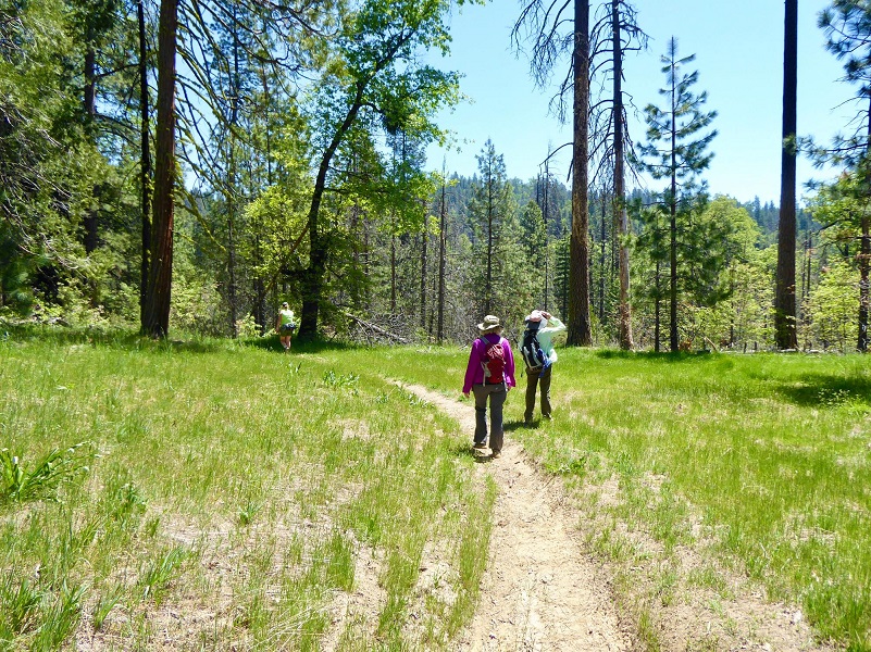
Photo by Gail Gilbert
The Ives family moved to Bailey Flats around 1911 or so, raising cattle and driving them to their leased grazing permit’s summer pasture at O’Neal’s Meadow. Cora had a Homestead Patent for 320 acres and her sister Annette had one for 80 acres in the Bailey Flats area.
Her father, Eugene Simms Ives, died in August 5, 1917 and in 1929, Annette died in a traffic accident in Kern County. I don’t know when the cattle operation ended but Cora continued to spend her summers there until her death in 1965. She wrote a column for Fresno newspapers, even writing 1 or more books. The Ives family had built a little chapel at O’Neal’s Meadow and at one time, a priest would come to the meadow once a month to give service in the chapel. There were originally 4 cabins but in Cora’s later years, only 2 cabins still stood. She called one of the cabins the Biltmore because it had been built onto more than the others. The other cabin consisted of a kitchen and living room where she did her entertaining. The cabin was described as having a kitchen with open screened sides and there were benches made of three-fourths logs, covered with Indian blankets for people to sit on.
There were some down trees across this dirt road/trail and here is an 11 minute video of my travels in. I want to warn you that it isn’t a very good video but it gives you a feeling of the meadow.
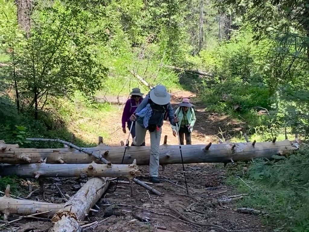
We ate lunch in the meadow, then back out to the main road, then to 5S12X. Just before we were getting ready to work our way around a down tree at the intersection, one of my hiking buddies spotted a clump of snow plants.

We had a few down trees to walk around or over. They were a piece of cake compared with some areas that I have traveled this year.

Photo by Betsy Blum
We tied in with N-6S24/Worman Road which led me back to my car. People activity is picking up in this area although I didn’t see anyone on my walk. I like to hit the trail early so that is probably one big reason. But I have heard that on the weekends it can be kind of crazy with people on motorcycles and 4 wheelers.
There are many roads and trails to explore in this area and many don’t show up on Topographic Maps. CALTOPO or using a download to the Avenza Map APP are the best that I have found. Links are below the Maps and Profile section toward the end. Other than when I was at my car, I didn’t see anyone on this hike but it does get use from motorcycles, 4 wheelers, bikes, horses and hikers. I suggest you be prepared because the motorcycles can fly by in an instant but you can hear them coming. I try and avoid the weekends in this area for that reason.
Dog Hike? Maybe
This could be a good dog hike if your dog is a good fit. The road is lightly traveled by vehicles so you would need to keep an eye open for a vehicle coming around one of the curves. In the summer you could run into a rattlesnake out here also. This is mountain lion country, along with other wildlife that you could encounter. There were a couple of areas with running water on my hike but it can dry up in summer, so you would probably need to pack dog water.
Doarama:
What is a Doarama? It is a video playback of the GPS track overlaid on a 3 dimensional interactive map. If you “grab” the map, you can tilt it or spin it and look at it from different viewing angles. With the rabbit and turtle buttons, you can also speed it up, slow it down or pause it.
Sunny Meadows to O’Neal’s Meadow Loop
Maps and Profile:
CALTOPO has some free options for mapping and here is a link to my hike this week, which you can view or download: CALTOPO: Worman’s Mill to Sonny Meadows and O’Neil Meadows Loop
A great interactive mapping source for these roads can be found at Sierra National Forest ORV Maps where you can download the Off Road Vehicle Maps to follow the roads and trails. Downloading them to the Avenza Map App from that site, you can even track your adventure to share with others or just save.
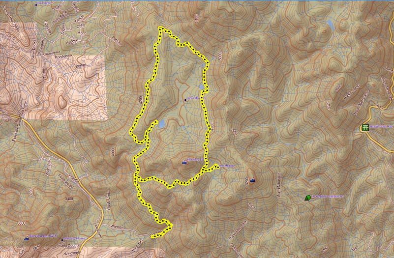
Worman’s Mill to Sonny Meadows and O’Neil Meadow Loop Topographic Map

Worman’s Mill to Sonny Meadows and O’Neil Meadow Loop Google Earth Image

Worman’s Mill to Sonny Meadows and O’Neil Meadow Loop Profile
Sources:
Dubel, Zelda Garey, To Yosemite by Stage, Zulu.com, Third Edition, 2011.
Wawona’s Yesterdays (1961) by Shirley Sargent
Samuel Lane Hogan Find a Grave
Rare brochure for Yosemite Stage Co. 1900
Rules and Regulations Yosemite National Park, United States National Park Service, 1925
Sierra National Forest ORV Maps
John R Hite Will Proceedings Court Listener
Signal Peak (Devil’s Peak) Lookout
Prior Blogs in this Area:
Walking up a Dirt Road: Westfall Picnic Area up Miami Mountain Road April 27, 2021
Walking Up a Dirt Road: Worman’s Mill to 4S04 Miami Creek Headwaters April 20, 2021
Walking Up a Dirt Road: Worman’s Mill to 6S09B Above Old Miami Mills January 17, 2021
Walking up a Dirt Road: Westfall Picnic Area up Miami Mtn Road June 2, 2020
Walking up a Dirt Road: Worman’s Mill Loop Along Sunny and O’Neals Meadows May 20, 2020
Walking up a Dirt Road: Worman’s Mill to O’Neals Meadow Loop May 5, 2020
Walking up a Dirt Road: Worman’s Mill to the Lone Sequoia April 28, 2020
Walking up a Dirt Road: Worman’s Mill to Pilot Peak April 22, 2020
Walking up a Dirt Road: Worman’s Mill to O’Neals Meadow April 15, 2020
Walking up a Dirt Road: Worman’s Mill to Sunny Meadows April 10, 2020
Walking up a Dirt Road: Worman’s Mill and Beyond March 31, 2020


