Have you ever snowshoed into Tuolumne Grove of Giant Sequoias? This was one adventure I had not experienced until this week. Tuolumne Grove was one of the big stops that early travelers made on their way to Yosemite. In the 1870’s, they left Hodgdon’s Stage Station, then headed up through these huge trees, even driving through one of the dead Giant Sequoias with their horses and wagons! I had my own special moment with that same dead Giant Sequoia on this adventure.
Where: Yosemite National Park
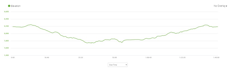
Distance: 2.87 but you can go farther
Difficulty: Moderate
Elevation Range: 5,737’ – 6,247’
Date: February 16, 2021
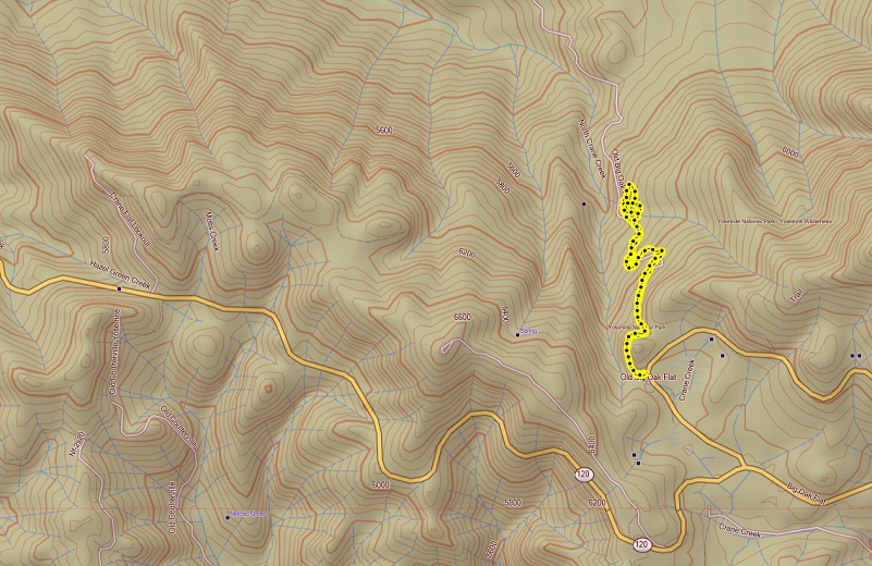
CALTOPO: Snowshoeing to Tuolumne Grove
Dog Hike? No
I headed up Hwy 140 to Big Oak Flat Road, at Crane Flat Gas Station, turned east at the intersection of Tioga Road, driving about a half of a mile to the Tuolumne Grove parking lot on the left side of the road. It was 28 degrees and only 1 other car was in the parking lot, besides the maintenance people cleaning the toilets. I had arrived earlier in the day to beat the crowd and there definitely was one when I returned from my adventure to my car. This is one of those places where it can get a bit crowded but if you plan, get there early, leave early, you can have a quite enjoyable day.
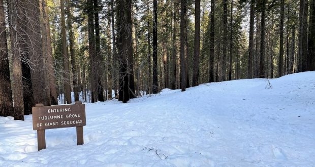
There are only 75 natural groves of Giant Sequoias and they are only found on the western slopes of the Sierra Nevada in Central California. Tuolumne Grove is a small grove of about 25 large Giant Sequoias, covering some 20 acres. The Trailhead begins on the north side of the parking area, is well marked and that is where I put on my snowshoes.
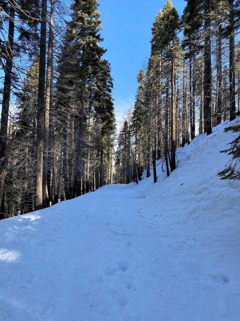
The trail is actually on a paved road but did you know that this is actually the Old Big Oak Flat Road?
The Big Oak Flat Road was the second wagon road to enter Yosemite Valley. Although relocated for most of its distance through the park, the route (now California Highway 120) remains the most important entrance to Yosemite from the north. Built as a toll road in a race to provide the first road to the Valley, the route carried the majority of park traffic from central and northern California before the completion of the Yosemite Valley Rail Road and the All Year Highway [HAER No. CA-150]. Most of the original route has been abandoned, although several short stretches remain open as scenic drives or service roads.
The route had its origins in a pack trail, called the “Big Oak Flat Trail,” after the early California mining community of Big Oak Flat in Tuolumne County through which it passed. About 1857, Tom McGee, a pack operator and saloonkeeper in that community, reopened the western portion of the old trans-Sierran Mono Indian trail which crossed the Sierra divide to the east. McGee’s portion connected Big Oak Flat via the South Fork of the Tuolumne River with the Coulterville route at Crane Flat. This route received less use than a roughly-parallel free trail from Coulterville which opened at about the same time. The Big Oak Flat Trail did, however, draw a number of visitors from Stockton, to which it was conveniently situated. Yosemite-bound tourists took the Coulterville Trail on to the Valley from Crane Flat. McGee’s trail continued on towards the mines to the east, leaving the shared route at Tamarack Flat.
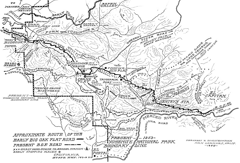
Approximate Route of Big Oak Flat Road (The Big Oak Flat Road (1955) by Irene D. Paden and Margaret E. Schlichtmann)
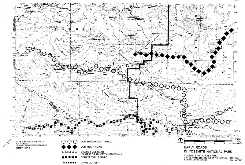
Early Roads in Yosemite National Park (Yosemite: the Park and its Resources (1987) by Linda W. Greene)
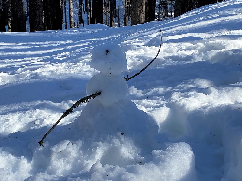
If you continue down to Hodgdon Meadow, you will be following the Old Oak Flat Road and that meadow is where the Hodgdon’s Stage Station was located back in the day. I hadn’t gone too far down the trail when I spotted this small, creative snowman.
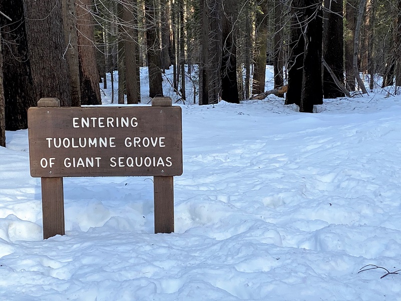
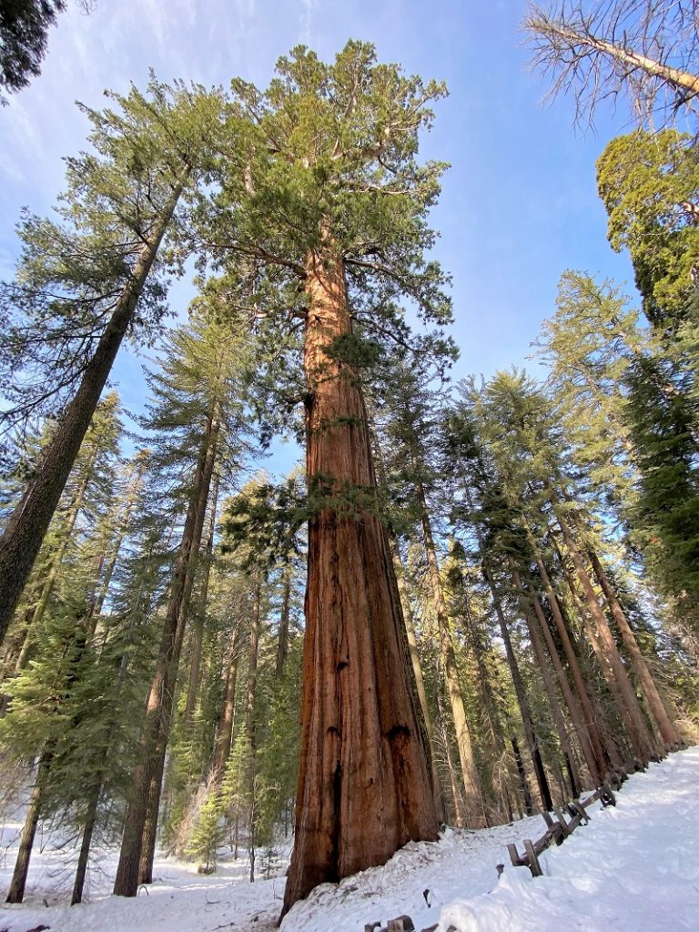
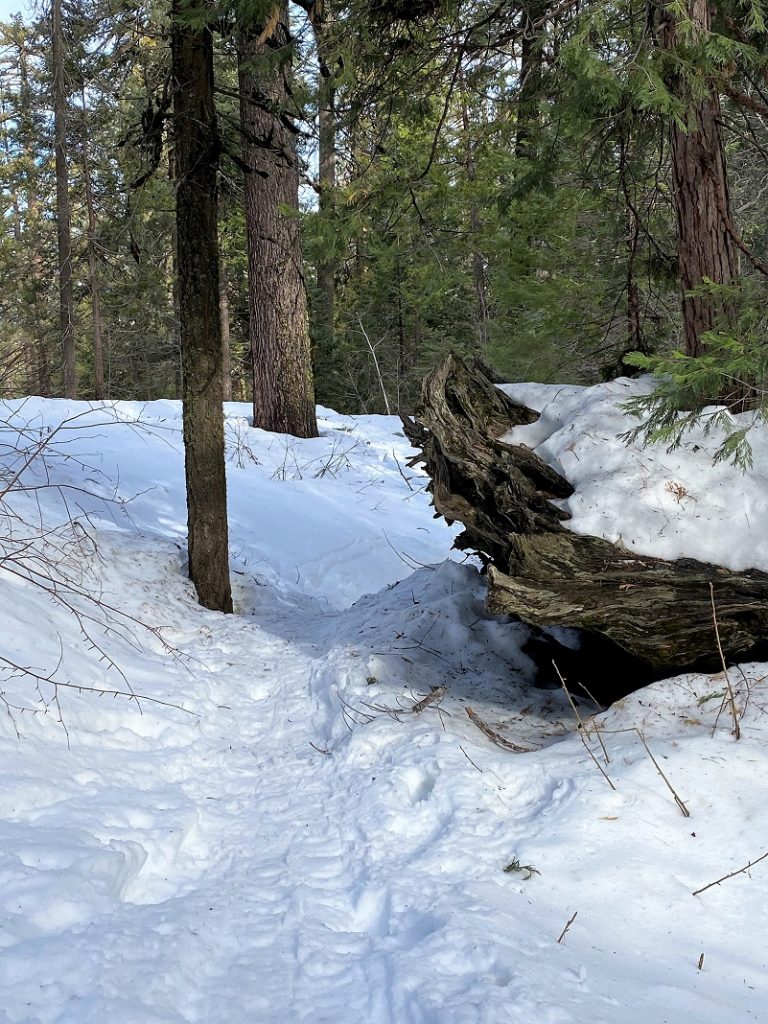
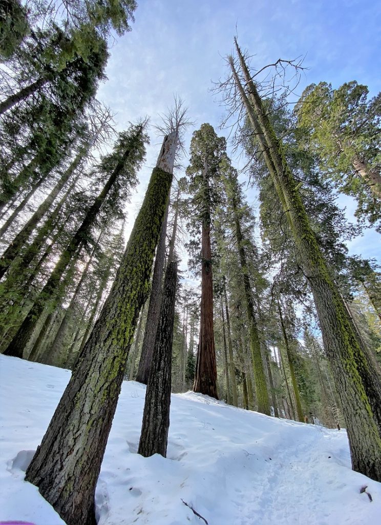
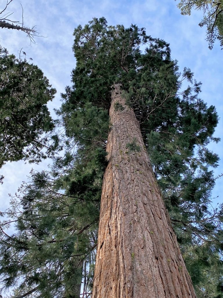
Soon I officially entered Tuolumne Grove of Giant Sequoias where the road led me along some huge trees. Pictures do not treat these Giant Sequoias properly and I don’t think you can really appreciate their size unless you are standing near one.

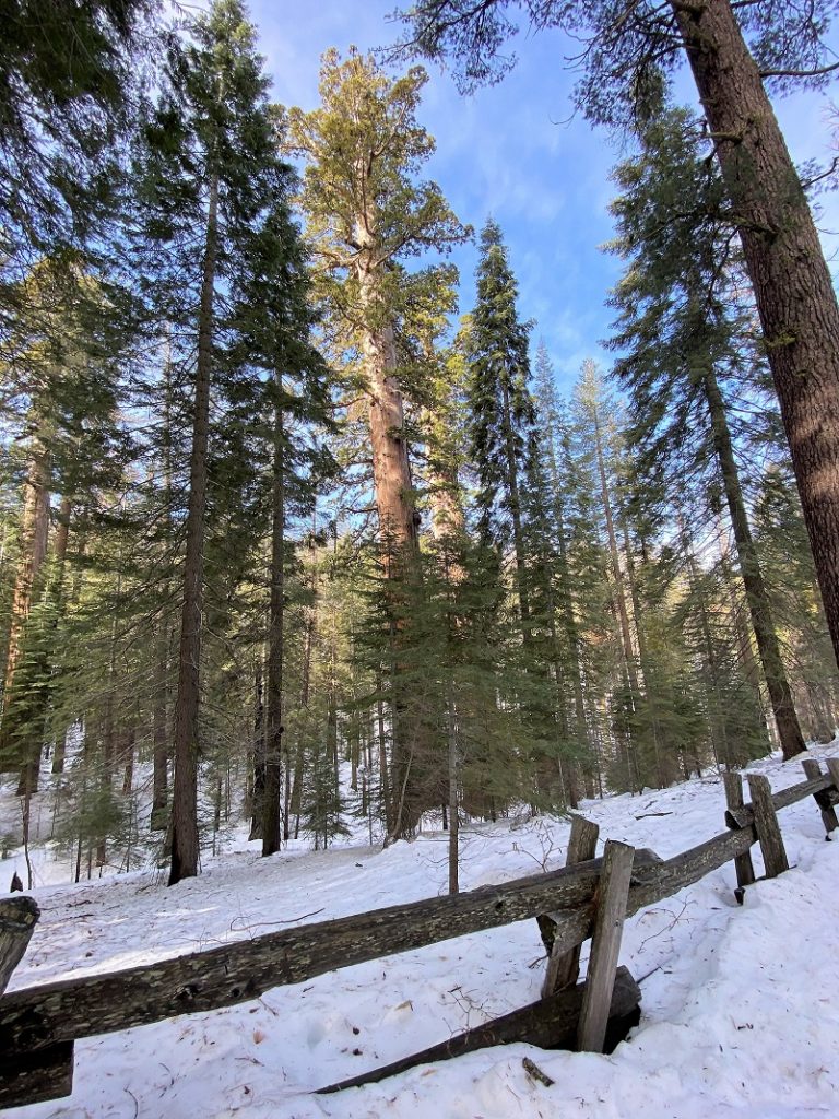

Signs led the way to a short loop.
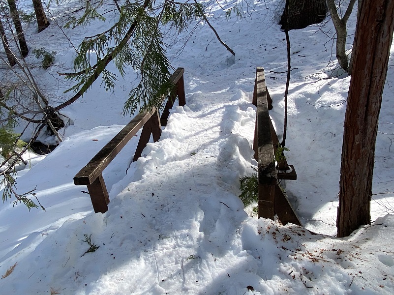
The trail was a winding trail that led across snow covered bridges.
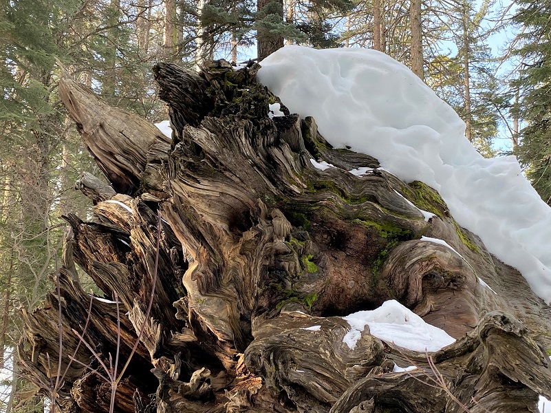
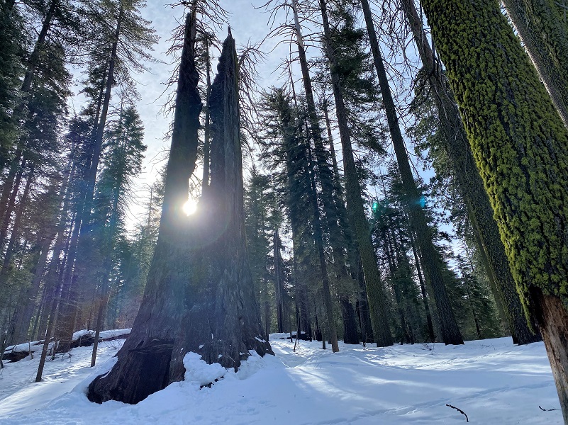
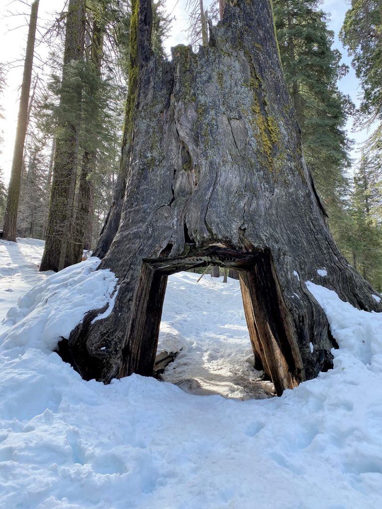
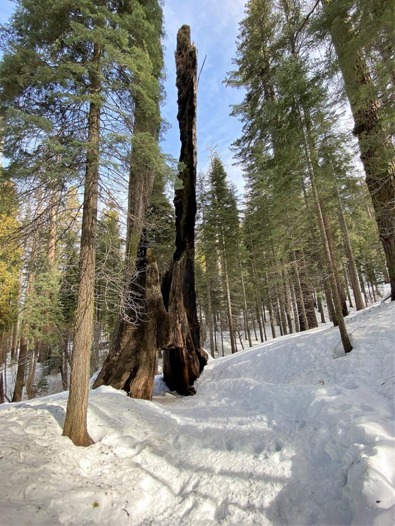
And then I took the short trail to the Dead Giant aka Tunnel Tree, which is 29 1/2 feet in diameter at the base. In 1878 a tunnel was cut through the Dead Giant so that a road then in use passed through it. The Big Oak Flat Road by Irene D. Paden and Margaret E. Schlichtmann described what the Tunnel Tree looked like to visitors in 1892:
The tree was charred into a black mass at the bottom where a large cavity had been used for years by the Indians as a shelter in which to build their fires and to cook. Lightning and forest fire had done their worst; two cathedral-like spires, shattered and scorched, topped the mighty trunk but the heart-wood was sound. This is attested by John V. Ferretti. As a boy of nine he went on the job with his father who supplied the team. He remembers a slab of wood weighing about one-half ton which was brought down to Priest’s Hotel and made fast to one of the locust trees as a souvenir. The tree tunnel was completed in ’78 and a branch of the road curved out to pass through the strange archway just as it does today.
Mr. P. Andersen traveled to Yosemite in a spring wagon in 1892. He wrote a description of his journey in Danish and sent it to his uncle in Denmark where it was published in a current magazine but never translated until a few years ago. “These trees are not small at all,” he wrote. “Just think, we drove through one of them. This tree is 31 feet in diameter. It may make you think of the women in Copenhagen who jumped over the Round Tower. But this has to be literal when I say we drove through this giant tree with horse and wagon. The tree is dead and burned at the top. About 200 feet of the trunk is still standing and the road goes right through the base of it.”
The archway in 1894 was ten feet wide by twelve in height.
What a treat to see the morning sun coming up through the two dead spires of the Tunnel Tree!
And of course, I needed to take a selfie of me with those sunbeams and the Tunnel Tree.

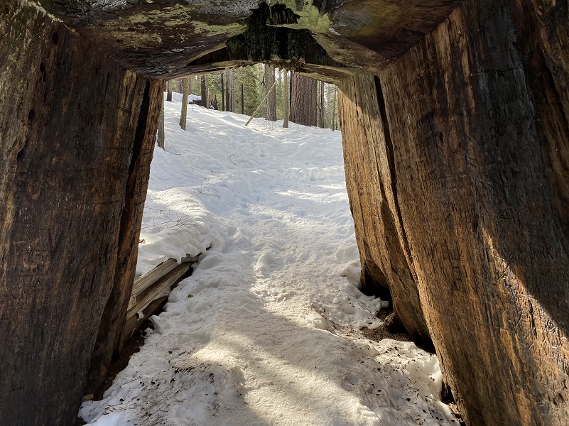
I continued on the trail and through the Tunnel Tree.
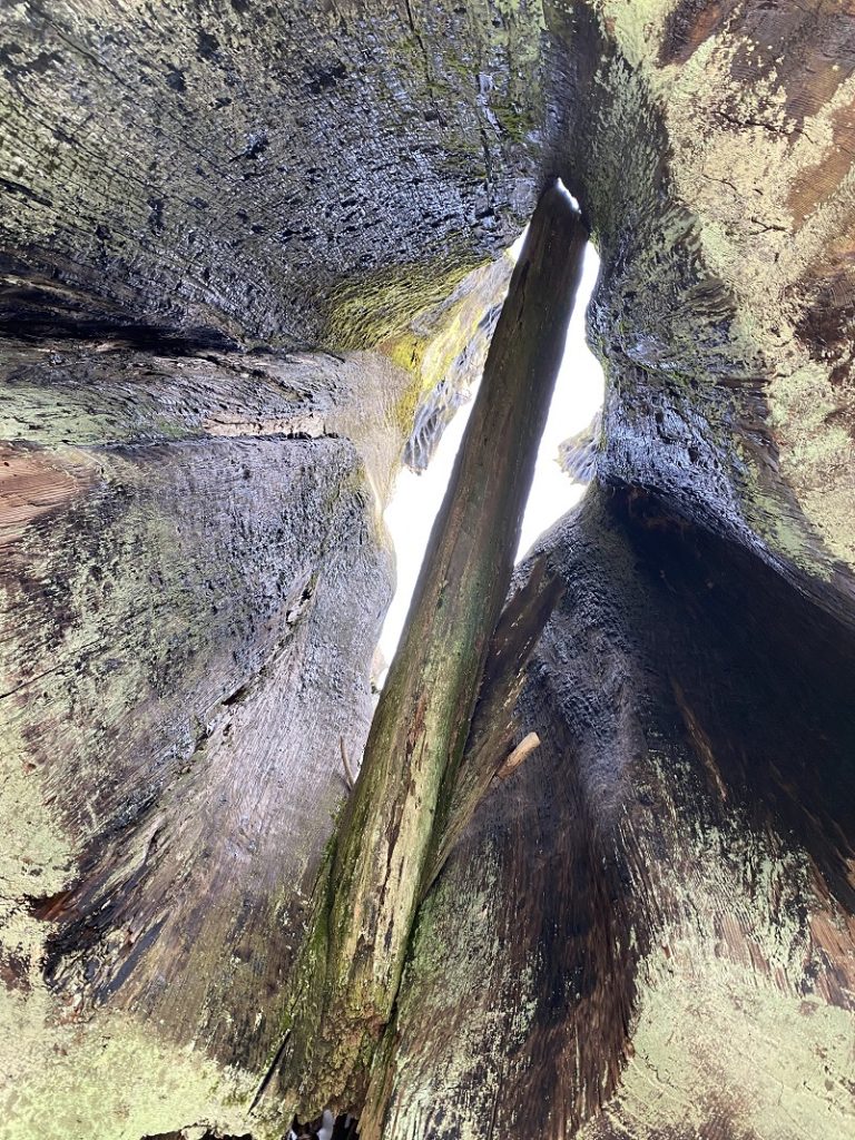
Looking up through the middle of the Tunnel Tree.
And looking back at the Tunnel Tree.
And as I wound my way on the trail back to the main trail, one last Giant Sequoia.
I can’t believe I had the Tuolumne Grove all to myself. That just does not happen and I credit my luck to being there early. This hike is a popular one and there always folks visiting it. This hike is not one of those lonesome hikes amongst the tall trees but if you haven’t been, or haven’t been in a long time, it might be worth your while. With the Mariposa Grove closed and Nelder Grove hard to access right now, it can be a good place to take visitors to see the tall trees and get a picture taken by the Dead Giant tree. Remember, that you are walking down from the parking lot, losing about 400 feet of elevation, and you will need to walk back all of that to get back to the parking lot. If you want a better workout, consider starting from Hodgdon’s Meadow or continuing down there for a 11 mile-ish hike. Also, it is totally doable to visit Merced and Tuolumne Groves in one day so that is an idea for you to try out.
If you want to visit other Giant Sequoia Groves, don’t forget about Nelder Grove, just outside of Yosemite but close by out of Oakhurst off of Sky Ranch Road.
Dog Hike? No
Dogs are not allowed on the Merced Grove Trail.
Where Pets Are Not Allowed
- On trails, including the trail to Vernal Fall (however, pets are allowed on the Wawona Meadow Loop)
- On unplowed roads covered in snow
- In undeveloped and wilderness areas
- In public buildings
- On shuttle buses
- In lodging areas
- In all walk-in and group campgrounds/campsites, including Camp 4
- In any other areas, as signed
These regulations protect both pets and wildlife from disease and each other. The National Park Service has prohibited pets on trails for many years. In particular, some pets chase wildlife, pollute water sources, and can become defensive and dangerous in unfamiliar surroundings. Pet owners have the burden to assure their pet does not damage the park values for others in those areas where pets are allowed.
Doarama:
What is a Doarama? It is a video playback of the GPS track overlaid on a 3 dimensional interactive map. If you “grab” the map, you can tilt it or spin it and look at it from different viewing angles. With the rabbit and turtle buttons, you can also speed it up, slow it down or pause it.
Snowshoeing to Tuolumne Grove Doarama
Maps and Profile:
CALTOPO has some free options for mapping and here is a link to my hike this week: CALTOPO: Snowshoeing to Tuolumne Grove
Sources:
Tuolumne Grove of Giant Sequoias Yosemite National Park
Giant Sequoias Yosemite National Park
Tuolumne Grove and Nature Trail
History of Big Oak Flat Road Wikipedia
The Big Oak Flat Road (1955) by Irene D. Paden and Margaret E. Schlichtmann
Browning, Peter, Yosemite Place Names: The History of Geographic Names in Yosemite National Park
Hartesveldt, Richard J., Yosemite Valley Place Names (1955)
Big Oak Flat Road (HAER No. CA-147) Written Historical and Descriptive Data Wikipedia
The Big Oak Flat Road (1955) by Irene D. Paden and Margaret E. Schlichtmann
Hodgdon Homestead Cabin National Register of Historic Places in Mariposa County
Yosemite: the Park and its Resources (1987) by Linda W. Greene
“Does it Pay to Visit Yo Semite?” (1870) by Olive Logan
Prior Blogs in this Area:
Hiking Through Snowy Merced Grove November 11, 2020
Hiking to Tuolumne Grove on the Old Big Oak Flat Road November 6, 2017
Hiking To Merced Grove and Beyond On The Old Coulterville Road November 6, 2017

