SIERRA NATIONAL FOREST – The Rough Fire continues to smother the Central Sierra in thick smoke, causing at least one false alarm for local firefighters this morning as a fire was called in on Road 224 in North Fork. After making contact with the person reporting the fire, crews determined that the smoke from the Rough Fire was the cause of the alarm.
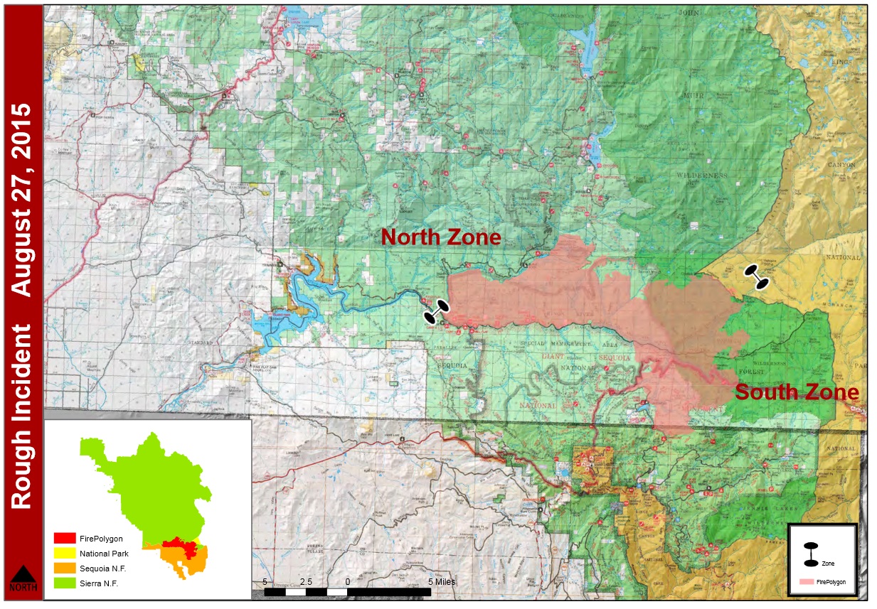
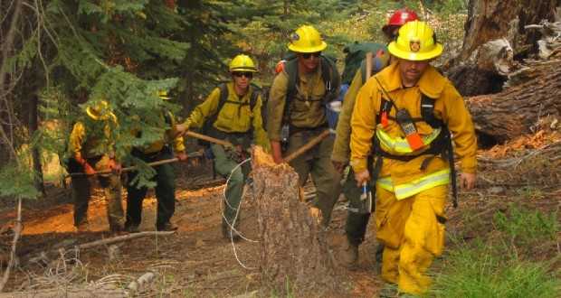
The Rough Fire is currently 60,238 acres with 25% containment. There are 2,033 personnel currently assigned to the incident, including 35 crews, 149 engines and 12 helicopters.
As a precaution, this morning at 10 a.m., there was an evacuation warning issued by the Fresno County Sheriff’s office for the areas of Wishon, alerting community members of the potential threat to life and property. An evacuation warning may be issued when the potential or actual threat to civilian to civilian life is more than two hours away. The warning is part of a planned firing operation in the Wishon area as crews tie fireline together in the effort of overall containment.
Firing operations will take place south of the Wishon Reservoir along the Crown Valley Trail today. Resources available for structure protection include hand crews, engines, water tenders and dozers.
Beginning at 10 a.m. this morning, the employees and families of PG&E will be allowed to re-populate the Balch Camp Facility, but there remains a tremendous amount of work prior to re-energizing the entire system, including cleaning insulators and cleaning fire retardant off of power poles.
Crews picked up a few spot fires along the Crown Valley dozer line. Structures were prepped and plumbed with hoses and indirect lines established for firing operations.
Contingency lines have progressed to the north and tied into Fence Meadow and are progressing to Ross Crossing. Fire in the Kennedy Grove area, southeast of Hume Lake, continues to move southeast in a slow to moderate rate of speed with short-range spotting. Fuels and topography to the east become more broken, which will cause the rate of speed to slow.
 Fire will continue to spread west from Highway 180 toward Converse Basin. Rapid rates of spread are expected in the drainage bottoms along the King River. These runs are expected to stall as they reach the ridge anchored by Converse Peak. The fire is not expected to progress southwest of Converse Peak.
With slight changes in weather patterns, expect to see heavy concentrations of smoke in the western foothills and areas within the Kings River Canyon until mid-afternoon. This evening smoke will once again settle into the Kings River Valley, bringing smoke into the western foothills and the San Joaquin Valley overnight.
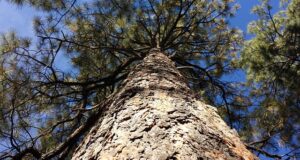
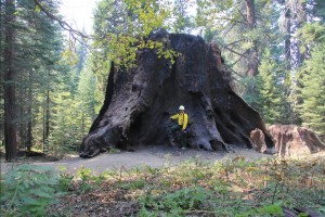 Fire crews are coordinating closely with agency resource advisors to protect natural and cultural resources at risk in Converse Basin. Approximately 12,000 feet of hose has been placed to protect the Boole Tree, Chicago Stump and sensitive wildlife habitats in that area.
Relics of both prehistoric and historic use remain in the grove, and all these items are protected by law and must remain in the woods. The oldest verified sequoia stump is in Converse Basin Grove and is just over 3,200 years old.
The Chicago Stump was originally known as the General Noble Tree. In 1897, it was cut down into sections and reassembled at the Chicago World’s Fair. This magnificent display was referred to as the “California Hoax,” because of widespread skepticism that a species as big as the giant sequoia ever existed.
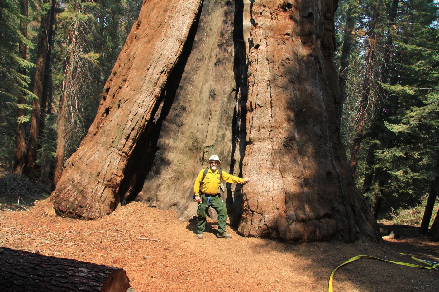 The Boole Tree is a giant sequoia in Converse Basin grove in Sequoia National Forest, in the edge of Kings Canyon, 5 miles (8 km) from Grant Grove in Kings Canyon National Park in the Sierra Nevada in eastern California. Converse Basin used to be a large grove, but was logged of most of its giant sequoias between 1892 and 1918.
Due to current fire conditions, fire closures and/or restrictions on public lands are expected for the 2015 hunting season. If you plan to hunt on U. S. Forest Service lands this year, it is important to monitor the individual forest’s websites for updates on forest closures and contact the California Department of Fish and Wildlife.
With the weekend approaching, it is expected that the number of visitors in the park will increase significantly. It is important to remember that public and firefighter safety is the first priority. Please drive with extreme caution as there is a significant amount of large, heavy equipment moving around there area. Drive with your lights on to make yourself more visible, especially in the morning and evening hours. Remember to wear your seatbelts at all times. Do not drive while talking or texting on your cell phone. Distracted driving is a leading cause of accidents.
- Sierra National Forest issued a closure order for the Rough Fire area.
- The Hume Lake Ranger District, Jenny Lakes Wilderness and Monarch Wilderness, including Forest Road 12S01, 12S01E, and 12S19 in the Sequoia Highlands area of the Sequoia National Forest remain closed.
- McKinley Grove Rd. (11S40) is closed at Wishon Dam, including the 11S07.
- 10S24 is closed from the intersection of 11S91 to where it meets 11S40 at Buck Meadow.
- 11S12 Rd. (Salt Flat Rd.) is closed at McKinley Grove Rd.
- Trimmer Springs Road at Kirch Flat.
All campgrounds in Kings Canyon National Park are now closed until further notice.
The Kings Canyon Visitor Center will be open with modified hours: 10 a.m. to 5 p.m.
The lightning-caused Rough Fire started on July 31, and is burning in the Kings River Drainage, 5 miles North of Hume Lake and 2.5 miles southwest of Spanish Mountain.
The fire is being managed on the Sierra National Forest, Sequoia National Forest, and Sequoia & Kings Canyon National Parks.
Fire Restrictions: are in place for the Sierra National Forest. Campfires are only allowed in designated developed recreation sites. No campfires are allowed within the Sequoia National Monument.