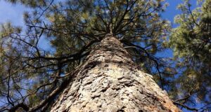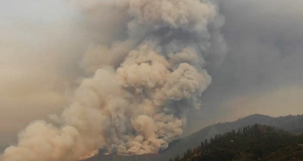
SIERRA NATIONAL FOREST – The Rough Fire, burning near Hume Lake, is now 30,901 acres with 3 percent containment. Though it is some 50 miles southeast of Eastern Madera County and the Central Sierra, the area continues to be impacted by heavy smoke, especially during the morning hours.
On Tuesday afternoon the Rough Fire spotted across the South Fork of the Kings River and crossed Highway 180 in the area of Horseshoe
Bend, and became established in the Lockwood Creek Drainage. As a result of the fire crossing the river, the pre-planned evacuation of the Hume Lake area was implemented.
Over 2,500 campers, hikers, employees and residents were notified and safely evacuated from Hume Lake Christian Camp, private cabins,
campgrounds, and the surrounding area in just over 2 ½ hours.
Agencies and cooperators have been working together since the fire began on July 31, looking at various fire scenarios. As the fire reaches certain areas, actions are implemented to keep the public safe. Last week, the decision was made to close Highway 180 and the Cedar Grove area. When the fire crossed the highway yesterday, the evacuation of Hume Lake was implemented.
Because of this pre-planning and collaboration by the Sierra National Forest, Sequoia National Forest, Sequoia & Kings Canyon National Parks, California Highway Patrol, Fresno County Sheriff, Pacific Gas & Electric, Hume Lake Christian Camps and others, everyone evacuated in a timely, orderly and safe fashion, according to the National Park Service.
The California Highway Patrol and Caltrans have also moved the road closure, which had been located at the intersection of Highway 180 and Hume Lake Road. Highway 180 is now closed just north of Grant Tree Road. The General Grant Tree and the Grant Grove area of Kings Canyon National Park are open.
Successful pre-planning on the part of the residents of Hume Lake was helped by the Ready, Set, Go! Program that encourages homeowners to be Ready before a fire occurs, Set as the fire approaches, and Go by acting early. For more information on the Ready, Set, Go! Program visit http://www.wildlandfirersg.org/
Dangerous conditions and rugged terrain have prevented firefighters from attacking the fire with direct line, and they have been establishing lines away from the edges of the fire, and doing burnouts to widen and strengthen those lines, removing fuel inside the perimeter. Some of the smoke is being attributed to those firing operations.
There are currently 1,141 personnel assigned to the incident, including 23 crews, 27 engines and 5 helicopters.
Closures & Advisories:
• Sequoia & Kings Canyon National Parks issued a closure of the Cedar Grove area.
• Sierra National Forest issued a closure order for the Rough Fire Area.
• Sequoia National Forest issued a closure order for the Hume Lake and Monarch Wilderness.
• Black Rock Campground and Forest Road 11S12 (also called Black Rock Road) is closed between Balch Camp and Sawmill Flat.
• The Hume Lake area is closed, as is Highway 180 beyond Grant Tree Road.
The lightning-caused Rough Fire, which started on July 31, is burning in the Kings River Drainage, 5 miles North of Hume Lake and 2.5 miles southwest of Spanish Mountain. It is being managed by the South Central Sierra Interagency Incident Management Team, under the leadership of Bass Lake Ranger District Fire Management Officer David Cooper. This is the same team that handled the Sky Fire, the French Fire, and the Willow Fire.
Fire restrictions are in place for the Sierra National Forest. Campfires are only allowed in designated developed recreation sites. No campfires are allowed within the Sequoia National Forest and Giant Sequoia National Monument.