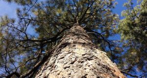
SIERRA NATIONAL FOREST – Smoke from the Rough Fire continues to impact the Central Sierra, and has now grown to 51,794 acres with 17 percent containment.
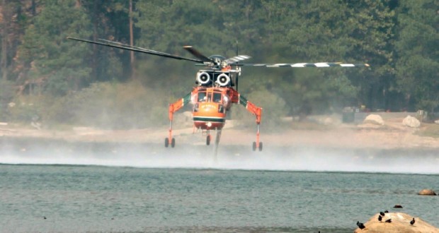
There are currently 1,984 personnel assigned to the incident, including 24 crews, 138 engines and 10 helicopters.
With slight changes in weather patterns, expect to see heavy concentrations of smoke in the western foothills and areas within the Kings River Canyon until mid-afternoon. Owens Valley will see good air quality for most of the day, changing to moderate in the afternoon and evening. This evening smoke will once again settle into portions of the Kings River Valley, bringing smoke into the western foothills and the San Joaquin Valley overnight.
There will be a community meeting regarding the Rough Fire on Wednesday, Aug. 26, at 6:30 p.m. at Dunlap School, 39667 Dunlap Road. The meeting will be hosted by California Interagency Incident Management Team 3. Incident Commander Mark von Tillow will discuss the current fire situation and the operational plan for the Rough Fire.
There will also be remarks by the local fire and law enforcement authorities, Sierra and Sequioa National Forests, Giant Sequoia National Monument, Sequoia Kings Canyon National Parks representatives. An open forum for questions from the public will follow.
All campgrounds in Kings Canyon National Park are now closed until further notice. The Kings Canyon Visitor Center will be open with modified hours: 10 a.m. to 5 p.m. The General Grant Tree, Panoramic Point, park trails, John Muir Lodge, Grant Grove Cabins, restaurant, market, and gift shop are open.
With the increased number of emergency equipment in the Squaw Valley Area combined with normal visitor travel, it is extremely important for everyone to have a heightened level of awareness behind the wheel. Please be extremely careful while driving.
The suppression strategy for the Rough Fire will utilize a combination of direct, indirect and point protection. A key element of the plan is flexibility and the ability to apply the right resource, to the right task, at the right time, for the right duration. It is understood fireline will be constructed only where it is feasible and safe to do so. The Incident Commanders and their staff are working with the Agency Administrators to ensure the plan is regularly reviewed and updated.
On the northwest portion of the fire, crews are working to protect the Pacific Gas and Electric infrastructure in the Balch camp area. The Fresno County Sheriff’s Office has issued evacuation warning notices to residents in the area of Sequoia Highlands. These homes are located northeast of Dunlap in small communities known as Crabtree, Sampson Flat, Davis Flat and Clover Meadows. The Sheriff’s Office wants to alert residents that they should be prepared to leave at a moment’s notice. As fire conditions change all efforts will be made to inform the public.
The rugged terrain of Southern California’s Rough Fire provides numerous hazards for wildland fire fighters. Steep mountains, rolling rocks, and hazard trees make for a dangerous job among the already treacherous risk involved on a fire. The need for medical personnel has become a higher priority on wild land fires. A Rapid Extraction Module (REM) is currently assigned to the Rough Fire to provide a safe, effective, and efficient way to get an injured fire fighter out of rugged areas that the fire may enter. Air and ground resources are not always a reliable option for emergency transportation due to access, smoke, or weather conditions. The REM is assigned to be available in close proximity to high risk areas of the fire, where quick extraction is needed. They are made up of approximately six Emergency Medical Technicians who are cross trained in low angle rope rescue, and wildland firefighting.
The Rough Fire is using two helibases on the incident – one in Dunlap in the Southern Zone and one in Auberry in the Northern Zone to ensure rapid support of crews when the inversion layers lift.
The Rough Fire began July 31. On Tuesday, Aug. 18, the Rough Fire spotted across the South Fork of the Kings River and crossed Highway 180 in the area of Horseshoe Bend and became established in the Lockwood Creek Drainage. As a result of the fire crossing the river, the pre-planned evacuation of the Hume Lake area was implemented. Over 2,500 campers, hikers, employees, and residents were notified and safely evacuated from Hume Lake Christian Camp, private cabins, campgrounds, and the surrounding area in just over 2 ½ hours.
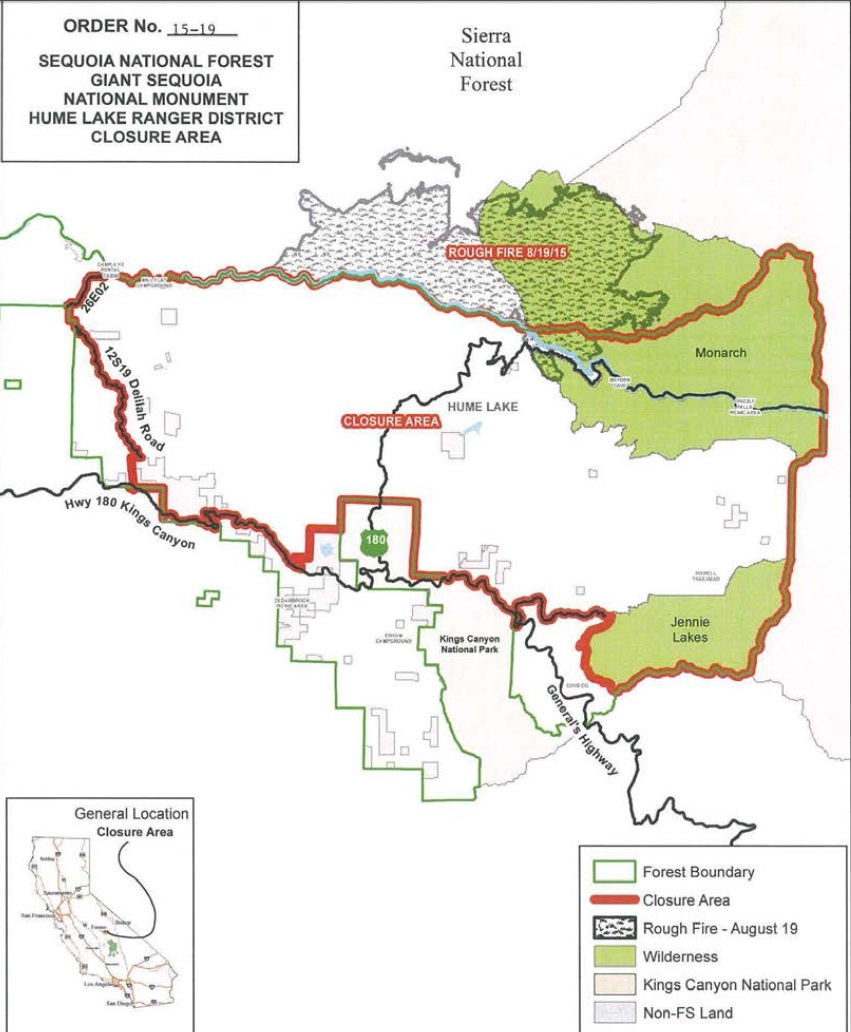
As the fire spread, existing closure orders were expanded to include almost the entire Hume Lake Ranger District. The current closure is defined in Forest Order 15-19, which closes these areas for public safety (see map below):
- Most of the Hume Lake Ranger District from Delilah Road.
- On the west to Jennie Lakes and Monarch Wildernesses to the east.
- From Highway 180 in the south to the Forest boundary to the north.
- Sequoia & Kings Canyon National Parks issued a closure of the Cedar Grove area and the Grant Grove area.
Other Closures:
• Sierra National Forest issued a closure order for the Rough Fire Area.
• Black Rock Campground and Forest Road 11S12 (also called Black Rock Road) is closed between Balch Camp and McKinley Road.
• Sequoia National Forest issued a closure order for the Hume Lake Ranger District, Jenny Lakes Wilderness and Monarch Wilderness, including Forest Road 12S01, 12S01E, and 12S19 in the Sequoia Highlands area.
• The Hume Lake recreation area is closed, as is Highway 180 beyond the junction of Highway 198 (Generals Highway).
No campfires are allowed within the Sequoia National Forest and Giant Sequoia National Monument.
California is in the midst of fire season. Ensure that you follow local fire restrictions, remain mindful of fire prevention, and maintain required defensible space around your home. In addition, have a plan following the Ready, Set, Go! program to evacuate should the need arise this season. To find out more about what you can do to prevent human caused, unwanted wildfires, please go to www.preventwildfireca.org
When disaster strikes, the same rules that apply to people apply to pets: Preparation makes all the difference, and if it’s not safe for you, it’s not safe for them.
While there has been no drone activity on the Rough Fire, drones interfere with firefighting efforts. The Federal Aviation Administration (FAA) has issued a Temporary Flight Restriction (TFR) that is in effect and any private aircraft or drone that violates the TFR could face serious criminal charges. Even without a TFR, anyone who hampers firefighting efforts could face charges as well. For more information on drones the public can visit the FAA’s website at www.KnowBeforeYouFly.org. “If you fly, we can’t!”