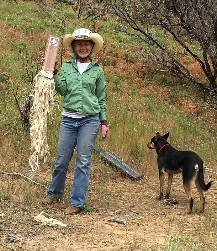
Cathy Miller with melted sign (Mary Odell)
Written by Mary Odell —
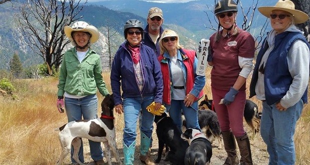
SIERRA NATIONAL FOREST — Members of the Sierra Freepackers were asked last year by the Bass Lake Ranger District of the US Forest Service to aid in the restoration of the historic French Trail. The French Trail was burned out in the course of the French Fire during the summer of 2014.
“TRAIL HISTORY: What is now called the French Trail began thousands of years ago. The trail follows natural river canyon terrain founded and used for thousands of years by the Mono people. Because of the route’s low elevation and western exposure, for most of the winter and within eight miles of the Sierra Nevada crest, it is below the heavy snow line. The Mono regularly used this trail to access the east side of the Sierra, for gatherings, spiritual walks, learning, visiting friends and relatives and to trade for items like obsidian, pinion pine nuts, baskets, games and songs. In recent history the route was to be the foundation for a Euro American wagon road. In 1879, John French began developing the already well established Native American trade route through the mountains.” Sierra National Forest
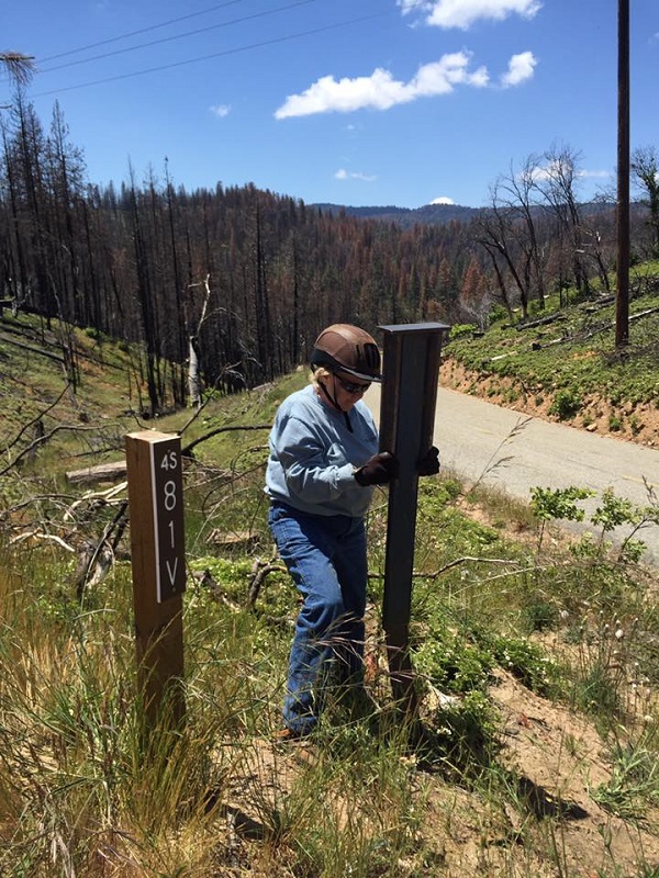
Linda Sadler installing sign (Mary Odell)
Last October we reconned and flagged a bit of the trail as we found it. Work for the spring was noted: replacing melted trail signs, along with downed trees and brush to be cleared. We studied various maps for the exact trail location, with starting and stopping points and places to park our rigs.
In May we gathered new signs and tools to get to work. Our first day started at the Power House 8 Road located on the Scenic Byway 81/Minarets Road (Road 200 off of Highway 41). Brush was cleared, the trail was found and marked, and trees were cleared. Working throughout May, we completed re-marking the section of the French Trail from the Power House 8 Road to the S81V.
The next section proceeds through the burn area and required a GPS to determine exactly where the trail goes. Our unit will continue to work and restore this trail as the area recovers from the fire. Oaks are sending out shoots, and bear clover and wild flowers have appeared in abundance.
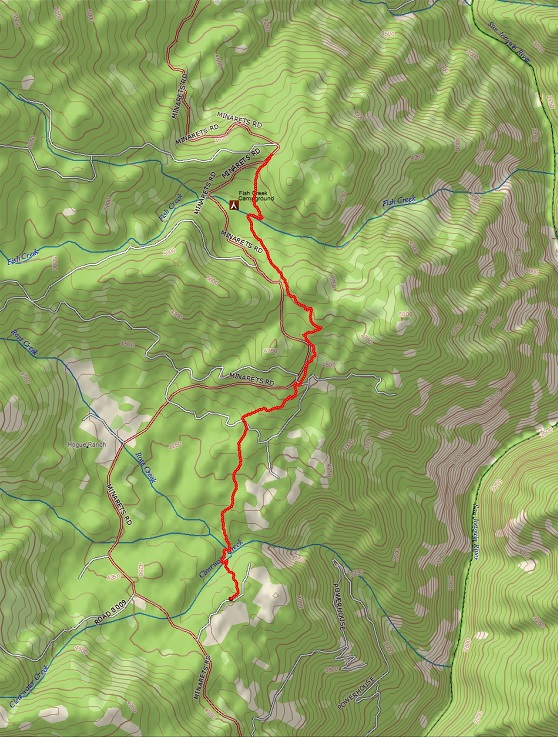
French Trail Map GPS reading of part of the trail from 4S81R to4S81V (sent by David Howse) http://www.delorme.com/
This is a beautiful trail with outstanding views of the San Joaquin River Gorge. This section of trail is located between 3,000 to about 4,000 feet. Eventually the trail will be connected with the San Joaquin River Gorge Trail, which starts at Highway 99, and will go over to the east side of the Sierra via Granite Creek to Reds Meadow.
Mary Odell is a member of Sierra Freepackers.
For more information, visit the website http://sierrafreepackers.com/

