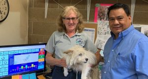
MADERA COUNTY, CA. – After thirty years of working at Madera Animal Services, Cindy Avila was promoted to director in July of 2020. Among her many goals was to make operations more efficient. She began to envision an online tool for animal control officers which highlighted which areas had the highest number of strays being picked up, loose dog calls ...
Read More »Search Results for: ACT Dog of the week
Camping With Horses at Utah’s Capitol Reef National Park
It had been a year and a half since I had a weeklong horseback adventure and it was time for a road trip to south central Utah, horse camping at Capitol Reef National Park. I recently received the sad news that the horse camping outfit called Hondoo Rivers & Trails would be having its final season this year. I had ...
Read More »Walking up a Dirt Road: Worman’s Mill, Sunny Meadows to O’Neal’s Meadow Loop
Whose footsteps did I walk in this week? I sure didn’t expect to discover a connection to Hite’s Cove on my looped hike along Sunny Meadows and through O’Neil’s Meadows. Distance: 12.12 Miles (but you can go shorter or longer)Difficulty: ModerateElevation Range: 3,417′ to 4,862′Date: May 18, 2021CALTOPO: Worman’s Mill to Sonny Meadows and O’Neil Meadows LoopDog Hike: Maybe As ...
Read More »Tioga Road Has Reopened: Hiking to Gaylor, Granite Lakes & the Old Mining Town of Dana City
That day when Tioga Road opens up in spring should be an official holiday. I celebrated that special day by taking a road trip from Entrance Gate to Entrance Gate, admiring the views and saying hello to old friends like Tenaya Lake and Tioga Pass. I also had a wonderful hike to the Gaylor Basin with icy lakes and Pikas, ...
Read More »Walking up a Dirt Road: Westfall Picnic Area up Miami Mountain Road
I had been walking the old wagon roads near my house for a while from the Nipinnawasee side, exploring the old homesteads from the 1880s. Many of them tie in with the old Miami Mill area and I was curious how the Sugar Pine side of Miami Mountain Road looked after our January Mono Wind event, especially the Westfall Burial ...
Read More »Walking Up a Dirt Road: Worman’s Mill to 4S04 Miami Creek Headwaters
Armed with an old Topographic Map and homestead records, I followed the old wagon and stagecoach roads above Nipinnawasee through 1880’s era homesteads. I climbed over, under and around about a million down trees from January’s Mono Wind Event as I tried to figure out the routes of travel, neighbor relationships and a few stories from back in the day. ...
Read More »Hiking From Glacier Point to Illilouette and Nevada Falls With Sooty Grouse
1 trail with 4 incredible waterfalls! That is exactly what the Panorama Trail off of Glacier Point delivered, along with a Sooty Grouse looking for love.Where: Yosemite National ParkDistance: 13.49 MilesDifficulty: Moderate to StrenuousElevation Range: 5,782′ to 7,276′Date: May 3, 2021CALTOPO: Glacier Point to Illilouette and Nevada FallsDog Hike? No I headed up Highway 41 through the South Entrance to ...
Read More »Hiking Through Time to the McCauley Addition and Foresta Falls
My hiking boots took me back through time to property once owned by James McCauley, an immigrant from Ireland seeking his fortune in gold. We remember him best for building the Four Mile Trail, building the two-story hotel at Glacier Point known as the Mountain House, starting the tradition that became known as the “firefall” and so much more. Since ...
Read More »Hiking on the Old Coulterville Road to Little Nellie Falls
My hiking boots took me on an adventure along the Old Coulterville Road, a historic stagecoach route that brought people to the Yosemite Valley starting in 1874. Stage stops along the way provided a change in horses, a break from the bumpy, dusty, cold or hot ride, and maybe some food or a night’s rest. Imagine the stories that came ...
Read More »Virtual Yosemite: Water Flows in Spring
YOSEMITE — Following some amazing wildflower blooms this year, Yosemite is now seeing rising river levels, proliferating greenery, and impressive waterfall displays with the onset of warm spring weather. See an immersive 360° VR view of Merced River’s spring runoff below the Pohono Bridge (from 2017) here. This year, unfortunately, appears to be bringing the start of another drought in ...
Read More »