SIERRA NATIONAL FOREST — Dozens of firefighters are currently on scene of a lightning-caused fire burning on the Sierra National Forest (SNF) along Beasore Road, according to the U.S. Forest Service.
At 2:30 p.m. on July 22, the Bowler Fire was reported on the Bass Lake Ranger District of the Sierra National Forest.
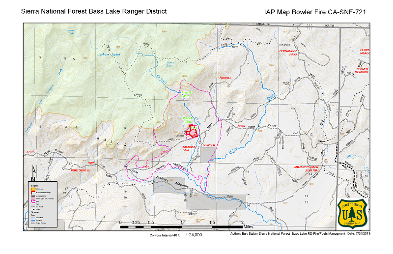
 The Bowler Fire is a lightning-caused fire burning north of the Bowler Campground off Beasore Rd. (5S07), west of Jackass Creek (see map below).
The fire has consumed approximately 35 acres.
A total of 25 personnel, including the Sierra National Forest’s Crane Valley Hotshots and Engine 53, are assigned to the fire.
On Wednesday, July 24, two large thunder cells moved over the fire area. The first thunder cell moved in around noon, producing strong outflow winds to the east which increased the fire behavior activity, according to the SNF.
The second thunder cell moved over the fire area around 4 p.m. on Wednesday, producing moderate outflow winds to the west. It also brought wetting rain over the fire area, slowing the rate of spread.
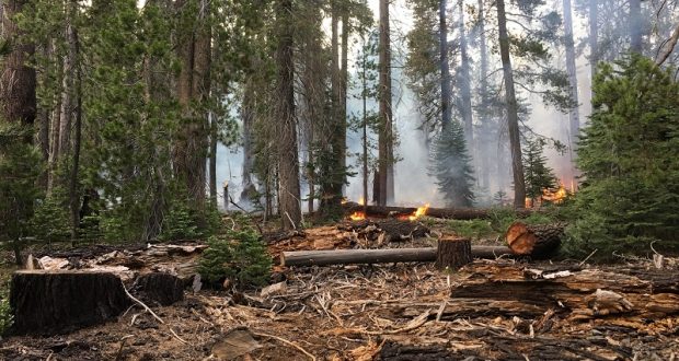
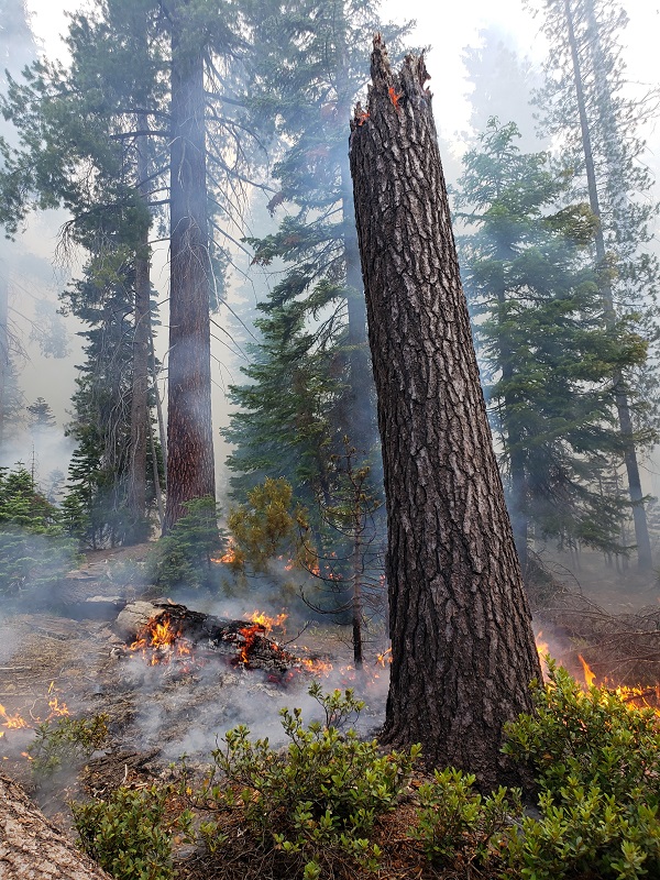
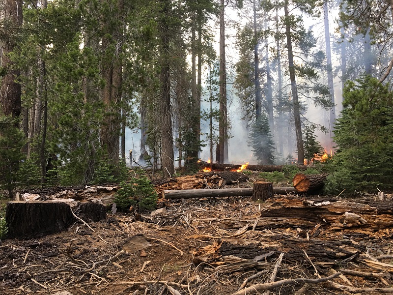
The fire is burning in a red fir and lodge pole pine stand with a mix of heavy dead and downed timber, as a result of the unprecedented tree mortality recently experienced on the forest.
There is logging debris on the ground from a recent road hazard timber sale, with no previous fire history in the immediate area dating back to the 1930s.
 Firefighters are using a confine and contain suppression approach to reduce hazardous vegetation (fuels) loading, to protect and restore wildlife habitat and heritage values. A confine and contain suppression strategy will keep the fire in a planned area, by constructing fire line along with natural barriers limiting the fire’s spread.
The north side of the fire is all rock, the east side is along Jackass Creek and the south side is Beasore Rd (5S07). The west side has a short piece of handline that ties into the rocks. A 50 acre box has been constructed around the fire allowing the fire burn to those control lines. This strategy will allow for the mitigation of known and anticipated hazards to our firefighters while providing the highest probability of success.
The high degree of tree mortality in the area results in an unacceptable level of risk to firefighter safety with a direct attack approach.
Smoke impacts
As high pressure continues over the region, nearby communities can anticipate smoke settling into the valleys in the late evening or early morning hours, lifting in the afternoon each day. You can learn more about air quality and smoke by visiting either AirNow.gov or ValleyAir.org.
Map and photos courtesy U.S. Forest Service
This article was editing on July 25 to reflect the correct spelling of the word ‘lightning’ in the headline.