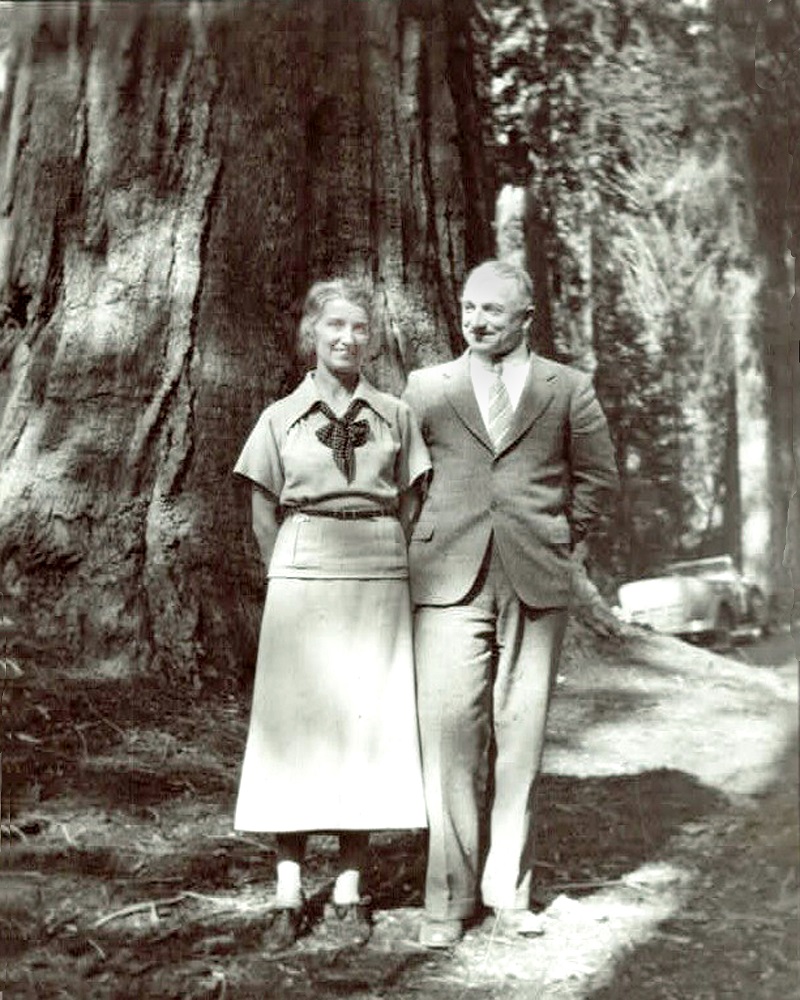
Doc and Liliane Wells
By Debby Carter, Librarian, Sierra Historic Sites Association
A well-known local figure in the mountain area from the early nineteen hundreds was Doc C. E. Wells. He grew up in the Visalia area, went to medical school in San Francisco, and worked in the hospital at the Madera Sugar Pine Lumber Company for 17 years. In 1927, he married Liliane, a nurse, and they served together in medicine for the rest of their lives. After the mill closed in 1933, they went to work at the Ahwahnee Tuberculosis Sanitorium, but also served as the local doctor for the eastern Madera County mountain area.
Their ranch, which they called “Mirimichi,” was in the area above Sky Ranch, until they sold it to the Presbyterian Church, and it became Calvin Crest Camp. After that they had a cabin just north of the Melody Inn (now Narrow Gauge Inn). Doc died in 1958, and before Liliane died in 1984, she established a scholarship fund at University of California San Francisco to assist interns who wanted to serve in family medicine.
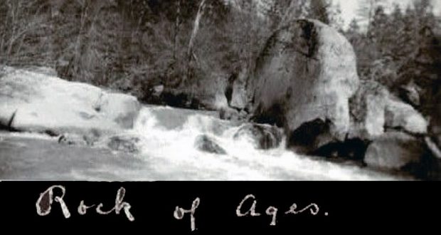
Doc and Liliane loved the mountains and spent a lot of time exploring them. Among their collection of photographs that was given to the SHSA Archives by John Glenn are many photographs of historical sites in our mountain area. The “Rock of Ages” photo, as they titled it, was among these.
Does anyone recognize this location? It could be somewhere along the Fresno River or its feeder creeks.
Follow-Up on History Mystery #99
The North Fork History Group thanks all who commented on this interesting History Mystery:
World Routes
June 3, 2021 at 3:39 pm
The photograph of History Mystery #99 is taken from what is today Highway 120 at Tioga Pass in Yosemite National Park. It is looking east down the Tioga Road into what today is the Mono Ranger District of the Inyo National Forest. Wikipedia indicates that the Mono National Forest was “…established on May 25, 1907. On July 1, 1945 land from the former Mono National Forest was added.” This would mean that this photograph was probably taken prior to 1945. If you go to Tioga Pass in Yosemite National Park on Google Maps, and then go to Street View, you can swivel the view to see the entrance stone work of the granite wall in front of the sign. The skyline to the left of the photo hides the Gaylor Lakes and historic mines of Bennettville. Enjoy! MJO
Don Grove
June 5, 2021 at 3:40 pm
Comments from SNO Facebook:
Bryant Platt
Looks like Tioga Pass?
Joe Meyer
Yes, looking northeasterly from the Tioga Pass gate, entrance kiosk and cabin would be on the left of this photo.
Top Fan
Mellie Bradley
Bryant that was my first thought too!
Joe Meyer
https://en.wikipedia.org/wiki/Mono_National_Forest
Mono National Forest – Wikipedia
EN.WIKIPEDIA.ORG
Mono National Forest – Wikipedia
Steven M. Bumgardner
There is no Mono Natl Forest. Perhaps they mean Inyo.
Joe Meyer
Steven M. Bumgardner there used to be.
Tom Atkeson
Steven M. Bumgardner Mono National Forest was established by the U.S. Forest Service in California and Nevada on July 1, 1908 with 659,456 acres (2,668.72 km2), almost all in California, from parts of Inyo, Toiyabe, Stanislaus and Sierra National Forests. On July 1, 1945 the entire forest was divided between Inyo and Toiyabe and the name was discontinued.
Top Fan
Mellie Bradley
Tioga Pass gate facing east heading out of Yosemite NP into National Forest. The stone gate with logs sticking out on right side of photo, and the rocky granite slope on left side of road look like they match historic photo. May be an image of tree, road and text.

