Not all adventures go as planned. You just never know what you will encounter. A smokey hike in the Mono and Parker Pass area, not fishing in Parker Pass Lake, looking for Sierra Nevada Bighorn Sheep, checking out fall color, a reflective little pool of water, busy Clark’s Nutcatchers and a fire all played roles in this week’s adventure.
Where: Yosemite National Park
Distance: 10.08 Miles
Difficulty: Moderate to Strenuous
Elevation Range: 9,596′ – 10,926′
Date: September 29, 2020
Maps: Falls Ridge, June Lake Topographic Quads
Dog Hike? No
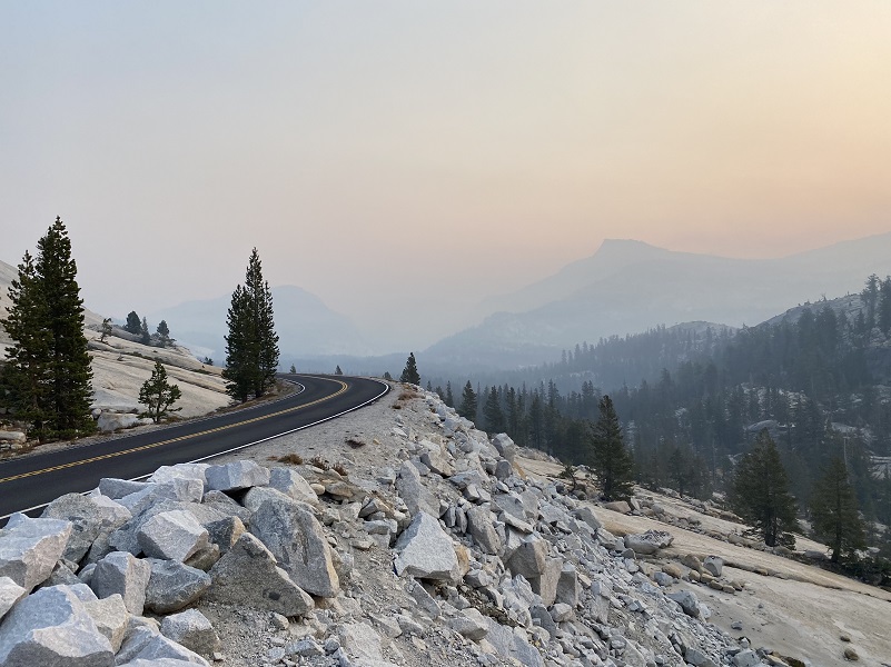
Even though it was smokey, I still wanted to try and get a hike in. I knew it wouldn’t be clear skies but hoped that it wouldn’t be horribly thick smoke. Driving east over Tioga Road, I could gauge how bad the smoke is from Olmsted Point looking to the east at Tenaya Lake. In my book, that was horrible smoke.
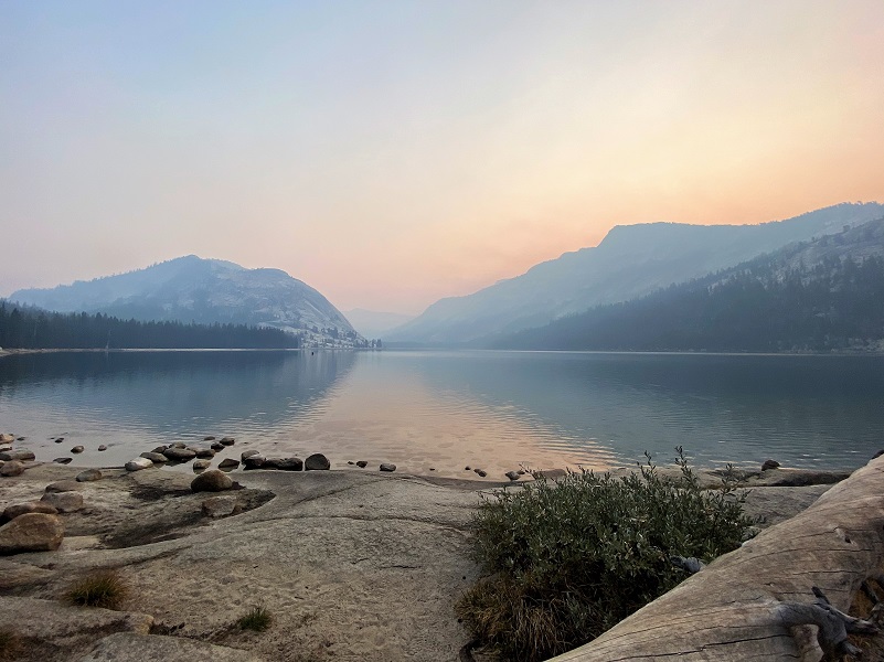
When I reached Tenaya Lake, I could see reflections in the lake, so made a quick stop to check it out.
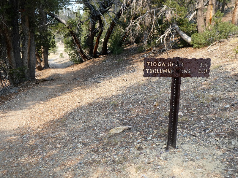
 It wasn’t long before I reached the Mono Pass Trailhead, about 5.6 miles east of the Tuolumne Meadows Campground and 1.4 miles south of Tioga Pass. I was the first car in the parking lot, checked out the restrooms, and stashed my stuff in the bear box. It wasn’t clear by any stretch but it wasn’t horrible smoke. I was hoping some of those winds that traditionally come up in this area would stir the smoke up a bit. I was going for it.
It was 38 degrees when I headed up the trail which was and is an important Native American trail.
The trail was also used by miners searching for gold and silver from the 1860’s to 1890’s or so. A few cabins were located along the trail to the Golden Crown Mine and Bloody Canyon.
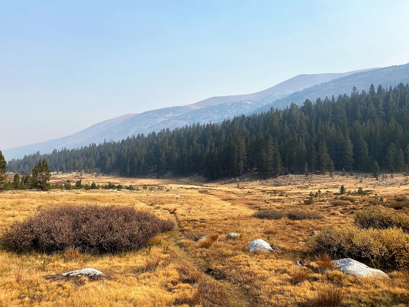
When I broke out of the trees into the meadow below Spillway Lake, I got a good feel for the amount of smoke that I would be breathing.
The trail led me along Parker Pass Creek lined with yellow fall colors.
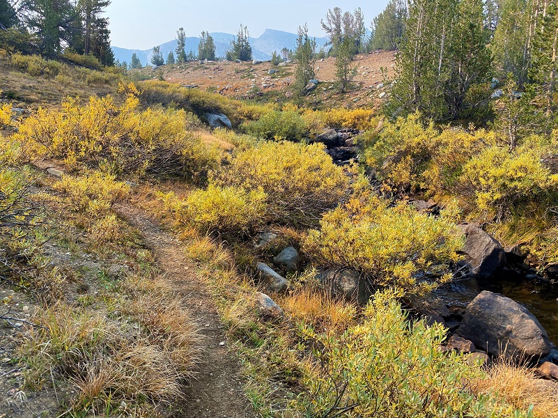
The water was low, tumbling into small pools every so often.
And fall color was nestled in the rocks.
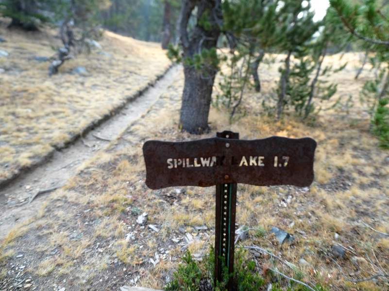
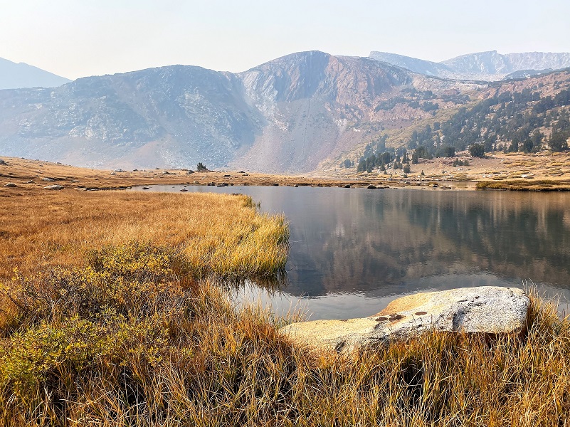
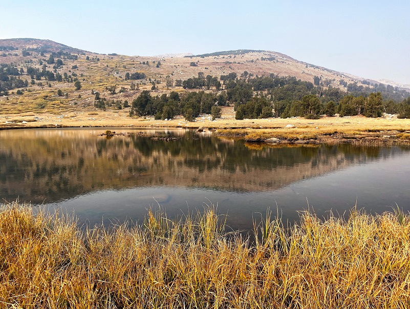
When I reached the junction of the trail that led to Mono and Parker Passes, I took the right fork to Spillway Lake. I would be returning via this trail though, making this a looped hike.
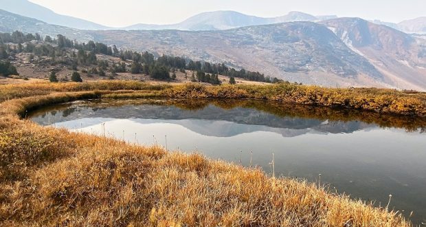
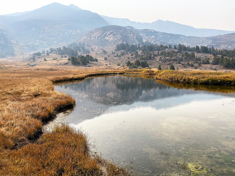
I wandered down to Spillway Lake (10,476′ elevation) to check out reflections.
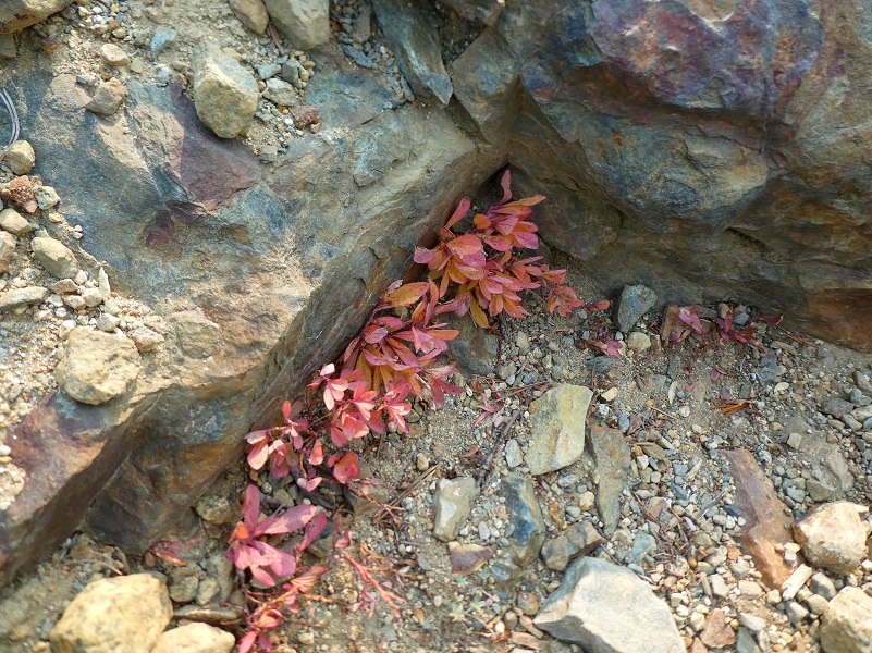
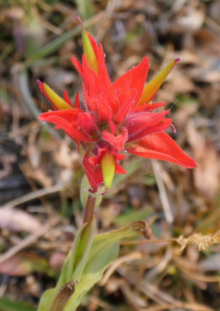
Heading cross country uphill, kind of aiming a straight line for Parker Pass, I wandered toward whatever caught my eye. Even though the vegetation was brown and appeared to be ready for winter, it always surprises me to find a stray wildflower such as this Paintbrush.
 Place Names of the High Sierra says that Parker Pass, Lake, Peak and Parker Pass Lake are named after an early settler in Mono County. Yosemite Place Names adds that Edward A. Parker, a student of Professor Joseph Le Conte is the likely person whom it is named for. When LeConte reported on the records that he found on the summit of Mount Lyell in 1889, the oldest was that of Parker and another man in 1875. “In 1889 the only records on the summit were: Edward A. Parker, —— McLean, July 2, 1875.”
Looking at old maps, Parker Pass doesn’t show up on the 1869 map. First Lieutenant 5th Cavalry Nathaniel F. McClure contributed a great deal to the knowledge of the upper Yosemite region. He made several trips in 1894 and 1895 north of the Tuolumne River exploring the canyons, trying to find a satisfactory route through this northern section of the park to connect Tuolumne Meadows and Hetch Hetchy. Sergeant Alvin Arndt had made a preliminary reconnaissance in 1893. McClure’s 1896 map is the earliest detailed map of the Yosemite area. The names of Parker Peak and Pass, along with Parker Glacier are found on the 1896 map.
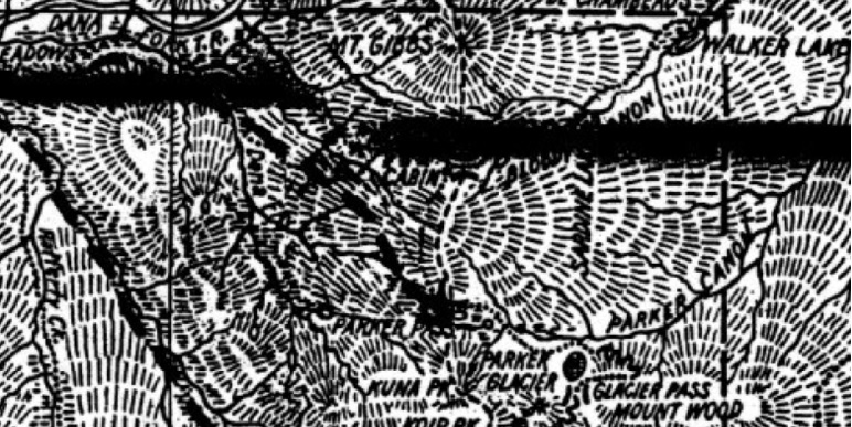
McClure 1896 Map Yosemite Cropped Parker Pass Area
I did some digging to try and find out more information on this person, checking census and voter registration for Mono County 1870 and 1880 but didn’t find him. There are Parker’s in the area, but none seemed to fit.There is a William Owens Parker, born 1842 in Scotland, shown on 1880’s Voter Registration records, applied for a homestead in 1883 and whose occupation is listed as Attorney At Law. There are no Parker names on the 1860 or 1870 census and 5 other Parker names on the 1880 census in Mono County. William Owens Parker had the largest footprint in the area through the homestead, voter and census records. But his homestead was in Benton Valley and he was living in Bridgeport, didn’t have children of an age or occupation to tie him to the Parker Pass area. He died in 1930 and is buried at Bridgeport. Here is his Obituary from the Bridgeport Chronicle-Union.
PIONEER OF MONO COUNTY LAID TO REST
WILLIAM O. PARKER BURIED HERE TUESDAY
“I came from God,” said George MacDonald, “I am going back to God. I will have no gaps of death in my life.” And thus it might well be said of our former and highly respected citizen, the late William Owens Parker, who passed to his rest following an illness of a few hours at the home of his daughter, Mrs. Mary Parker White in Los Angeles, Friday, August 29th, 1930.
Born in Glasgow, Scotland, December 6, 1842, he came as a young man to the United States, making the journey around the Horn and landing at an Oregon port. Shortly after coming to this county he visited a brother in British Columbia, later returning to Oregon where he enlisted in Company E of the 6th Oregon Infantry during the Civil War, but before he saw active service word came that peace had been declared and he was discharged from his country’s service.
William O. Parker came to California in the early ’70s and was married in Portland, to Annie Boucher Hine in 1871. To this happy union four children were born, two passed to the other world. Surviving their beloved parent is one daughter, Mrs. Mary Parker White of Los Angeles and one son, Hon. Pat R. Parker, Judge of the Superior Court, Bridgeport, and one grandson, Willie.
Mr. Parker came to Bridgeport about 1877, and engaged in the practice of law. he was for some time District Attorney of Mono County and also served the County in other official capacities. As a man, he was always intensely interested in the things which tended to the betterment of the town in which he lived and, if there was a religious service or Sunday School he was always ready to do his part, especially in the singing. The writer well remembers this on the occasion of one of his early visits to Bridgeport.
The last of the men of Mono County to be numbered as members of the once Great Army of the Republic, his going, even at a ripe old age, he will be missed from his place, for none ever left this county or watched its failures or successes with greater interest than did our late friend and neighbor.
Leaving Bridgeport on account of failing health, he with his daughter lived in Reno for several years, later going to Pasadena and then to Los Angeles, where, in the presence of his children he closed his eyes in that sleep which is eternal.
Funeral services were held from the undertaking parlors in Los Angeles, Sunday morning, August 31st at ten A.M. and were conducted by Rev. Bailey of St. John’s Episcopal Church of which the deceased was a member. The casket bearing his body, was brought to Bridgeport on Monday and services were held from his old home in the presence of a large number of his friends of many years standing who came to pay their last tribute of love and respect to his memory. The service being conducted by A. C. E. Bridger. Murven Bryant, assisted by Mrs. Gertrude Smith at the piano, sang “Lead Kindly Light.” Mesdames Venita R. McPherson and Gertrude Smith and Mr. Murven Bryant singing “God Be With You ‘Till We Meet Again.”
Banked with beautiful flowers, the casket bearing his body was borne by former friends acting as pall bearers and interment made in Bridgeport cemetery. At the open grave the choir sang “We’re Tenting Tonight on the Old Camp Ground” and the service was concluded with the benediction.
The sympathy of many friends is extended to the bereaved family in the great loss they have sustained in the death of their father and friend.
“Withered is the garland of war,
The soldier’s pole is fallen.”
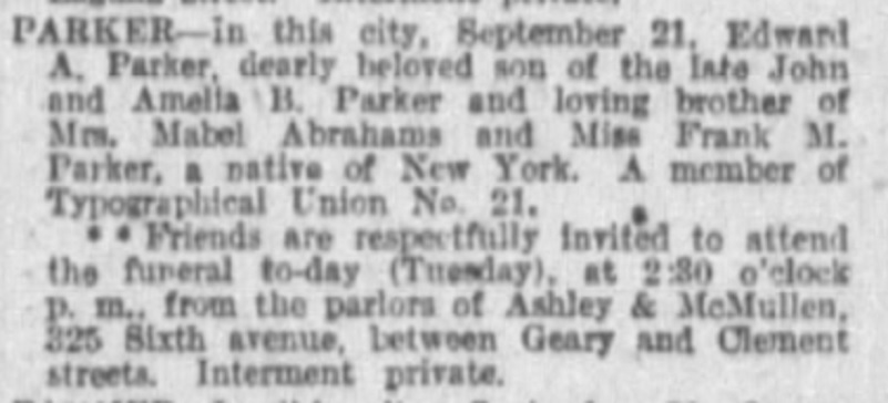 The other possibility was Edward Allen Parker but he wasn’t an early settler in Mono County. He could fit the bill for a student of Joseph Le Conte’s though, only because he lived in the Bay Area and had various connected occupations. He was born in New York 1849. His father was a Retail Grocer, born in Ireland and his mother was born in New York. He had at least 3 siblings and the family had moved from New York to Grass Valley by 1864. California Voter Registration lists Edward’s occupation through the years as Mining Man, Compositor, Printer and Mining. On the 1900 census, his occupation is Civil Engineer and on the 1910 census, his profession is Surveyor. In later city directories, his occupation is listed as Field Assistant, Surveyor and Clerk. It doesn’t appear that he married and he died September 21, 1913 in San Francisco, CA.
There are several McLean’s working in the mining field in Mono County in 1880 around the Bodie area and as a sidenote, there is a John McLean working in the Homer District which could include the Tioga Pass area in 1880. The bottom line is that I cannot confirm the the right person is.
Thinking of the fact that Edward A. Parker summited Mount Lyell on July 2, 1875, I discovered that Joseph Le Conte was in the area that year. It is a longshot, but could Parker and McClean have been part of that party of 4? From The Autobiography of Joseph Le Conte:
In 1875, with a party of four, all connected with the University, I again camped in the high Sierra. We visited the Yosemite, Tuolumne Meadows, and Lake Mono, and expected to go southward to Lake Owen, thence over the Kearsarge Pass into the King’s River cañon, and from there back to Berkeley by way of Fresno. But a severe accident with dislocation of my thumb and a general battering and bruising of the whole body prevented me from carrying out this plan, and we went no farther than Mono, which I had visited twice before. This time, however, I examined still more carefully the volcanoes and visited the islands in the lake to ascertain their structure and age. The outcome of these observations was a paper On the Extinct Volcanoes about Lake Mono and their Relation to the Glacial Drift.
It would have been nice to figure out who Parker was but it doesn’t look like I will solve this mystery in time for this blog.
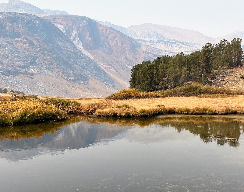
Parker Pass Creek wanders down the hill, sometimes spreading into boggy areas but I came across some small ponds that stayed here into the fall this year.


I have been hoping for quite a while to spot Sierra Nevada Bighorn Sheep in this area. They were native to this area and three herds were reintroduced during 1979-88, releasing 27 bighorns in Lee Vining Canyon, east of Tioga Pass, in 1986. In its first year, the Yosemite Herd split into two herds, the Mt. Warren and Mt. Gibbs herds, with sheep in the Mount Gibbs herd moving seasonally between Inyo National Forest lands and the high-elevation border with Yosemite National Park. Biologists successfully returned bighorns to the Cathedral Range on March 26, 2015. By 2014, over 600 Sierra Nevada bighorn sheep were living in their ancestral homelands along the crest of the Sierra Nevada.
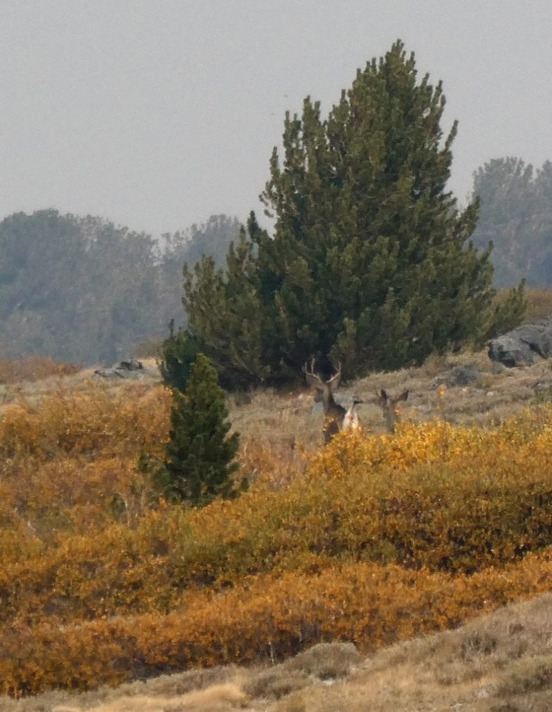
Over the past years I had seen plenty of sign in this area and had walked by some really fresh sign on this hike. I would stop periodically and scan the country, hoping to see one. So when I caught movement ahead of me, flashing white rear ends, I was sure I had finally seen them. I whipped out my camera and took several pictures, knowing that I could look at the detail of these sheep when I got home. Well, surprise, surprise. My sheep were really deer.

I decided on not approaching Parker Pass Lake from the outlet due to the willow patches, boggy area and time. I headed uphill to intersect Parker Pass Trail, hitting it close to the pass. I pondered going there just to say I did it that day but was too lazy. Picking up the trail, it lead me toward the junction of Mono Pass Trail and back toward the Trailhead.
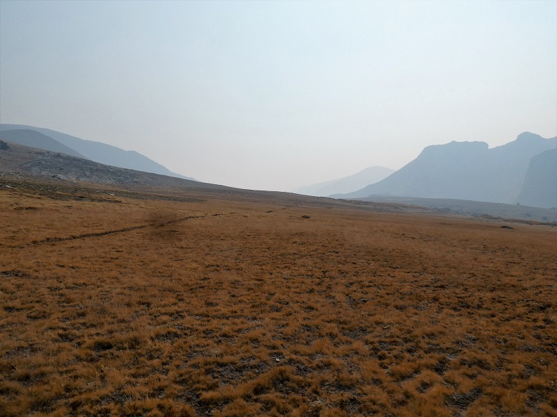
Looking toward Parker Pass
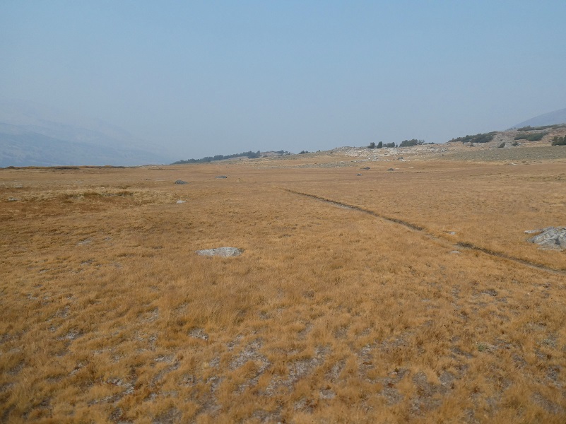
Looking toward Mono Pass
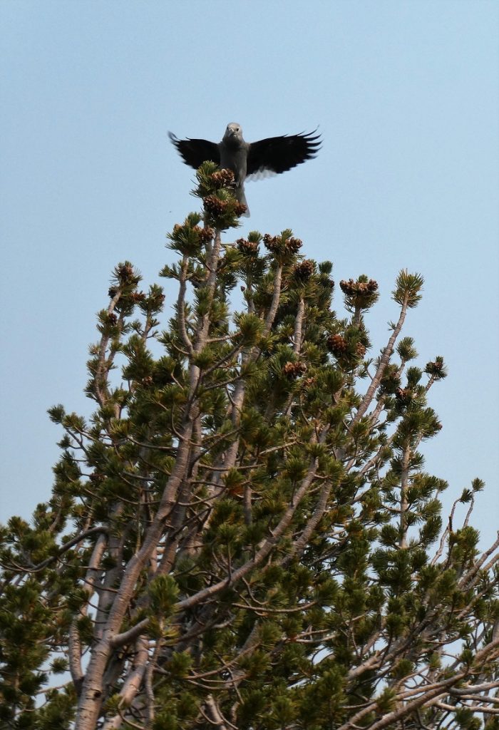
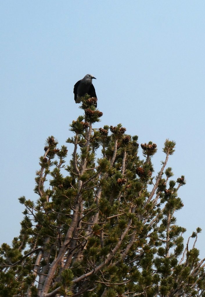
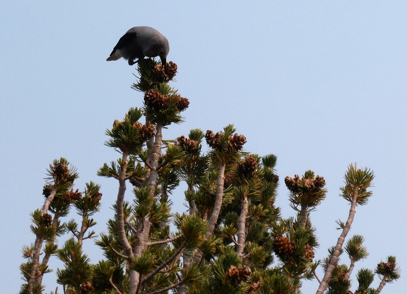
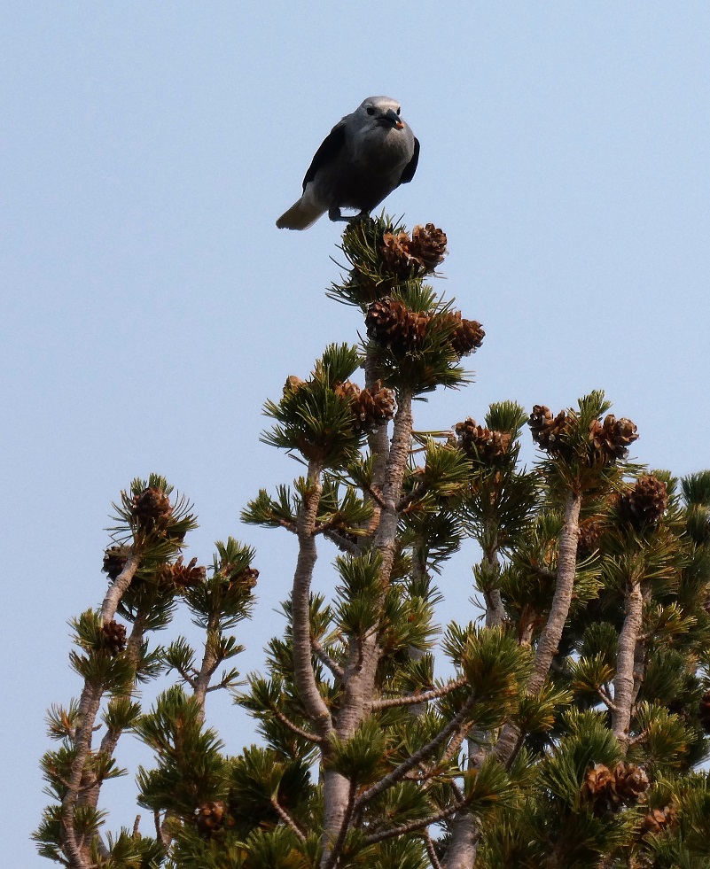
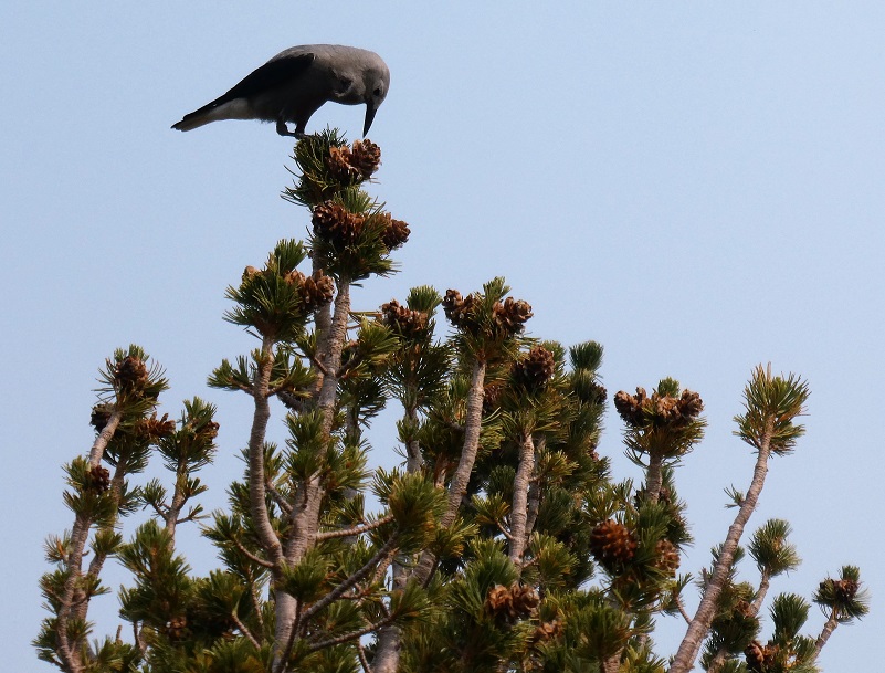
As I approached a small stand of pines, I could hear Clark’s Nutcrackers squawking. If you haven’t heard their squawking, you can listen to them here.
I watched them flying, landing on the trees. There were 8-10 of them but what were they up to? I watched them for a while and solved the mystery. They use their bills to rip into pine cones and pull out seeds, which they stash in a pouch under their tongue and then carry away to bury for the winter. Each birds buries tens of thousands of seeds each summer and remembers the locations of most of them. Seeds they don’t retrieve play a crucial role in growing new pine forests.
I continued down the trail, past the junction of the trail that leads through Mono Pass, and toward the Trailhead I had started from.
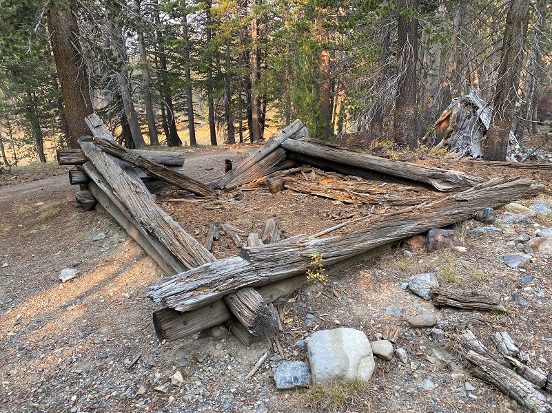
Remains of an old mining cabin were getting pretty flat but the detail of the notches that had been cut to place the logs still stood out.
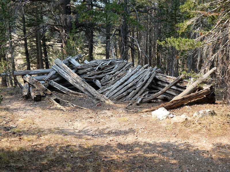
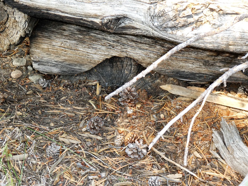 Both of the old cabins that I stopped by show up on the 1901 Mount Lyell Topographic Map.
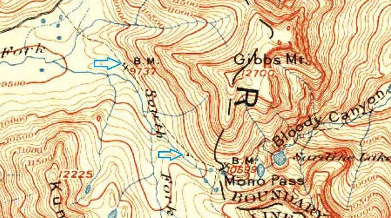
1901 USGS Mount Lyell Topographic Map
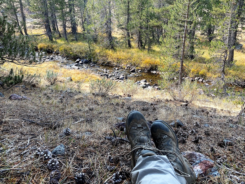
Once I hit the main trail, I kept heading back toward the trailhead but was getting a bit hungry and picked a spot next to the creek and off the trail to eat my peanut butter sandwich.
I made it back to the car early and knew that I would make it home early. Except I didn’t. As I drove, I could see the column of the Blue Jay Fire building, with helicopters dropping water on it. I hoped I would sneak through. I didn’t. I was almost through when I reached a point where they were holding traffic as the fire became lively along the road. Then they told us to turn around. I headed to Olmsted Point where I had a glimmer of cell service and between texting and my Garmin InReach Mini, I communicated that I would be late but didn’t know how late. I had a good view of the fire operations and soon saw the column going down. I hadn’t seen any official vehicles on the road and the cars that headed down that way were turning back. I figured I would go down and see what the official word was, whether it was closed for the day and if I needed to come up with an alternate plan for my night. There were about 15 cars lined up and as soon as I got there a Ranger told us that they hoped to get us through in about an hour. So I waited. About 30 minutes later, someone yelled “get in your cars, we are moving!” So I did. We didn’t move right away but soon did, very slowly, led by a Pilot Car, weaving our way back and across lanes avoiding fire engines. There was plenty of new burn along the road from when I came through in the morning but don’t know how many additional acres had burned in this run. I made it through and was very happy about that!

On my drive in, I noticed that the fall color along the road was definitely showing up more. Along Big Oak Flat Road, the dogwoods had picked up speed with more of them sporting their red leaves. Yellows along Tioga Road had deepened with a couple of spots showing a tint of orange yet some where still all green with maybe the tip top starting some yellow.
Dog Hike? No, dogs are not allowed on this trail in Yosemite National Park.
Doarama:
What is a Doarama? It is a video playback of the GPS track overlaid on a 3 dimensional interactive map. If you “grab” the map, you can tilt it or spin it and look at it from different viewing angles. With the rabbit and turtle buttons, you can also speed it up, slow it down or pause it.
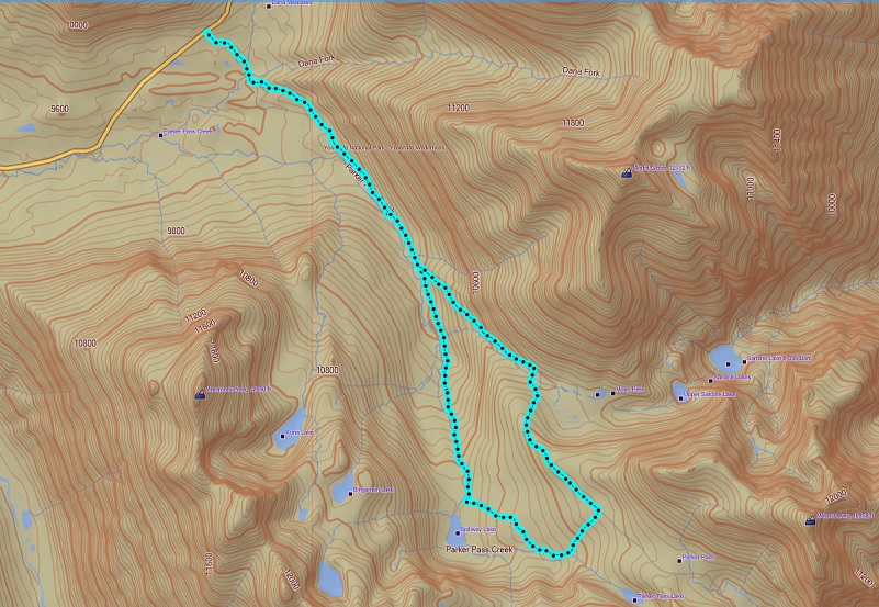
Spillway Parker Pass Trail Loop Doarama
Map:

Prior Blogs in the Area:
Hiking Between Yosemite’s Mono Pass Trail and the Kuna Crest August 20, 2020
Adventures with Candace: Hiking Up Yosemite’s Mono Pass Trail July 7, 2020
Wandering up Yosemite’s Mono Pass Trail August 14, 2019
Hiking up to Bingaman Lake on a Chilly Day November 8, 2018
Hiking along Yosemite’s Mono Pass Trail August 15, 2018
Hiking up to Mono Pass Trail’s High Lakes August 25, 2017
Exploring High Lakes Above the Mono Pass Trail July 28, 2016
Hiking and Fishing High Lakes along the Mono Pass Trail August 14, 2013
Sources:
Mono Pass Trail Yosemite Hikes
History of Sierra Nevada Bighorn Sheep Yosemite
Place Names of the High Sierra (1926) by Francis P. Farquhar
Browning, Peter, Yosemite Place Names, Great West Books, Layfayette, California, 1988
Exploration of the Sierra Nevada (1925) by Francis P. Farquhar
Wiliam Owens Parker Find a Grave
Bridgeport Chronicle-Union, September 6, 1930
Clark’s Nutcatcher All About Birds
1901 USGS Mount Lyell Topographic Map
Pathways: A Story of Trails and Men (1968), by John W. Bingaman
The Ahwahneechees: A Story of the Yosemite Indians (1966) by John W. Bingaman
The above two books by John W. Bingaman were digitized by Dan Anderson, September 2004, from a copy in the UCSD Library. These files may be used for any non-commercial purpose, provided this notice is left intact.
—Dan Anderson, www.yosemite.ca.us

