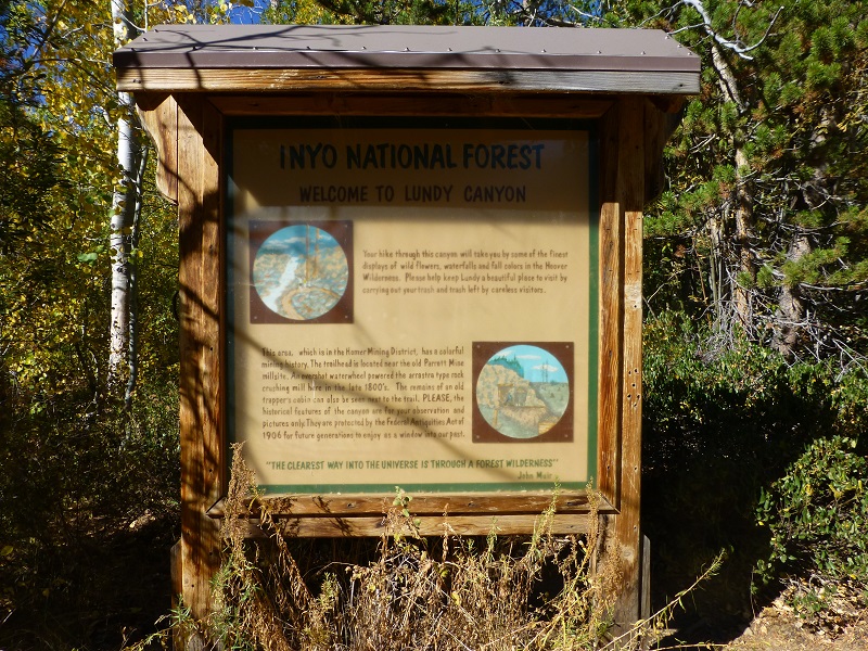
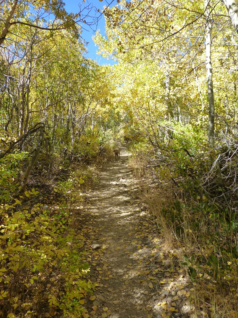
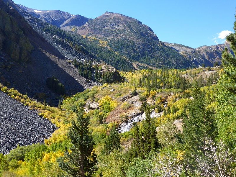
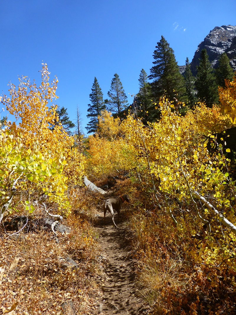
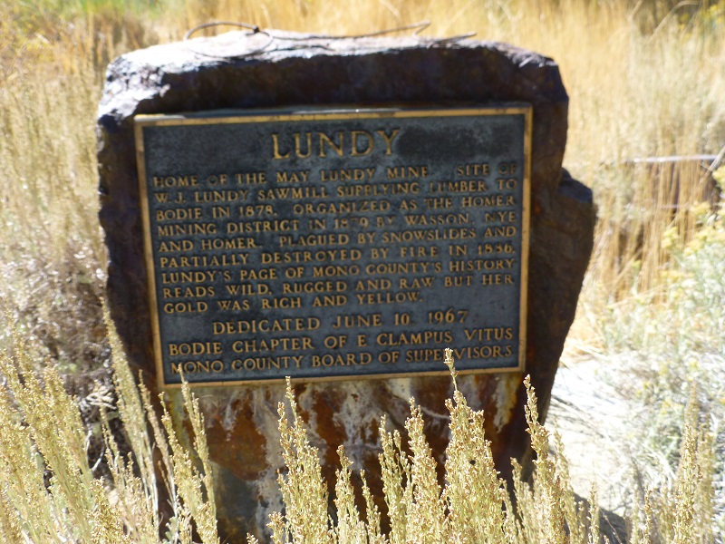
Sally and I followed the footprints of miners that lived in the towns of Lundy and the long gone town of Wasson to check out those gold producing mines. As we followed those old roads and trails, we took in the fall colors and reflections in the beaver ponds along the way.
Where: Inyo National Forest, Hoover Wilderness
Distance: 10.23 Miles
Difficulty: Moderate
Elevation Range: 7,637′ – 8,584′
Date: September 27, 2016
Maps: Big Alkali, Buckeye Ridge, Falls Ridge and June Lake Topographic Quad
Dog Hike? Maybe
Sally and I had headed across Tioga Road, north on Highway 395 through the town of Lee Vining, then up Lundy Lake Road to the Mono County Campground for a few days to feel the beginnings of fall. I know this sounds little crazy but I wanted to walk the routes where the miners had walked back in the early 1880s so Sally and I walked up the road along Lundy Lake toward the town of Lundy. We could look across at the old road that was used by the miners to head up to the May Lundy Mine. We could also look along the northern edge of the lake and see the old road that went along the north side of the lake before Lundy Lake’s present dam raised the level of the lake. Of course, the reflections in the lake were beautiful.
We walked up what used to be called Main Street, past where the May Lundy Hotel, the Miners Saloon, the Wells Fargo Office, and Lundy & Bodie Stage Office were on the right side of the street. The Lundy Pharmacy, Blacksmith, Sierra Telegraph Office and the Lake View House would have been on the left side of the street.
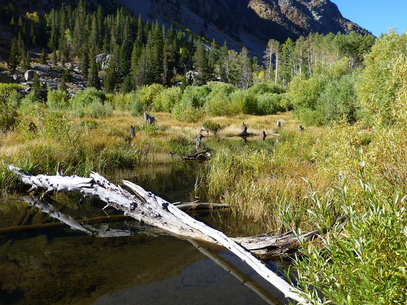
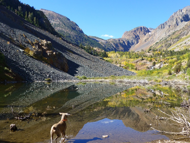
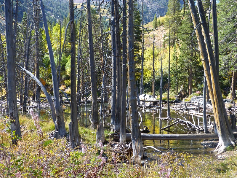
When we reached the beaver pond, I knew that we had reached the site of the old town of Wasson, earlier known as Old Emigrant Flat, located at 8,360′ elevation. It is said that it was named after one of the Wasson family, probably William D. Wasson, who had a homestead there, or possibly his brother Joe. It is said that they were newspaper men with the Silver City, Idaho Owyhee Avalance from 1865 to 1867. They were born in Ohio to David and Mary Wasson and living next door to them on the 1850 Darke County, Ohio census is David Wasson, 71 born Ireland and his wife and children. So I think there is a good chance that this is a family group of 3 generations of Wassons, all farmers.
William D. Wasson’s wife Mary Anna died in 1910 and is buried at Santa Maria Cemetery District, Santa Maria as are two of her children but William is not there. He registered to vote in 1904 there but I cannot find him after that. One Hundred Years in Yosemite by Carl P. Russell states “In the spring of 1879, William D. Wasson took his family to Mill Canyon, near Lundy Lake, and engaged in prospecting. He was followed by C. H. Nye and L. L. Homer, who located rich veins of ore. J. G. McClinton, of Bodie, investigated and was persuaded by what he found to bring capital to the new camp at once. Homer District was organized at Wasson’s residence at Emigrant Flat, in Mill Creek Canyon, September 15, 1879. Prior to this time the region was included in the Tioga District, but because the books of the Tioga recorder were kept at an inconvenient point, a new district was formed. L. L. Homer, for whom the district was named, bowed down by “financial troubles,” committed suicide in San Francisco a few months later.”
Joe Wasson had covered the Modoc War in Northern California, sent the first newspaper coverage of that famous battle that involved George Custer, and was elected to the State Assembly in 1880 representing Mono and Inyo counties. It was written that Joe “was red-haired, muscular and high spirited. He went into the field with troops to bring greater reliability to newspaper accounts of Indian fighting than could be obtained by correspondents. . . He was elected and served in the California Assembly representing Inyo and Mono Counties fro 1880-1882. Failing health took him to San Blas, Baja California, Mexico in 1883 as U.S. Consul and he died there two months later.” His body was later reinterred at Mountain View Cemetery in Oakland. He also helped interview old timers from the Bodie area for a book that he helped write around that area and there is a link to that free E-Book at the end of the blog.
Both brothers William and Joe had mining interests in the Homer Mining District but had moved on by the fall of 1881.
Back in 1880, the Homer Mining Index said “a townsite has been laid out, and sub-divided into lots, upon which are located about twenty log houses and tents.” The townsite had two streets east and west on the north side of Mill Creek, running parallel with the walls of the canyon, with one street that crossed Mill Creek. The central street was Main Street and one of the parallel streets was Bonanza.
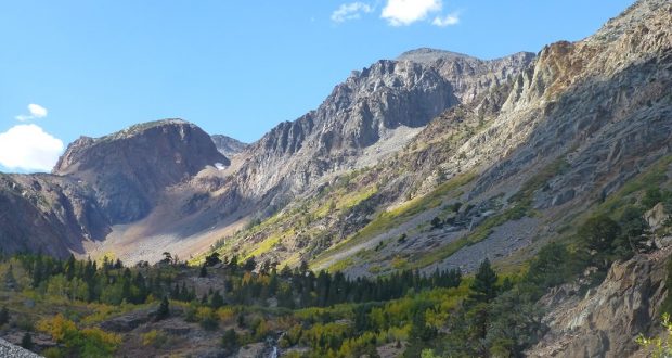
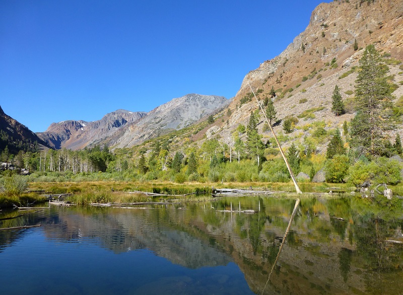
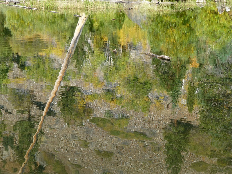
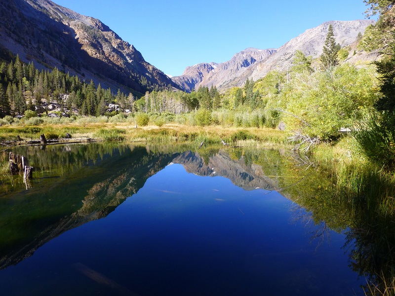
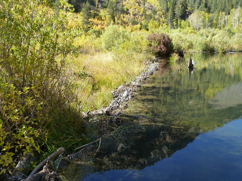
The following pictures were taken at that beaver pond that was once a meadow where the town of Wasson stood.

If I would have walked this road back in the summer of 1880, I would have been on Main Street, walking past Louis Bronson’s saloon, the Chinese Laundry, stable, and the boarding house that was called the “Snow House”, run by Mrs. Rebecca A. Nye. Many miners lived here but there were also families.
There was an arastra in town, basically a circular pit that would have been paved with flat stones, with some drag stones and a center post coming out of it with a long arm. A horse or mule would pull that arm around and around, with those stones crushing the ore. Some arastras back then were powered by water or even steam or gasoline engines. Some of the people only lived here seasonally because the mines would stop work then but some stayed year round. Avalanches swept through this area and 1882 was an especially disastrous year for the town with many buildings being destroyed. After that Wasson isn’t mentioned as a town.
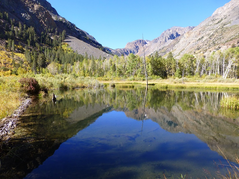
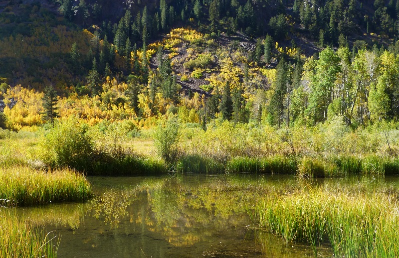
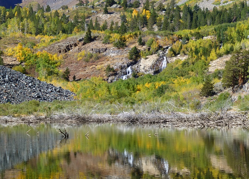
As I reached the upper end of the meadow and beaver ponds, I looked at to the sides of the mountains and tried to spot the mines. There were so many old diggings that it was hard to make things out. I knew that they would have needed water to run that arastra so it had to be by the creek or waterfalls ahead. There had to be signs left of where they had brought the mining material to be processed and moved down the hill but the aspens and willows were doing a good job of hiding the lay of the land.
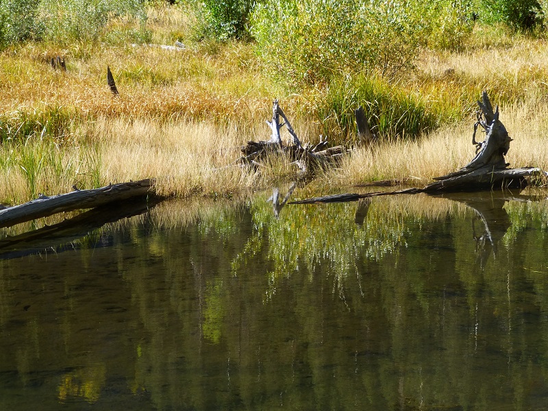
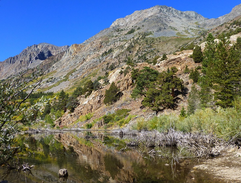
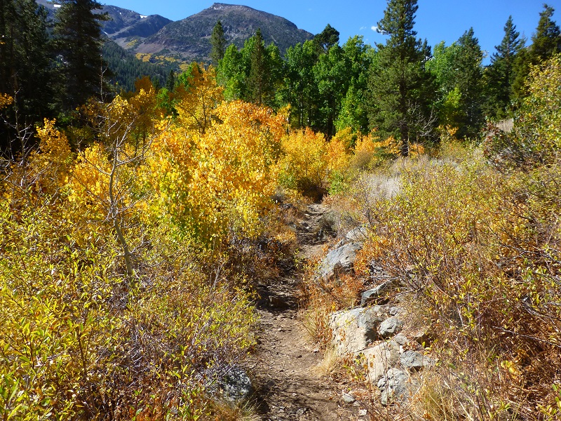
I continued walking on up the road, admiring more reflections helped along by beaver dams.
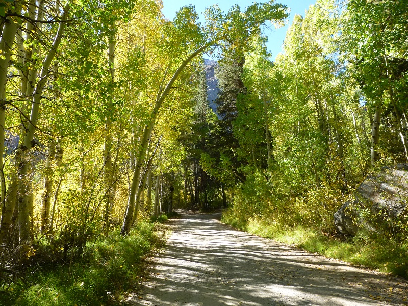
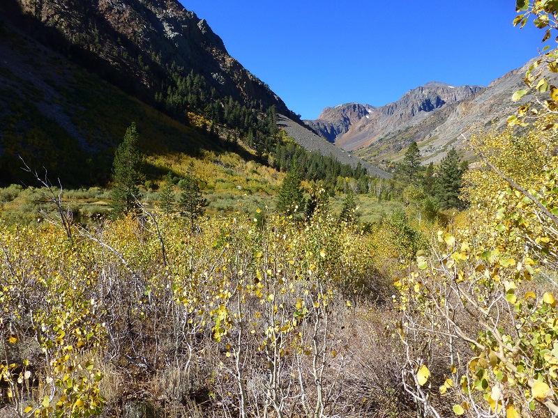
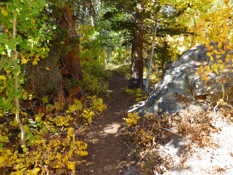
We reached the end of the road and started to enter Mill Creek Canyon. This trail is known as the Lundy Canyon Trail and the old Parret Mill was located where the trailhead parking is today..
Miners living in Wasson could walk to their mines.
- The Homer Mill and Mining Company worked 6 claims with the Nioma and Wasatch Mines on the south side of Mill Creek Canyon being considered very rich.
- In the spring of 1880, the Homer Land, Water, Mill and Mining Company from Bodie was working the Buena Vista Mine on the north side of the canyon.
- The Black Fox Mine was owned by a company out of Carson City and was located on the north side of the canyon. There is no record of their production.
- The Mocking Bird Mine was located on the south side of Mill Creek near the Homer Mine. They say that this mine had a two foot wide vein assaying $128 per ton and more. In September of 1880, two to five men were working and extracting ore, using three mules to haul the ore down to the arastra. By January 1881, legal problems caused the mine to change hands and nothing is head of it after March 1882.
- The Gorilla Mine was a gold mine that was a money maker from the beginning. It was located in January 1881 and the original owners were J. W. Mathews, J. F. Murray, James McCallum and William Miller. The Gorilla Mine was located on the canyon wall above the Mocking Bird Mine. In 1881, the owners were staying in a cabin that was built at the Mocking Bird Mine and when an avalanche hit, they barely escaped. The next winter they built a log building under a cliff where they thought they would be safe from avalanches but on March 15, 1882 an avalanche buried that build. Luckily, they were able to escape from that one also. The Gorilla Mine had two tunnels and it was the second mine to build a tramway to bring its ore down to Wasson where it was then transported by wagon to the reduction works. By1883, this mine was producing 50 tons or ore per day. The mine was still active and producing when the mine foreman Henry Miller was killed in an accident at the mine and that ended its operation. It had produced $61,773 in its five years or operation.
- Mines with names such as Buttevant, Monitor, Sunset, Forrest, Grand Prize, Little Chief, Don Alvarado, Golden Girdle, Bridgeport and Gold Hill were also operating in this area.

We continued up the trail, which headed up over a red, rocky hill, taking us above the waterfalls. I took a look back at where I had come from.

I followed an old road that took off on the left side of the trail below the waterfalls but the vegetation was too thick to figure out what structures had been there in the past. They didn’t put that road in for nothing though!
We kept on heading up the trail. I wanted to get to the top of the canyon under some mines and get a good picture of them.


The trees were not opening up to let me get the pictures that I had hoped so I turned around and headed back down.
As I got more distance between me and the top of the canyon, I was able to capture some pictures of the mines at that end.

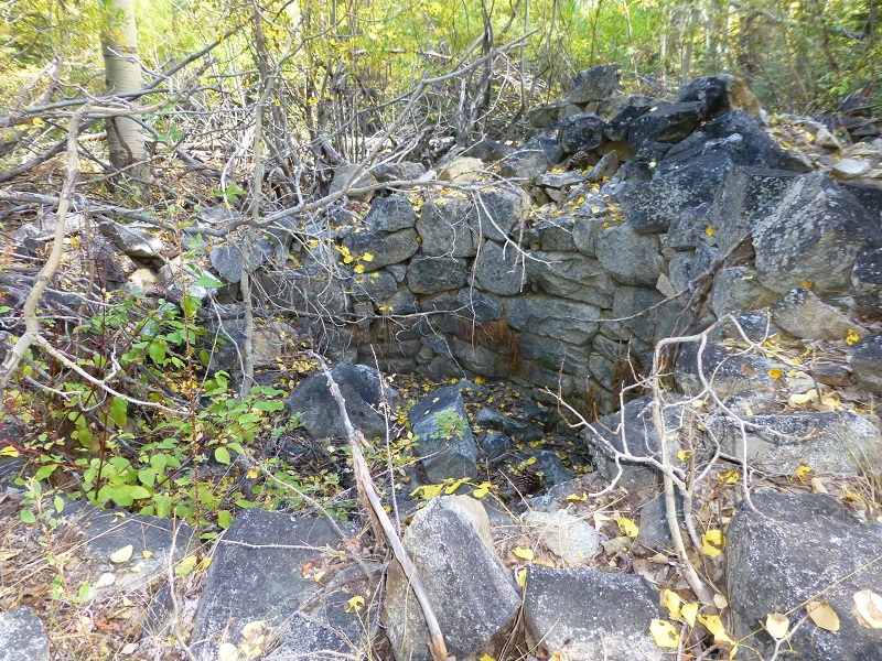
I left the road and hugged the creek when I reached the upper side of Lundy because I was hoping to see some more of the old town. I had hoped to come down the old Chicago Ave. where the Lundy Reduction Works were located and try to find the location of the old Pack Station area but couldn’t make them out. There were many old stone foundations all along the way though. I came across these old cisterns though.
I highly recommend a trip to Lundy. Many people stop by to check out the amazing fall colors but there is plenty to see at other times. There is some beautiful hiking to be done and the fishing can be great. It is also a great home base to explore other nearby areas such as Bodie and Mono Lake. Just a heads up that Lundy Lake Rd. closes during the winter and is gated.
There is an excellent book written about Lundy that I cannot recommend enough if you can get your hands on it. It is Lundy by Alan H. Patera. It is one of a series of books from Western Places written by Patera that give a lot of detail about old mining communities and ghost towns, especially on the east side of the Sierra. I utilized his book on much of my research for this blog and am very thankful for him sharing his research.
Map and Profile:
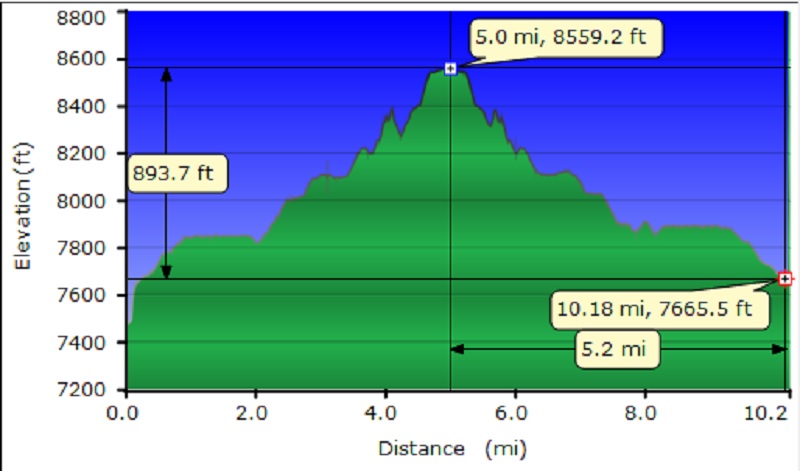
Mill Creek Canyon Topographic Map and Profile
Dog Friendly?
This area can be a great place to hike with your dog, if your dog is a good fit. There are some rocky areas that can be tough on a dog’s feet, wearing the paw pads down, with the possibility of slicing them. I carry boots with me when I bring Sally, just in case she gets too much wear or an injury to her foot. The water sources that a dog can access are good year round. This is an area that has Bubonic Plague, so need to keep your dogs away from squirrels and rodents. Below are the dog rules for the Hoover Wilderness:
- Dogs are allowed in the Hoover Wilderness, but are not allowed in wilderness areas in adjacent national parks.
- Pet food must be stored to the same standard as people food. In areas where use of a bear resistant food storage container is required, pet food must be stored in your container.
- Leashes protect dogs from becoming lost and from wilderness hazards such as porcupines, mountain lions, and sick, injured or rabid animals.
- Unleashed dogs may intimidate other hikers and their dogs, depriving them of a peaceful wilderness experience.
- Unleashed dogs may harass, injure and sometimes kill wildlife.
- A leashed dog’s keen senses can enhance your awareness of nearby wildlife or other visitors.
Prior Blogs in this Area:
Hiking with Sally From Lundy Lake to the May Lundy Mine September 27, 2016
Hiking to the Old Mining Town of Bennettville and the Lakes Beyond November 11, 2014
Hiking with Sally up to the Hess Mine in the Tioga Pass Area October 26 2015
Gaylor Lakes & Great Sierra Mine Hike: Part 2 October 29, 2012
Sources:
Patera, Alan, Lundy, Western Places, Lake Grove, Oregon, 2000
One Hundred Years in Yosemite (1947) by Carl P. Russell
California Graveyard Assembly 1880
Bodie & Esmerelda by Joseph Wasson, William Phipps Blake, Benjamin Silliman


Wow! Great detail. Interesting history. Great staff report, with topography maps, photos, and research. You still got it!
TY for you wonderful comments.