Waterfall season is upon us and Chilnualna Falls is a beautiful hike to check out its 5 tiers of waterfalls. A good workout if you decide to go to the top of the falls, but the lower part of the falls is a dandy if you don’t want to go as far. . . or climb over, around or under a few trees. 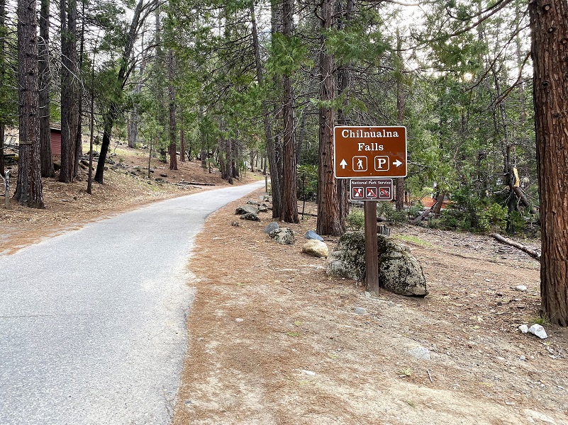 Where: Yosemite National Park
Distance: 8.4 Miles but you can co farther
Difficulty: Moderate to Strenuous
Elevation Range: 4,171′ – 6,340′
Elevation Gain: 2,148′
Date: April 4, 2022
CALTOPO: Chilnualna Falls Hike
Dog Hike? No
 From Wawona, I drove down Chilnualna Road toward the end of the road, just shy of the bridge and to the signed Trail Parking Lot on the right hand side, about 100 yards shy of where the pavement ends and right next to the large home where they have been doing construction for many years. There are actually two parking areas at this location, one of them down the dirt road by the bear boxes and a small parking area up on the road. When I pulled into the parking area, I was the first car but both lots were pretty full when I returned. There is a restroom and bear boxes to store your goodies while you are hiking.
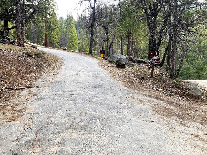
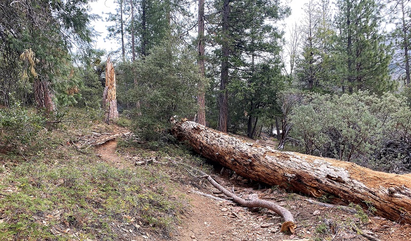
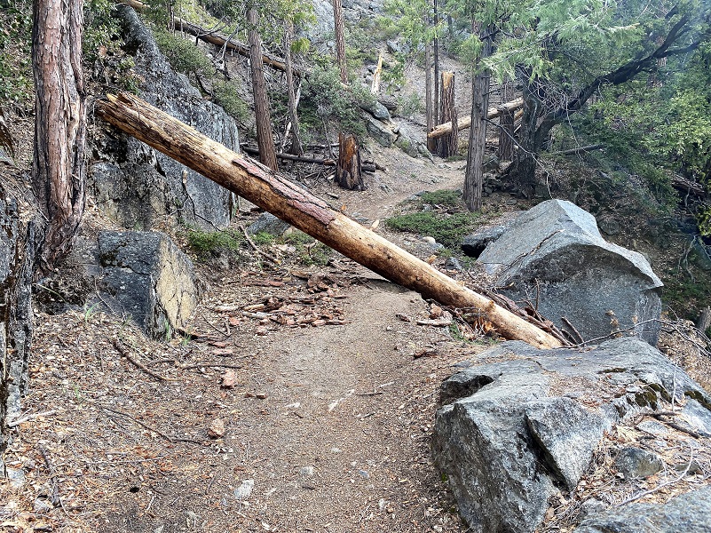
 I followed the signs up to the trail, taking the hiking trail, not the stock trail. They join up shortly but just fyi, the current down tree situation on the trail makes it not passable for stock at this writing but I am sure it will be cleaned up soon. People can hike it just fine, with a few trees to climb over, under or around. I headed up the trail.

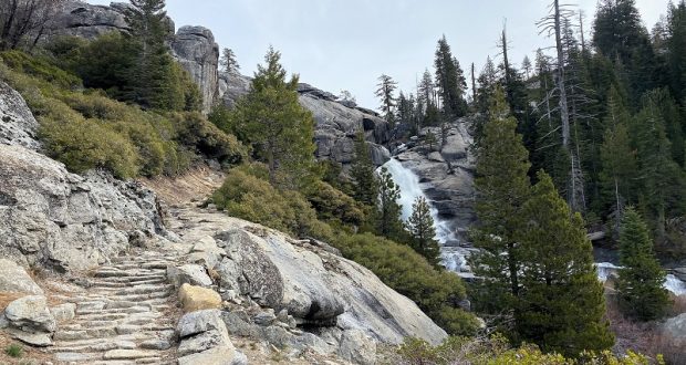
After hiking a little over a mile, I reached the base of Chilnualna Falls and its beautiful pool. Chilnualna Falls is not a single waterfall, but actually a series of 5 tiers of waterfalls, dropping a total of about 700 feet. Wawona’s Yesterdays, by Shirley Sargent, says that according to one source Chilnualna was named by the Piute Indians and means “leaping waters” but that another Wawona native insisted that an Indian told him that Chilnualna means “many rocks” because the falls are in a very rocky canyon. If you are curious how to pronounce this name, it is an easy one once you get the hang of it. Give it a try: “Chil-noo-al-na.”
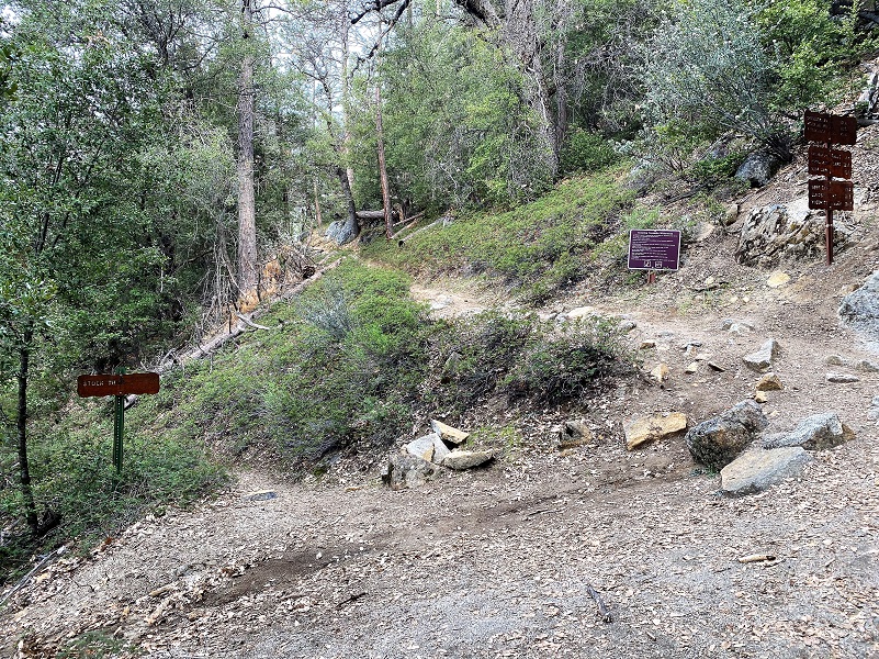
The trail soon met up with the stock trail and the trail above this point is shared by hikers and stock. I mean it will be shared once the trail is cleared. Here are some examples of the down trees impacting the trail on the day of my hike.

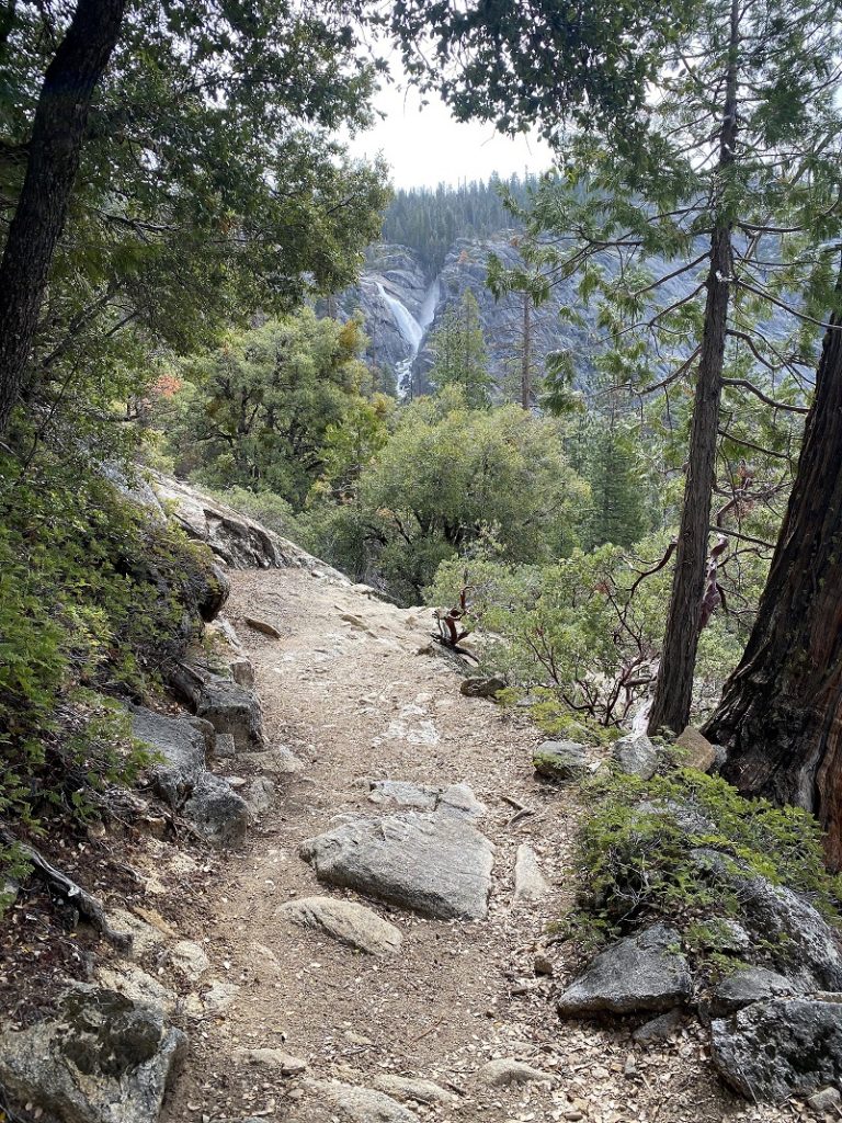
Through the trees, I caught a glimpse of the portion of Chilnualna Falls that had the biggest drop.

But I had more climbing to do . . . and trees to get over.


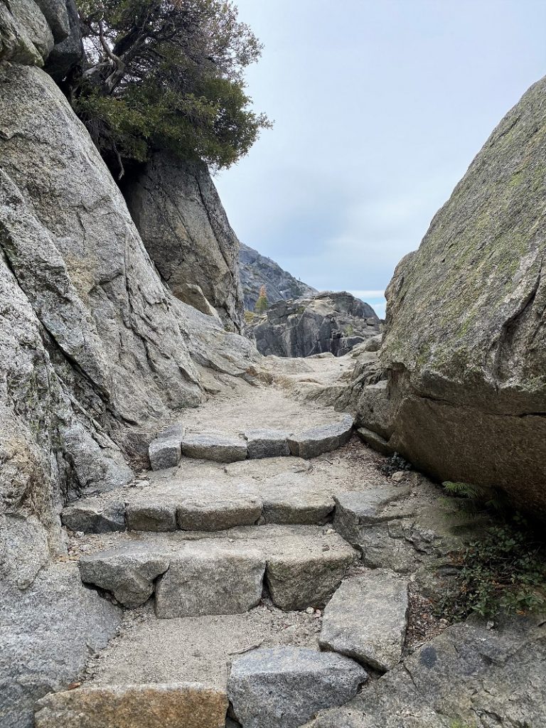
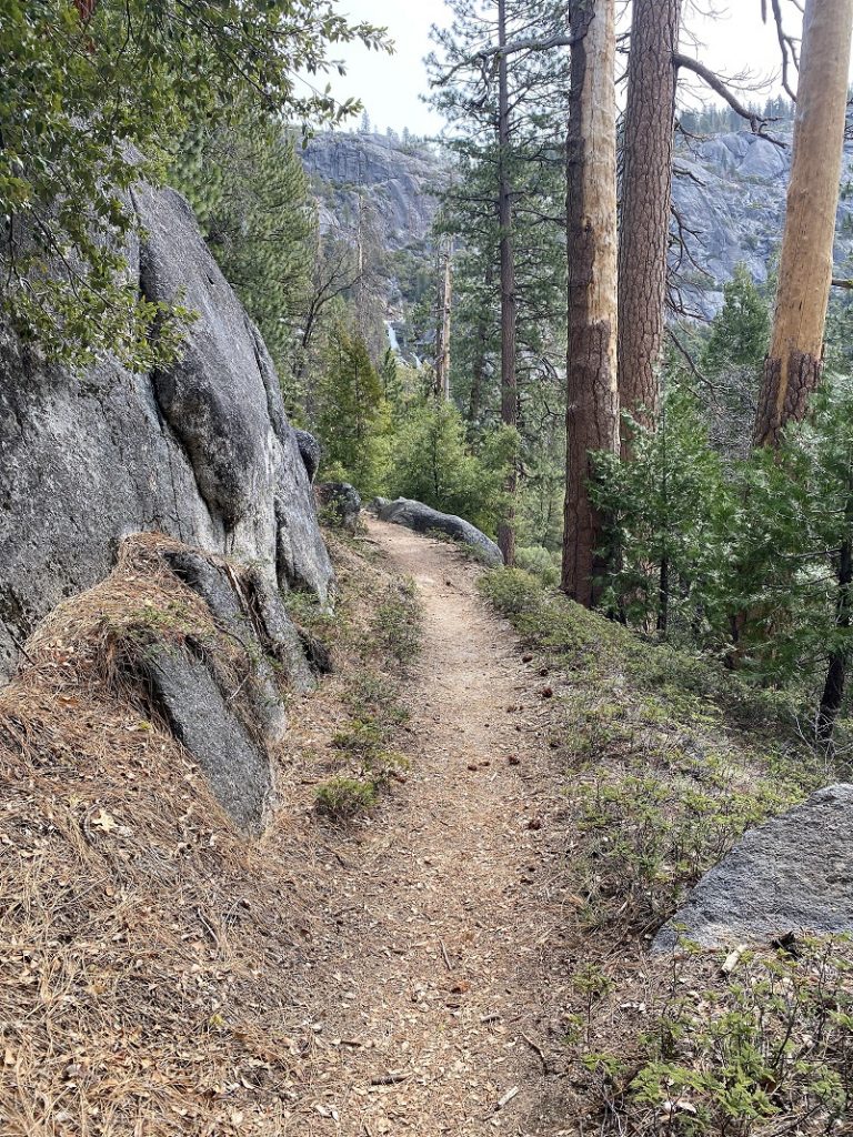
After that, it was smooth sailing and no more trees, just a smidge of uphill with pretty views.

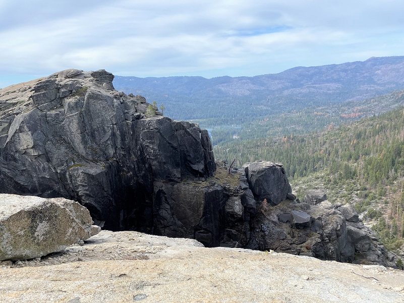
When I reached the biggest drop that Chilnualna Falls makes, I was by myself.
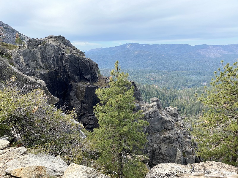
I worked my way up a little farther until a slabby rock seemed like a good place to take a break and have a snack. The view of the next set of falls was very pretty.

I headed back down, taking looks back at the falls as I walked.

I had a very good workout but you don’t need to go as far as I did. You could walk up to the lower falls and see a very pretty view. I met about 40 people on my way down, singles or small groups. I like to start this hike earlier in the day when it is cooler, less people and in warmer weather the gnats can be irritating.
Dog Hike? No
Dogs are not allowed on the Chilnualna Trail.
Where Pets Are Not Allowed
- On trails, including the trail to Vernal Fall (however, pets are allowed on the Wawona Meadow Loop)
- On unplowed roads covered in snow
- In undeveloped and wilderness areas
- In public buildings
- On shuttle buses
- In lodging areas
- In all walk-in and group campgrounds/campsites, including Camp 4
- In any other areas, as signed
These regulations protect both pets and wildlife from disease and each other. The National Park Service has prohibited pets on trails for many years. In particular, some pets chase wildlife, pollute water sources, and can become defensive and dangerous in unfamiliar surroundings. Pet owners have the burden to assure their pet does not damage the park values for others in those areas where pets are allowed.
Doarama:
What is a Doarama? It is a video playback of the GPS track overlaid on a 3 dimensional interactive map. If you “grab” the map, you can tilt it or spin it and look at it from different viewing angles. With the rabbit and turtle buttons, you can also speed it up, slow it down or pause it.
Maps and Profile:
CALTOPO has some free options for mapping and here is a link to my hike this week: CALTOPO: Chilnualna Falls Hike
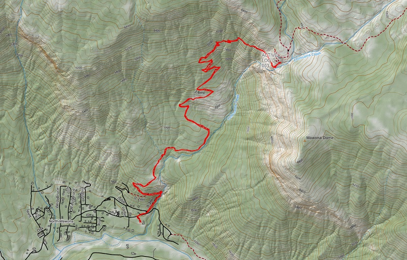
Chilnualna Falls Topographic Map
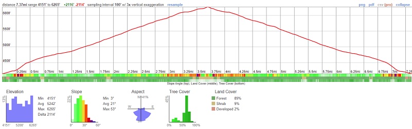
Chilnualna Falls Profile
Sources:
Wawona’s Yesterdays (1961) by Shirley Sargent
Prior Blogs in this Area:
Hiking to Chilnualna Falls and Beyond December 11, 2018
Hiking to Chilnualna Falls and a Smidge Beyond December 18, 2017

