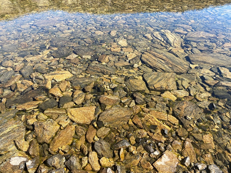
My short hike had a bit of a climb up to a pretty lake with late summer wildflowers still blooming and nearby mountains reflecting in its clear water. Waterfowl were feeding, frogs were swimming and Clark’s Nutcatchers were busy harvesting!
Where: Inyo National Forest
Distance: 3.19 Miles
Difficulty: Moderate
Elevational Range: 9,730′ to 10,526′
Elevation Gain: 869′
Date: September 1, 2022
CALTOPO: Hiking to Gardisky Lake
Dog Hike? Maybe
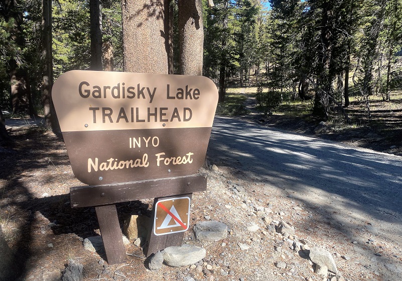 I drove to Saddlebag Lake Road, just east of the Yosemite National Park Tioga Pass entrance. Heading up the mostly dirt road to Saddlebag Lake,I parked at the small parking area for the Gardisky Trailhead, about 1.25 miles north of Saddlebag Lake Road and Tioga Road. This hike is a short one, but a bit of an uphill climb. It is about 1.2 miles one way (2.4 miles round trip), but you gain 746′ in that short distance. My slightly longer distance included a great big loop around the lakes.
The trail started across the road from the Gardisky Lake Trailhead parking and a new sign was up at the start of the trail. And this is an old trail, one that was used by miners as they traveled from Lundy, from the May Lundy Mine along the Dore Crest toward the mining operations at Dana City and Bennettville. Of course this was long before Tioga Road and Hwy 120 existed.

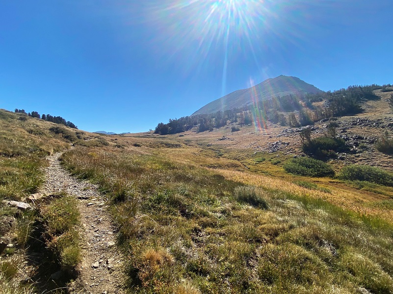
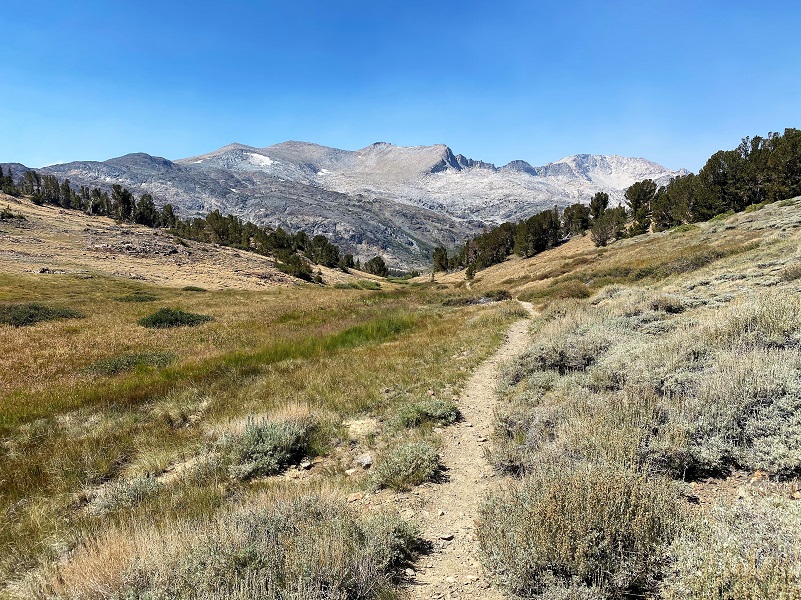
As the trail climbed, I could spot areas of the trail where it had slightly changed over the years. I had wonderful views, including out toward White Mountain with haze from the Rodgers Fire.

The switchback trail continues to climb, basically following a small creek fed by springs. After about .6 miles, the climb was pretty much over and the trail started to level out.
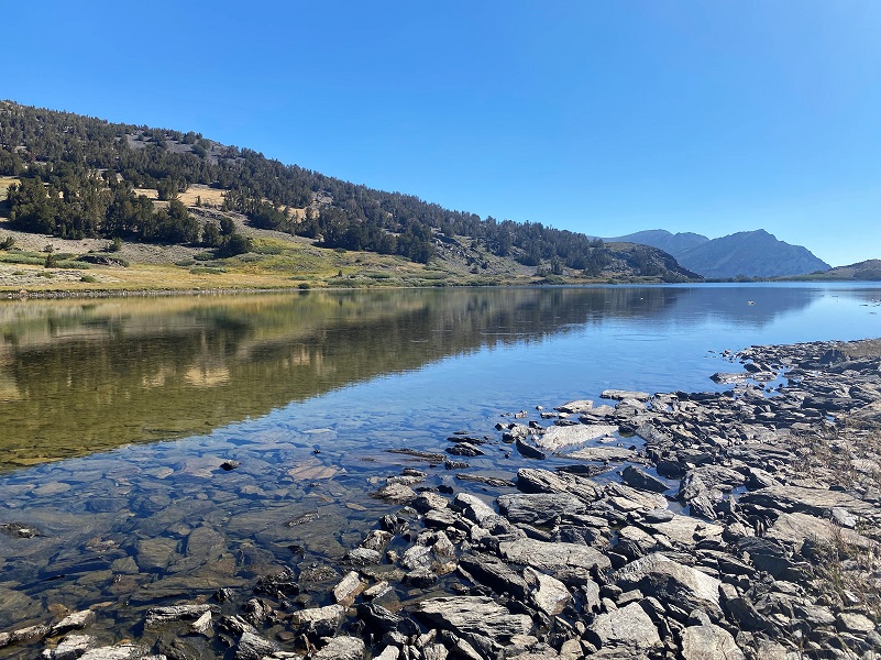
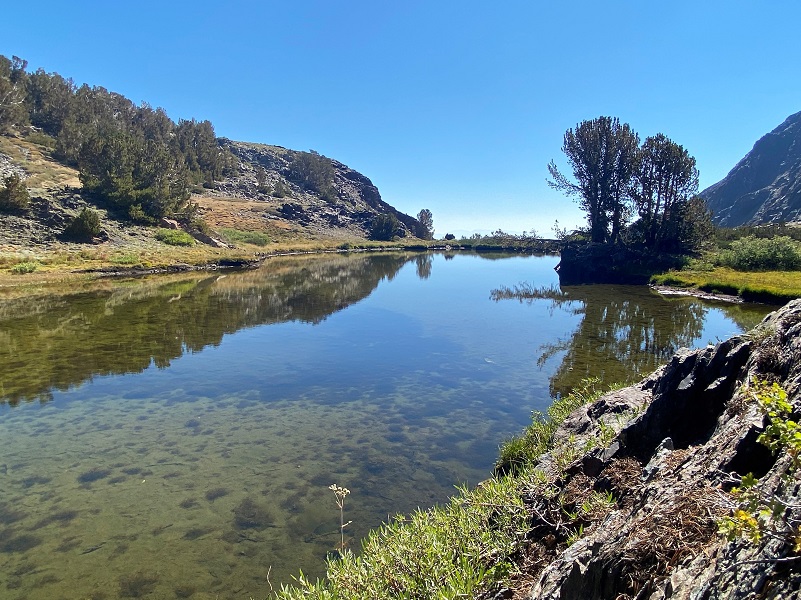
When I reached Gardisky Lake (10,502′ elevation), I decided to circle the lake, going clockwise, to see what I could discover.
It is said that in 1932, Mrs. Everett Spuller named Gardisky Lake after Albert J. Gardisky, a miner who had come to the area around 1914. He had built a cabin at what later became the Tioga Pass Resort that year, later adding a store, lodge and cabins for rent. He lived at the resort called Camp Tioga until 1935, then Lee Vining.
He was born November 1, 1880 in Rochester, New York and his parents were born in Germany. I believe I located his family on records that show that his parents, Charles and Mary immigrated to the United States in 1869. By 1917, Albert was living in Mono County and was a Prospector. On the 1930 census, Albert J. Gardisky is shown living in Homer, Mono County, California and has no occupation. The California Death Index says that he died in April 3, 1941 in Alameda, California. The story goes that after Albert J. Gardisky’s death, his relatives believed that he had hid his treasure in one of the buildings, so they tore the place apart looking for it. After failing to find anything, they sold Camp Tioga.
Wonder what Albert J. Gardisky looked like? Me too, but I couldn’t locate a picture of him. Here is his WWI Draft Registration Card with some information though. It describes him as tall, medium build, brown eyes and black hair.
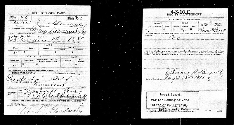
Albert J. Gardisky WWI Draft Registration Card
I spotted some sort of waterfowl swimming and feeding.
Is it just me or do these guys look like they are practicing for synchronized swimming?
A small spring fed creek was still flowing strongly.
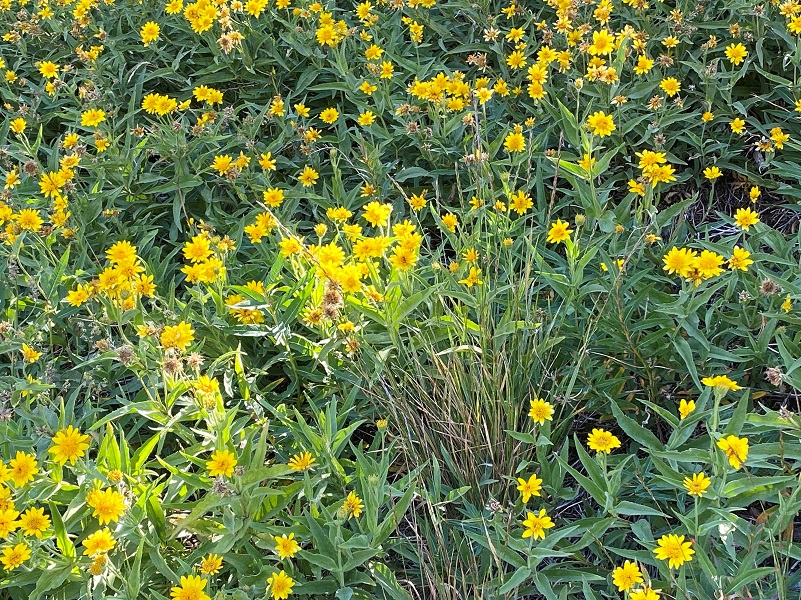
Many plants had completed their flowering for the year such as this wild onion.

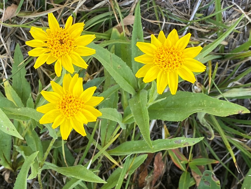
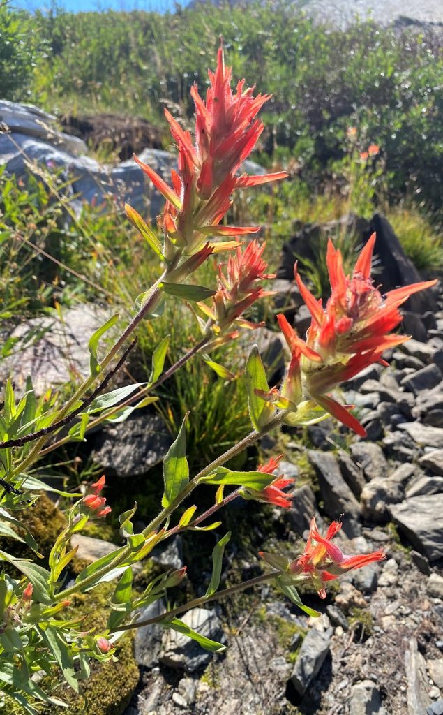
But I was very surprised that many beautiful wildflowers were in their prime. I also spotted a few others such as Asters, Slender and Shrubby Cinquefoils.
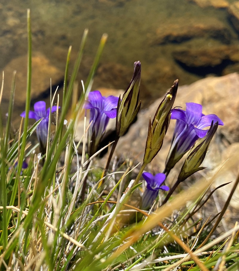
Sierra Fringed Gentian
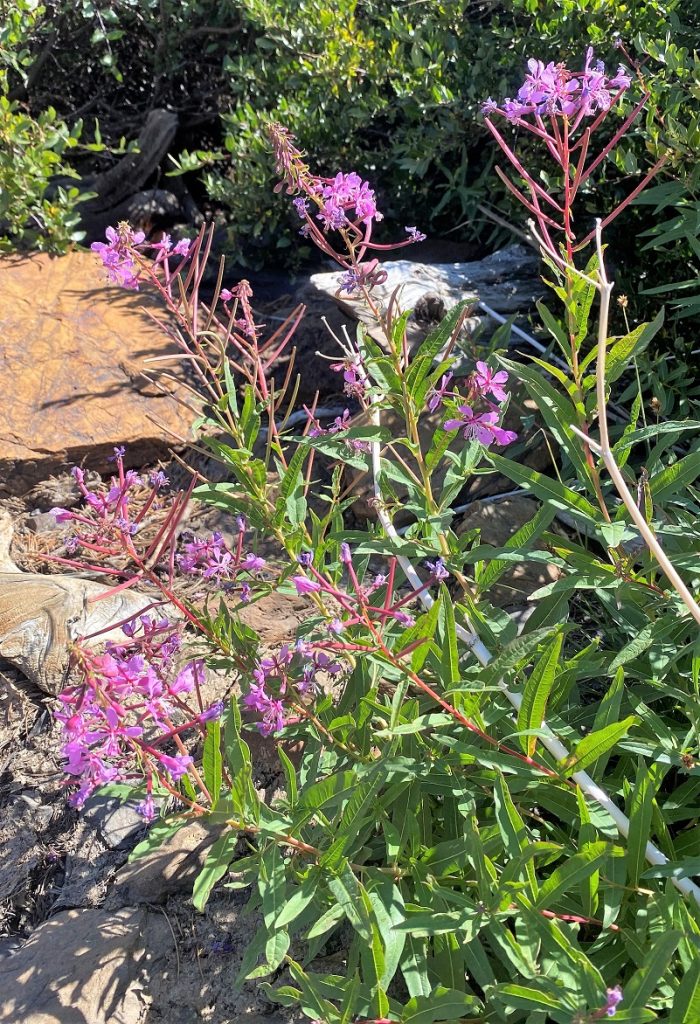
Fireweed

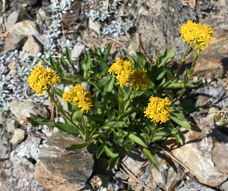
Alpine Sorrel

 I continued my walk around, watching the reflections of Tioga Peak (11,526′ elevation) in the lake.

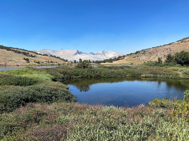
The look to the west with White Mountain (12,054′ elevation) was also very pretty.
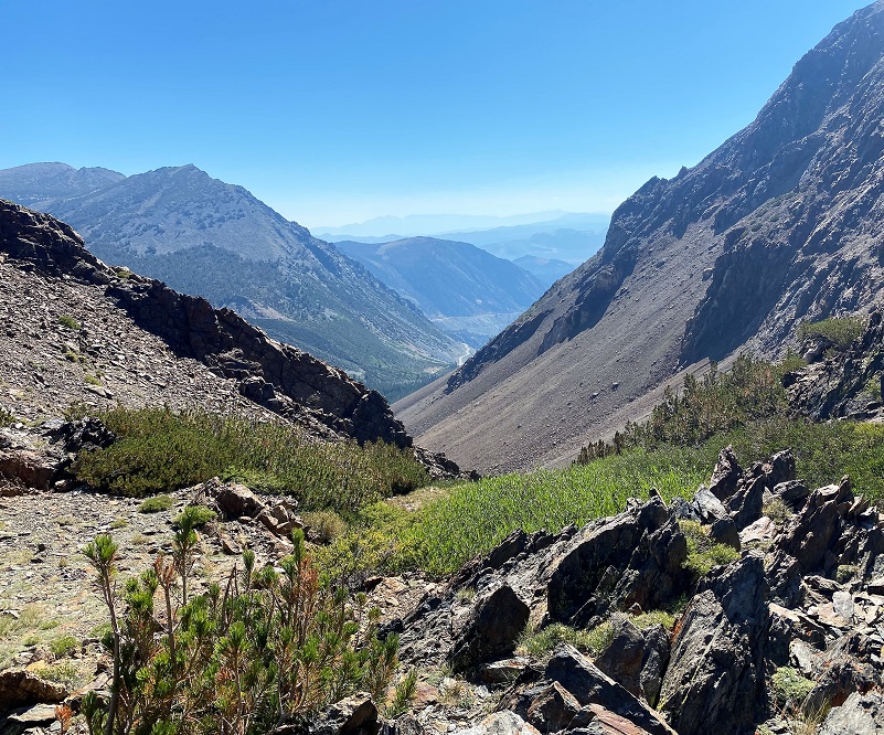
I made my way toward the outlet of Gardisky Lake which wasn’t running but was full of views down toward Hwy 120 and onward.
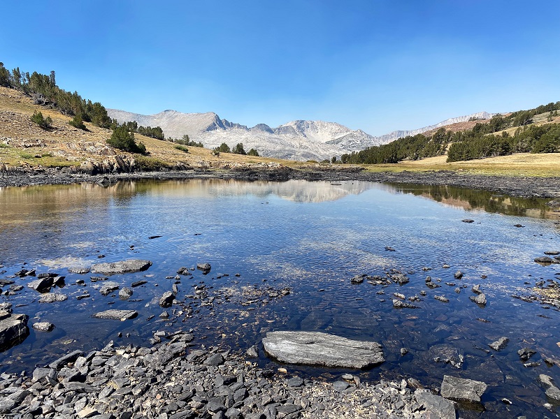
The lake was down about a foot, which made walking along its shore easy. At the beginning of a good season, this area is one lake but by the end of summer, it had dried up to be split into 3 different bodies of water. I made my way toward the western shallow lake.
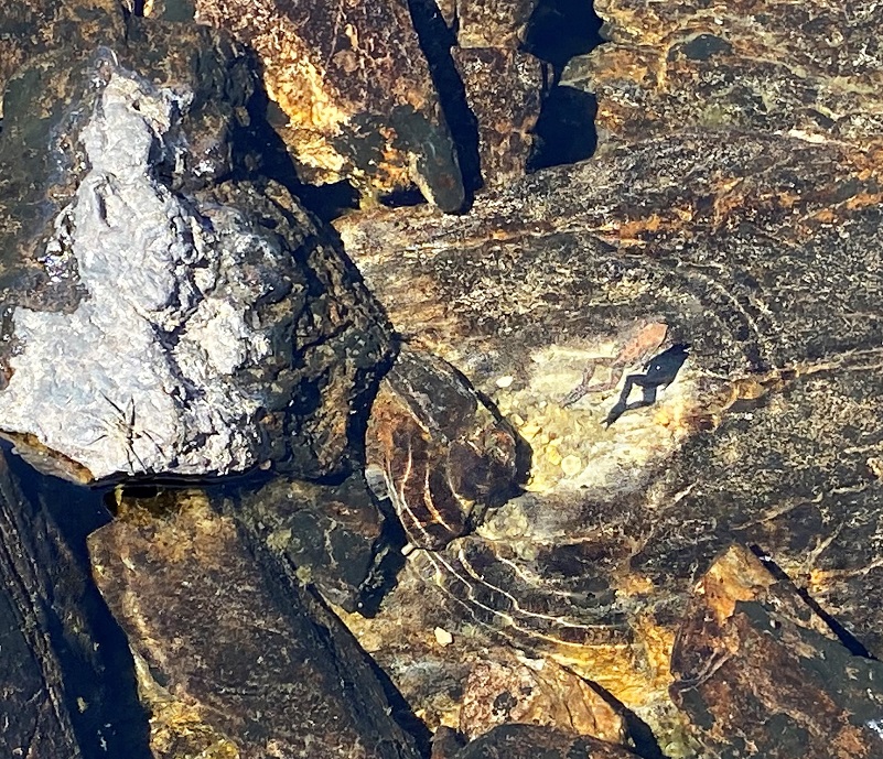
I saw movement in this lake and checked it out closer to discover many small frogs swimming around.
It was time for me to make my way back down the hill.
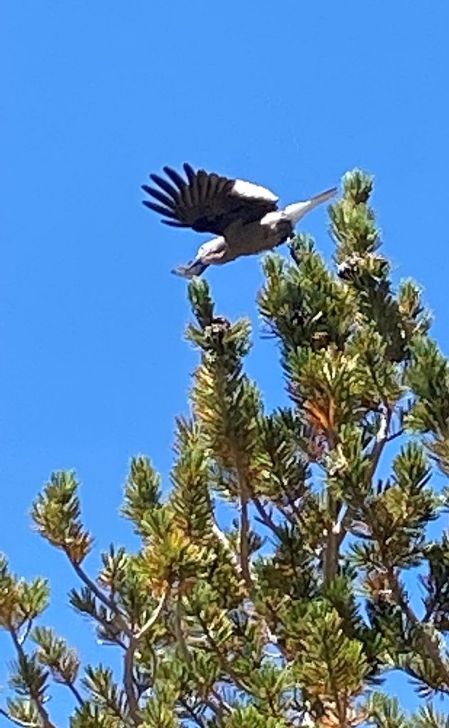
Clark’s Nutcatchers were very busy working the Whitebark Pine trees. I stopped and watched them for a while while they used their bills to rip into pine cones and pull out seeds, which they stash in a pouch under their tongue and then carry away to bury for the winter. Each birds buries tens of thousands of seeds each summer and remembers the locations of most of them. Seeds they don’t retrieve play a crucial role in growing new pine forests.
This isn’t a hike that you will likely have to yourself and I like this one early in the spring when I can get up in these parts. When snow and a bit of ice is still on the lake, it is beautiful, along with those white capped mountains around it. There was one person that started out a smidge before I did but they disappeared and I didn’t see them once I was at the lake. One the way down, there were a few small groups heading up, one with a couple of dogs on leash. I have taken my dogs and I think this is a good dog hike.
Since my hike was a short one, I decided to drive down to the Mobil Station for a Whoa Nellie Deli fix, hadn’t been yet this year. That way I would be well fortified on the drive home.
The drive to and from this hike was pretty brutal in terms of road stops, a total of 11! Keep in mind that I came through Hwy 140, so had the Ferguson Slide plus the culvert replacement east of MidPines. There were 3 pilot car stops for construction in Yosemite in the morning with the same in the afternoon, along with a bonus stop for tree work on the way home.
Dog Hike?
This hike can be a good dog hike if your dog is up to it. The rocky terrain is very rough on a dog’s feet and I pack dog boots just in case they got a sore spot on their paws. Even if you think your dog’s feet are toughened up enough for this hike, you can have surprises so please be prepared.
This is a good hike for Sally and Fannie. There aren’t any rattlesnakes or poison oak and there is plenty of good, fresh drinking water for her all along the way. That means I don’t have to pack her water and that is a good thing! My dogs have never had any problems drinking the water out of these higher elevations but some dogs may not be as easy as them on this issue. I think you need to know your dog and you may need to carry some water for them. There are wildlife up in this country and your dog can get in trouble with them. A few years ago, a small pack of coyotes harassed Sally and I on this hike. They were very active in trying to get her to come “play” with them but I kept Sally on leash. Those coyotes were so bold to come within 20-30 feet of me while I was fishing and at that point we called it quits and left. There were no signs of coyotes on my hike on this day though. This area also has bubonic plague and if you dog gets a hold of a critter such as a squirrel or mouse, this could be something to watch for after a trip in this area.
There is a great link from the Inyo National Forest regarding their dog rules: Inyo National Forest Hiking and Camping with Dogs
Doarama:
What is a Doarama? It is a video playback of the GPS track overlaid on a 3 dimensional interactive map. If you “grab” the map, you can tilt it or spin it and look at it from different viewing angles. With the rabbit and turtle buttons, you can also speed it up, slow it down or pause it.
I regretfully need to share that Ayvri, the company that created and serves the Doaramas announced on September 7, 2022, that they will be shutting down their consumer facing portion in phases but the bottom line for SNO readers is that October 31st, access to the Doarama scenes will be removed and all consumer data will be removed from the platform. so, these fun Doaramas that are linked to my blogs will no longer be available. Until then, keep on enjoying them.
Map and Profile:
CALTOPO has some free options for mapping and here is a link to my hike this week, which you can view or download: CALTOPO: Hiking to Gardisky Lake
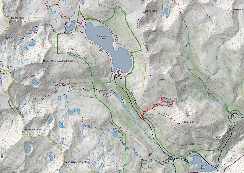
Gardisky Lake Topographic Map
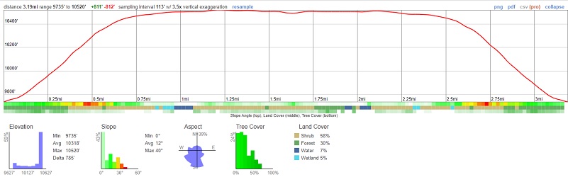
Gardisky Lake Profile
Sources:
Inyo National Forest Policies and Rules
Inyo National Forest Hiking and Camping with Dogs
Clark’s Nutcatcher All About Birds
Prior Blogs in this Area: