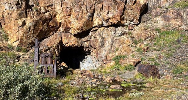
Miners were digging their way by the shovelful through a rocky mountain, hoping to make their big strike along “The Great Silver Belt,” but that big strike never happened. As I hiked in their footsteps, it almost felt like they could be returning any day now. Mining equipment is strewn near the tunnel opening and firewood is stacked, ready to be brought down to the miners. But they are long gone, been gone over 100 years. But they brought a town, telephone line and most importantly a road they called the Great Sierra Wagon Road, the road that today we call the Tioga Road.
Where: Inyo National Forest, Hoover Wilderness, Hall Natural Area
Distance: 5.96 Miles
Difficulty: Easy to Moderate (depends on how far you go and the route)
Elevation Range: 9,670′ – 9,970′
Elevation Gain: 609′
Date: September 14, 2022
CALTOPO: Hiking to the Great Sierra Mine and Beyond
Dog Hike? Probably yes
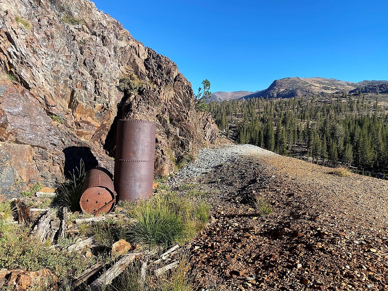
 I started my hike from Tioga Lake. East of the Yosemite National Park’s Tioga Pass entrance, there is a large parking lot with restrooms above Tioga Lake. I drove just a smidge east of this and there is a wide spot on the left where I parked. You will know you are in the right spot because there is an old piece of mining equipment on the east side of this parking area but it is nestled in the trees and easy to miss. You can also hike up to these beautiful places I visited from Junction Campground just a couple of miles east at the Saddlebag Lake Road junction with Hwy 120.
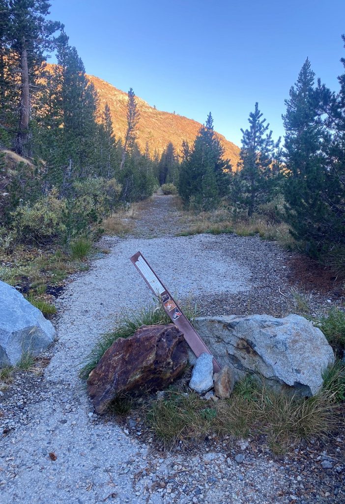 I headed up the trail, which used to part of the old road system created by the mining operations related to the Great Sierra Mining Company. The Great Sierra Wagon Road was built to bring supplies to the mines near Tioga Pass. The road was built in 1882 by the Great Sierra Silver Mining Company in 130 days and extended over 56.25 miles. A crew estimate to be 160, including Chinese and white laborers but worked almost entirely with hand tools, averaged almost one half mile a day. Cost of constructing the wagon road, which went from an elevation of 4200 feet at Crocker’s Station to nearly 10,000 feet at the summit of McLean’s (Tioga) Pass, was reported to have been $61,000. At some point, the road was planned to add an additional four miles from the Bennettville area down Lake Canyon to Lundy to give a through route across the Sierra. That stretch was never finished, and the present road down Lee Vining Canyon was not completed by the State of California until 1911.
The Great Sierra Wagon Road soon fell into disrepair after the collapse of the Great Sierra Mining Company, and remained neglected until its purchased in 1915 for $15,500 by Stephen T. Mather, the first director of the National Park Service, with the help of the Sierra Club and others. Following its acquisition from members of the Swift family of new Bedford, the road was deeded to the Federal Government. The Park Service opened the road to the public, calling it the Tioga Road, and the road traverses the park from its west to east entrances.
The portion of the road that was listed on the National Register of Historic Places on August 25, 1978 is now known as the Old Tioga Road, left behind when the Tioga Road was realigned to avoid Aspen Valley in the western part of the park. The position of the Old Tioga Road within Yosemite National Park is a park service road, not open to the public apart from a short section that provides access to private inholdings.
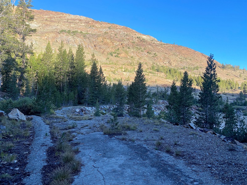
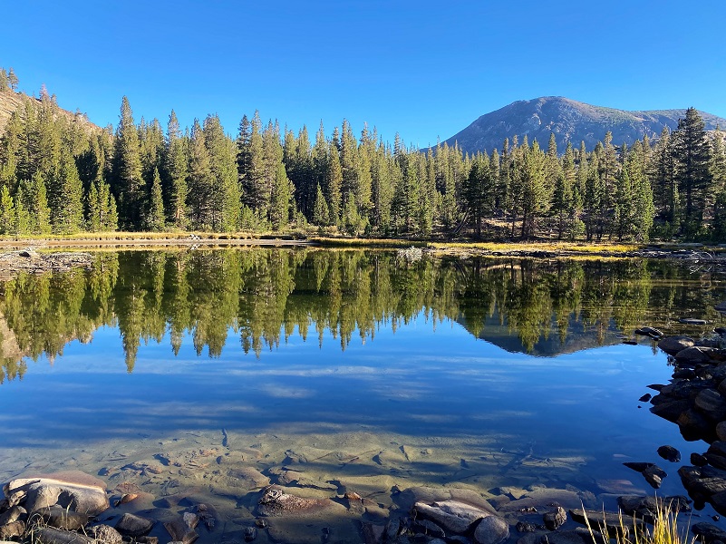
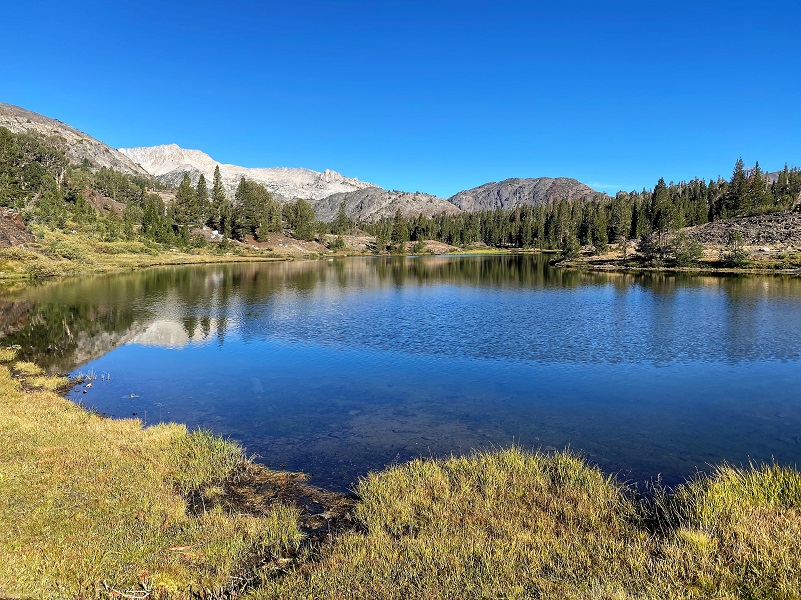
I wandered along, checking out areas along the old road that had showed a human touch, wondering whether these were old diggings from the miners or previous versions of the old road. I checked out reflections in the small tarns along the way.
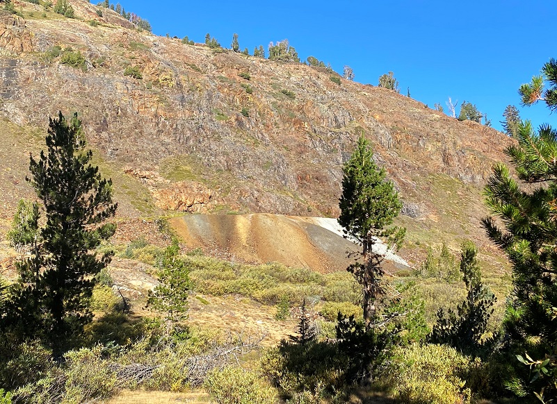
It wasn’t long before the road gave me a glimpse of the Great Sierra Mine and its colorful tailings.
To better understand how this mine played into the local mining history with Lundy and Dana City, we need to go back in time a bit with the help of the Lundy newspaper The Homer Index.
The story goes that “in 1860 a prospecting party consisting of a justice of the peace, an ex-sea captain, a surveyor, a dentist and a professor was prospecting in the Bloody Canyon area. The dentist, George W. “Doc” Chase, remarked, while camped near Tioga Pass, that if they could but spend one more day in the area he could locate and claim ‘the biggest silver ledge ever discovered.’
The next day he placed a flattened tin can, on which he scratched the location notice with his knife, on Tioga Hill. The ore he carried out was never assayed as he and his partners arrived at Monoville just when the Aurora strike was made. Each made money but none ever returned to the ‘thundering big silver ledge’ on Tioga Hill.
15 years later, William Brusky, Jr. was herding his father’s sheep and he found a rusty pick and shovel and a flattened tin can, on which he could make out, “Notice, we the undersigned” and the date 1860. Having heard of the lost mine, Brusky took ore samples to his father, who tested them and pronounced them worthless.
Young Brusky did not discourage easily. The next summer he ‘sank a small hole in the ledge and procured some better looking ore.’ It was not until 1877 that an assay found the ore to be rich in silver.”
In 1878, nine claims were made in the area and the Tioga Mining District was organized. Dana City, the site of the mine called the Great Sierra Mine, was given a Post Office in 1880. In 1881, the Great Sierra Consolidated Silver Company bought up all of the claims on Tioga Hill. No pay dirt was hit so they regrouped.
The Homer Index covered much of the mining news in the area and many copies of it still exist, providing us with a glimpse into what life was really like in these mining communities, including how the equipment was brought into these remote areas. Remember, this was long before Hwy 120 and the Tioga Road.
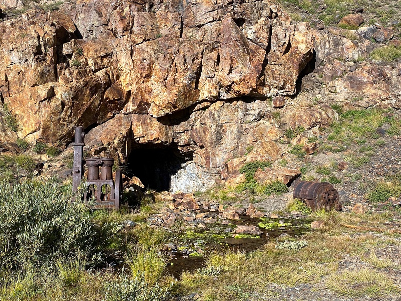
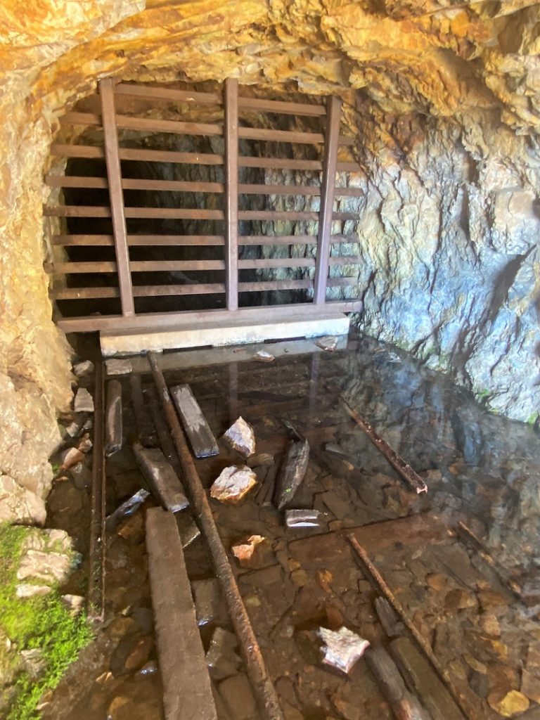
Tunnel and Equipment, Great Sierra Mine Tunnel
On November 12, 1881 (The Homer Index):
The Great Sierra Mining Company of Tioga District has advertised for sealed proposals for running a double track tunnel or adit 500 feet into Tioga Hill, the tunnel to be nine feet wide, six feet high in the clear at the walls and seven feet in the arch. The tunnel will be started in the cove at the head of the south fort of Lee Vining Creek, and driven for the Lake and Sonora locations on the Sheepherder Lode, and the survey for it is now being prosecuted.
The second part of this project was building a road to the mine from the west that pretty much followed today’s Tioga Road from Crocker’s Station on the Big Oak Flat Road, through Tuolumne Meadows. Even though that road hadn’t been built yet, the work on the mine started, moving equipment and workers from Lundy. By January 16, 1882, the tunnel was 62 feet in length. Can you imagine hauling 16,000 pounds of equipment up from Lundy and down to the Great Sierra Mine?
In 1882, they started working round the clock with 3 shifts to dig in the Great Sierra Tunnel. Their plan was to dig a tunnel 1,784′ down where they hoped to hit that big silver ledge. That year, the new town of Bennettville got its own Post Office. More than 350 claims had been made in the Tioga Mining District by this time. “Bennettville was touted as an excellent location with ample room for 50,000 inhabitants, an abundant water supply and invigorating climate.”
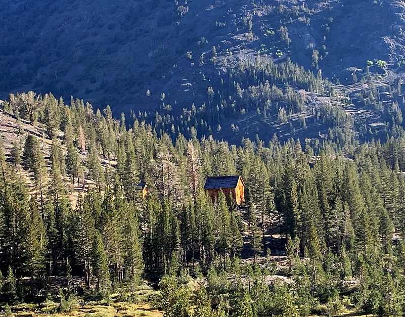
The old mining town of Bennettville housed those hardy miners and there used to be 14 buildings but they have been lost to time. The United States Forest Service restored two of the buildings, an assay office and a bunkhouse, back in 1993. Information from the Inyo National Forest shares that with permission, visitors can see inside the barn. Sometimes it is open when I have visited and sometimes it is locked. If you are interested in more history related to Bennettville and the mining in this area, you can access the links of my prior blogs on the area at the bottom.
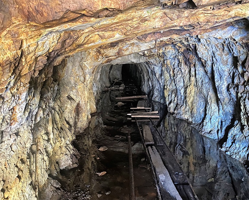
Looking Toward Bennettville From the Great Sierra Mine Tunnel
Bennettville was first called Bennett City and shows up in the Homer Mining Index on February 18, 1882:
“The Coming City. The embryo town at the mouth of the Great Sierra (commonly called Tioga) tunnel is called Bennet City, in honor Thomas Bennett Jr., of New Bedford, Massachusetts, President of the Great Sierra Consolidated Silver Company. . . Bennett City, being centrally and beautifully situated, will be the principal town of the district, though when the mines are developed they will doubtless support one or two other towns of considerable size. But all the mines of Tioga Hill as far north as Mount Conness will be tributary to this place, as will also the Rhinedollar group of mines on the eastern line of contact and on both sides of Lee Vining creek, and all the mills and other reduction works required by both tiers of mines in the central portion of the district. Bennett City will also be the terminus of the wagon road to be built early in the coming Spring, but the Great Sierra Company, to connect the mines with the railroads of the San Joaquin Valley. A portion of the flat near the mouth of the tunnel has been located for placer mining and some good prospects obtained, but there is ample room on gently rolling ground for a city of 50,000 inhabitants, with an abundance of wood and water of the best quality on the ground.”
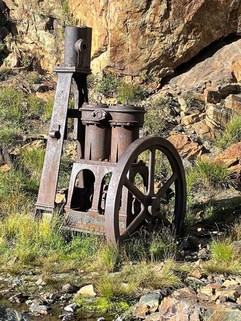
Old rails, parts of orecarts and other mining equipment is located near the tunnel’s entrance. The story about how it got here is so very interesting to read in The Homer Index.

Mining equipment to support the Great Sierra Mining Company’s operations came in from Lundy. March 4, 2881 (Homer Mining Index):
The transportation of 16,000 pounds of machinery across one of the highest and most rugged branches of the Sierra Nevada mountains in mid-winter, where no roads exist, over vast fields and huge embankments of yielding snow and in the face of furious wind-storms laden with drifting snow, and the mercury dancing attendance on zero, is a task calculated to appall the sturdiest mountaineer; and yet J. C. Kemp, manager of the Great Sierra Consolidated Silver Company of Tioga, is now engaged in such an undertaking, and with every prospect of perfect success at an early day—so complete has been the arrangement of details and so intelligently directed is every movement. The first ascent, from Mill Creek to the mouth of Lake Canyon, is 990 feet, almost perpendicular. From that point to the south end of Lake Oneida, a distance of about two miles, is a rise of 845 feet, most of it in two hills aggregating half a mile in distance. The machinery will probably be hoisted straight up to the summit of Mount Warren ridge from the southwest shore of Lake Oneida, an almost vertical rise of 2,160 feet. From the summit the descent will be made to Saddlebags Lake, thence down to and along Lee Vining Creek to the gap or pass in the dividing ridge between Lee Vining and Slate creeks, and from that point to Tunnel, a distance of about one mile, is a rise of about 800 feet—most of it in the first quarter of a mile. The machinery consists of an engine, boiler, air-compressor, Ingersoll drills, iron pipe, etc., for use in driving the Great Sierra tunnel. It is being transported on six heavy sleds admirably constructed of hardwood. Another, or rather, a pair of bobsleds, accompanies the expedition, the latter being laden with bedding, provisions, cooking utensils, etc. The heaviest load is 4,200 pounds. Ten or twelve men, two mules, 4,500 feet of one-inch Manila rope, heavy double block and tackle, and all the available trees along the route are employed in “snaking” the machinery up the mountain—the whole being under the immediate supervision of Mr. Kemp, who remains at the front and personally directs every movement. It is expected that all the sleds will be got up into Lake Canyon today, and then the work will be pushed day and night, with two shifts of men. Meantime, the tunnel is being driven day and night, with three shifts of men under Jeff McClelland.
 March 11, 1882 (Homer Mining Index) :
High Up. The Lundy and Tioga telephone line, recently constructed by the Great Sierra Con. S. Co., of Tioga, is the highest telephone line in the world. The line is nine miles in length, ascends 4,245 feel from Lundy, crosses Mount Warren divide at an elevation of 12,250 feet above sea level, descends 3,750 feet to Lee Vining Creek, and again ascends 800 feet to Bennett City, which is 9,300 feet above sea level.
As I took a peek into the barricaded mine tunnel, I imagined the hard life that these miners must have had.
Many stories are documented about life in the Bennettville area but this one is at the top of my list.
March 25, 1882 (Homer Mining Index):
Twenty-one Men Buried at Tioga. At the usual hour, 11 o’clock on the night of the 15th, 21 men were buried in the Great Sierra tunnel lodging house at Bennett City, by a huge avalanche from Tioga Hill. Several smaller snow slides had coursed down the hill during the day, covering the portal of the tunnel with their wings, and hence work had been suspended and all the men were in the lodging house – a structure of huge logs two to three feet in diameter, with a partition wall of similar material, the whole building half buried on the side next to the mountain, with the deep ravine of Slate Creek between the base and the building; and yet the avalanche swept across the creek, up the ridge, demolished the building and plunged through heavy timber and along the side of the ridge for a distance of 1,000 feet or more. R.W. Woolard (Secretary) and Dr. F. Kemp were occupying the small frame office at the end of the building , and were just preparing to retire when the crash came. The frame building was crushed to the ground, Woolard was pinned across the hot stove and nails projecting through the roof nailed his head to the floor, Dr. Kemp was fastened against and behind the stove – and their lighted lamp was broken and their bed set on fire! A rafter from above and a plant shelf below closed tightly across Dr. Kemp’s hip. Dr. Kemp could have worked his way out, but the moment he removed his support from Woolard’s body the latter would be left hanging by the neck.
The Rescue. The log house had been struck between ‘wind and water’ as it were, the upper portion carried away, and the men left lying in their bunks, with eight or ten feet of soft snow above them. Jack Hammond was the first to dig his way out, and, realizing from the situation that the other men in the log building were not in danger, he went to the rescue of Woolard and Kemp. With bare feet and hands he dug down through the snow to the base of the building, and crawled in between the roof and the floor on his belly. A strong table had been overturned and ws supporting the roof, and the legs of this table obstructed Hammond’s passage. Tearing off one of the legs he continued crawling until he reached the men. He had carried a hatchet in with him, and with this he cut the rafter away and released Woolard’s neck, broke the stove and released his legs and dragged both men out. . . All the other men escaped without injury, except Frank Cavin, who had one foot severely cut by a window glass. Woolard sustained two long cuts on the head, made by nails, and a severe burn on the front portion of the left thigh. On the 24th, he was placed upon a sled and drawn across the mountains to Lundy.
The Great Sierra Wagon Road took 100 days to build at a cost of $62,000 and went into service in 1883. A lot of money had been spent by the Great Sierra Consolidated Silver Company and they pretty much ran out of money by the end of 1883. Appeals were made to the stockholders for money with limited success. Work was stopped on July 3, 1884 despite an appeal to the stockholders that “the heading of the tunnel was at 1784 feet, and without debt, is within 200 feet of the great Sheep Herder’s ledge, doubtless one of the largest and richest ore at present in existence in this country.
Creditors received judgement in 1887 and a Sheriff’s sale was made in 1888. The Great Sierra Mine showed up in property and tax records throughout the years, changing hands. Much of the equipment that was at the mine was donated by the landowner to Yosemite National Park where some of it is displayed today at Wawona.
On July 3, 1884, the boom was over. A financial ‘crisis’ occasioned the Great Sierra’s Executive Committee to suspend all operations and soon Dana City and Bennettville joined the silent ranks of fabled western ghost towns. Although more than $300,000 had been spent, as best we know no ore ever left the Sheepherder Mine for milling. But a road had been built. We know that road today as the Tioga Road.
So, how much money did the Great Sierra Mine make in profit over its life? No records survive of any ore shipments. More than $300,000 had been spent, but it appears that no ore ever left for milling.
Yosemite Nature Notes is a wonderful web series that puts together gorgeous videos about Yosemite National Park. Dana City is located within the Park but Bennettville is just outside. You can even subscribe to their YouTube Channel to be notified when a new video comes out (link at the end of the blog). They recently released a video about Dana City, Bennettville and other old, abandoned Mining communities in this area, please check it out.
I have been asked about what was the official name of this mine where this Great Sierra Tunnel was dug into Tioga Hill’s. The name of a mine may change over the many years since it was first “discovered”. New owners may change the name or add it to a grouping of nearby mines under a different name. People today will refer to the name of this mine under slightly different names because of this. Because the Great Sierra Mining Company underwent this large mining endeaver, the mine at Bennettville and Dana City, often are both called the Great Sierra Mine. The Homestake Mine and Tioga Mine are shown on Mine.dat and Mono County’s records as the latest names and September Holdings also has mining claims in this immediate area.
Here is a CALTOPO Historic Map overlay from my tracks on this hike and one to Dana City that shows the proximity and relationship of the tunnel that was being driven between the two locations.
I wandered on, heading a little up the hill, then wandered along the west side of Shell Lake (9,880′ elevation).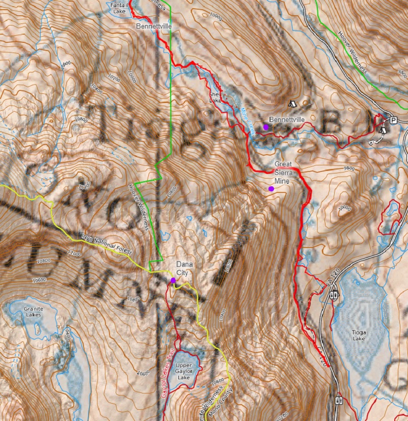

I continued up the trail.

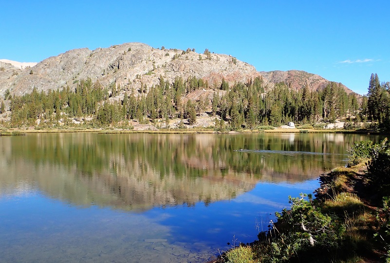
Fantail Lake (9,905′ elevation) is another beautiful lake, full of reflections.


I had pondered heading through Crystal Pass to Spuller, Green Treble and Maul Lakes but near the upper end of Fantail Lake, I wandered to the east and toward a saddle where I could look down toward the Sawmill Campground, once the location of a real sawmill. To me, this is a special place that unofficially is called Cordwood Ridge.
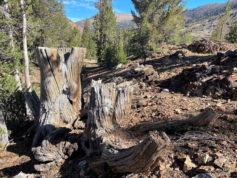
It gets its name because it follows along the west side of a ridge, bordered on the west by Mine Creek and on the east by Lee Vining Creek. Back in the day when mining was active in this area, one of the important occupations was woodchopper. A huge amount of firewood was needed to heat and cook with, along with being used as timbers for the mines. The woodchopper’s main work involved cutting firewood with crosscut saws and axes, then stacking them in cord units (4 feet high, 8 feet long and 4 feet wide). This wood was then loaded on the backs of mules or on sleds in the winter to take to the mine or town. Cordwood crews were often recent immigrants, often Chinese workers. Many of these cordwood stacks are still laying on Cordwood Ridge as if they are ready to be loaded up and brought down to be used when the mining operations suddenly shut down.
It is like time stopped in this area. The wood is cut, stacked and ready to be picked up and taken where it was needed. I could even pick areas where you could see the indentations of where things were skidded or packed by stock off of this area. It would be a fairly decent route back to Bennettville, the mine or the sawmill area. Some of the stacks are smaller and some are huge. All were Western White Pine, and probably cut and stacked around 1884. I’ll do the math for you so you don’t need to: that is 138 years ago! I can’t help but think of those hard workers who cut and stacked it as they probably didn’t get paid when the operation abruptly ran out of money and shut down.

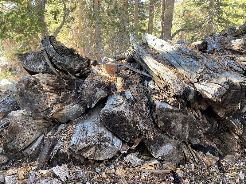
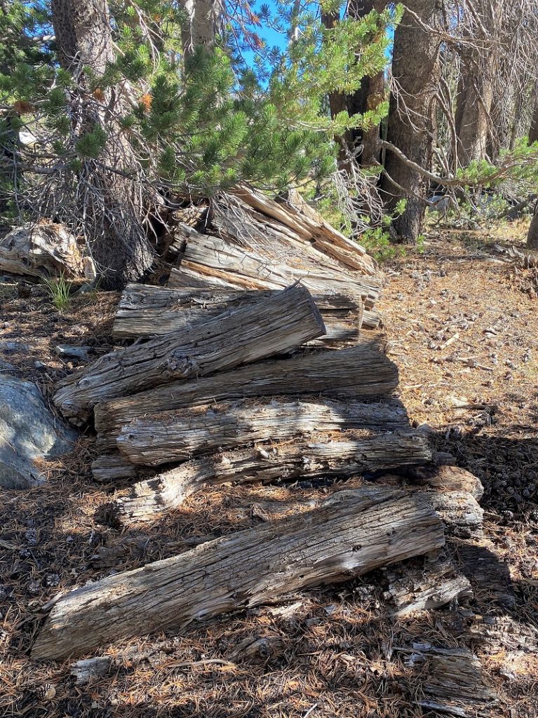
Even the trees that they cut for this wood still tell the story!
I wandered along the ridge for a while then back to the trail, following it back to the car.

Along the way, I watched Clark’s Nutcatchers gathering Whitebark Pine seeds and spotted a few late summer wildflowers such as fireweed, aster and paintbrush still holding on. This is also an incredible trail if you are a geology buff because it is full of interesting features that slice through eons.
This is a fairly easy hike up to Fantail Lake and I would classify it as Moderate after that due to the elevational gain up to Maul and Green Treble Lakes.
There is a wonderful book at Bennettville that I cannot recommend enough if you want to learn more about Bennettville and the surrounding area. It is called Bennettville and the Tioga Mining District by Alan H. Patera. He includes many stories about the people who lived here, along with historical information. You will probably have a challenge finding it but you can usually pick up a copy on EBay if you set a search.
Dog Hike?
This hike can be a good dog hike if your dog is up to it. The rocky terrain is very rough on a dog’s feet and I pack dog boots just in case they got a sore spot on their paws. Even if you think your dog’s feet are toughened up enough for this hike, you can have surprises so please be prepared.
This is a good hike for Sally and Fannie. There aren’t any rattlesnakes or poison oak and there is plenty of good, fresh drinking water for her all along the way. That means I don’t have to pack their water and that is a good thing! My dogs have never had any problems drinking the water out of these higher elevations but some dogs may not be as easy as them on this issue. I think you need to know your dog and you may need to carry some water for them. There are wildlife up in this country and your dog can get in trouble with them. This area also has bubonic plague and if you dog gets a hold of a critter such as a squirrel or mouse, this could be something to watch for after a trip in this area.
There is a great link from the Inyo National Forest regarding their dog rules: Inyo National Forest Hiking and Camping with Dogs
Doarama:
What is a Doarama? It is a video playback of the GPS track overlaid on a 3 dimensional interactive map. If you “grab” the map, you can tilt it or spin it and look at it from different viewing angles. With the rabbit and turtle buttons, you can also speed it up, slow it down or pause it.
I regretfully need to share that Ayvri, the company that created and serves the Doaramas announced on September 7, 2022, that they will be shutting down their consumer facing portion in phases but the bottom line for SNO readers is that October 31st, access to the Doarama scenes will be removed and all consumer data will be removed from the platform. so, these fun Doaramas that are linked to my blogs will no longer be available. Until then, keep on enjoying them.
Map and Profile:
CALTOPO has some free options for mapping and here is a link to my hike this week, which you can view or download: CALTOPO: Hiking to the Great Sierra Mine and Beyond
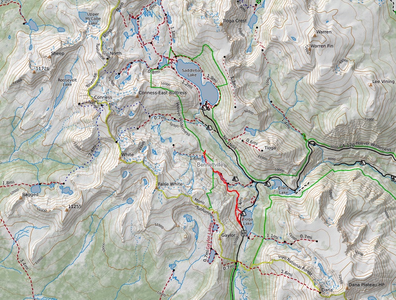
Great Sierra Mine and Beyond Topographic Map
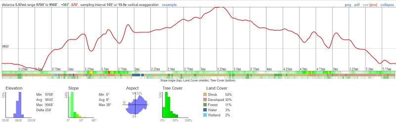
Great Sierra Mine and Beyond Profile
Prior Blogs in this Area:
Hiking With Sally & Fannie to Bennettville and The Great Sierra Mine September 30, 2021
Hiking With Sally to the Old Mining Town of Bennettville July 17, 2019
Camping & Fishing With Sally in Tioga Pass June 19, 2019
Hiking Through July Snow To Gaylor, Granite Lakes & The Old Mining Town Of Dana City July 1, 2019
Hiking from Tioga Lake to Bennettville and up to Green Treble Lake Loop October 12, 2018
Hiking from Tioga Lake to the Great Sierra Mine and High Lakes Beyond August 10, 2017
Hiking with Sally From Bennettville to Green Treble Lake August 18, 2016
Bennettville to Spuller Lake Snow & Ice Hike February 13, 2013
Hiking With Sally And Raven from Bennettville to Green Treble Lake June 2, 2014
Hiking to the Old Mining Town of Bennettville and the Lakes Beyond November 11, 2014
Bennettville to Spuller Lake Snow & Ice Hike February 13, 2013
Sources:
The Great Sierra Mining Road Ghost Mines of Yosemite (1958) by Douglass Hubbard
The Great Sierra Wagon Road Wikipedia
The Great Sierra Mining Road Ghost Mines of Yosemite (1958) by Douglass Hubbard
Chinese in the Woods: Logging and Lumbering in the American West By Sue Fawn Chung
Homer Mining Index
http://www.lundycanyon.com/the-homer-mining-index/
Hubbard, D. H.,Ghost Mines of Yosemite, 1958, Awani Press, Fresno.
Trexler, Keith A., The Tioga Road; a History 1883-1961 http://www.yosemite.ca.us/library/tioga_road/mines.html
Patera, Alan, Bennettville and the Tioga Mining District, Western Places, Lake Grove, Oregon, 2003


Want to share some wonderful news from SNO reader Lindon Baker. He located where you can order Alan Patera’s books and the information is below. Thank you so much Lindon!
Hi Candace:
After some searching I found that books by Alan Patera, including ”Bennettville and the Tioga Mining District” are still readily available for purchase at the Western Places web store:
https://www.westernplaces.net/store/
No need to hunt for a used copy on eBay!
The store site is a little quirky. I was not able to get the site to work correctly using current versions of Google Chrome or Firefox, but it almost works with obsolete Internet Explorer. I was finally able to complete a purchase using a current version of Microsoft Edge. They only accept payments via PayPal.
I reported the web store quirks to Alan Patera. Alan said he would forward the issues to the web store manager.
Lindon Baker