Sometimes hikes don’t go as planned, creating an unexpected fun adventure. A pretty little lake, beautiful end of September wildflowers and a one of a kind view all made this hike a winner.
Where: Ansel Adams Wilderness, Sierra National Forest
Distance: 7.08 Miles
Difficulty: Moderate to Strenuous
Elevation Range: 8,040′ – 9,612′
Date: September 17, 2018
Maps: Merced Peak Topographic Quad
Dog Hike: Maybe
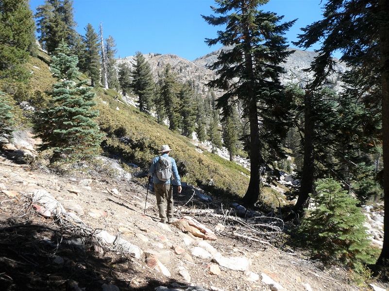
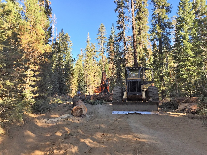 We headed up Beasore Road, turning left on 5S04, past the Chiquito Pass Trailhead. We had a bit of surprise when we came around a corner and the road was blocked from logging. From the looks of it, I thought we would be waiting for a long time but those nice loggers cleared the road for us in no time.
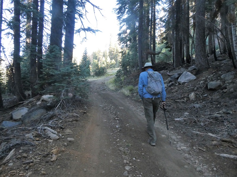 The road was starting to look a little rough, with some big rocks that could make for difficult driving, even with the 4WD vehicle we were in this day. We had hoped to get farther up the road but that did not happen. The road had some pretty good sized loose and high rocks on it as it climbed. We opted to park the car 1 ½ miles shy of the end of the road, then walked up the road.
I need to make a confession. I could have titled this blog “Hiking Almost to Sing Peak” but liked the way that “Hiking to the Headwaters of the East Fork of Chiquito Creek” rolled off my tongue much better. Our real plan was to hike up to Sing Peak but we ran out of time, partly because we had to walk additional miles because of the parking issue and partly because we didn’t allocate enough time for our hike. It was still an excellent adventure!
When we reached Klette Meadow, we headed cross country and uphill. That got me wondering who this meadow was named for and when I got home I did some digging. I couldn’t determine for sure but I bet I have it narrowed down. There is an excellent publication by John O’Neal with stories of cattlemen and grazing in our local forests that I highly recommend called Two Blades of Grass Where Thousands Grew Before and here is an excerpt:
Before the establishment of the Forest Reserves, many stockmen grazed their stock in the mountains in the summer time. Each had his range which was more or less respected by others. Migrant sheepmen were discouraged and sometimes shot at—and some were hit. At times these migrant sheepmen warred among themselves for range. Henry Daulton, Bill Raynor, Sr., George Mordecai and Miller and Gordon were local early-day sheepmen who ran sheep on the high mountain ranges. P. M . Klette, father of the late Judge Ernest Klette of Fresno County, ran sheep on Peckinpaw Mountain as did George Wagner and his partner. Jim Walker ran sheep on what is now the Green Mountain range. Bill Brown, father of Billy, Herrick, Jerry and Blaine, once took 100 head of mules into Cassidy County. The sheepmen would not let him cross them at Miller’s Bridge (named after Heber Miller’s father) so he crossed the San Joaquin River near the mouth of the South Fork and brought the mules up and through a gap near the side of Balloon Dome.
Miller and Lux also trailed sheep from their West Side ranges up into the mountains. Alex Grieves was their camp tender. There is an old chair that he cut from a log at my camp in Jackass Meadow. Later Miller and Lux quit taking sheep to the mountains and started taking steers. When I hauled the quartz mill to Jackass Mountain, Miller and Lu x had 1,000 steers on the Beasore-Jackass ranges and another 1,000 head on the Cassidy range. Tom Beasore and Tom Jones also had cattle in the Beasore area. I took my first cattle into the mountains in 1900 when I was 19 years old and continued to take either cattle or sheep into the mountains each year— except for 1944—until 1950. The first year I took 125 head of my father’s cattle. It was a mixed bunch consisting of cows, calves, steers and bulls. With the exception of one year I ran cattle on the Jackass range until the close of 1916 when I sold out to Bill Turner and went into the sheep business. Up until this time my father and I were partners and we held a permit for 500 counters, 490 cattle and 10 horses.
It sounds like Klette Meadow was named after P.M. Klette, son of Judge Ernest Klette and I was off to the races in finding more information.
Ernest Klette was born about 1875 in Canada, both of his parents being born in Germany. On the 1910 census, he is single and living with his sister Bertha in Fresno County, born about 1872 in Canada. Ernest married Olga, born about 1890 in Canada, both of her parents born in Denmark. Ernest came to the US in 1876 and was naturalized in 1881. And that led me to Ernest’s father, Paul Hugo Lincoln Klette, born September 1865 in Canada. In 1888 and 1892, he registered to vote in Fresno County. On the 1900 census, Paul H. Klette is listed as a Gold Miner living in Madera County. He died June 10, 1933 in Madera County. I think this Paul Hugo Lincoln Klette is the same one referenced in the O’Neal document above but was unable to find any additional documents referencing his involvement with sheep.
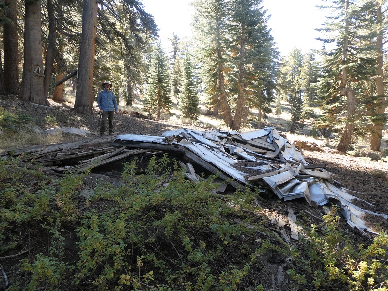
From Klette Meadow, we walked by the remains of the old cabin that used to be there.

We didn’t go by the location of the other old cabin that was in this area but here is a picture that I took in 2014. I wonder if it is still standing?

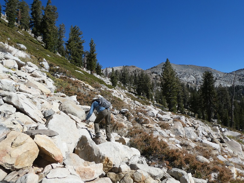
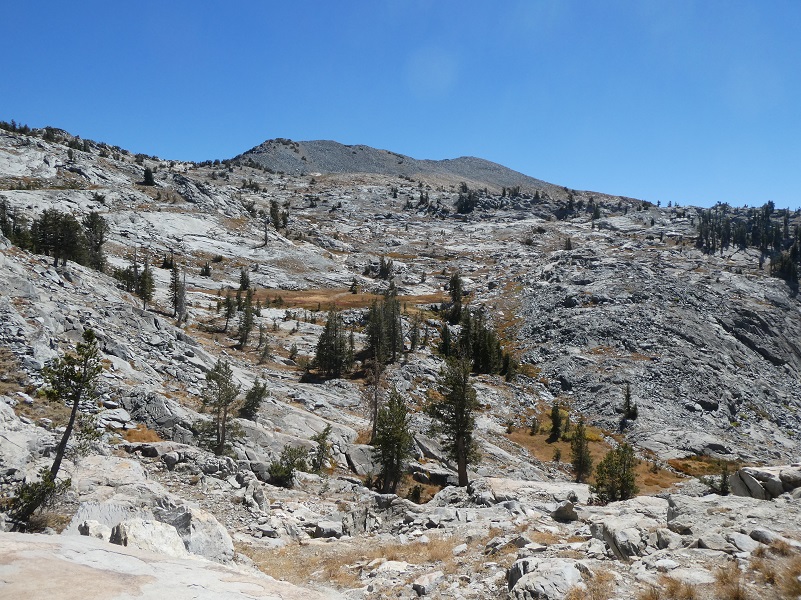
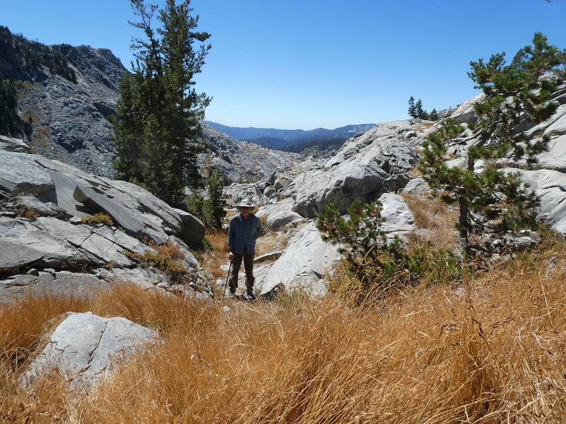
Our short uphill cross country jaunt took off a little distance and a couple of switchbacks in the road by the time that we reached the end of the road, which looked like a landing. There was a new trail marker at the end of the road that said no vehicles past that sign. A very rough use trail led up toward the top of Redtop Mountain (9,960′ elevation) but we headed a smidge downhill from that point, trying to find the best route, minimizing bushwhacking through brush and boulder hopping while trying to not lose too much elevation. People had placed trail markers along the way we went in but we weren’t purposefully following them. It was reassuring that the route that we had plotted had been a good one in other hiker’s eyes.
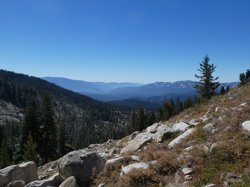
When I looked back, I had a beautiful view.
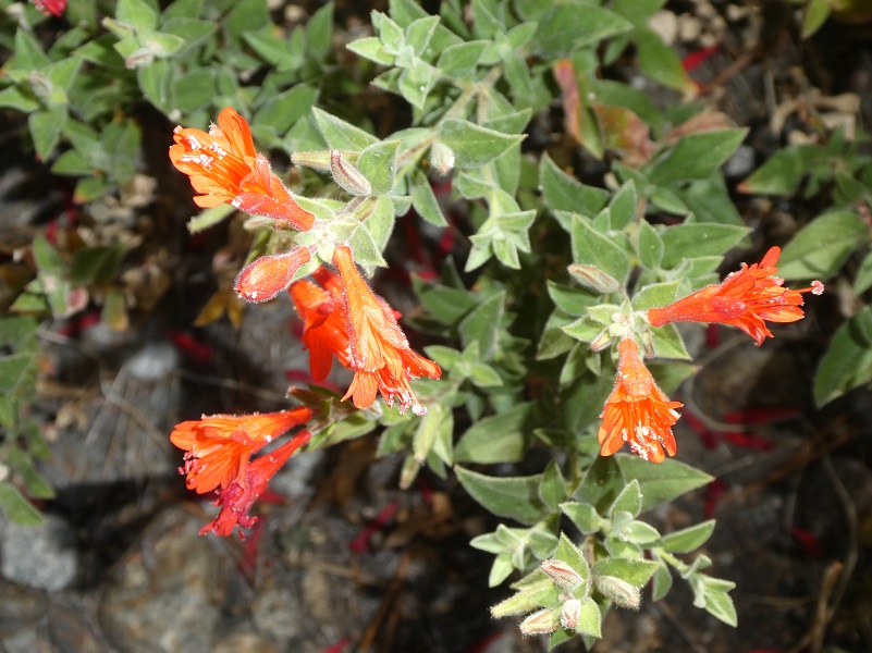
We saw a few wildflowers along the way.
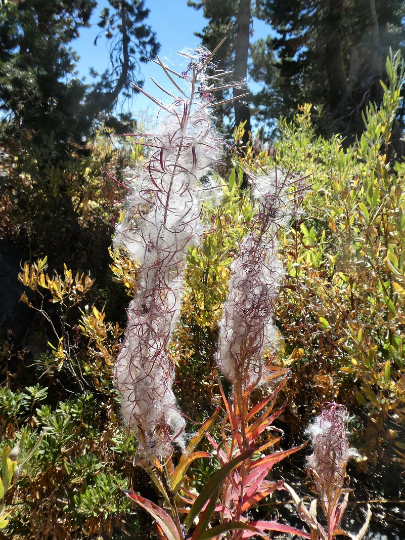
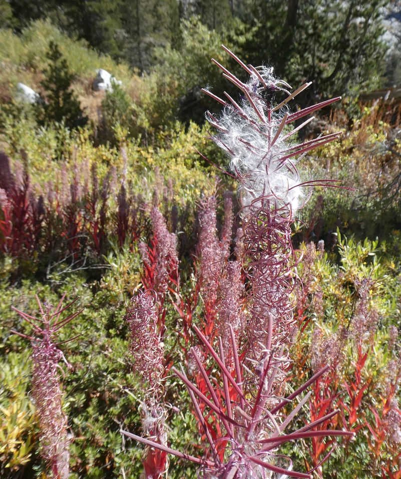
 But the star of the wildflower show by far was the fireweed. It was going into its cotton phase, going to seed. I think it was especially pretty because it was right at that transition so there was still a lot of red going on and the way it contrasted with the puffy white was gorgeous.

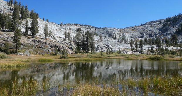
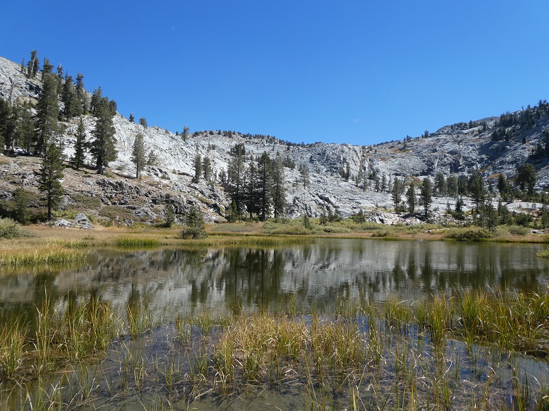
We dropped in to a small unnamed lake, full of reflections of Sing Peak and the surrounding granite mountains.
It was lunchtime and we had made it to our approach to Sing Peak (10.502′ elevation), if we were going to do that, so we picked a good sitting rock with a view and evaluated our options.
Sing Peak is named in honor of Ty Sing, who was the head chef for the first director of the National Park Service and an inspiration that helped create the National Park Service that we know today.
Chinese people played a very important role in shaping the area where we live. Whether it was in the local mines, on the construction of the Wawona Road in 1875 and the Tioga Road in 1882, the Chinese labor made these huge endeavors a realty. Did you know that 250 Chinese Americans built the Tioga Road, which was originally built for the Great Sierra Consolidated Silver Company’s mining ventures at Dana City and Bennettville in 1882?
For 28 years, a Chinese Chef named Ty (also spelled Ti and Tie) Sing ran a field kitchen for the Chief Geographer of the United States Geological Survey, Robert Marshall. In 1915, Ty Sing was handpicked by Marshall to cook for the famous Stephen Mather and his mountain expedition that included 18 powerful men from the private and public sector.
This expedition is credited with helping support the development of National Parks. As a result of these meals that Ty Sing cooked on this expedition that journeyed to our surrounding mountains and what would later become Sequoia National Park, the men from this expedition called Tie Sing “a gourmet chef of the Sierra” and “philosopher of the Sierras.”This expedition’s incredible detail is captured in “The Mather Mountain Party 1915”, including what Ty Sing served at meals and his secret method to get his sourdough to rise. I highly recommend that you read this because it paints such a colorful picture of their life on the trail during this journey. You can access it online here.
At our lunch spot in the shadow of Sing Peak, we looked across toward Madera Peak (10,480′ elevation) and what looked like a couple of dried up tarns. One option might be to swing by those tarns and head into that pretty little lake from east side. And that is exactly what we did. Those “tarns” ended up not being tarns, just a dried up meadow with a little watercourse, now dry, running along side it.
We continued down.

We made it to the little lake then back the same way we had come in. It was disappointing to not make it up to the top of Sing Peak but we had a beautiful hike and good workout. I had never seen fireweed in that stage before and it was just so beautiful. I had seen it in the flower and cotton stages but not in the just before the cotton flies stage. We were also surprised to find quite a bit of water flowing at those headwaters. It must be coming out of a spring or springs that we didn’t stumble across. The little long meadow between that fireweed and little lake was actually swampy. We just never know what one of our adventures will bring. We will plan a redo of Sing Peak another time and another year.
I also want to share that hunters were out and I had wished that I had worn more visible colors to stand out. On the hike back down from Klette Meadow, I tied my yellow handkerchief on my head to help out on that issue.
Dog Hike? Maybe, depending on your dog
I didn’t bring Sally on this hike, but she would have been welcome on it. This hike could potentially be a good hike to take with your dog, if they are the type of dog that stays with you on the trail and negotiate short stretches though the boulders. There is plenty of wildlife in this area. Rattlesnakes, bear, coyote and mountain lion all call this area home. Cows also graze in this area. There is usually water available one you get down to the East Fork of Chiquito Creek but one summer that I visited had none until reaching the little lake.
Here are the Sierra National Forest rules for pets from their website:
Domestic pets are allowed in wilderness areas. You are responsible for their actions as well as their welfare. Pets should either be leashed or under direct voice control. When camping in areas with other visitors, pets should be kept on a leash. Wilderness visitor’s who plan to travel into an adjacent National Park should be aware that National Parks do not permit pets.
We ask the public to remember these rules when taking pets into the wilderness.
For additional information from Sierra National Forest regarding pets, please click the following link: Canine Camper
Map, Profile and Doarama:
Headwaters Chiquito Creek Doarama
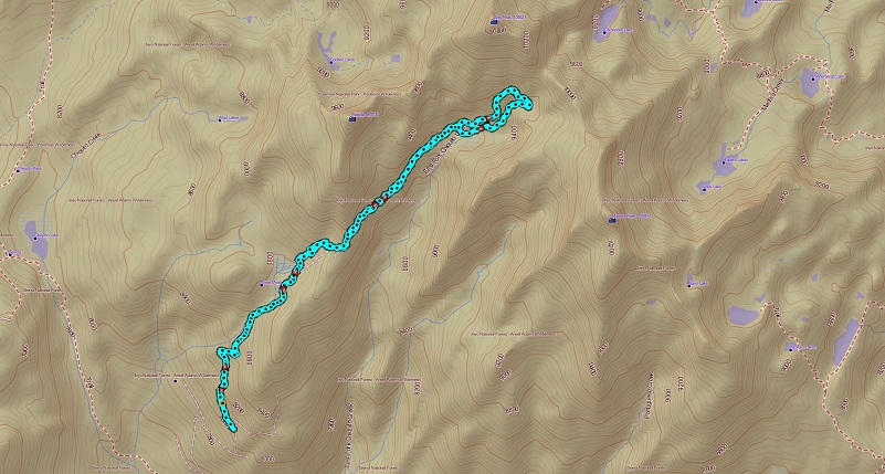
Headwaters of the East Fork of Chiquito Creek Topographic Map
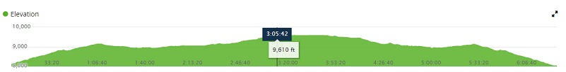
Headwaters of the East Fork of Chiquito Creek Profile
Sources:
Two Blades of Grass Where Thousands Grew Before by John O’Neal
The Mather Mountain Party 1915
http://education.nationalgeographic.com/education/thisday/jul14/ http://www.pbs.org/nationalparks/history/ep3/2/
http://calphotos.berkeley.edu/cgi/img_query?enlarge=6666+6666+0514+0078
Prior Blogs in this area:

